North Little Rock, Arkansas: The City Once Called Argenta
North Little Rock, Arkansas, is named for its spot across the river from Little Rock, and along the way it went by DeCantillon, Huntersville and Argenta. It even gave up the name Argenta twice, and a railroad town’s politics had a lot to do with it.
“Opposite Little Rock”
For a long time the north bank of the Arkansas River didn’t need its own name. The city’s history commission says early maps just called it “Opposite Little Rock.” In 1845 an army officer, Richard DeCantillon Collins, registered eight blocks for sale there, and “the first name given to the area was DeCantillon.” Dallas T. Herndon’s 1922 Centennial History of Arkansas tells the same story with the date about 1846, and says the town “did not amount to anything” until the Memphis & Little Rock Railroad ended its line on that bank.
The settlement by the depot became Huntersville. The city’s history says an 1871 Arkansas Gazette editorial traced that name to William Hunter, the military superintendent of the depot during the Civil War.
Argenta, from the Latin for silver
In 1866, the heirs of Thomas W. Newton had a new town laid out next to the station. Herndon explains the name: a few miles up the river “were the old Kellogg mines, which were believed to contain silver, and Robert C. Newton suggested the name ‘Argenta’ for the new town, which was adopted.” The city’s history adds that argentum is Latin for silver, and that “Kellogg’s Diggins” really was a lead mine that yielded some silver. It also mentions a second, less likely story, about a hotel called the “Argenta.”
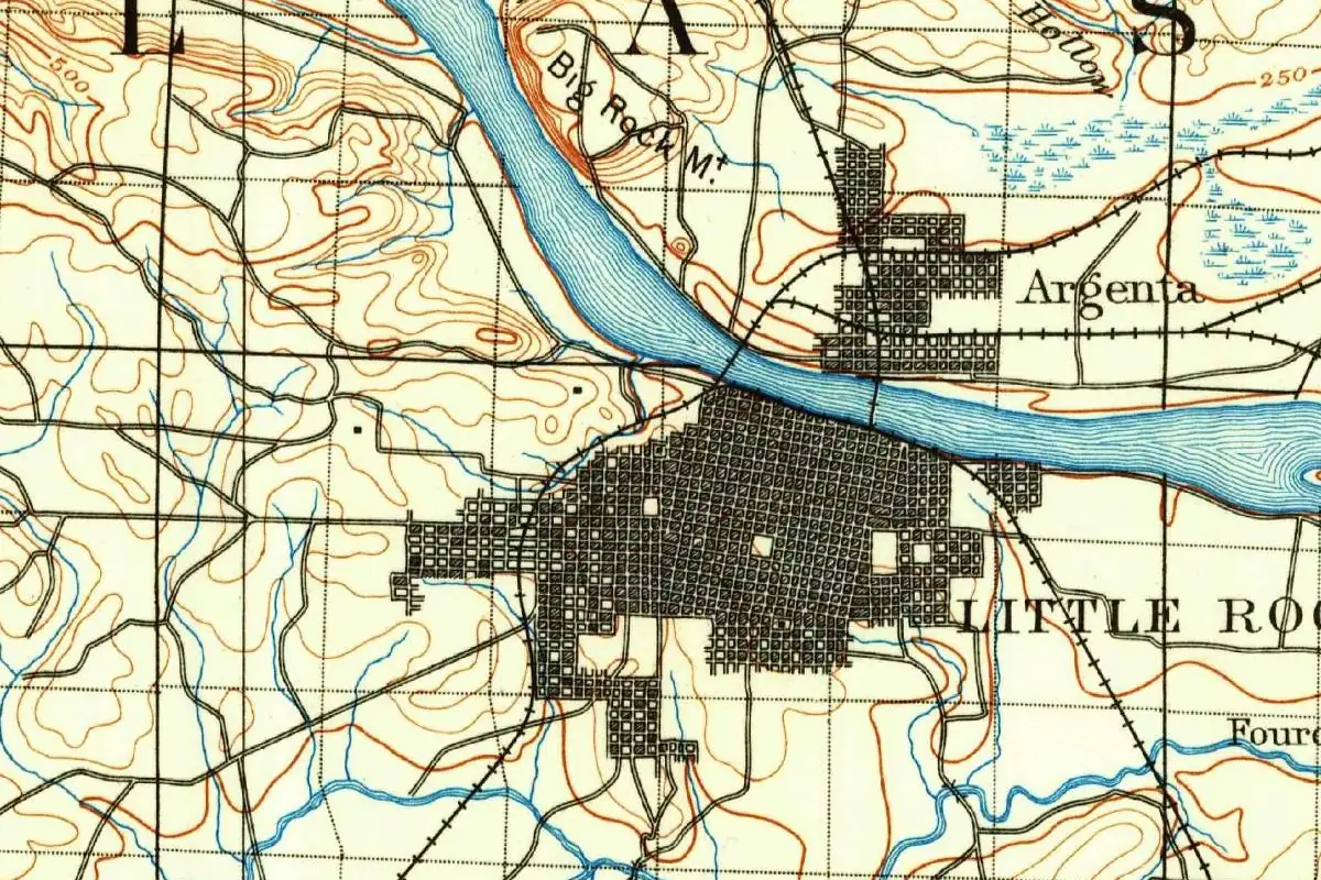
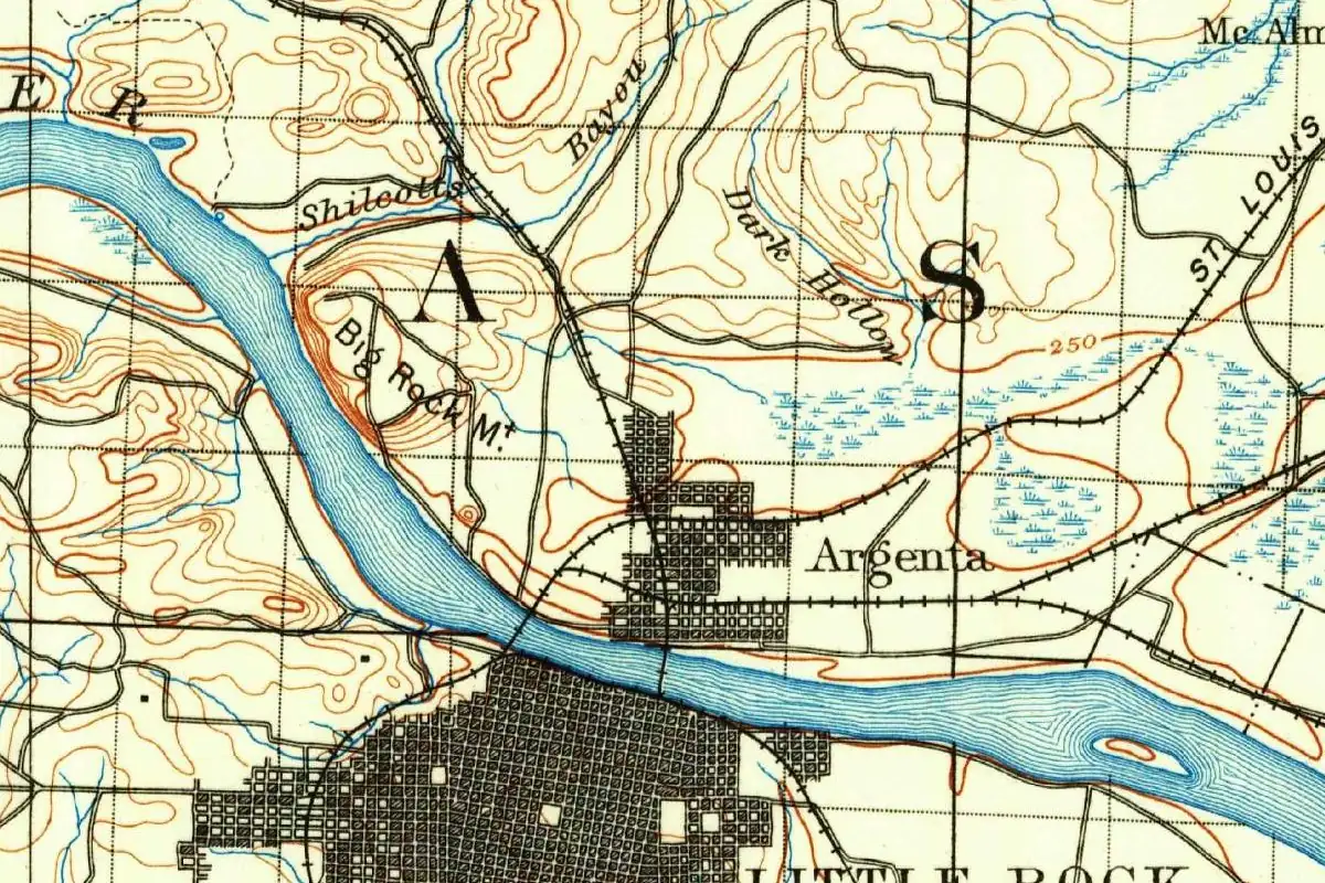
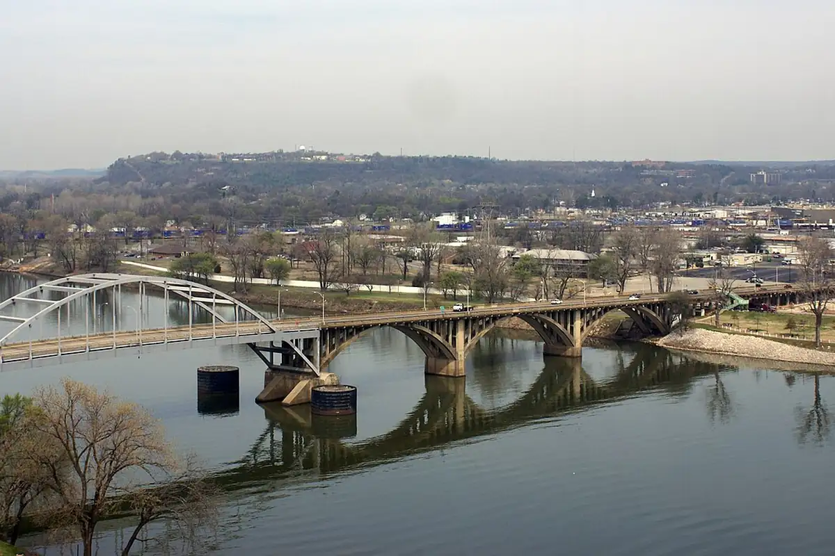
Railroads made Argenta grow. In 1873 the Baring Cross bridge, the first steel bridge over the Arkansas, linked it to Little Rock. The neighborhood of Baring Cross took its name from Baring and Company, the British bankers who paid for the bridge, and by the late 1870s Argenta was a major railroad crossing. On the 1891 Geological Survey map above, it’s the little grid labeled Argenta on the north bank, facing the big city.
Annexed, freed and renamed twice
Then Little Rock swallowed it. In an April 1890 election, Little Rock’s voters annexed Argenta as their eighth ward. Some Argenta men wanted out. In 1901, the city’s history says, a group led by the brothers William C. and James P. Faucette incorporated a “Town of North Little Rock” on the land just north of Argenta. In 1903 they steered a bill through the legislature that let one town annex another within a mile (1.6 km) of it. It was known as the “Hoxie-Walnut Ridge Bill,” and lawmakers paid it little attention, thinking it was special-interest legislation to let those two small towns consolidate. The governor signed it in March 1903. In July 1903, Argenta voted to leave Little Rock and join North Little Rock, and the Arkansas Supreme Court upheld it in February 1904.
That’s when the name started bouncing around. In January 1906 a city ordinance changed the name to Argenta. In October 1917 the city council changed it again, back to North Little Rock. The city’s history says James P. Faucette pushed for it after seeing, in California, how a small town near Hollywood had profited by changing its name to West Hollywood. In 1958 there was a campaign to go back to Argenta, and it failed. If you walk downtown today, though, you’ll see the old name is still around: the historic district is called Argenta.
Herndon tells a shorter version, with a few dates that don’t match the city’s account. He says Argenta was incorporated in 1871, annexed to Little Rock in 1890, “disannexed” in 1903, and renamed North Little Rock in 1917. The city’s history says Argenta got a post office in 1871 but had not incorporated. Both agree on 1917.
Quick answers
What was North Little Rock called before?
DeCantillon, Huntersville and Argenta, according to the city’s history and Herndon’s Centennial History of Arkansas. The city was named Argenta again from 1906 until October 1917.
What does Argenta mean?
It comes from argentum, Latin for silver. Herndon says Robert C. Newton suggested it because the Kellogg mines up the river were believed to hold silver.
When did Argenta become North Little Rock?
Twice, in a way. Argenta joined the new Town of North Little Rock in 1903, was renamed Argenta in 1906, and the city council changed the name back to North Little Rock in October 1917.
Key dates
- 1845Richard DeCantillon Collins registers eight blocks on the north bank; the area's first name is DeCantillon.
- 1866The town of Argenta is surveyed and platted.
- 1873The Baring Cross railroad bridge connects Argenta with Little Rock.
- 1890April: Little Rock voters annex Argenta as the city's eighth ward.
- 1901The Town of North Little Rock incorporates just north of Argenta.
- 1903July: Argenta votes to leave Little Rock and join North Little Rock.
- 1906January: a city ordinance renames the city Argenta.
- 1917October: the city council changes the name back to North Little Rock.
Getting there
Open North Little Rock in Google Maps
Opens in a new tab. The pin is the center of North Little Rock in the USGS place-name record.
The closest airports, Amtrak stations and intercity bus stops, measured in a straight line from the center of North Little Rock.
Airports
- Bill and Hillary Clinton Ntl/Adams Field (LIT) Little Rock 4 mi 6 km
- Fort Smith Regional (FSM) 125 mi 201 km
Amtrak trains
- Little Rock station (LRK) 2 mi 3 km
- Malvern station (MVN) 42 mi 67 km
Intercity buses
- Greyhound Bryant-Little Rock Gassy's 16 mi 26 km
- Jefferson Lines Conway 24 mi 39 km
Distances are as the crow flies, not by road. We don't list schedules or fares because they change; check with the airline, Amtrak or the bus company before you go. Official data (FAA commercial service airports (2025), FAA airport locations, Amtrak stations and Intercity Bus Atlas) from the FAA and the U.S. Bureau of Transportation Statistics, checked Nov 6, 2026.
Sponsored
Staying in North Little Rock?
Compare hotels in North Little Rock, Arkansas, on Expedia.
See hotels in North Little RockWe may earn a commission if you buy through this link. It never changes what we write. Read our affiliate disclosure
Historical Sources & References
- City of North Little Rock, “Ward 2” (Stories from the North Side). DeCantillon in 1845, Huntersville and William Hunter, Argenta platted in 1866 and the Latin for silver, Baring Cross and its bridge, the 1890 annexation, the 1901 Town of North Little Rock, the Hoxie-Walnut Ridge Bill, the 1906 and 1917 name changes and the 1958 campaign.
- Dallas T. Herndon, ed., Centennial History of Arkansas, vol. 1 (1922), pp. 880-881. De Cantillon, Huntersville, the Newton heirs’ town of 1866, Robert C. Newton’s suggestion of “Argenta” because of the Kellogg mines, Baring Cross, and Herndon’s dates for incorporation, annexation and the 1917 name change.
- GNIS feature 77862 (U.S. Geological Survey). The official record for North Little Rock in the Geological Survey’s place-names database.
Spot something wrong, or know more? Tell us here. You can also email us or use our contact page. Corrections are noted here with their date, never made silently.