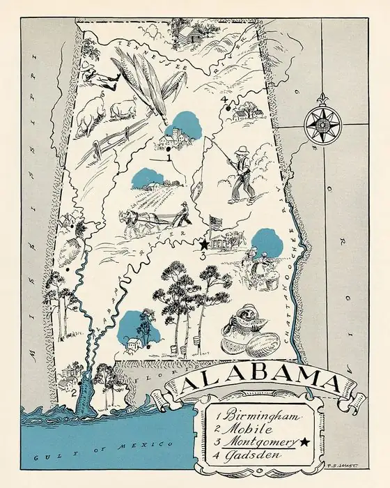
Attalla, Alabama: One Old Name, Two Meanings
Attalla’s name goes back to a settlement called Atale, and two old Alabama reference books disagree about what that word meant. One says it described the people who lived there. The other says it described the land.
A town on the end of Lookout Mountain
Thomas McAdory Owen’s History of Alabama, published in 1921, puts Attalla “on the plateau of Lookout Mountain, at its southern extremity,” about 5 miles (8 km) west of Gadsden. By then it sat on the main lines of three railroads, the Louisville & Nashville, the Alabama Great Southern, and the Nashville, Chattanooga & St. Louis, and it shipped cotton from several counties. Owen counts more than 75,000 bales warehoused and shipped in 1915.
The place is older than the rails. Owen writes that the town “occupies the site of an Indian village which was of considerable importance during the Creek War,” the home of Capt. John Brown, whom he calls “a famous Indian.” The first white settler among the Native people was John Radcliff, in 1800. In 1859, John S. Moragne bought mineral lands there and sank what was probably the first mine shaft in northeast Alabama, and in 1871 he shipped the first ore out of the state, to Wheeling, West Virginia.
The town itself is younger. It was founded in 1870 on land donated by W. C. Hammond, Owen says, and incorporated on February 5, 1872. The first post office, a mile (1.6 km) from the present site, went by a different name altogether: Bennettsville.
Farming people or a mountain?
Here’s where the sources split. Owen says the settlement “was first known as ‘Atale,’ meaning ‘the farming Indians.’” William A. Read, a scholar who studied Alabama’s Native place names, came to a different answer in 1937: “The first settlement here was called Atale, which is a corruption of Cherokee otali, ‘mountain.’”
You can see why the mountain reading is tempting, since the town sits at the tip of Lookout Mountain. But neither book explains how it arrived at its meaning, and Read doesn’t mention Owen’s version at all. So the safe answer is that Attalla comes from Atale, and that the meaning of Atale is disputed.
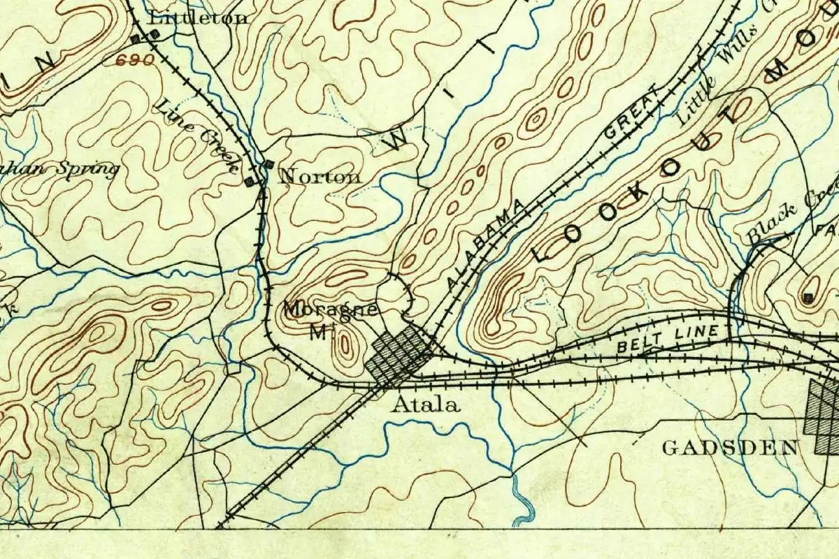
The spelling wobbled, too. On the U.S. Geological Survey’s Gadsden map of 1885, shown above, the town is “Atala,” with one t and one l. The 1888 edition of the same sheet has “Atalla,” and “Attalla” first shows up on the 1892 edition. The 1895 edition went back to “Atala.”
Mines, cotton and three railroads
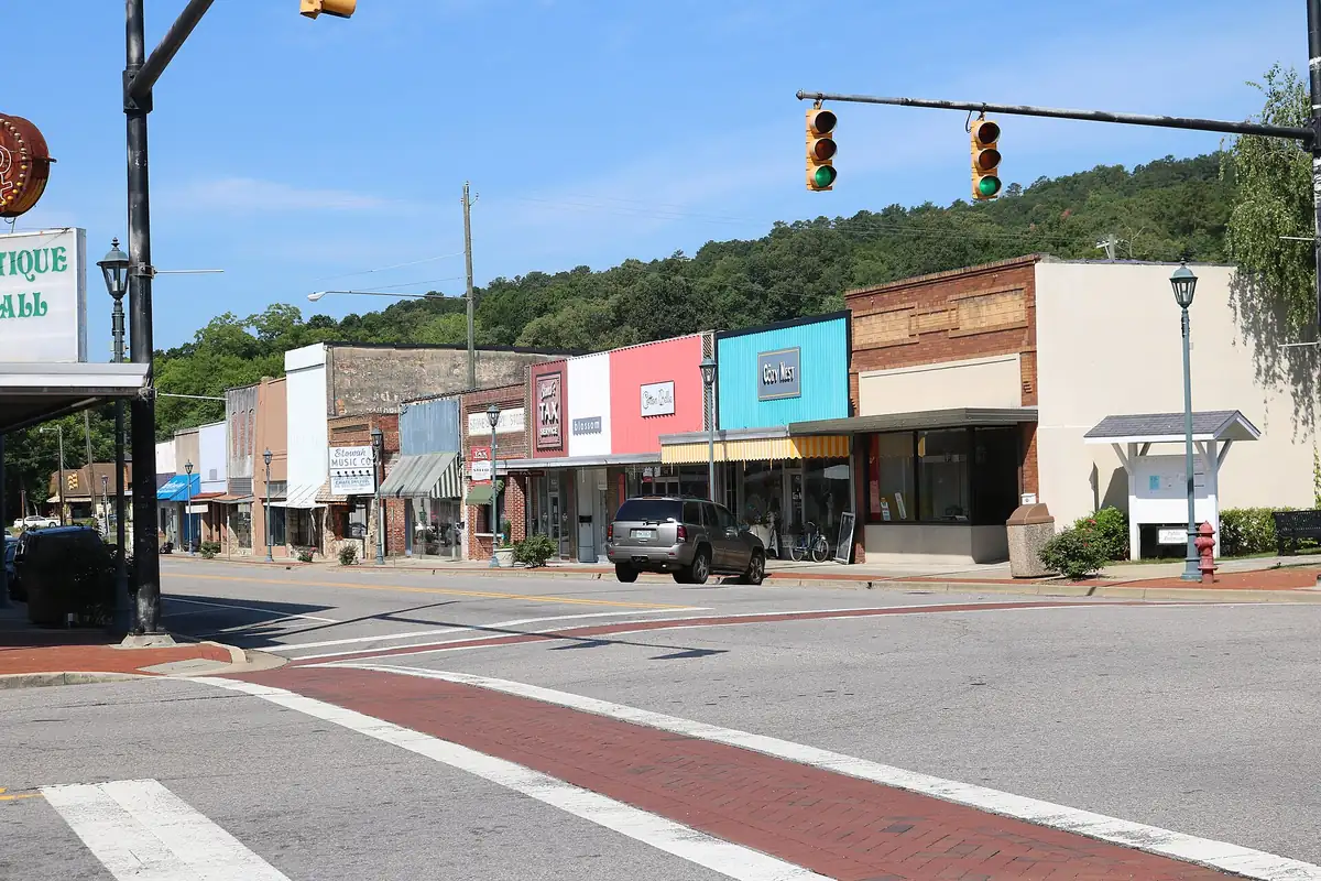
Owen’s list of what Attalla made in his day reads like a small industrial city: a pipe plant, hosiery mills, 50 coke ovens, ore and coal mines, marble and sandstone quarries. It also sat on the old public road between Huntsville and Tuscaloosa. If you drive through downtown today, you’ll pass a row of old brick storefronts like the ones in the photo below.
Quick answers
What does Attalla mean?
It’s disputed. Owen’s 1921 history says the old name Atale meant “the farming Indians.” Read’s 1937 study of Alabama’s Native place names calls it a corruption of Cherokee otali, “mountain.”
When was Attalla, Alabama, founded?
In 1870, on land donated by W. C. Hammond, by Owen’s account. It was incorporated on February 5, 1872.
Was Attalla always spelled that way?
No. The Geological Survey’s Gadsden map spelled it “Atala” in 1885, “Atalla” in 1888 and “Attalla” in 1892, then went back to “Atala” in 1895. The first post office nearby was called Bennettsville.
Key dates
- 1800John Radcliff becomes the first white settler among the Native people at the site, by Owen's account.
- 1859John S. Moragne buys mineral lands and sinks what is probably the first mine shaft in northeast Alabama.
- 1870The town is founded on land donated by W. C. Hammond.
- 1872February 5: Attalla is incorporated.
- 1885A Geological Survey map spells the town "Atala."
Getting there
Open Attalla in Google Maps
Opens in a new tab. The pin is the center of Attalla in the USGS place-name record.
The closest airports, Amtrak stations and intercity bus stops, measured in a straight line from the center of Attalla.
Airports
- Birmingham-Shuttlesworth International (BHM) 50 mi 80 km
- Huntsville International-Carl T Jones Field (HSV) 58 mi 93 km
- Hartsfield/Jackson Atlanta International (ATL) 99 mi 159 km
Amtrak trains
- Anniston station (ATN) 30 mi 48 km
- Birmingham station (BHM) 54 mi 87 km
Intercity buses
- Greyhound Gadsden U-Haul 5 mi 8 km
Distances are as the crow flies, not by road. We don't list schedules or fares because they change; check with the airline, Amtrak or the bus company before you go. Official data (FAA commercial service airports (2025), FAA airport locations, Amtrak stations and Intercity Bus Atlas) from the FAA and the U.S. Bureau of Transportation Statistics, checked Nov 6, 2026.
Sponsored
Staying in Attalla?
Compare hotels in Attalla, Alabama, on Expedia.
See hotels in AttallaWe may earn a commission if you buy through this link. It never changes what we write. Read our affiliate disclosure
Historical Sources & References
- Thomas McAdory Owen, History of Alabama and Dictionary of Alabama Biography, vol. 1 (1921), p. 72. The “Attalla” entry: the three railroads, the site at the end of Lookout Mountain, the 1870 founding and 1872 incorporation, Capt. John Brown and John Radcliff, the old name “Atale” as “the farming Indians,” Moragne’s mine and the Bennettsville post office.
- William A. Read, Indian Place-Names in Alabama (1937), p. 6. Atale as “a corruption of Cherokee otali, ‘mountain.’”
- U.S. Geological Survey, Gadsden sheet, editions of 1885 to 1895. “Atala” in 1885, “Atalla” in 1888, “Attalla” in 1892 and “Atala” again in 1895.
- GNIS feature 157880 (U.S. Geological Survey). Attalla’s record in the national place-names database, in Etowah County.
Spot something wrong, or know more? Tell us here. You can also email us or use our contact page. Corrections are noted here with their date, never made silently.