How Vermillion, South Dakota Got Its Name
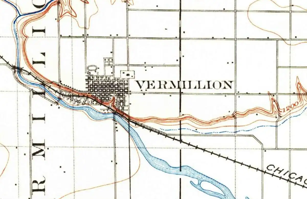
Vermillion, South Dakota, is named after the Vermillion River, which got its name from the red color of the soil along its banks. Vermilion is the name of a bright red pigment, and that’s the color people saw in the riverbanks.
Where the name comes from
The town is named for the river, and the river is named for its color. Encyclopaedia Britannica says the river was named for the red clay along its banks. A 1908 railroad guide to place names, in its Clay County entry, gives the town’s name a one-line explanation: “Named from the red color of the soil, due to the presence of iron.” The U.S. Geological Survey’s place-name record cites that same book.
The river also had a Native name. We found different translations of it in different places, and none from a dictionary of the language, so we’re leaving it out until we can check it properly.
What Lewis and Clark called it
Lewis and Clark came through here in August 1804, and they didn’t call it the Vermillion. In William Clark’s journal for August 25, he wrote that they “droped down to the mouth of White Stone River where we left the Perogue” (his spelling) before walking north to see Spirit Mound. So for at least one famous set of travelers, it was the White Stone. The red name is the one that stuck.
The town that had to climb the bluff
Vermillion was founded in 1859, according to the USGS record. The first town sat down low, on the Missouri River bottomland below the bluffs.
That was a mistake, as it turned out. South Dakota Public Broadcasting says that in the spring of 1881, after a brutal winter, the Missouri’s ice broke up into huge jams that held back the meltwater, and when it let go, Vermillion was “all but wiped out.” The town’s residents rebuilt on higher ground, on top of the bluff. That’s where the town is on the 1898 map above, and where it still is today.
Sources & further reading
- W. H. Stennett, A History of the Origin of the Place Names Connected with the Chicago & North Western and Chicago, St. Paul, Minneapolis & Omaha Railways (1908). A public-domain railroad guide. Its Clay County entry says the name comes from the red soil.
- GNIS feature 1258745 (U.S. Geological Survey). The federal record for Vermillion. Quotes the 1908 guide and gives 1859 for the founding and 1878 for incorporation.
- Encyclopaedia Britannica, “Vermillion.” Says the river was named for the red clay along its banks.
- William Clark’s journal, August 25, 1804. The White Stone River and the walk to Spirit Mound. Read through the University of Nebraska’s online edition.
- South Dakota Public Broadcasting, “Vermillion Before the 1881 Flood.” The ice jams of 1881 and the move to higher ground.
Spot something wrong? Corrections are noted here with their date, never made silently.