Vail, Colorado: The Town Named for a Highway Engineer's Pass
Vail, Colorado, is named for a mountain pass, and it was the second Colorado pass to carry the name of state highway engineer Charles D. Vail. The first one went back to being Monarch Pass after local boosters protested, but the second one, on U.S. 6 east of the Gore Creek valley, kept his name, and the ski town that grew up below it borrowed it.
Charles D. Vail, Colorado’s road man
Charles Vail ran the Colorado State Highway Department from 1930 to 1945, according to a 2019 history of the Vail Pass highway prepared for the Colorado Department of Transportation. When he died in January 1945, the trade magazine Excavating Engineer called him “for 14 years Colorado state highway engineer and widely recognized as one of the nation’s outstanding road engineers.” He was 76, and he died in a Denver hospital after a long illness.
The magazine put his work in miles. When he took office, the state had “only slightly more than 500 miles of hard-surfaced highways.” By 1945 it had more than 4,400, including roads “through rugged canyons and over high mountain passes.” That last part is how his name ended up on the map.
The first Vail Pass was Monarch Pass
In 1939 a new highway opened over Monarch Pass, and for a short while it was called Vail Pass. Maxine Benson’s 1001 Colorado Place Names says local boosters “soon protested,” and “So Monarch Pass it was.”
Duane Vandenbusche told the local version in the Gunnison Country Times in 2020. In his telling, a “Vail Pass” sign went up on top of the Continental Divide, and upset locals kept throwing it into a ditch until the old name stuck. He also says Vail named the pass after himself. Benson doesn’t say who picked the name, so you’re getting that part from one storyteller.
The pass that kept the name
And Vail got his pass. In 1940 the state moved U.S. 6 onto a new, paved route over what the CDOT history calls “an unnamed pass between Frisco and Eagle,” around the south end of the Gore Range. Before that, the highway had looped south through Leadville. “This new mountain pass was named Vail Pass, after State Highway Engineer Charles Vail,” the history says. Benson puts it the same way: Vail was “honored the next year with another, and permanent, Vail Pass.”
The new road mattered. The Rocky Mountains west of Denver had long been a barrier to travel, and CDOT’s history says many areas stayed “remote and inaccessible, especially in Eagle and Summit Counties and the vicinity of present-day Vail.” The federal government made the name official, too. The U.S. Geological Survey’s names database lists Vail Pass under a Board on Geographic Names decision dated 1950 and puts the pass in Summit County, the same county as Breckenridge. Interstate 70 later took over the crossing. CDOT’s 2019 history notes that the interstate only “adopted his namesake from the preexisting portion of US 6,” decades after his death.
A ski town borrows the name
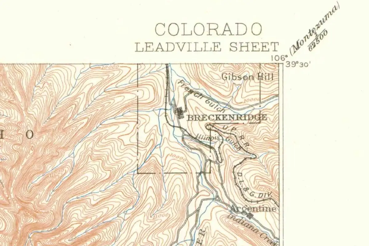
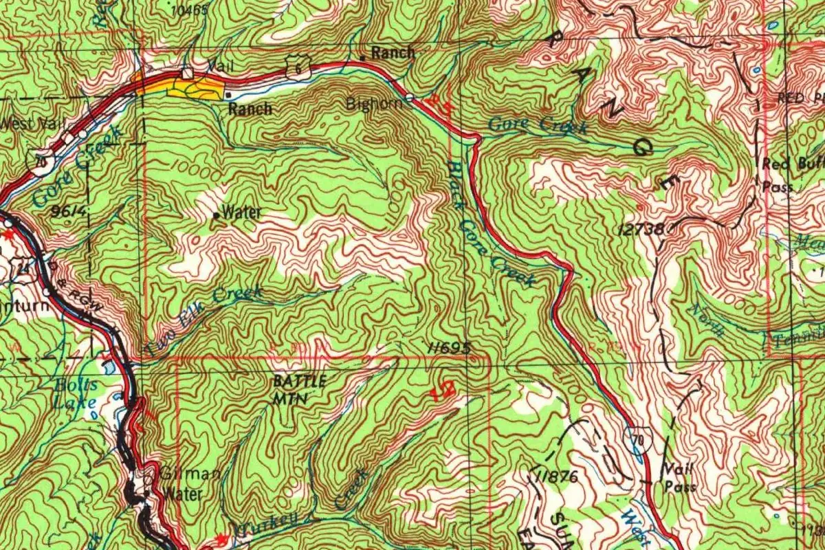
When the pass got its name, there wasn’t a town to share it with. The 1964 printing of the U.S. Geological Survey’s Leadville map shows nothing in the Gore Creek valley west of the pass but a sawmill, a ranger station and a couple of ranches along U.S. 6. You can see what changed on the revised sheet at the top of this page: Vail, West Vail and Bighorn now sit along the creek, with Vail Pass in the corner.
The ski area opened in December 1962, and the town grew up on a small ranch bought by former ski troopers who had formed a company called Vail Associates, according to a 1973 Editor & Publisher profile of the town’s newspaper. That same story says it plainly: “The town took its name from Vail Pass about ten miles to the east and over 10,000 feet high.” Colorado’s place-name books agree. William Bright’s Colorado Place Names says the town was “Named for nearby Vail Pass,” which was “in turn named for Charles D. Vail, Colorado state highway engineer who planned the road in the 1930s.” The town incorporated in 1966.
Who actually picked the name for the town? None of the sources here says, so you won’t get a guess from us.
A name two steps removed
By the 1965-1966 season, CDOT’s history says, Vail was drawing more visitors than its competitors, all under the name of a road engineer who had died almost 18 years before the lifts opened. What he planned, in Bright’s words, was “the road.” The ski town came after he was gone. If you want the place that was actually named for him, look east up I-70: the summit of Vail Pass is about 11 miles (18 km) from town as the crow flies.
Quick answers
Is Vail, Colorado, named after a person?
Indirectly. The town is named for Vail Pass, and the pass is named for Charles D. Vail, who ran the Colorado State Highway Department from 1930 to 1945.
Was Vail named after Vail Pass or the other way around?
The pass came first. It was named when U.S. 6 was moved over it in 1940, more than 20 years before the ski area opened in 1962, and the town took its name from the pass.
Was Monarch Pass ever called Vail Pass?
Yes, briefly. When the new Monarch Pass highway opened in 1939 it was called Vail Pass, but local boosters protested and the Monarch name came back. Vail got his permanent pass the next year.
How far is Vail from Vail Pass?
About 11 miles (18 km) in a straight line, going by the federal coordinates for the town and the pass. A 1973 magazine story put it at “about ten miles to the east.”
Key dates
- 1930Charles D. Vail takes charge of the Colorado State Highway Department as state highway engineer.
- 1939The new highway over Monarch Pass is briefly called Vail Pass, until local protests bring back the name Monarch.
- 1940U.S. 6 is rerouted over an unnamed pass between Frisco and Eagle, and the new pass is named Vail Pass.
- 1945January 8: Charles D. Vail dies in a Denver hospital at 76.
- 1950The federal Board on Geographic Names makes Vail Pass official.
- 1962December: the Vail ski area opens in the Gore Creek valley, west of the pass.
- 1966The Town of Vail incorporates.
Getting there
The closest airports, Amtrak stations and intercity bus stops, measured in a straight line from the center of Vail.
Airports
- Eagle County Regional (EGE) 29 mi 46 km
- Aspen-Pitkin County/Sardy Field (ASE) 39 mi 63 km
- Denver International (DEN) 92 mi 147 km
Amtrak trains
- Fraser-Winter Park station (WIP) 36 mi 59 km
- Winter Park station (WPR) 37 mi 59 km
Intercity buses
- OurBus Vail, CO (Vail Transportation Center 241 S Frontage Rd E Ste 4, Vail, CO 81657. Look for a van with Peak 1 Express written on it.) under 1 mi 0.2 km
- Colorado Department of Transportation Bustang · Vail Transportation Center under 1 mi 0.3 km
- Greyhound Vail Eco Transit under 1 mi 0.3 km
Distances are as the crow flies, not by road. We don't list schedules or fares because they change; check with the airline, Amtrak or the bus company before you go. Official data (FAA commercial service airports (2025), FAA airport locations, Amtrak stations and Intercity Bus Atlas) from the FAA and the U.S. Bureau of Transportation Statistics, checked Oct 31, 2026.
Historical Sources & References
- Mead & Hunt, Historic Context: Vail Pass Segment of Interstate Highway 70, for the Colorado Department of Transportation (2019). The 1940 rerouting of U.S. 6 over “an unnamed pass,” named “after State Highway Engineer Charles Vail,” and his years running the highway department, 1930-1945 (pp. 1, 6); the 1962 ski area and the town’s 1966 incorporation (pp. 57-58); the interstate’s “loosely associated” link to Vail (p. 63).
- “Charles D. Vail,” Excavating Engineer, February 1945, p. 104. Vail’s obituary: 76, 14 years as state highway engineer, died January 8 in a Denver hospital, and the growth from about 500 to more than 4,400 miles of hard-surfaced road.
- Ben Wright, “The Weekly Editor: Ski Town Paper Grows,” Editor & Publisher, February 17, 1973, p. 31. The ski area’s December 1962 opening, the ranch bought by former ski troopers, and “The town took its name from Vail Pass.”
- Maxine Benson, 1001 Colorado Place Names (1994). Under “Monarch Pass,” the 1939 highway “briefly called Vail Pass” and the protest; under “Vail” and “Vail Pass,” the town taking its name from the pass and the pass crossed by U.S. 6 in 1940. Read through archive.org’s full-text search; the book is a restricted loan.
- William Bright, Colorado Place Names (2004), “Vail”. The town “Named for nearby Vail Pass,” in turn named for Charles D. Vail, who “planned the road in the 1930s.” Also online: George R. Eichler, Colorado Place Names (1977), with the same two-step origin. Both read through archive.org’s full-text search.
- Duane Vandenbusche, “The Saga of Monarch Pass,” Gunnison Country Times, December 31, 2020. The “Vail Pass” sign on top of the Divide at Monarch, the locals who threw it into a ditch, and Vail getting his name on the pass toward the Vail ski area later.
- U.S. Geological Survey, Leadville sheet (1:250,000). The 1957 sheet revised in 1977 (the map at the top of this page) shows Vail and Vail Pass; the 1964 printing shows the valley with no town.
- GNIS feature 202339, Vail (U.S. Geological Survey). The federal record and coordinates for the town, in Eagle County. Also online: GNIS feature 176167, Vail Pass, in Summit County, with its 1950 Board on Geographic Names decision.
Spot something wrong, or know more? Tell us here. You can also email us or use our contact page. Corrections are noted here with their date, never made silently.