Centralia, Illinois: A Name Drawn on the Railroad's Map
Centralia, Illinois, took its name from a spot on the Illinois Central’s own map, where the railroad’s main line met its branch to Chicago. The company picked the place as a central location for its shops, and the name says as much.
Where two lines of the Illinois Central met
In the 1850s the Illinois Central built two routes up the state: a main line, and a branch that ran north to Chicago. Centralia sits where they joined. Henry Gannett, the Geological Survey’s geographer, put it plainly in his 1905 book of American place names: the city was “so named by the Illinois Central Railroad from its location at the junction of the main line and the Chicago line.”
William K. Ackerman, writing for the Illinois Central about where its station names came from, tells the same story from the inside. Centralia was “laid out by the Illinois Central Railroad Company,” it says, and the company built its machine shop there “in 1856, or thereabouts, to accommodate the southern end of the Chicago Division and the main line, being selected as a central location.” If you’ve ever wondered whether the name came from the middle of Illinois, the sources point to the middle of a railroad instead.
A town built for the graders
An 1881 history of Marion County says Centralia “sprang up with the building of the Illinois Central railroad.” A first plat went on record on May 21, 1853, in the names of Jones, Gregory and Hickney. The company sold lots from 1853, but couldn’t hand over deeds until a state law of January 14, 1855, let it lay out towns. Its own addition, which the book calls “Centralia proper,” followed that May.
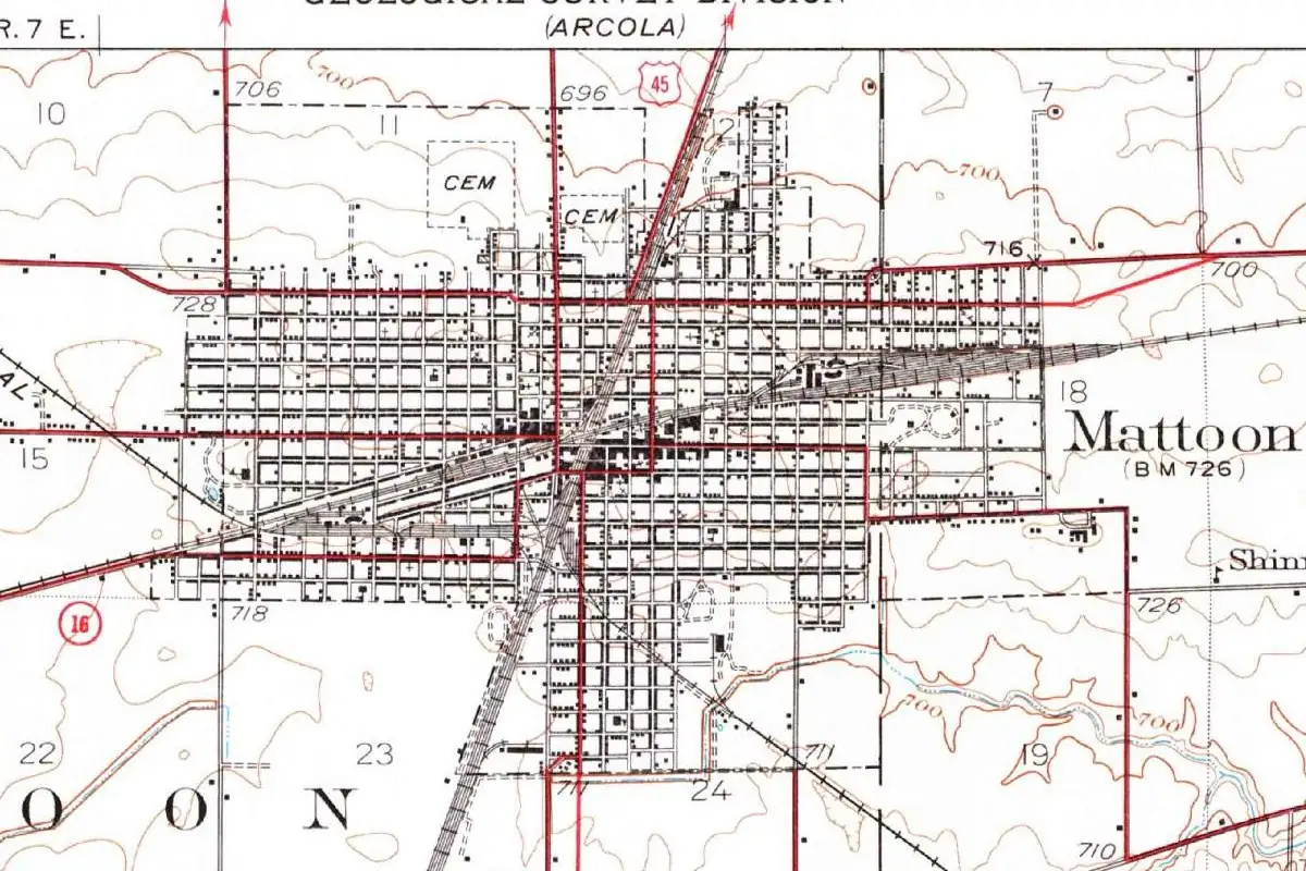
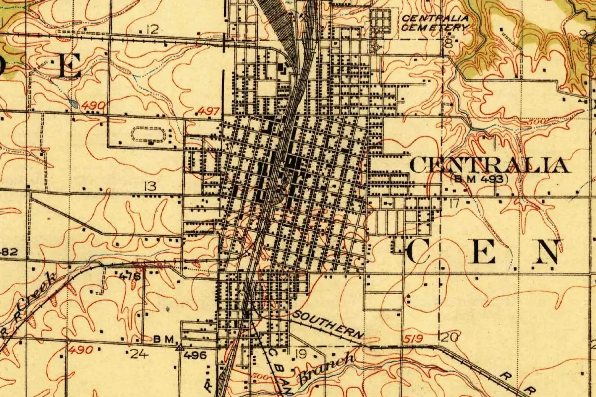
On the 1914 map at the top, you can still see the grid built on both sides of the tracks. The very first building, the same history says, was a log house where Thomas Green fed and lodged the men grading the line. The town’s name even rubbed off on a neighbor. Ackerman says nearby Central City was “so called from its proximity to Centralia,” which means one railroad name ended up spawning another.
Quick answers
What does the name Centralia refer to?
Its spot on the railroad. According to Gannett’s 1905 bulletin, the Illinois Central named it for its location at the junction of the main line and the Chicago line. The railroad’s station-name booklet says the spot was “selected as a central location” for its shops.
Is Centralia named after the center of Illinois?
No source here says so. Both old accounts tie the name to the railroad’s junction, not to the geography of the state.
When was Centralia laid out?
The first plat dates from May 21, 1853, and the Illinois Central laid out its own addition in May 1855, according to the 1881 county history.
Key dates
- 1853May 21: Jones, Gregory and Hickney lay out the first town plat at Centralia, as the Illinois Central is being built.
- 1855January 14: a state law lets the railroad lay out towns and sell lots. In May the Illinois Central lays out its own addition, "Centralia proper."
Getting there
Open Centralia in Google Maps
Opens in a new tab. The pin is the center of Centralia in the USGS place-name record.
The closest airports, Amtrak stations and intercity bus stops, measured in a straight line from the center of Centralia.
Airports
- Scott AFB/Midamerica St Louis (BLV) Belleville 38 mi 61 km
- Veterans Airport of Southern Illinois (MWA) Marion 54 mi 86 km
- St Louis Lambert International (STL) St. Louis 69 mi 110 km
Amtrak trains
- Centralia station (CEN) under 1 mi 0.4 km
- Du Quoin station (DQN) 36 mi 58 km
Intercity buses
- Greyhound Mt. Vernon IL (MVI) 17 mi 28 km
- OurBus Troy, IL (Pilot Travel Center at 820 Edwardsville Rd, Troy, IL) 44 mi 71 km
- FlixBus Carbondale Train Station 56 mi 89 km
Distances are as the crow flies, not by road. We don't list schedules or fares because they change; check with the airline, Amtrak or the bus company before you go. Official data (FAA commercial service airports (2025), FAA airport locations, Amtrak stations and Intercity Bus Atlas) from the FAA and the U.S. Bureau of Transportation Statistics, checked Nov 6, 2026.
Sponsored
Staying in Centralia?
Compare hotels in Centralia, Illinois, on Expedia.
See hotels in CentraliaWe may earn a commission if you buy through this link. It never changes what we write. Read our affiliate disclosure
Historical Sources & References
- Henry Gannett, The Origin of Certain Place Names in the United States (1905), p. 74. Centralia “so named by the Illinois Central Railroad from its location at the junction of the main line and the Chicago line.”
- William K. Ackerman, Origin of the Names of Stations on the Line of the Illinois Central Railroad Co., p. 33. The railroad laid out the town and built its machine shop there, “being selected as a central location”; Central City named for its “proximity to Centralia.”
- History of Marion and Clinton Counties, Illinois (1881), p. 220. The plat of May 21, 1853, the law of January 14, 1855, the railroad’s addition of May 1855 and Thomas Green’s log boarding house.
- GNIS feature 405910 (U.S. Geological Survey). The U.S. place-name listing and map location for Centralia, in Marion County.
Spot something wrong, or know more? Tell us here. You can also email us or use our contact page. Corrections are noted here with their date, never made silently.