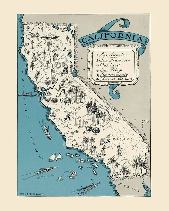
Tehachapi, California: An Old Name the Railroad Took
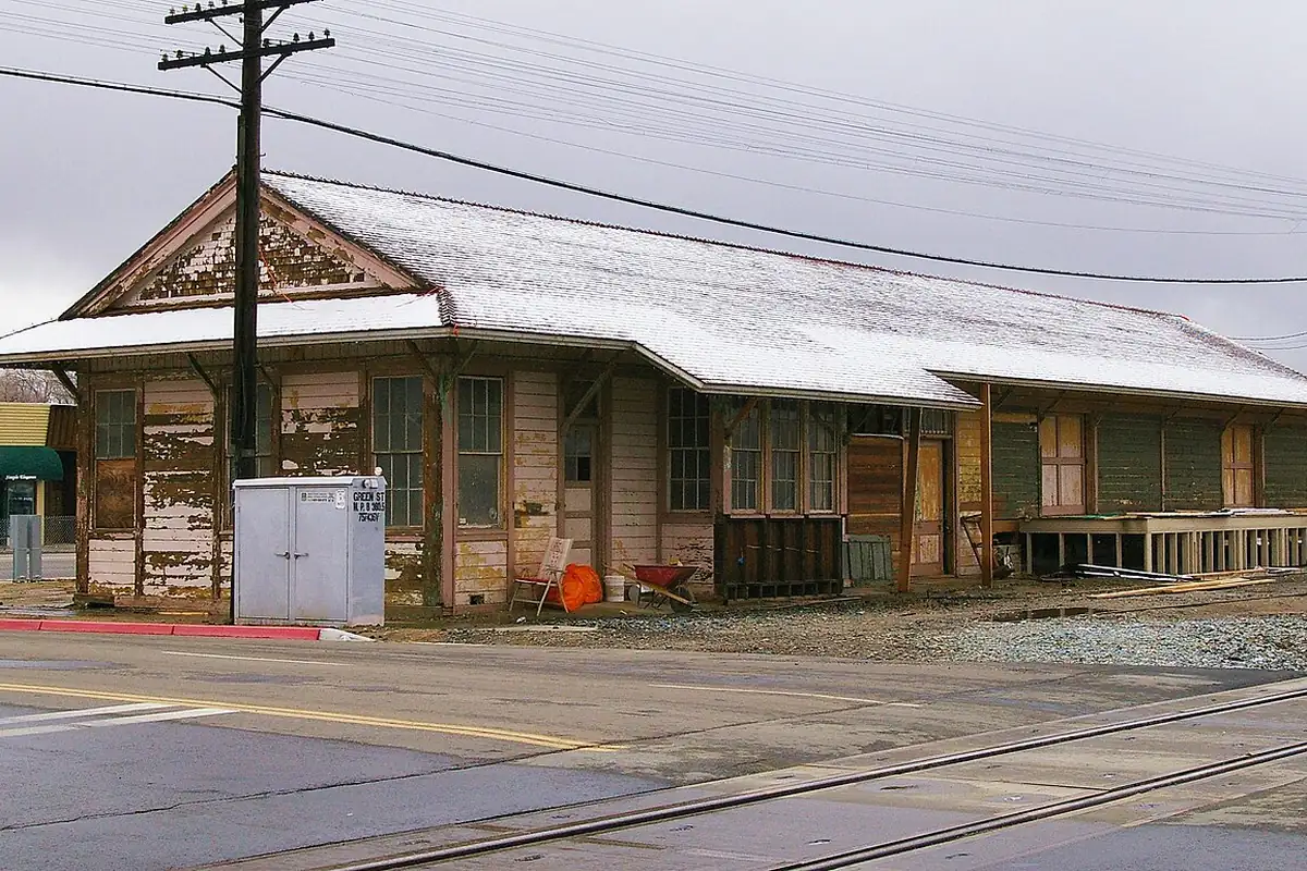
When the Southern Pacific reached the top of Tehachapi Pass in 1876, it built a new town and borrowed the name of an older one in the hills. The old place became Old Town, and a little settlement called Greenwich gave up its own name to join the new one.
Two towns, one name
Wallace Morgan tells the story in his 1914 History of Kern County. The original Tehachapi was a mining and stock town “about three miles west of the site of the present town, in the edge of the hills” (about 5 km). It lived off the gold placers of China Hill and the teams hauling freight between Los Angeles and the San Joaquin Valley. The first permanent settler in the area, “according to the best memory of the oldest present residents,” was John Moore Brite, who came to Tehachapi Valley in the fall of 1854.
Then, in the summer of 1876, “the railroad was built through Tehachapi pass, and changes began to take place in the map.” The tracks wanted flat ground. “The railroad founded the new town of Tehachapi,” Morgan writes, “taking the name of the older place in the hills,” which “struggled against fate for a time, came to be known as Old Town and finally capitulated to the power of modern transportation.” That took a while. Morgan writes in another chapter that it “was not until 1883 or thereabout that Old Town began to move over, bodily, to the railroad.”
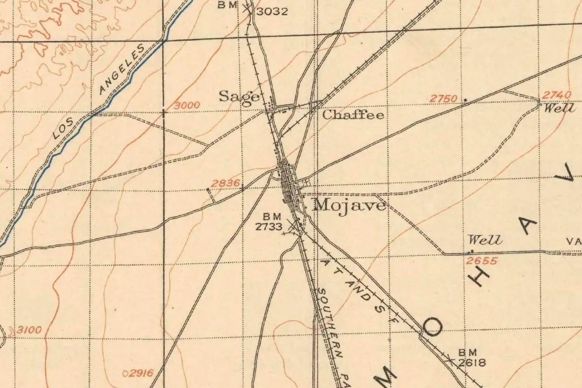
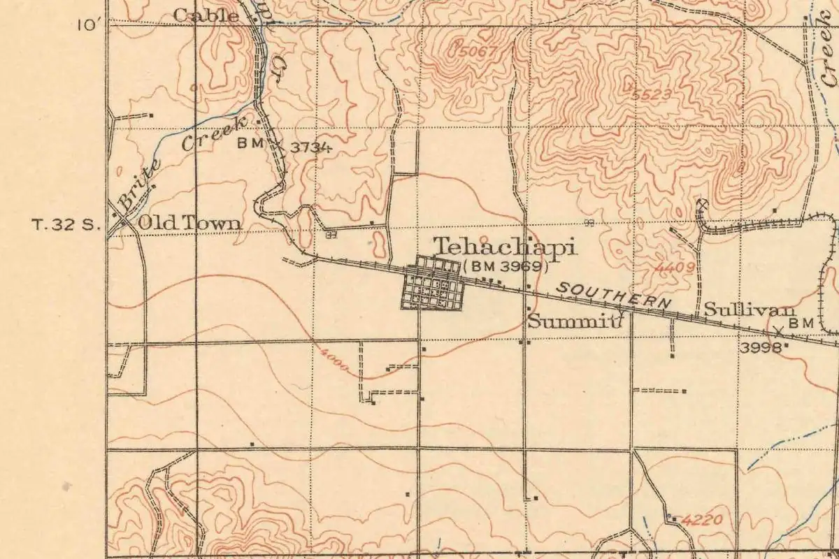
Almost forty years later the Geological Survey still drew both. On its 1915 Mojave sheet, Tehachapi sits on the Southern Pacific line, and a smaller spot marked Old Town lies off to the west.
The Greenwich detour
There was a third name in the mix. Expecting the railroad, people had started a settlement about a mile (1.6 km) west of the station, Morgan says, “under the name of Greenwich, so called in honor of P. D. Green, who kept the post office there.” When the new town went up, Greenwich “promptly moved itself to the railroad’s townsite,” post office and all.
For a while the mail still went to Greenwich. “In the end it was changed to Tehachapi,” Morgan writes, “and the name Greenwich survived only as the designation of a voting precinct.” In another chapter he calls Ben Kessing the first postmaster of the new town, with Green after him, so his book isn’t fully consistent on that point.
What does Tehachapi mean?
Here the sources part ways, and you’ll want to keep all three answers in view.
- A tribe. In 1905 the government geographer Henry Gannett wrote that the town and pass were “named for the Indian tribe Ta hi cha pa han na.”
- A crow’s nest. Morgan, nine years later, calls the old town “Tehachapi, meaning ‘the crow’s nest.’” Elsewhere he uses the same phrase as a picture of the town’s site, “the saddle at the crest, the crow’s nest, in which the town of Tehachapi sits.”
- Acorns and water. The 1939 WPA guide to California glosses the Tehachapi Mountains as “(Ind., land of plenty of acorns and good water).”
None of the three says where it got its meaning. The most careful source is the one that gives the least. A. L. Kroeber, the University of California anthropologist, wrote in 1916 that “the name is of Indian origin.” The pass was in the territory of the Kawaisu, as he spelled it, a Shoshonean people, “but it has not been ascertained whether the word occurs in their speech.” The Yokuts to the north, he added, call the region, “or some spot in it,” Tahichpiu, with “-u being the regular locative case ending.” Kroeber offers no translation at all.
Up and over the pass
For train travelers in 1879 this was the high point of the trip. George Crofutt’s guide listed “Tehachapi Summit” at 3,964 feet, “the highest on the road,” with one store, a hotel, a telegraph office “and half-a-dozen buildings.” If you kept going, down the other side lay Mojave, where the helper engines were coupled and uncoupled. The WPA guide later summed up the move to the tracks in one line: “the town, Mohammed-like, went to the railroad.” The same guide places the first settlement “3 miles east” (5 km), which runs against Morgan’s account and the 1915 map. Tehachapi incorporated on August 13, 1910, Morgan says.
A railroad station took an old name, left the old town behind and absorbed a third one along the way.
Quick answers
Why is Tehachapi called Tehachapi?
The Southern Pacific founded the town in 1876 and gave it the name of an older settlement about three miles (5 km) west, according to Morgan (1914). That older town became known as Old Town.
What does Tehachapi mean?
Nobody agrees. Gannett (1905) ties it to a tribe, Morgan (1914) says “the crow’s nest,” and the 1939 WPA guide says “land of plenty of acorns and good water.” Kroeber (1916) only says the word is Indian and gives the Yokuts form Tahichpiu.
What was Greenwich?
A settlement about a mile (1.6 km) west of the station, named for postmaster P. D. Green. It moved to the railroad’s townsite, and its post office name was later changed to Tehachapi.
Key dates
- 1854John Moore Brite settles in Tehachapi Valley, the first permanent settler there, as old residents remembered it.
- 1876Summer: the Southern Pacific crosses Tehachapi Pass and founds a new town at the summit.
- 1879Crofutt's guide lists Tehachapi Summit at 3,964 feet, the highest station on the road.
- 1883About this year, Morgan says, Old Town starts moving bodily to the railroad.
- 1910August 13: Tehachapi votes to incorporate.
Getting there
Open Tehachapi in Google Maps
Opens in a new tab. The pin is the center of Tehachapi in the USGS place-name record.
The closest airports, Amtrak stations and intercity bus stops, measured in a straight line from the center of Tehachapi.
Airports
- Meadows Field (BFL) Bakersfield 40 mi 65 km
- Hollywood Burbank (BUR) 65 mi 104 km
Amtrak trains
- Bakersfield station (BFD) 36 mi 57 km
- Wasco station (WAC) 59 mi 95 km
Intercity buses
- Alvand Transportation Amtrak Connecting Service · Tehachapi Amtrak Bus Stop under 1 mi 0.2 km
- Gold Runner Tehachapi - Burger King under 1 mi 0.3 km
- International Bus Lines Lamont (Chevron Exit 119) 34 mi 54 km
Distances are as the crow flies, not by road. We don't list schedules or fares because they change; check with the airline, Amtrak or the bus company before you go. Official data (FAA commercial service airports (2025), FAA airport locations, Amtrak stations and Intercity Bus Atlas) from the FAA and the U.S. Bureau of Transportation Statistics, checked Nov 6, 2026.
Sponsored
Staying in Tehachapi?
Compare hotels in Tehachapi, California, on Expedia.
See hotels in TehachapiWe may earn a commission if you buy through this link. It never changes what we write. Read our affiliate disclosure
Historical Sources & References
- Wallace M. Morgan, History of Kern County, California (1914), pp. 28, 89-90, 185-187. The old town “about three miles west,” the railroad “taking the name of the older place in the hills,” Greenwich and P. D. Green, “the crow’s nest” (as a meaning, p. 186, and as a description of the site, p. 28), John Moore Brite in 1854, Old Town moving “1883 or thereabout,” Ben Kessing as first postmaster and the incorporation of August 13, 1910.
- A. L. Kroeber, California Place Names of Indian Origin (1916), p. 61. The name “is of Indian origin,” the pass in Kawaisu territory, and the Yokuts form Tahichpiu.
- Henry Gannett, The Origin of Certain Place Names in the United States (1905), p. 298. “Named for the Indian tribe Ta hi cha pa han na.”
- Federal Writers’ Project, California: A Guide to the Golden State (1939), pp. 606-607. “Land of plenty of acorns and good water,” the China Hill placers and “the town, Mohammed-like, went to the railroad.”
- George A. Crofutt, Crofutt’s New Overland Tourist and Pacific Coast Guide (1879), p. 233. “Tehachapi Summit,” 3,964 feet, “the highest on the road.”
- GNIS feature 1652798 (U.S. Geological Survey). Tehachapi’s federal name record, with its spelling and its place in Kern County.
Spot something wrong, or know more? Tell us here. You can also email us or use our contact page. Corrections are noted here with their date, never made silently.