Clarksdale, Mississippi: John Clark's Town on the Sunflower
Clarksdale is named for John Clark, who bought his first land on the Sunflower River in 1848, platted a village there in 1868, and the village was incorporated as Clarksdale in 1882, according to the 1938 WPA guide. Dunbar Rowland's 1907 cyclopedia of Mississippi says the city is named for John Clark, 'brother-in-law of Governor Alcorn.'
Clarksdale, Mississippi, carries the name of John Clark, a logger who bought land on the Sunflower River in 1848 and laid out a village there in 1868. It was incorporated as Clarksdale in 1882. The story starts earlier, with a 14-year-old boy whose father died of yellow fever in New Orleans.
The architect’s son
The fullest account is in the Federal Writers’ Project guide to Mississippi, published in 1938. “Though a few French Huguenot families are said to have been established earlier in the locality, John Clark is given credit for founding Clarksdale,” it says.
Clark, the guide says, was the son of an English architect who had been sent to Halifax by the British government to help rebuild the city after a fire. The father died of yellow fever in New Orleans in 1837, “leaving John, age 14, to make his way.” In December 1839 John landed at Port Royal, near today’s Friar Point, and went into the logging business with a man named Ed Porter. After a few years both of them quit logging for farming.
“Clark bought his first 100 acres of land from the Government in 1848,” the guide says. The city’s historical marker for him gives the figure as 101 acres and says he started a timber business there. The marker adds that he “steadfastly declined the use of slaves.”
Dry ground where two trails met
The guide explains why he picked that spot. The Delta above the Lake Washington district was “largely a trackless swamp at the time,” but here, on the banks of the Sunflower, “was a narrow spot of dry ground.” Two Indian routes crossed there, the Chakchiuma trade trail running northeast toward Pontotoc and the Lower Creek trade path running west from Augusta, Georgia. “At the point of intersection was a fortification.”
In 1858 Clark began building his house, Hopedale, with workmen brought from Philadelphia. In 1868, the guide says, he “opened a store and platted off a village on the site of the Indian fortification. In 1882 it was incorporated as Clarksdale.” The City of Clarksdale counts 1848, the year of the land purchase, as its founding date.
The governor’s brother-in-law
Dunbar Rowland’s cyclopedia of Mississippi, published in 1907, puts the naming in one line: “The city was platted in 1868, and is named for John Clark, brother-in-law of Governor Alcorn.” Rowland placed the town 76 miles (122 km) south of Memphis, “at the head of high water navigation on the Sunflower river.”
James L. Alcorn, governor in 1870 and 1871, lived at Eagles’ Nest, a plantation in the same county, the WPA guide says. Coahoma County’s own history page repeats Rowland’s wording almost word for word. The city’s marker tells it from the other side: Clark married a sister of a nearby major planter who later became governor. The couple had ten children, and eight of them survived.
A county with a Choctaw name
The town’s name is plain English, but the county around it isn’t. The City of Clarksdale says Coahoma comes from the Choctaw “Co-i-humma,” meaning red panther, and the county gives the same meaning. Coahoma County was established on February 9, 1836, a dozen years before Clark bought his land. If you know Tuscaloosa, Alabama, that’s another town name built from Choctaw words.
A cotton town, then a blues town
Rowland says the Louisville, New Orleans & Texas railway arrived in 1884 and “gave the first impetus to the town.” In 1889 the whole business district burned and was rebuilt “with substantial brick and iron structures.” The city says Clarksdale was known in the early 20th century as the “Golden Buckle of the Cotton Belt,” and that the first cotton crop commercially produced entirely by machine was grown in 1944 on land owned by the Hopson Planting Company of Clarksdale.
The blues is a later chapter, and it isn’t where the name came from. You’ll find that part of the story in the museums and markers listed below this article.
The 1935 map
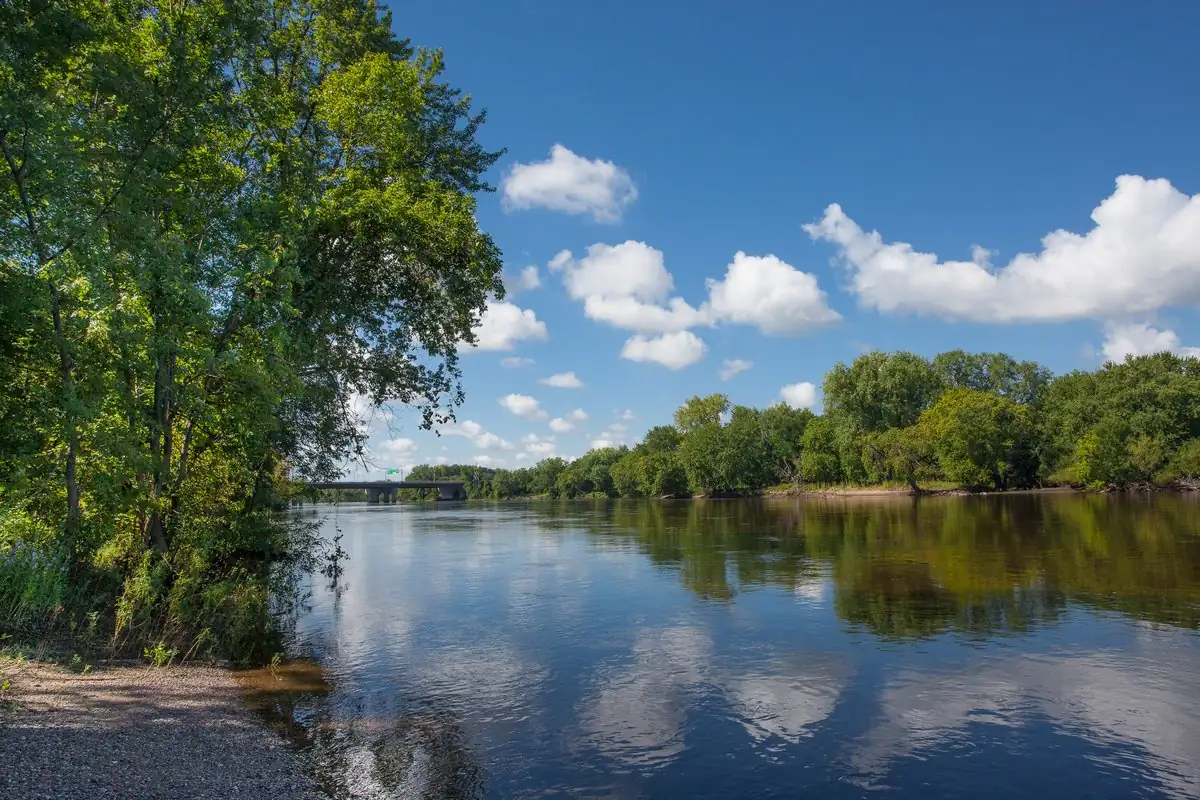
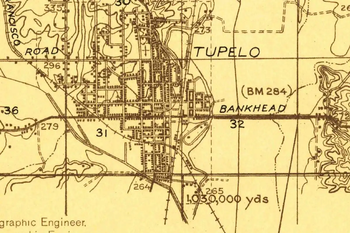
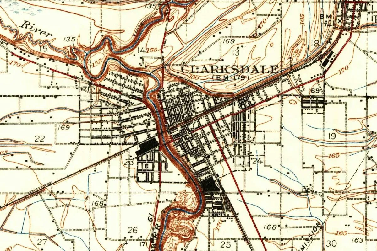
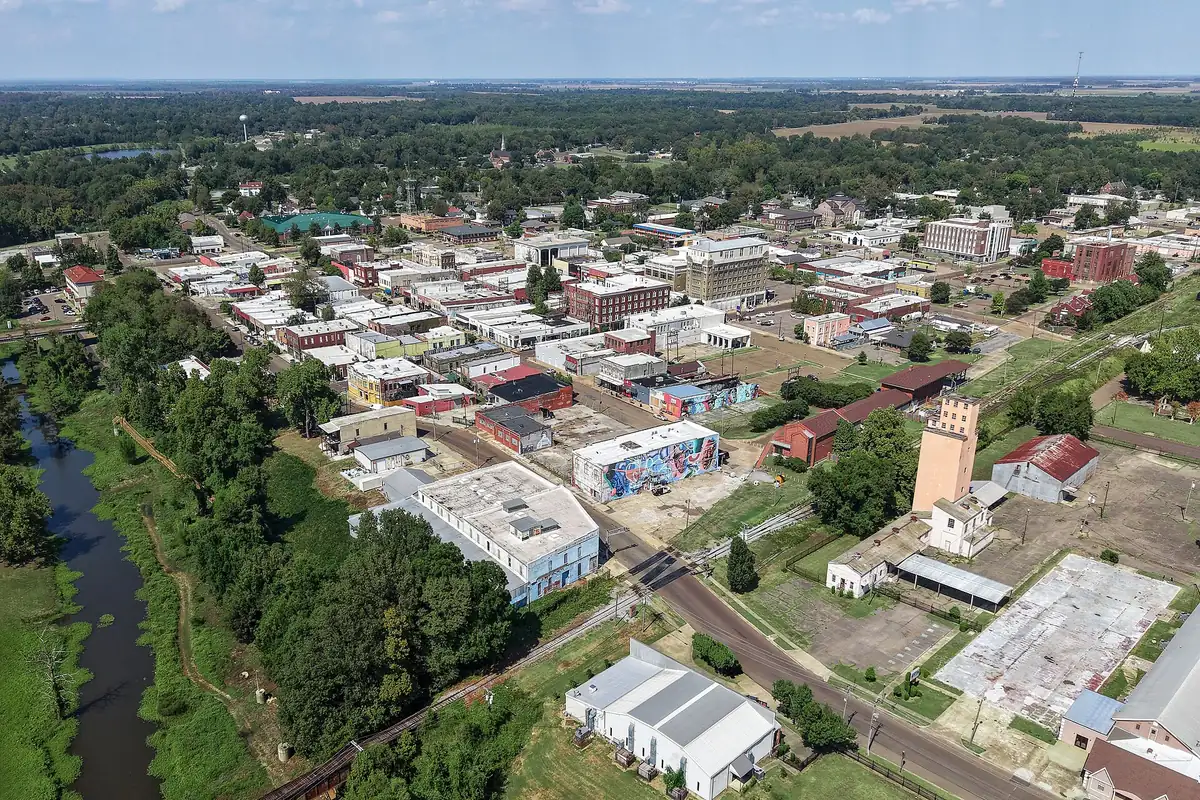
The map at the top of this page is a corner of the Geological Survey’s Clarksdale sheet, 1935 edition, surveyed in 1908 and again in 1931 and 1932. The Sunflower winds through the middle of town between steep brown banks, and the denser blocks are drawn in solid black. Route 61 is marked near the bottom. The photo below shows the same river from the air, with downtown to its right.
Quick answers
Who was Clarksdale named after?
John Clark, who bought his first land on the Sunflower River in 1848 and platted a village there in 1868. The town was incorporated as Clarksdale in 1882, the 1938 WPA guide says.
Was John Clark related to Governor Alcorn?
Yes. Dunbar Rowland’s 1907 cyclopedia calls him “brother-in-law of Governor Alcorn,” and the city’s marker says Clark married a sister of a nearby planter who later became governor.
What does Coahoma mean?
The City of Clarksdale says it comes from the Choctaw “Co-i-humma,” red panther. The county gives the same meaning.
When was Clarksdale founded?
The city dates its founding to 1848, when John Clark bought his land. Rowland and the WPA guide say the village was platted in 1868, and it was incorporated in 1882.
Key dates
- 1836Coahoma County is established on February 9.
- 1837John Clark's father dies of yellow fever in New Orleans, leaving John, 14, on his own, the WPA guide says.
- 1839In December, Clark lands at Port Royal, near Friar Point, and goes into logging with Ed Porter.
- 1848Clark buys his first land on the Sunflower River from the government.
- 1858Work begins on Hopedale, Clark's house.
- 1868Clark opens a store and lays out a village on the site of an Indian fortification.
- 1882The town is incorporated as Clarksdale.
- 1884The Louisville, New Orleans & Texas railway reaches the town, Rowland says.
- 1889Fire destroys the business district, which is rebuilt in brick and iron.
Things to do in Clarksdale, Mississippi
Delta Blues Museum
The museum calls itself the state's oldest music museum. It was set up in 1979 by the Carnegie Library's board and has been on its own since 1999, in the old freight depot on Blues Alley. It shows the remains of the cabin where Muddy Waters lived on Stovall Farms.
Crossroads of 49 & 61
The Blues Trail marker says this junction of the old Highways 49 and 61 was locally known as the crossroads in the 1930s, and later fans tied it to Robert Johnson lore. Vic Barbieri's three-guitar sculpture went up in 1999.
Riverside Hotel
The building opened in 1916 as the Clarksdale Colored Hospital, where Bessie Smith died on September 26, 1937. Mrs. ZL Hill opened it as a hotel on November 9, 1944, the Blues Trail marker says.
John Clark historical marker
The city's marker for the founder stands in the 100 block of Delta Avenue, in front of the Carnegie Public Library.
Getting there
Open Clarksdale in Google Maps
Opens in a new tab. The pin is the center of Clarksdale in the USGS place-name record.
The closest airports, Amtrak stations and intercity bus stops, measured in a straight line from the center of Clarksdale.
Airports
- Frederick W Smith International/Memphis (MEM) 67 mi 108 km
- Bill and Hillary Clinton Ntl/Adams Field (LIT) Little Rock 101 mi 163 km
Amtrak trains
- Marks station (MKS) 18 mi 28 km
- Greenwood station (GWD) 52 mi 84 km
Intercity buses
- Delta Bus Lines Inc. Clarksdale under 1 mi 1 km
- Greyhound Batesville Terza One Stop Shop 42 mi 68 km
Distances are as the crow flies, not by road. We don't list schedules or fares because they change; check with the airline, Amtrak or the bus company before you go. Official data (FAA commercial service airports (2025), FAA airport locations, Amtrak stations and Intercity Bus Atlas) from the FAA and the U.S. Bureau of Transportation Statistics, checked Nov 17, 2026.
Sponsored
Staying in Clarksdale?
Compare hotels in Clarksdale, Mississippi, on Expedia.
See hotels in ClarksdaleWe may earn a commission if you buy through this link. It never changes what we write. Read our affiliate disclosure
Historical Sources & References
- Dunbar Rowland, ed., Mississippi, vol. 1 (1907), p. 449. “Named for John Clark, brother-in-law of Governor Alcorn,” the platting in 1868, the 76 miles (122 km) to Memphis, the railway of 1884 and the fire of 1889. Checked against the page image.
- Federal Writers’ Project, Mississippi: A Guide to the Magnolia State (1938), pp. 317-319. Clark’s father, New Orleans in 1837, Port Royal in 1839, the 100 acres of 1848, the two trade trails, Hopedale, the village of 1868 and the incorporation of 1882; Eagles’ Nest and Alcorn’s term, on p. 317. Checked against the page images.
- City of Clarksdale, “Clarksdale History”. The founding date, the “Golden Buckle of the Cotton Belt,” Coahoma as “red panther” and the machine-picked crop of 1944.
- City of Clarksdale, John Clark marker. The 101 acres, the timber business, the marriage, the ten children and the marker’s location.
- Coahoma County, “History”. John Clark as Alcorn’s brother-in-law, and the county’s founding on February 9, 1836.
- Delta Blues Museum; Mississippi Blues Trail markers for the Delta Blues Museum, the Crossroads of 49 & 61 and the Riverside Hotel. The details in the things-to-do list.
- GNIS feature ID 666084 (U.S. Geological Survey). The national names database entry for Clarksdale, in Coahoma County, with its coordinates.
- U.S. Geological Survey, Clarksdale sheet (1935). The 1:62,500 map that the image at the top of this page was cropped from.
Spot something wrong, or know more? Tell us here. You can also email us or use our contact page. Corrections are noted here with their date, never made silently.