Why Is It Called Wildwood, NJ? A Forest by the Sea
Wildwood is named for the woods. Philip Pontius Baker, a merchant from Vineland, chose the name for the dense, twisted forest that covered Five Mile Beach when he and his brothers developed it, say the National Park Service and the Wildwood Crest Historical Society. The borough was formed in 1895; nearly all the trees are gone.
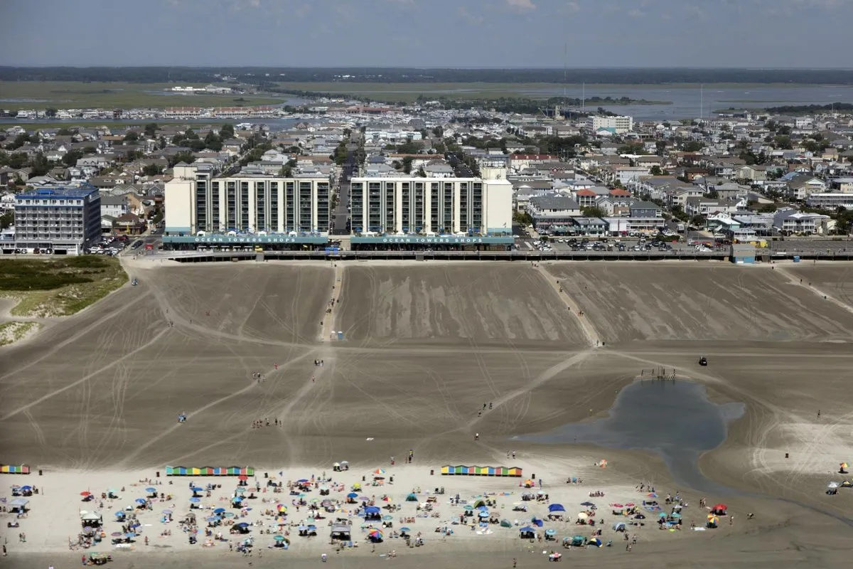
Wildwood, New Jersey, is named for the thick forest that once covered its barrier island, a name the developer Philip P. Baker gave it in the 1890s. The forest is almost entirely gone now, and the beach and boardwalk took its place.
Why is it called Wildwood, New Jersey?
Because there were wild woods. A 2018 National Park Service study of preservation on the Jersey Shore, written by Stephanie M. Hoagland, says Philip Pontius Baker gave the name Wildwood to the resort communities after the thick, twisted forest that grew over the island when they were founded. It quotes an early real estate brochure that sold the place as “a veritable forest by the sea.”
The Wildwood Crest Historical Society gives the founders’ version. Baker and his brothers, merchants from the farm town of Vineland, had been to Five Mile Beach several times and liked what they saw. In 1895, the society says, the brothers organized a firm, the Wildwood Beach Improvement Company; then they started a borough they called Wildwood, because the new town really did stand in a forest beside the ocean. The society adds that it’s hard to picture now, since nearly every tree on the island has disappeared.
For a look at what those woods were like, turn to the county history Lewis Townsend Stevens put out in 1897. Stevens describes the Wildwood tract as 100 acres (40 ha) running from the ocean back to the thoroughfare behind the island, with about half of it in timber. Some of the trees, he wrote, stood close to 100 feet (30 m) tall. He lists oaks, cedars, holly, magnolia, sassafras, wild cherry, persimmon, sweet gum and beech, green mosses dangling three to six feet (1 to 2 m) from the branches, a grape vine nearly a yard (0.9 m) around that spread 200 feet (61 m) through the oaks, and a small freshwater pond called Magnolia Lake.
A name that outlasts the thing it describes isn’t unusual. Orange Beach, Alabama, still carries the name of orange groves that hard freezes wiped out more than a century ago.
Wildwood, NJ history
Wildwood is one of three towns on a barrier island about six miles (10 km) long that are known together as the Wildwoods; the other two are North Wildwood and Wildwood Crest. The Park Service study says all three got their start between 1880 and 1905, mostly at the hands of land developers.
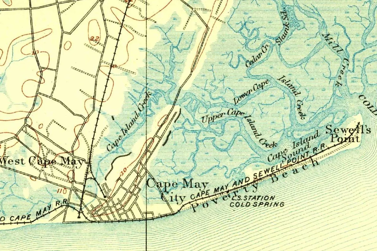
Stevens, whose county history also covers the Dutch naming of Cape May, places Wildwood on Five Mile Beach, northeast of Cape May City by about six miles, and says Baker of Vineland founded it about 1890. The Crest society has the brothers buying a large tract on Five Mile Beach in the mid-1880s. The legal date is firmer. John P. Snyder’s 1969 history of New Jersey’s civil boundaries records the borough of Wildwood as formed from Middle Township on May 1, 1895, after a referendum held the day before. Stevens gives the same incorporation date.
Baker himself, according to the Crest society, was born on January 14, 1846, in Union County, Pennsylvania, moved to Vineland in 1869 with his brother Latimer, and won a seat in the state Assembly in 1882 and in the Senate in 1886.
Wildwood had a neighbor that was older. Snyder lists Holly Beach as a borough from April 14, 1885, later reorganized as Holly Beach City. In a referendum on August 29, 1911, voters agreed to join the two, and on January 1, 1912, the city of Wildwood replaced both boroughs. Holly Beach disappeared as a town name. Lincoln City, Oregon, was made the same way half a century later, out of five beach towns that merged. Snyder also notes that maps from 1777 and 1834 show Turtle Gut Inlet at the site of today’s Wildwood.
The Bakers kept going south. The Crest society says Wildwood Crest became a borough on April 6, 1910, with Baker as its first mayor. He died on August 14, 1920.
Growth came with the trains. The Park Service says the island grew slowly until reliable railroad service arrived in 1889, bringing visitors from Philadelphia and as far off as New York. According to the tourism authority, Wildwood’s leaders decided in 1903 to build a wide, raised boardwalk nearer the water. Later the island became a stage for postwar pop culture: the Park Service study says Bill Haley and His Comets played “Rock Around the Clock” at the HofBrau in 1954, and that on August 5, 1957, American Bandstand went on the air from the Starlight Ballroom. Wildwood sits in New Jersey’s Cape May County, near the state’s southern tip.
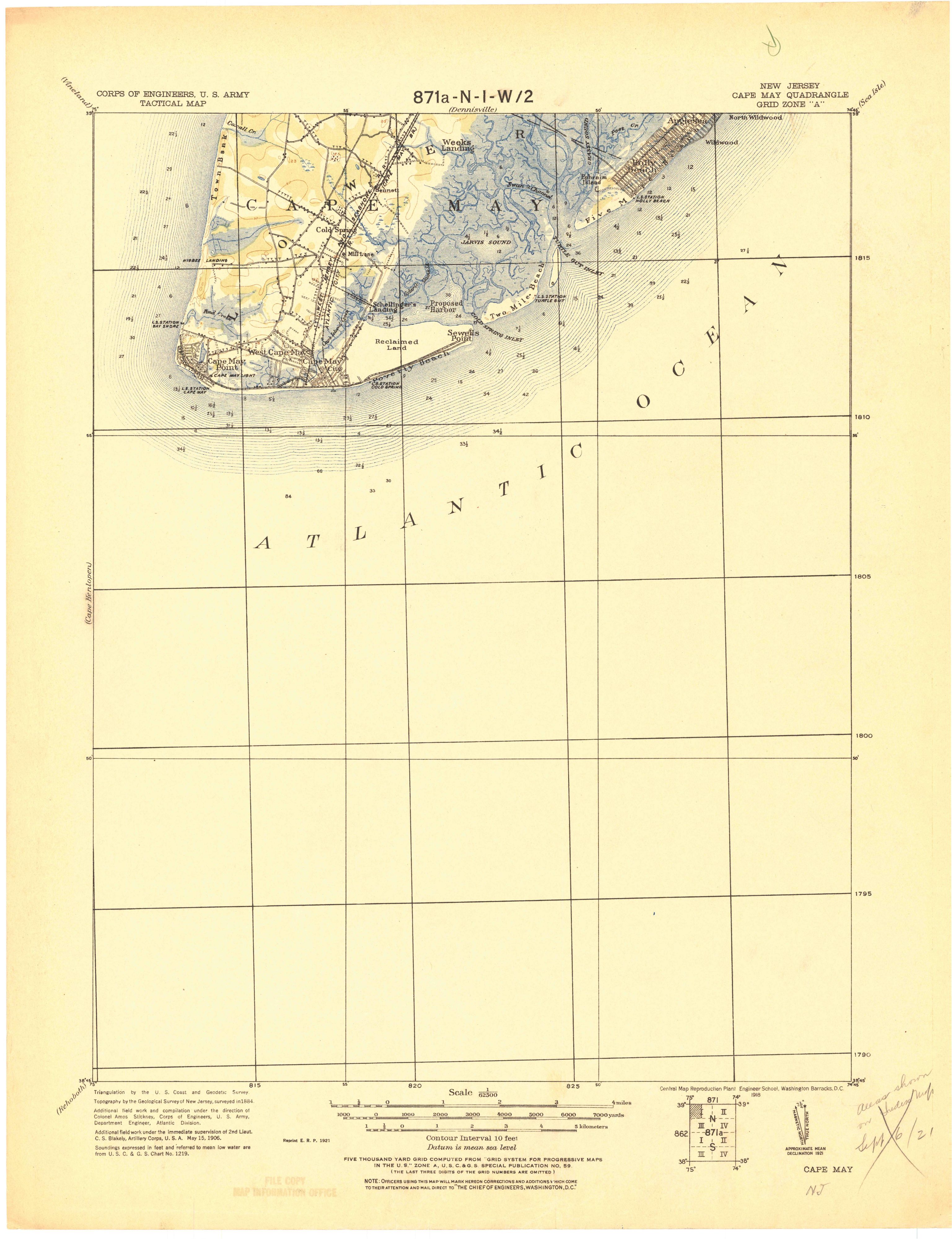
Wildwood on the 1921 map
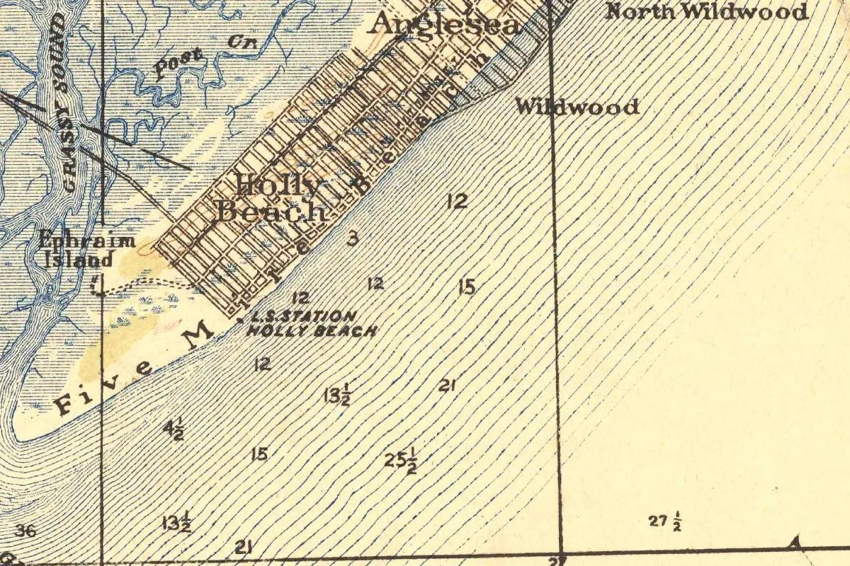
Our map comes from a crop of the Cape May quadrangle, a 1:62,500 tactical map issued by the Army’s Corps of Engineers. Its margin explains how it was built: triangulation from the Coast and Geodetic Survey, “Topography by the Geological Survey of New Jersey, surveyed in 1884,” additional field work under Col. Amos Stickney and by Second Lieut. C. S. Blakely, dated May 15, 1906, and soundings from a Coast and Geodetic Survey chart. The printing line reads “Reprint E. R. P. 1921.” So the shoreline is mostly an 1884 picture with 1906 updates, on a sheet printed nine years after Holly Beach stopped being a town.
That’s why Holly Beach is still lettered large across the street grid, with Anglesea above it and “L.S. Station Holly Beach” on the shore. The words Five Mile Beach run along the sand, and Grassy Sound, Post Creek and Ephraim Island lie in the marsh behind. The names Wildwood and North Wildwood sit out in the ocean, among the depth numbers.
Quick answers
Who founded Wildwood, New Jersey?
Philip Pontius Baker of Vineland and his brothers, according to Stevens and the Wildwood Crest Historical Society. Baker also chose the name.
What was Holly Beach in Wildwood, New Jersey?
A borough on the same island, formed in 1885. It merged with Wildwood to form the city of Wildwood on January 1, 1912, Snyder records.
Are there still woods in Wildwood, New Jersey?
Hardly any. The Wildwood Crest Historical Society says the island has lost nearly all of its trees.
Key dates
- 1884The Geological Survey of New Jersey surveys the topography later used for the Cape May tactical map.
- 1885Holly Beach is formed as a borough on April 14.
- 1889Reliable railroad service reaches the island, the National Park Service says.
- 1890Stevens dates Baker's founding of Wildwood to about this year.
- 1895Wildwood is formed as a borough on May 1, after a referendum the day before.
- 1897Stevens describes Wildwood's forest in his county history.
- 1903Wildwood's leaders decide to build a wide, raised boardwalk closer to the ocean.
- 1910Wildwood Crest becomes a borough on April 6, with Baker as its first mayor.
- 1912On January 1, the city of Wildwood replaces the boroughs of Wildwood and Holly Beach City.
- 1920Philip P. Baker dies on August 14.
- 1921The Army reprints its Cape May tactical map, still showing Holly Beach.
Things to do in Wildwood, New Jersey
The Wildwoods Boardwalk
A boardwalk of more than 70,000 planks that runs nearly 2.5 miles (4 km) and 38 blocks, between Cresse Avenue, in Wildwood Crest, and 15th Avenue, in North Wildwood. It began in the 1890s as a stretch of boards about 150 yards (137 m) long.
The Boardwalk tram car
The yellow sightseer tram cars that carry riders along the boardwalk, which the tourism authority says were first built for the 1939 World's Fair in New York City.
Doo Wop Experience and Neon Sign Garden
A museum in Fox Park, across from the convention center, housed in the Surfside, a 1960 space-age restaurant from Wildwood Crest that preservationists took apart in 2002 and rebuilt here.
Morey's Piers
Amusement piers on the boardwalk that grew from two boardwalk lots the Morey family bought in North Wildwood in 1969, where they opened Surfside Pier with a giant fiberglass slide.
Getting there
Open Wildwood in Google Maps
Opens in a new tab. The pin is the center of Wildwood in the USGS place-name record.
The closest airports, Amtrak stations and intercity bus stops, measured in a straight line from the center of Wildwood.
Airports
- Atlantic City International (ACY) 35 mi 56 km
- Salisbury-Ocean City Wicomico Regional (SBY) 59 mi 94 km
- Philadelphia International (PHL) 65 mi 104 km
Amtrak trains
- Atlantic City station (ACY) 33 mi 52 km
- Absecon station (ABN) 34 mi 55 km
Intercity buses
- OurBus Wildwood Boardwalk, NJ (Schellenger Ave at Ocean Ave) under 1 mi 0.6 km
- Greyhound Atlantic City Pacific Ave 32 mi 51 km
- FlixBus Dover, DE 40 mi 65 km
Distances are as the crow flies, not by road. We don't list schedules or fares because they change; check with the airline, Amtrak or the bus company before you go. Official data (FAA commercial service airports (2025), FAA airport locations, Amtrak stations and Intercity Bus Atlas) from the FAA and the U.S. Bureau of Transportation Statistics, checked Nov 21, 2026.
Sponsored
Staying in Wildwood?
Compare hotels in Wildwood, New Jersey, on Expedia.
See hotels in WildwoodWe may earn a commission if you buy through this link. It never changes what we write. Read our affiliate disclosure
Historical Sources & References
- Stephanie M. Hoagland, “Preservation Stagnation on the Jersey Shore” (National Park Service, 2018). Baker and the forest behind the name, the “veritable forest by the sea” brochure, founding between 1880 and 1905, the railroad in 1889, and the HofBrau and Starlight Ballroom.
- Wildwood Crest Historical Society, “The Founding of Wildwood Crest”. The Baker brothers, the Wildwood Beach Improvement Company of 1895, the vanished trees, Wildwood Crest in 1910 and Baker’s life.
- Lewis Townsend Stevens, The History of Cape May County (1897), pp. 446-447. The forest of the Wildwood tract, founding about 1890 and incorporation on May 1, 1895. Checked against the page image.
- John P. Snyder, The Story of New Jersey’s Civil Boundaries, 1606-1968 (1969), pp. 16, 114, 116. The boroughs of Holly Beach and Wildwood, the 1911 referendum and the city of 1912, and Turtle Gut Inlet. Checked against the page image.
- Wildwoods Tourism Authority, Fun Facts and Boardwalk; Doo Wop Experience, The Museum. The 1903 boardwalk and the details in the things-to-do list.
- U.S. Geological Survey, GNIS feature 881829. Wildwood’s federal record.
- Corps of Engineers, U.S. Army, Cape May quadrangle, tactical map, reprinted 1921. The sheet the map at the top was cropped from.
Sponsored
Put this 1921 map on your wall
An Army tactical map of the Cape May peninsula, from an 1884 New Jersey survey updated in 1906 and reprinted in 1921, with Holly Beach still lettered on the island, is in the public domain. Download the full-size scan for free, then have it printed on canvas with CanvasOnTheCheap.
Print a map on canvasDownload the full-size mapWe may earn a commission if you buy through this link. It never changes what we write. Read our affiliate disclosure
Spot something wrong, or know more? Tell us here. You can also email us or use our contact page. Corrections are noted here with their date, never made silently.