Crater Lake: Deep Blue Lake, Lake Majesty and a Name
Crater Lake got its name in 1869 from James M. Sutton’s party, after earlier visitors had called it Deep Blue Lake, Blue Lake and Lake Majesty. That’s four names in 16 years for one lake, and the first three all came from people trying to describe its color or the feeling of standing on the rim. The one that stuck describes the shape instead. If you’re wondering who first put the plainest name in print, it was Sutton, who ran a newspaper.
Why Is It Called Crater Lake?
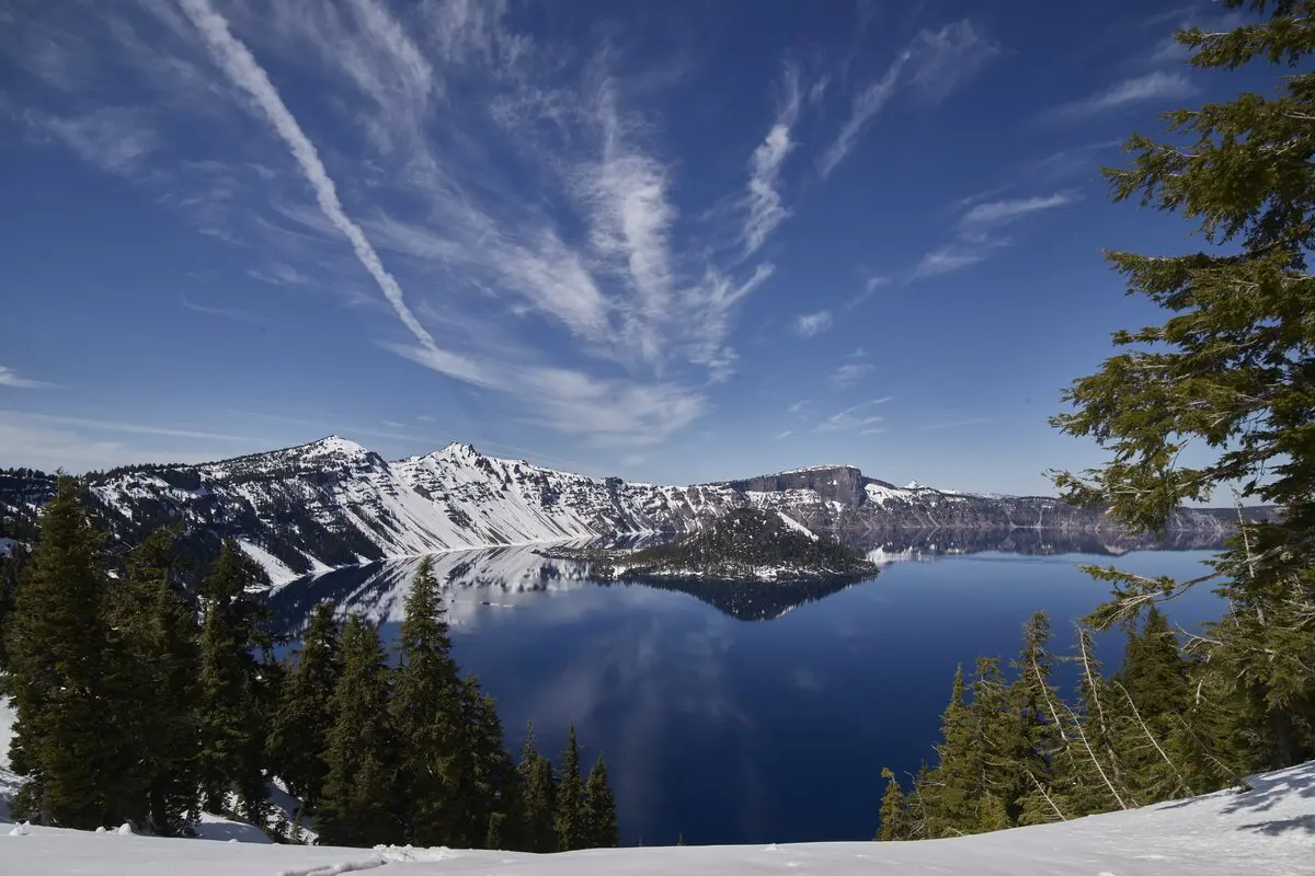
The lake sits in a hole where a mountain used to be. The Park Service says it lies inside what’s left of Mount Mazama, a volcano about 12,000 feet (3,660 m) tall that collapsed after a huge eruption 7,700 years ago. To anyone standing on the rim in the 1860s, the bowl looked like a crater, and that’s the image Sutton’s party chose.
There may be a more specific reason. Harlan Unrau’s 1987 administrative history of the park says “some sources” claim the 1869 party renamed the lake for the crater on top of Wizard Island, the cinder cone that pokes out of the water. M. W. Gorman, writing in 1897, describes the party climbing into that “tiny crater” and calls it a miniature copy of the great caldera that holds the lake. Neither source quotes Sutton giving his reason, so you should treat both explanations as likely rather than proven.
Crater Lake’s Earlier Names
The first outsiders to see it were gold prospectors. The Park Service says three members of a party financed by John Wesley Hillman came on the lake on June 12, 1853, and one of them, Skeeters, proposed “Deep Blue Lake.” Unrau quotes Hillman’s memory, printed in the Oregonian in 1903, that the men voted between “Mysterious Lake” and “Deep Blue Lake.” Nobody followed up, and the find was forgotten.
In 1862 a party led by Chauncy Nye passed through, and Nye’s article in the Jacksonville Oregon Sentinel said the water’s deep blue color made them “name it Blue Lake.” No earlier description of the lake had appeared in print, according to the Park Service.
The Army came next. Fort Klamath went up in 1863, about seven miles (11 km) southeast of today’s park boundary, and a road crew’s hunters found the lake again in August 1865. A group of soldiers and civilians went to see it. The Park Service brochure says Sergeant Orsen Stearns climbed down and was the first non-Native person known to reach the shore, and Captain F. B. Sprague, joining him, suggested “Lake Majesty.” Unrau dates Sprague’s visit to August 24, 1865, says he wrote his account the following day, and notes that the Sentinel printed it on September 9.
Then came Sutton. Unrau says his party left Jacksonville on July 27, 1869. Gorman adds that David Linn’s wagon hauled their boat up (a wooden one, he says, though the Park Service brochure calls it canvas), and that on August 4 five men rowed out to the island Sutton christened Wizard Island. Gorman calls them the first party to name the lake “Crater Lake” and says Sutton’s account in the Oregon Sentinel of August 21 and 28, 1869, was the name’s first appearance in print. The University of Oregon’s newspaper program points to the same August 21 issue. The brochure’s version is shorter: Sutton swapped in “Crater Lake” for Lake Majesty, and it stuck.
The mountain is younger as a name than the lake. Gorman’s history, published in October 1897, says the name Mount Mazama was given to the mountain that holds the lake “on August 21” of the previous year, during the Mazamas climbing club’s 1896 outing. Many rim names are older: Gorman lists Llao Rock, the Watchman, Dutton Cliff, Cleetwood Cove and Phantom Ship among names given during the 1886 survey, and he says Llao Rock was once Mount Jackson.
What does Mazama mean? In a letter printed in the same issue, the naturalist C. Hart Merriam traced the word to Fernandez in 1651, who used it for a Mexican deer or antelope, and noted that Gray, in 1850, made it a scientific name for the mountain goat.
The Klamath people had their own names long before any of these. The Park Service’s 2008 traditional use study, In the Footprints of Gmukamps, reports that Klamath Tribes interviewees remembered giwas and giwas e’ush as the Klamath names for the caldera and for the lake. One tribal historian quoted there spells it Gii-was. A note in the study warns that sources don’t agree on exactly what each word refers to, since the ethnologist Albert Gatschet, writing in 1890, attached giwash to Mount Scott.
Crater Lake History as a Park
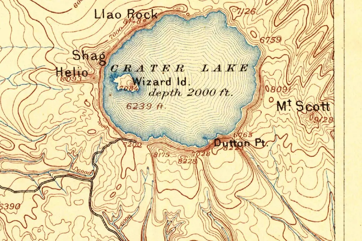
William Gladstone Steel read about the lake in a newspaper in 1870, the Park Service says, and first saw it 15 years later. In 1886 he helped with Clarence Dutton’s Geological Survey mapping, which sounded the lake to 1,996 feet, as the Park Service tells it. The modern figure, from a 2000 survey, is 1,943 feet (592 m), and the Park Service says no lake in the United States is deeper. The 1891 map below comes out of that survey work, with “depth 2000 ft.” printed in the lake. After protection in a forest reserve in 1893, Crater Lake National Park was created on May 22, 1902.
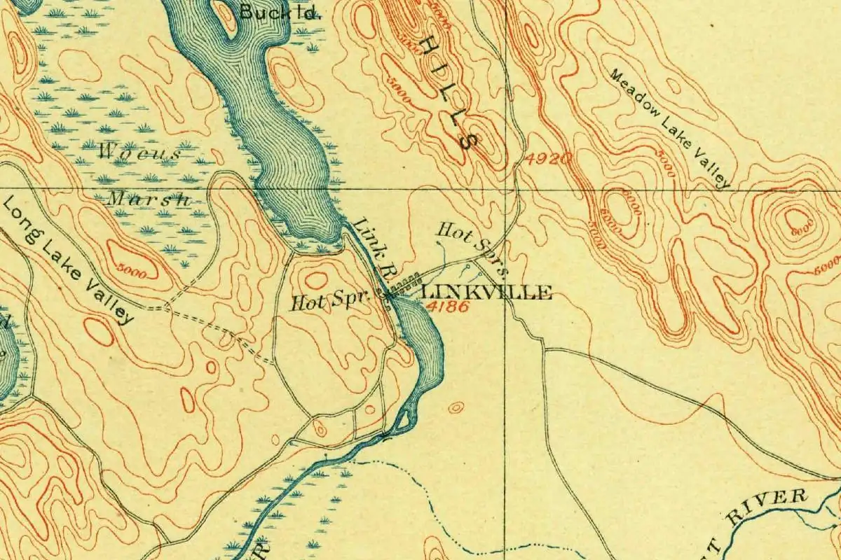
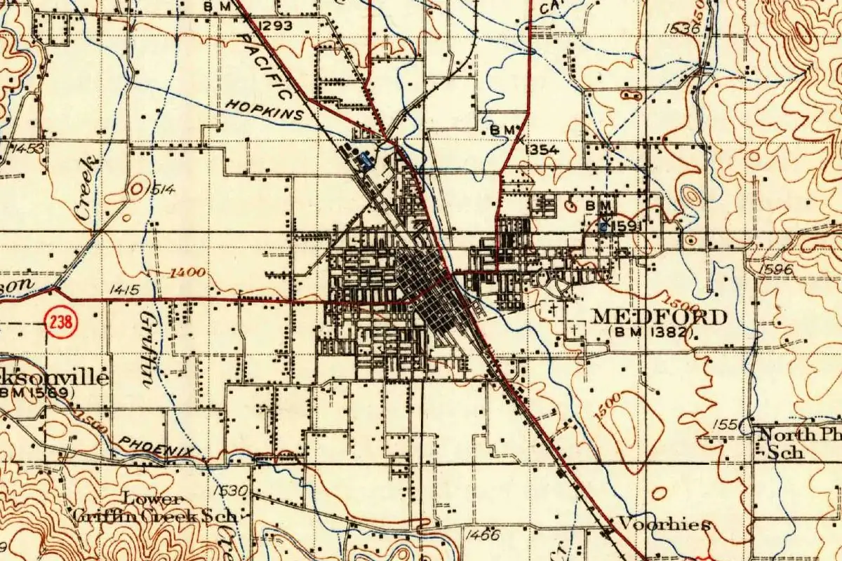
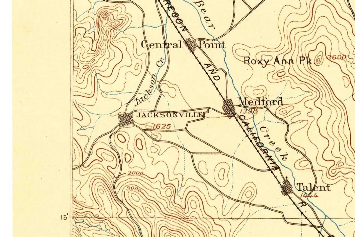
The lake’s names keep turning up in nearby towns. Sutton’s party set out from Jacksonville, where the first paper was called the Table Rock Sentinel. In Medford, a theater in a 1924 building got its name, Craterian, from a contest with 1,500 entries, partly after the lake. And Klamath Falls was called Linkville until 1891, when a surveyor for the county made the case that a falls town ought to be named for its falls.
Quick answers
Why Is Crater Lake Called Crater Lake?
Because it fills a crater-like bowl, the shell of collapsed Mount Mazama. James M. Sutton’s party chose the name in August 1869, and Sutton’s account in the Oregon Sentinel first printed it. Some sources say the small crater on Wizard Island inspired the choice.
What Was Crater Lake Called Before?
Prospectors in 1853 suggested “Deep Blue Lake,” Chauncy Nye’s party called it Blue Lake in 1862, and soldiers from Fort Klamath named it “Lake Majesty” in 1865. The Klamath names giwas and giwas e’ush, for the caldera and the lake, are far older.
Who Named Crater Lake?
James M. Sutton’s party of 1869, according to M. W. Gorman’s 1897 history. Sutton, a Jacksonville newspaperman, published the trip in the Oregon Sentinel on August 21 and 28, 1869, the first time “Crater Lake” appeared in print, and his name replaced Lake Majesty.
How Deep Is Crater Lake?
The Park Service puts it at 1,943 feet (592 m), measured in a 2000 survey, deeper than any other lake in the country. The 1886 survey, done with pipe and piano wire, came within 53 feet of that, at 1,996 feet.
Key dates
- 1853June 12: prospectors from John Wesley Hillman's party find the lake, and one of them, Skeeters, suggests "Deep Blue Lake."
- 1862Chauncy Nye's party calls it Blue Lake, in the earliest printed description of it.
- 1865Soldiers from Fort Klamath reach the shore; at Capt. F. B. Sprague's suggestion it becomes "Lake Majesty."
- 1869August: James M. Sutton's party boats to Wizard Island, and his Oregon Sentinel account prints the name "Crater Lake."
- 1886A Geological Survey party under Clarence Dutton maps and sounds the lake, with William G. Steel helping.
- 1896August 21: the Mazamas climbing club names the mountain that held the lake Mount Mazama.
- 1902May 22: Crater Lake becomes a national park.
Find it in Google Maps
Opens in a new tab. The pin is a point from the USGS place-name record, so it may not be the middle of the area.
Sponsored
Planning a visit?
Compare hotels in the area on Expedia.
See hotels nearbyWe may earn a commission if you buy through this link. It never changes what we write. Read our affiliate disclosure
Historical Sources & References
- National Park Service, Crater Lake “History & Culture”. Hillman’s party, June 12, 1853, and Skeeters’s “Deep Blue Lake”; Nye’s 1862 article, “name it Blue Lake,” the first published description; Steel’s newspaper story of 1870.
- National Park Service, Crater Lake “History” brochure. Fort Klamath, 1863; Stearns first to the shore and Sprague’s “Lake Majesty”; Sutton’s 1869 boat trip and his substitution of “Crater Lake”; the 1886 survey’s 1,996 feet against 1,943 in 2000; the 1893 forest reserve; the park of May 22, 1902.
- National Park Service, Crater Lake “Frequently Asked Questions”. 1,943 feet, deepest in the United States; Mount Mazama, about 12,000 feet, collapsed 7,700 years ago.
- Harlan D. Unrau, Administrative History: Crater Lake National Park, vol. I (1987), chapter 1. Hillman’s 1903 recollection of the vote; Sprague’s visit of August 24, 1865, his account written the next day and printed September 9; the Sutton party’s dates; “some sources” on the Wizard Island crater.
- M. W. Gorman, “The Discovery and Early History of Crater Lake,” Mazama (1897). Page 156: Stearns and “Lake Majesty.” Page 157: Wizard Island named by Sutton, whose group was “the first party to name it ‘Crater Lake.’” Page 158: the Oregon Sentinel of August 21 and 28, 1869. Pages 159-160: the 1886 rim names, Llao Rock once Mount Jackson, and Mount Mazama named August 21.
- C. Hart Merriam, “The Name Mazama” (1897). Fernandez, 1651; Gray’s use for the mountain goat, 1850.
- Douglas Deur, In the Footprints of Gmukamps (2008). Page 52: giwas and giwas e’ush; pages 53-54: Barbara Alatorre’s “Gii-was”; page 274, note 19: Gatschet’s different reading.
- Oregon Digital Newspaper Program, “The Blue Jewel of Oregon”. Sutton’s Oregon Sentinel article of August 21, 1869, as the earliest use of “Crater Lake” in the paper.
- Stephen R. Mark, “Crater Lake National Park,” The Oregon Encyclopedia. The state encyclopedia’s history of the park; it doesn’t take up the name.
- USGS, Ashland, Oregon, 1:250,000 map, October 1891 edition. Shown on this page; based on survey work of 1886 and 1887; federal, so free of copyright.
- GNIS feature 1163669, Crater Lake (USGS). GNIS record for the lake, with its federal coordinates.
Spot something wrong, or know more? Tell us here. You can also email us or use our contact page. Corrections are noted here with their date, never made silently.