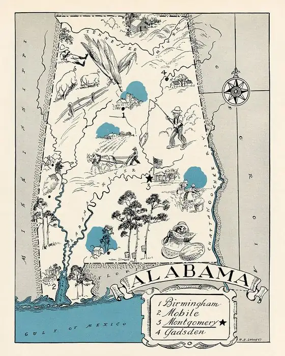
Why Is It Called Gulf Shores? A Developer and Miami Shores
Developer George C. Meyer named Gulf Shores, his widow, Erie Hall Meyer, said in a 1985 interview published in 1986. He had admired the name Miami Shores and saw no reason this beach couldn't be Gulf Shores. She recalled him getting Rand McNally to drop 'Foley Beach' from its map. She gave no year; the post office opened in 1947.
Gulf Shores, Alabama, was named by developer George C. Meyer, who admired the name Miami Shores, his widow said in an interview recorded in 1985. She also remembered the label he got rid of: Foley Beach.
Why is it called Gulf Shores?
The answer comes from the developer’s family. On December 10, 1985, Patricia G. Harrison sat down in Gulf Shores with Erie Hall Meyer, born in 1908, for an oral history that the Gulf Coast Historical Review printed in its fall 1986 issue. The journal’s introduction calls her husband, George Charles Meyer (1878-1959), “an early developer of Gulf Shores,” and adds: “Indeed, it was he who gave the name, Gulf Shores, to the area.”
Asked by Harrison where the name came from, Erie Meyer answered: “George had been to Miami year after year. Miami Shores had just started. He had admired the name in the beginning and he had said, ‘I see no reason for this not being Gulf Shores.’ He said, ‘I like that name.’ And he named it Gulf Shores.”
She remembered an earlier label, too. Her husband once opened a Rand McNally map, she said, and where Gulf Shores should be it read “Foley Beach.” She said she couldn’t remember seeing him angry until then. He called the company to say the place was “Gulf Shores, properly named and authenticated,” and asked for the map to be corrected, and she said it was.
This rests on one source, a widow’s memory, recorded decades later, with no year for the naming. The journal’s introduction repeats it as fact. The City of Gulf Shores and the Encyclopedia of Alabama, which tell how the town grew, say nothing about the name. A 2010 marker from the state tourism department and the city says George C. Meyer saw potential where many saw unusable land, and it credits gifts from Erie Hall Meyer and the George C. Meyer Foundation.
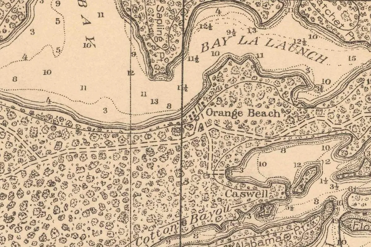
Two other details from the interview don’t line up neatly with later histories. Erie Meyer said her husband built “the big, old Gulf Shores Hotel” on the beach in 1928, while the Encyclopedia of Alabama dates the beach’s first hotel to the early 1940s. And the old maps leave a gap. In 1921 the Army engineers printed a tactical map of the area, titled the Bon Secour quadrangle, from field work done by 2nd Lt. S. S. Winslow between November 1911 and June 1912. It names Bon Secour, Roscoe and Orange Beach, but the strip of beach south of Little Lagoon, near Oyster Bay, carries no place name at all, Gulf Shores or Foley Beach. The next sheet of the area, surveyed in 1940-41, does.
Gulf Shores history: canal, park and post office
The city’s history credits two projects with drawing people in: the Intracoastal Waterway, finished in 1937, and Gulf State Park, which opened in 1939. Before then, it says, few people lived there apart from a fishing community going back to the early 1800s. In the Encyclopedia of Alabama’s account, the beaches and wetlands here were hard to get to until the 1940s; a beachfront hotel went up early in that decade, reached by a rough road, and a post office followed in 1947.
Shrimp kept the place going. The encyclopedia says shrimping began around 1918, mostly to supply bait, and that deep-sea trawling for the food market took hold in 1956. The city adds that until the 1970s nearly every job here was in shrimping, oystering or fishing. To bring business in the off-season, the community started fishing rodeos and, in 1971, the National Shrimp Festival.
A town that had to go to court
Becoming a town wasn’t simple. The encyclopedia says that in 1956 some residents asked to incorporate and were granted a charter. Others, afraid of higher local taxes, fought it, and in 1957 a judge threw the charter out. In 1958 the Supreme Court of Alabama ruled for incorporation. The city says the first town covered some 206 acres (83 ha) along the Intracoastal Canal, with a cantilever bridge tying the strip north of the canal to the larger part south of it.
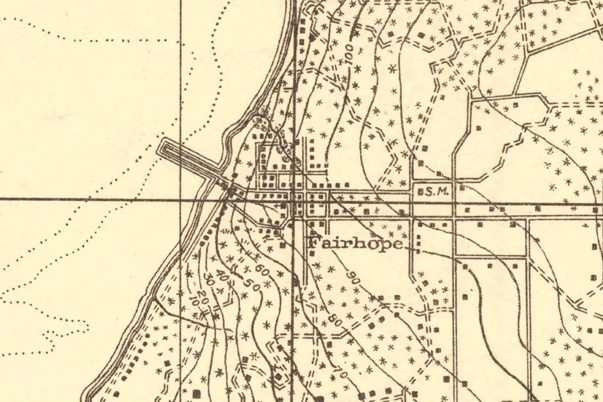
Hurricane Frederic hit Gulf Shores directly in 1979, the city says, and it was during the building boom that followed that Gulf Shores became a city. Elsewhere in Baldwin County, Fairhope has its name on record from the start: one of the 1894 single-tax colonists who settled it said the colony they planned had a “fair hope” of succeeding.
Gulf Shores isn’t the only town drawn around an intracoastal canal. In Delray Beach, Florida, Delray, on the west side of the canal that became the Intracoastal Waterway, was incorporated in 1911, and Delray Beach, on its east side, in 1923. Along the Florida Panhandle, four beach municipalities were merged into Panama City Beach by a 1970 state law.
Pleasure Island
The other name around here does have a source. The 2010 marker says the area was “Officially designated ‘Pleasure Island’ in 1949 by Governor Jim Folsom.” The local tourism office tells it a little differently: Folsom came up with the nickname, and the Gulf Shores Lions Club adopted it officially in 1949.
Gulf Shores on the 1943 map
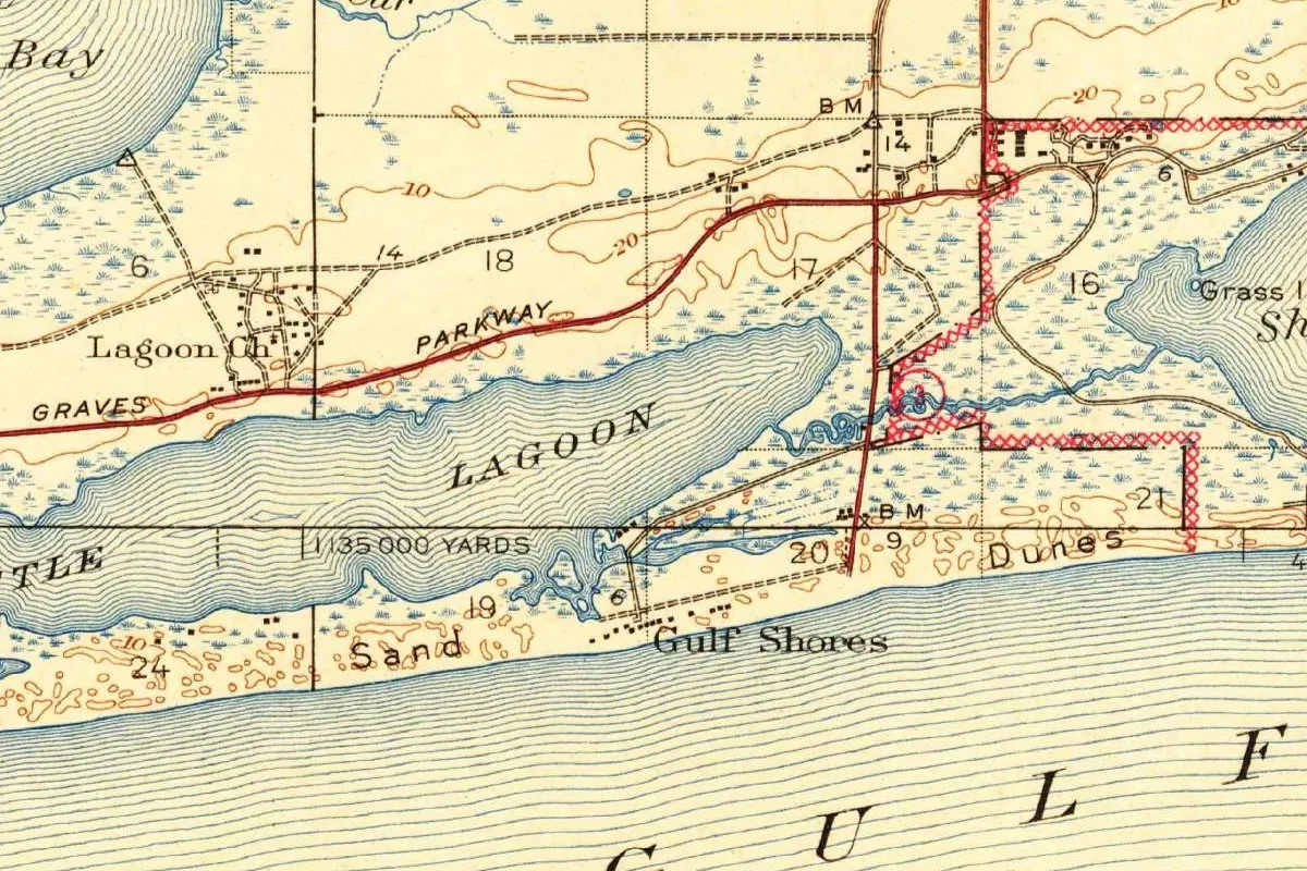
The map heading this article was cropped from the Foley quadrangle, Alabama-Florida, 15-minute series, at 1:62,500, a Geological Survey sheet that also carries “War Department” across the top. Its margin credits topography to Crawford Dickey, R. C. Darnell, J. T. Gist, F. A. Davidson, Le Grand Smith, M. E. Sojka and L. B. Walker, “Surveyed in 1940-1941,” and the title block reads “Edition of 1943.”
If you look at the crop, Gulf Shores is lettered next to a row of small buildings on the beach, with Sand Dunes along the shore and Little Lagoon stretched out behind. A red road runs south to the beach, Graves Parkway and Lagoon Ch. are to the west, and a red crosshatched line at the right marks a boundary that the full sheet labels Gulf State Park.
Quick answers
Who named Gulf Shores, Alabama?
George C. Meyer, a developer, borrowing from the name Miami Shores. That’s how his widow, Erie Hall Meyer, told it in a 1985 interview published in 1986.
When did Gulf Shores get a post office?
In 1947. The city’s history and the Encyclopedia of Alabama give the same year.
When was Gulf Shores incorporated?
Residents began in 1956. After a judge threw out the charter in 1957, the Alabama Supreme Court upheld incorporation in 1958.
Key dates
- 1921An Army engineers' map of the area, from field work in 1911-12, puts no name on the beach by Little Lagoon.
- 1928George C. Meyer builds the Gulf Shores Hotel on the beach, his widow recalled; the Encyclopedia of Alabama dates the first beach hotel to the early 1940s.
- 1937The Intracoastal Waterway is completed.
- 1939Gulf State Park opens.
- 1943The Foley quadrangle, surveyed in 1940-41, labels Gulf Shores.
- 1947The first post office opens.
- 1949Pleasure Island becomes the official nickname, credited to Governor Jim Folsom.
- 1956Residents petition to incorporate the town.
- 1958After a judge overturns the charter in 1957, the Alabama Supreme Court upholds incorporation.
- 1971The first National Shrimp Festival is held.
- 1979Hurricane Frederic hits; in the rebuilding years the town becomes the City of Gulf Shores.
Things to do in Gulf Shores, Alabama
Gulf State Park
A state park dedicated in 1939 with two miles (3.2 km) of beach and 6,150 acres (2,489 ha) for hiking and biking, plus Lake Shelby, a 900-acre (364 ha) freshwater lake close to the Gulf, and a nature center.
Gulf State Park Fishing and Education Pier
A Gulf fishing pier with covered seating, a raised observation deck, rail fishing for wheelchair users, and signs along the way about local fish, birds and other wildlife.
Bon Secour National Wildlife Refuge
A refuge set up by Congress in 1980 where loggerhead, green and Kemp's ridley sea turtles nest and the endangered Alabama beach mouse lives. The Gator Lake Trail is an accessible loop through maritime forest and wetlands.
Gulf Shores Museum
A city museum in a prewar beach house that belonged to a Mobile family, given to the city after Hurricane Frederic, with a steeple from Oyster Bay Baptist Church watching over its garden and the 1940 mast of the shrimp boat Sea Biscuit as a flagpole.
Getting there
Open Gulf Shores in Google Maps
Opens in a new tab. The pin is the center of Gulf Shores in the USGS place-name record.
The closest airports, Amtrak stations and intercity bus stops, measured in a straight line from the center of Gulf Shores.
Airports
- Gulf Shores International/Jack Edwards Field (JKA) 3 mi 6 km
- Pensacola International (PNS) 34 mi 55 km
Amtrak trains
- Mobile station (MOE) 37 mi 59 km
- Pascagoula station (PAG) 52 mi 84 km
Intercity buses
- Greyhound Pensacola International Airport 34 mi 55 km
- FlixBus Mobile AL (MOG) 38 mi 61 km
Distances are as the crow flies, not by road. We don't list schedules or fares because they change; check with the airline, Amtrak or the bus company before you go. Official data (FAA commercial service airports (2025), FAA airport locations, Amtrak stations and Intercity Bus Atlas) from the FAA and the U.S. Bureau of Transportation Statistics, checked Nov 18, 2026.
Sponsored
Staying in Gulf Shores?
Compare hotels in Gulf Shores, Alabama, on Expedia.
See hotels in Gulf ShoresWe may earn a commission if you buy through this link. It never changes what we write. Read our affiliate disclosure
Historical Sources & References
- City of Gulf Shores, “About Gulf Shores”. The waterway in 1937, the park in 1939, the post office in 1947, incorporation from 1956 to 1958, the 206 acres, the 1971 festival and Hurricane Frederic.
- Encyclopedia of Alabama, “Gulf Shores”. Access before the 1940s, the first beach hotel, shrimping since about 1918, the court fight of 1956-58 and Gulf State Park.
- Historical Marker Database, “Gulf Shores Community”. Pleasure Island in 1949 and George C. Meyer.
- Gulf Shores & Orange Beach Tourism, fun facts. Folsom’s nickname and the Lions Club in 1949.
- Patricia G. Harrison, “The Development of Gulf Shores, Alabama: An Interview with Erie Hall Meyer,” Gulf Coast Historical Review 2, no. 1 (Fall 1986), pp. 79-80, 94. The introduction crediting George C. Meyer with the name, the interview of December 10, 1985, Miami Shores, Foley Beach and the 1928 hotel. Checked against the page images.
- Corps of Engineers, Bon Secour quadrangle tactical map, printed 1921. Field work 1911-12; no name on the beach south of Little Lagoon.
- City of Gulf Shores museum history; Alabama State Parks pages for Gulf State Park and its pier; Bon Secour National Wildlife Refuge and its trails. The details in the things-to-do list.
- U.S. Geological Survey, GNIS feature 119462. Gulf Shores in Baldwin County.
- Foley quadrangle, surveyed 1940-41, edition of 1943. The sheet the map at the top was cropped from.
Spot something wrong, or know more? Tell us here. You can also email us or use our contact page. Corrections are noted here with their date, never made silently.