Fairhope, Alabama: Named for a Colony's 'Fair Hope'
Fairhope comes from a remark by one of its founders, members of a single-tax club in Des Moines, Iowa. In 1894 one of them said their planned colony had a 'fair hope' of succeeding. The Encyclopedia of Alabama, the city and the Fairhope Single Tax Corporation all give that story. The colonists reached Mobile Bay on November 15, 1894.
Fairhope, Alabama, got its name in 1894 from a single-tax colony whose founders thought they had a fair hope of making their experiment work. They weren’t even in Alabama yet when they picked it. The name was chosen by a club of reformers in Iowa, before the colony had a site.
A club in Des Moines
The Fairhope Single Tax Corporation, which still exists, tells the start this way: “Members of the single tax club in Des Moines, Iowa, decided in 1894 that they wanted to do more than just discuss the single tax theory. They wanted to build an actual community.” The club met in the Iowa capital, whose own name, as the story of Des Moines tells it, goes back to an Army fort.
The idea behind it belonged to Henry George, whose Progress and Poverty came out in 1879. In the Encyclopedia of Alabama, Paul M. Gaston of the University of Virginia explains that George “argued that land should be common property, made available for use rather than speculative profit,” and that his followers wanted to raise all public money “from a single tax on land values.”
The man who led the founding party was Ernest Berry Gaston, whom the encyclopedia describes as “a young Iowa journalist and Populist Party officer.” He called his program “cooperative individualism.” The City of Fairhope adds that some of the founders had already tried once, with a colony in Louisiana called the National Cooperative Company, which failed.
Where the name came from
Three sources tell it, in slightly different words. The Single Tax Corporation says the club wrote a constitution while still meeting in Iowa, and “Upon passage of the constitution one of the founding members said he believed there was a fair hope that the experiment would succeed. Thus the name for the utopian demonstration community: Fairhope.”
The encyclopedia puts it as “The members chose the name Fairhope when one of their number remarked that they had a ‘fair hope’ of succeeding.” The city’s version is looser: “They thought using the Single Tax plan would give them at least a fair hope of succeeding.”
None of them names the member who said it. If you were hoping for a name, the sources don’t give one.
The colony’s company was called the Fairhope Industrial Association, and in 1904, the encyclopedia says, it became the Fairhope Single Tax Corporation.
Round-Up Day
The club sent two members, James Bellangee and Shuah S. Mann, to find land. The corporation says they looked at sites in Arkansas, Alabama, Louisiana, Mississippi, Tennessee and Texas before settling on the eastern shore of Mobile Bay. The encyclopedia gives a reason the South was favored: land was cheaper and the weather warmer.
The colonists arrived on November 15, 1894, the encyclopedia says, “numbering 19 adults and nine children.” The corporation counts “a group of 28 single taxers.” The city calls that date Round-Up Day and says the founders “settled on the high bluff where they bought clear-cut wasteland for $5.50 per acre.”
Henry George didn’t come. The corporation is blunt about it: George “never endorsed these changes or the Fairhope experiment, and declined all invitations to visit the community.” The changes it means are practical ones. Instead of taxing private land, the colony owned the land and leased it out for 99 years.
Colony and town
The encyclopedia describes a rough start. The colonists couldn’t raise enough money to buy all the land they wanted, and they had to open the settlement to nonmembers, many of whom opposed its principles. Complaints about rent, among other things, led to the incorporation of the Town of Fairhope in 1908. The encyclopedia gives its population then as 569. The city says “around 500.”
The town drew writers, actors, artists and craftspeople, the encyclopedia says. In 1907 Marietta Johnson founded her School of Organic Education there, and John Dewey came to see it in 1913. The encyclopedia adds that the “ideal of equality” Dewey praised there “was limited to white people,” and that Johnson and Gaston both knew segregation went against their own principles.
For a while the colony earned well from its pier. The corporation says it earned “significant income from the usage fees on the Fairhope Pier” until a causeway opened in 1927, and then that money dried up. In the 1930s, the city says, it took over the beachfront park, the bluff parks, Henry George Park, Knoll Park and “the quarter-mile-long pier, all gifts of the Single Tax Colony.” Early visitors, it adds, came over by bay boat from Mobile.
New Harmony, Indiana, is another town tied to a plan to remake society: it took its name from George Rapp’s Harmonists, and Robert Owen bought it in 1825. Ernest Gaston edited the colony’s newspaper, the Fairhope Courier, until he died in 1937.
The 1921 map
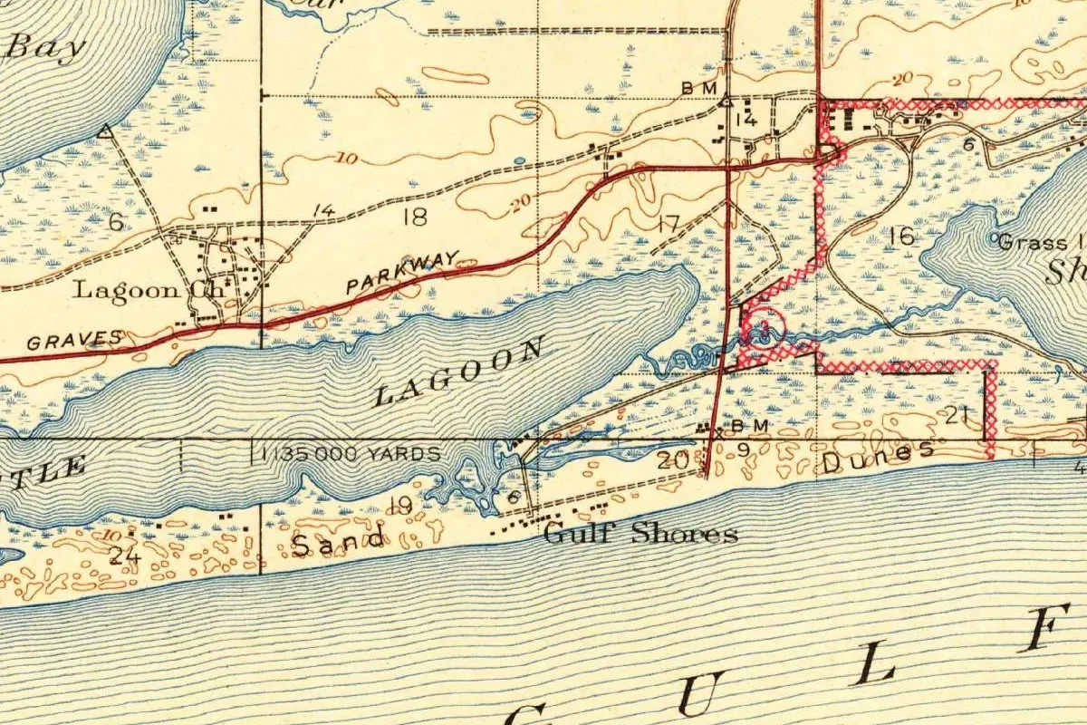
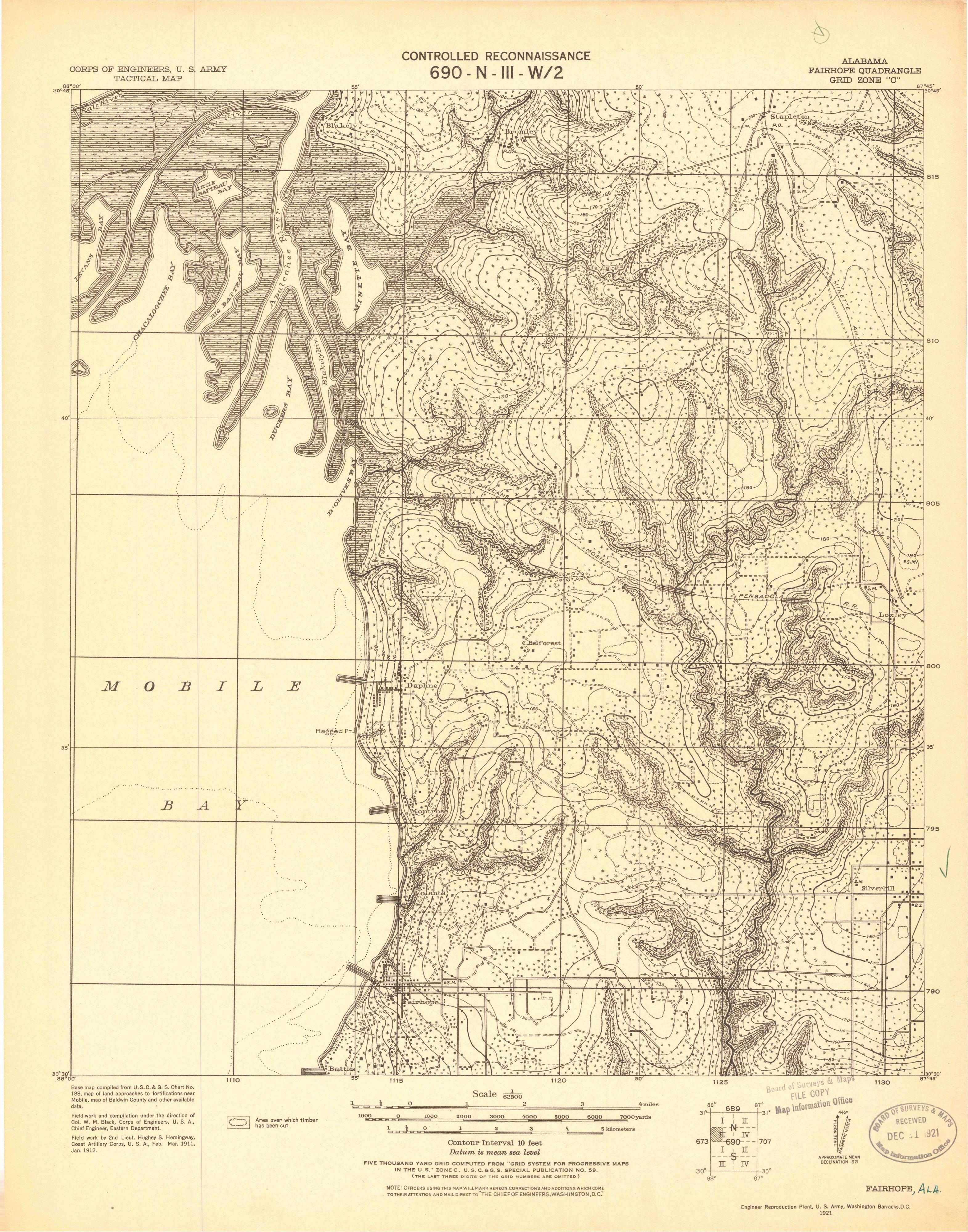
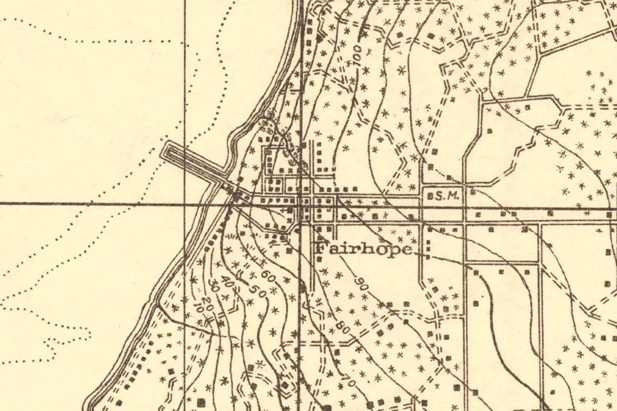
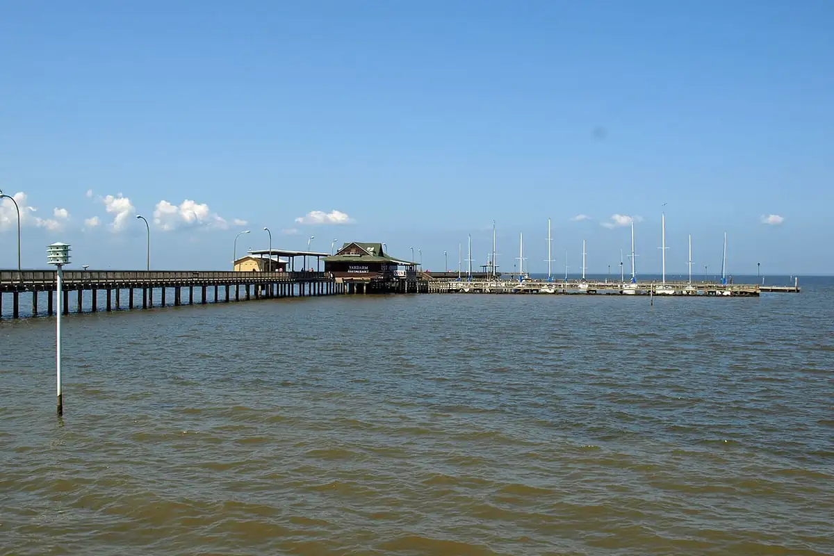
The map at the top of this page wasn’t made by the Geological Survey. It’s a tactical map drawn by the Army Corps of Engineers, from field work done in 1911 and 1912 and printed in 1921. You can see the street grid on the bluff and the long pier running straight out into the bay. The photo below shows the pier in 2012, rebuilt after Hurricane Katrina; the city calls it Fairhope’s “town square.” It stands where the original commercial pier went out into the bay in 1894, the city says.
Quick answers
Why is it called Fairhope?
Because of a remark. One of the founders said in 1894 that their single-tax colony had a “fair hope” of succeeding, and the name stuck, according to the Encyclopedia of Alabama, the city and the Fairhope Single Tax Corporation.
Who founded Fairhope?
Single-tax reformers from Des Moines, Iowa, led by Ernest Berry Gaston. Nineteen adults and nine children arrived on November 15, 1894, the encyclopedia says.
What is the Fairhope Single Tax Corporation?
The colony itself. It began as the Fairhope Industrial Association, took its present name in 1904, and leases its land for 99 years under Henry George’s single-tax idea.
Key dates
- 1879Henry George publishes Progress and Poverty, the book behind the single tax.
- 1894A single-tax club in Des Moines adopts a constitution and the name Fairhope; the colonists reach Mobile Bay on November 15.
- 1904The Fairhope Industrial Association becomes the Fairhope Single Tax Corporation.
- 1907Marietta Johnson founds the School of Organic Education in Fairhope.
- 1908The Town of Fairhope is incorporated.
- 1913John Dewey visits Johnson's school.
- 1927The causeway opens, and the colony's income from pier fees dries up.
- 1937Ernest Berry Gaston dies, still editor of the Fairhope Courier.
Things to do in Fairhope, Alabama
Fairhope Museum of History
A city museum in the circa 1928 Spanish mission-style building that once served as City Hall, with permanent exhibits on Fairhope's founders, the Single Tax theory, the town jail and the Jubilee phenomenon.
Fairhope Municipal Pier and Park
The 1,448-foot (441 m) pier at the west end of Fairhope Avenue, on the site of the city's original commercial pier of 1894, rebuilt after Hurricane Katrina. The park beside it has a rose garden, a fountain, a duck pond and a sandy beach.
Marietta Johnson Botanical Garden and Tree Trail
A garden on the community college campus in the middle of downtown, named for Marietta Johnson, the educator who founded the School of Organic Education in 1907.
Flying Creek Nature Preserve
A 108-acre (44 ha) forested sanctuary between Veterans Boulevard and Fly Creek, with nature trails that connect to the Eastern Shore Trail and outdoor classrooms.
Weeks Bay Reserve
A national estuarine research reserve of 9,317 acres (3,770 ha), established in 1986, with hardwood forests, salt and freshwater marshes and bog habitats, a visitor center and a pitcher plant bog.
Getting there
Open Fairhope in Google Maps
Opens in a new tab. The pin is the center of Fairhope in the USGS place-name record.
The closest airports, Amtrak stations and intercity bus stops, measured in a straight line from the center of Fairhope.
Airports
- Gulf Shores International/Jack Edwards Field (JKA) 21 mi 34 km
- Mobile Regional (MOB) 23 mi 38 km
- Louis Armstrong New Orleans International (MSY) Kenner 145 mi 234 km
Amtrak trains
- Mobile station (MOE) 14 mi 23 km
- Pascagoula station (PAG) 41 mi 65 km
Intercity buses
- FlixBus Mobile AL (MOG) 16 mi 25 km
- Greyhound Pensacola International Airport 42 mi 68 km
Distances are as the crow flies, not by road. We don't list schedules or fares because they change; check with the airline, Amtrak or the bus company before you go. Official data (FAA commercial service airports (2025), FAA airport locations, Amtrak stations and Intercity Bus Atlas) from the FAA and the U.S. Bureau of Transportation Statistics, checked Nov 17, 2026.
Sponsored
Staying in Fairhope?
Compare hotels in Fairhope, Alabama, on Expedia.
See hotels in FairhopeWe may earn a commission if you buy through this link. It never changes what we write. Read our affiliate disclosure
Historical Sources & References
- Paul M. Gaston, “Fairhope,” Encyclopedia of Alabama. Ernest Berry Gaston and cooperative individualism, Henry George, the “fair hope” remark, the name change of 1904, the arrival of November 15, 1894, the town of 1908, Marietta Johnson, Dewey and segregation.
- City of Fairhope, “History”. The Louisiana colony, Round-Up Day, $5.50 per acre, “a fair hope of succeeding,” about 500 residents in 1908, the gifts of the 1930s and the bay boats from Mobile.
- Fairhope Single Tax Corporation, “Fairhope History”. The Des Moines club, the constitution and the name, Bellangee and Mann, the six states, the 28 single taxers, Henry George’s refusal, the 99-year leases and the pier fees.
- Fairhope Museum of History; Fairhope Municipal Pier and Park; Marietta Johnson Botanical Garden; Flying Creek Nature Preserve; Weeks Bay Reserve. The details in the things-to-do list.
- GNIS feature ID 118120 (U.S. Geological Survey). Fairhope in the national gazetteer, in Baldwin County, with its coordinates.
- Corps of Engineers, Fairhope quadrangle (1921). The 1:62,500 map that the image at the top of this page was cropped from.
Sponsored
Put this 1921 map on your wall
The 1921 Army Corps of Engineers tactical map of the Fairhope Quadrangle, from fieldwork in 1911 and 1912, is in the public domain. Download the full-size scan for free, then have it printed on canvas with CanvasOnTheCheap.
Print a map on canvasDownload the full-size mapWe may earn a commission if you buy through this link. It never changes what we write. Read our affiliate disclosure
Spot something wrong, or know more? Tell us here. You can also email us or use our contact page. Corrections are noted here with their date, never made silently.