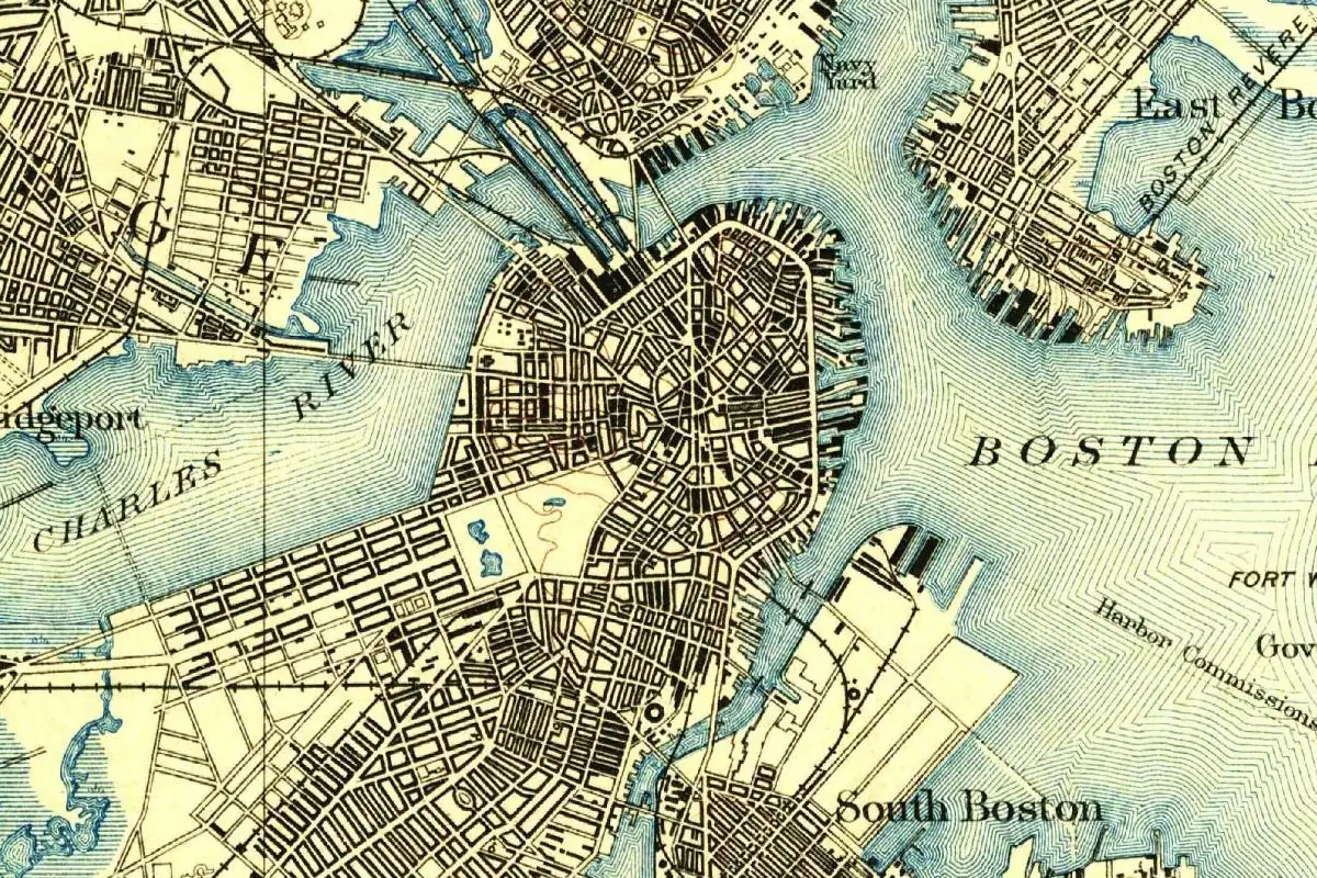
Freedom Trail: History, Walking Tours and the 1951 Name
The Freedom Trail began as a 1951 newspaper column in which Bill Schofield asked Boston for a “Puritan Path,” “Liberty Loop” or “Freedom’s Way.” The city took the idea within weeks and opened the route that June under a name none of his three suggestions used: the Freedom Trail.
Freedom Trail History: The 1951 Column Behind the Name
Schofield was an editor and daily columnist at the Boston Evening Traveler. In a 1996 interview with the writer Susan Wilson, he said he kept getting lost when he went looking for the city’s old buildings, and wondered how a visitor from somewhere like Cincinnati was supposed to manage. His partner in the idea was Bob Winn, from Old North Church, the church whose steeple held the two lanterns. Wilson describes Winn as a church member who had kept the building open to the public since 1942. The Park Service’s brochure calls him the church’s sexton.
The pitch ran in Schofield’s “Have You Heard” column on March 8, 1951, under the headline “Hub Needs ‘Liberty Loop.’” Seth Bruggeman’s 2019 history of Boston National Historical Park, written for the National Park Service, quotes the key line: Boston should “mark out a ‘Puritan Path’ or ‘Liberty Loop’ or ‘Freedom’s Way’ or whatever you want to call it,” so that visitors would know where to start and which way to go. Schofield thought it could be done “on a budget of just a few dollars and a bucket of paint.”
He and Winn had a route in mind. According to Bruggeman, it started at the State House and ran past the Granary Burying Ground, King’s Chapel, the Old South Meeting House, the Old State House, Faneuil Hall, the Paul Revere House and Old North Church to Copp’s Hill Burying Ground. Faneuil Hall’s own name, as our page on it explains, came from a Boston town vote in 1742.
Schofield kept writing about it. A follow-up on March 19 carried the headline “‘Freedom Way’ Sign Idea Big Hit,” and in it he recalled a cousin who used to say he’d started for Bunker Hill “but somehow I wound up at Revere Beach.” That beach is in Revere, which took the name in 1871; as our page on the town explains, the law didn’t say which Revere, and an 1874 gazetteer named Paul. On March 31 he reported that Mayor John B. Hynes had phoned to say the city would “go along with the Freedom Way plans.”
The name changed before the signs went up. On June 11, 1951, Hynes dedicated the route as the “Freedom Trail,” according to the Freedom Trail Foundation, which cites the city’s own record of that week. Painted signs at 30 street corners pointed the way, and the Park Service brochure says they showed a colonial rider and led to 12 historic sites between the State House and Copp’s Hill. Who swapped “Way” for “Trail” isn’t recorded in any source we found. Schofield himself, asked about it by Wilson 45 years later, said he couldn’t remember: “That’s just too far back!”
The trail caught on fast. By 1953, Bruggeman writes, an estimated 40,000 people had walked it, and the city ordered permanent metal signs, each with a gold silhouette of Paul Revere on horseback. Wilson credits Dick Berenson, a Boston businessman, with the red line painted on the sidewalks in 1958. The Foundation says the trail officially reached Charlestown in 1972, taking in all 16 of its present sites. Two years after that, Congress created Boston National Historical Park, and the Park Service says every one of its sites except Dorchester Heights is on the Freedom Trail.
Freedom Trail Walking Tour: Guided or Self-Guided
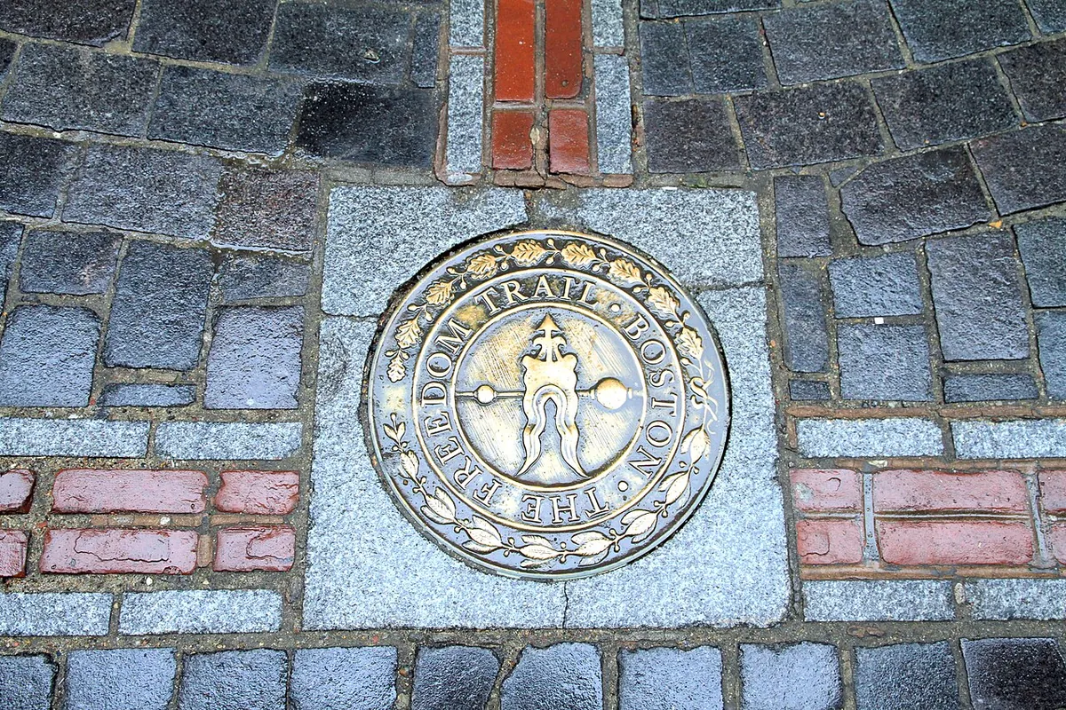
Today’s trail runs about 2.5 miles (4 km), from Boston Common across the river to Bunker Hill and the old Navy Yard in Charlestown, the Park Service says. You follow a line of red brick or red paint set into the sidewalk, with round markers like the one at the top of this page. The Park Service brochure starts it at the Boston Common Visitor Center, in a city that, as our Boston page explains, was briefly Trimountain before it borrowed a Lincolnshire town’s name in 1630.
In a column that July, after the opening, Schofield wrote that the new trail took about 45 minutes at an easy pace, Bruggeman notes. The longer route takes more. The Park Service suggests that a visit can run from a few hours to a whole weekend if you go inside every site. Plenty of people pick a handful of stops instead of walking end to end.
For a self-guided tour, the Park Service’s Boston staff have recorded a free audio guide to the trail, available online and in the NPS App, in English, Spanish and French. When we checked in November 2026, guided tours ran seasonally, led by Park Service staff and by private companies, and the Park Service noted that few public tours cover the whole route. Many of the buildings are owned and run separately and may charge admission. If you can’t manage stairs, the Park Service lists detours around stairs at the Shaw Memorial, the Granary Burying Ground and the stretch from Paul Revere Park to Old North Church.
Quick answers
Who came up with the Freedom Trail?
Boston Evening Traveler columnist Bill Schofield, working with Old North Church’s Bob Winn. Schofield proposed it in his column of March 8, 1951, and Mayor John B. Hynes dedicated it that June.
What was the Freedom Trail almost called?
Schofield’s first column offered “Puritan Path,” “Liberty Loop” and “Freedom’s Way.” By late March, the city and the column were calling it the Freedom Way plan.
When was the red line added to the Freedom Trail?
It came in 1958. For the trail’s first seven years, signs on street corners marked the way.
How long is the Freedom Trail walk?
About 2.5 miles (4 km), from Boston Common to Charlestown, the Park Service says. The original 1951 route, the Foundation says, was about a mile and a fifth (1.9 km) and stopped in the North End.
Key dates
- 1951March 8: Bill Schofield's column proposes a marked walking route; June 11: Mayor John B. Hynes dedicates the Freedom Trail.
- 1953About 40,000 visitors follow the trail, and the city orders permanent metal signs.
- 1958The painted red line is added to guide walkers.
- 1972The trail is extended across the river into Charlestown.
- 1974Congress creates Boston National Historical Park, most of whose sites lie on the trail.
Getting there
Open Freedom Trail in Google Maps
Opens in a new tab. The pin is an approximate point for Freedom Trail.
The closest airports, Amtrak stations and intercity bus stops, measured in a straight line from the center of Freedom Trail.
Airports
- General Edward Lawrence Logan International (BOS) Boston 3 mi 4 km
- Worcester Regional (ORH) 42 mi 68 km
Amtrak trains
- Boston North station (BON) under 1 mi 0.8 km
- Boston South station (BOS) under 1 mi 0.9 km
Intercity buses
- Concord Coach Lines Boston South Station under 1 mi 0.9 km
- CandJ Bus Lines South Station (Boston) under 1 mi 0.9 km
- Boston Express Bus Boston South Station under 1 mi 0.9 km
Distances are as the crow flies, not by road. We don't list schedules or fares because they change; check with the airline, Amtrak or the bus company before you go. Official data (FAA commercial service airports (2025), FAA airport locations, Amtrak stations and Intercity Bus Atlas) from the FAA and the U.S. Bureau of Transportation Statistics, checked Nov 21, 2026.
Sponsored
Planning a visit?
Compare hotels near Freedom Trail on Expedia.
See hotels nearbyWe may earn a commission if you buy through this link. It never changes what we write. Read our affiliate disclosure
Historical Sources & References
- Seth C. Bruggeman, Trails to Freedom: An Administrative History of Boston National Historical Park (2019): Schofield’s columns of March 8, 19 and 31 and July 25, 1951, with their headlines and quotations, the planned route, the dedication on June 11, 1951, the 45-minute walk of the July column, the 40,000 visitors of 1953 and the metal Paul Revere signs.
- Susan Wilson, “History Notebook: Inventing the Freedom Trail” (1996): Schofield’s interview, Bob Winn at Old North since 1942, the “Freedom Way” column of March 31, Schofield not remembering the name change, and Dick Berenson’s red line of 1958.
- Freedom Trail Foundation, “Freedom Trail Establishment”: the dedication by Mayor Hynes on June 11, 1951, citing the City Record of June 9, the signs at 30 corners, the red line in 1958 and the extension to Charlestown in 1972.
- National Park Service, “Freedom Trail Audio Described Brochure”: Winn as sexton, the 1951 signs with a colonial rider and 12 sites, the 2.5-mile route of 16 sites, the start at the Boston Common Visitor Center, and the park’s sites on the trail.
- National Park Service, “Walk the Freedom Trail”: the red brick line, visit length, the free audio tour, seasonal guided tours, admission at some sites and the detours (as of November 2026).
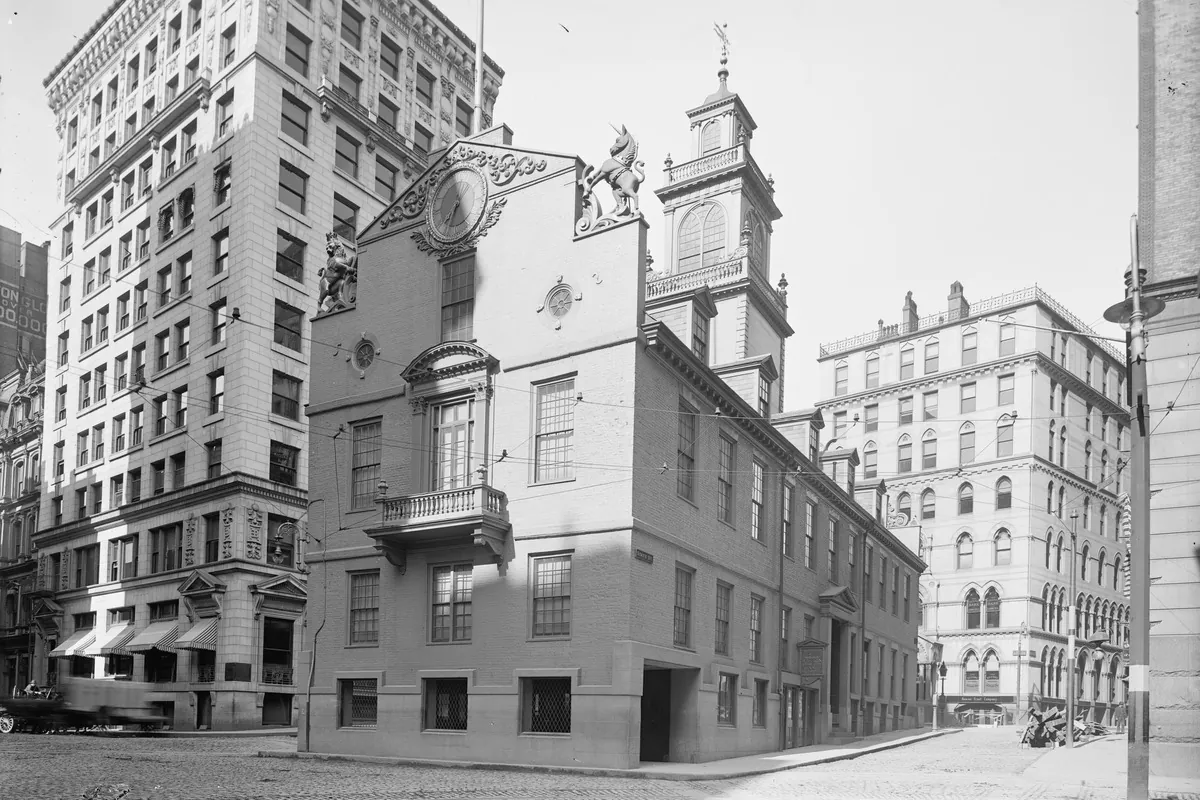
- “Old State House, Boston, Mass.,” Library of Congress: the photo at the bottom of this page, from the Detroit Publishing Company.
Spot something wrong, or know more? Tell us here. You can also email us or use our contact page. Corrections are noted here with their date, never made silently.