Cape Cod: Why It's Called Cape Cod and Its History
Cape Cod is named for a fish: in May 1602 an English crew caught so much cod off the cape that, as one man aboard wrote, they changed its name. He was Gabriel Archer, and his account is short enough to quote almost whole. The name has held for more than four centuries, even after John Smith tried to replace it on his map.
Why Is Cape Cod Called Cape Cod?
Bartholomew Gosnold’s ship reached this coast in the spring of 1602. Archer, one of the men aboard, kept the record. On May 15, he wrote, they came to the west end of what they took for an island and saw a large opening, “we called it Shoal Hope.” Then: “Near this cape we came to anchor in fifteen fathoms, where we took great store of codfish, for which we altered the name, and called it Cape Cod.”
That’s the whole naming story, and it’s firsthand. The only fuzzy part is what name got “altered.” Archer’s next words suggest the first label was Shoal Hope. But six days later, near the islands to the south, he uses Shoal Hope again for another opening. So Shoal Hope was at most a passing label in one man’s account, never an official name, and you shouldn’t think of it as Cape Cod’s old name in any formal sense.
A second man on the voyage, John Brereton, backs up the fish. In his Briefe and True Relation, he says they found themselves “embayed with a mightie headland.” Gosnold, Brereton and three others went ashore while the rest stayed with the ship, and in five or six hours the men on board had “pestered our ship so with Cod fish, that we threw numbers of them over-boord againe.” Brereton doesn’t use the name Cape Cod in that passage, but Henry Burrage’s 1906 edition identifies his headland as Cape Cod in a footnote and quotes Archer beside it.
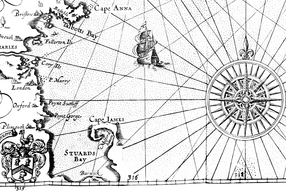
Fourteen years later, John Smith tried to change it. His Description of New England (1616) opens with a list of “the old names” and “the new,” explaining that the book had gone to press before the prince “had altered the names.” First on the list: Cape Cod, now Cape James. You can see that on his map at the bottom of this page. The Osher Map Library at the University of Southern Maine says Smith asked Prince Charles to replace the names on the coast, and that only three of the new ones lasted: Cape Ann, the Charles River and Plymouth. So the name of Plymouth was already on Smith’s map in 1616, four years ahead of the Pilgrims. Cape James didn’t make the cut. The fishermen’s name won.
Cape Cod History: People, Geology and Changing Shores
The land itself is young. The U.S. Geological Survey’s Robert Oldale explains that glaciers piled up most of this sand during the ice age, leaving a peninsula that bends out into the Atlantic like an arm. The Park Service puts its age at about 18,000 years.
Smith saw it the same way, in his own spelling. Cape Cod, he wrote, was “onely a headland of high hils of sand, ouergrowne with shrubbie pines,” with the sea on one side and a big bay on the other, shaped like a sickle. He named the people living on it as the people of Pawmet.
People had been here a very long time by then. The Park Service says the area around Nauset Harbor in Eastham was settled from at least 4,000 BC. The first written description of it comes from the French explorer Samuel de Champlain. He entered the harbor on July 21, 1605, and drew a map of it. When he came back the next year, he counted about 150 people living around Nauset Harbor and 500 to 600 around Stage Harbor, near present-day Chatham. After 1620, colonists from Plymouth came often to buy food and trade, and the diseases that came with them killed many of the Nauset people. In 1639, about half of Plymouth’s English settlers moved to the Nauset area and started the town that’s now Eastham.
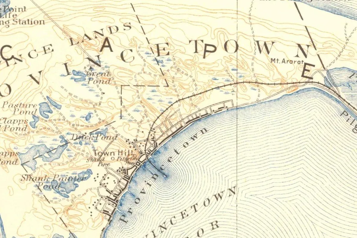
The Pilgrims had touched the cape first. The Park Service notes they signed the Mayflower Compact while anchored in Provincetown Harbor in 1620. That town at the tip got its own name much later: in 1727, according to our story on Provincetown, the settlement wanted the name Herringtown, and the legislature in Boston turned it down.
Visiting Cape Cod: The Coast Behind the Name
Much of the outer shore is protected now, though not all of the cape. On August 7, 1961, President John F. Kennedy signed the law that authorized Cape Cod National Seashore. The Park Service says it was set up out of worry about development on the Outer Cape, and that it now covers forty miles (64 km) of sandy beach along with marshes, ponds and uplands. The park’s home page lists six seashore beaches, with lifeguards on duty between late June and Labor Day.
If you want to see where Champlain landed, the Park Service points you to Fort Hill in Eastham, just off Route 6, where two trails run from the hilltop down to the marsh. Exhibits about Nauset are at Salt Pond Visitor Center, where Route 6 meets Nauset Road.
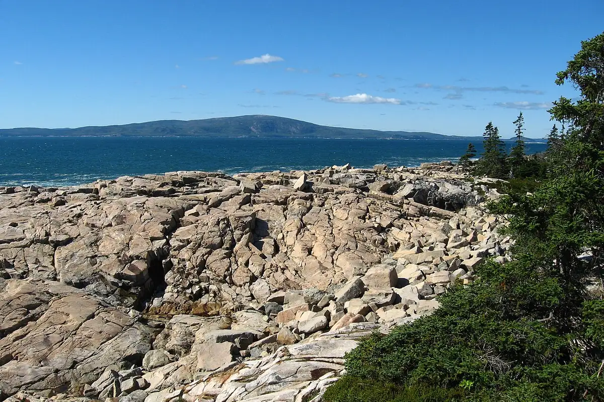
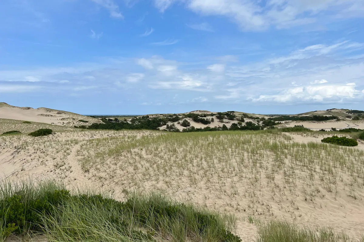
The photo at the top of this page was taken in the Province Lands dunes near Provincetown. They fit Smith’s 1616 description pretty well: hills of sand and low pines.
Quick answers
Why is Cape Cod called Cape Cod?
Because of codfish. Gabriel Archer, who sailed with Bartholomew Gosnold in 1602, wrote that they caught “great store of codfish” there, “for which we altered the name, and called it Cape Cod.”
Did Cape Cod have another English name?
Briefly, on paper. Archer’s account mentions Shoal Hope just before Cape Cod, but he used it loosely and it was never official. John Smith’s 1616 map called the cape Cape James, and that name didn’t last.
Who named Cape Cod?
Bartholomew Gosnold’s crew, in May 1602. Archer’s account says “we” named it, and it doesn’t single out one person.
Is Cape Cod National Seashore the entire peninsula?
No. The seashore, authorized in 1961, protects about forty miles (64 km) of beach and nearby land on the Outer Cape, not the whole peninsula.
Key dates
- 1602May 15: Gosnold's crew takes "great store of codfish" and, Gabriel Archer writes, calls the headland Cape Cod.
- 1605July 21: Samuel de Champlain sails into Nauset Harbor and later maps it.
- 1616John Smith's book on New England swaps Cape Cod for Cape James in its table of new names.
- 1620The Mayflower anchors in what's now Provincetown Harbor, where the Pilgrims sign the Mayflower Compact.
- 1639About half the English at Plymouth move to the Nauset area and settle what's now Eastham.
- 1961August 7: President John F. Kennedy signs the law authorizing Cape Cod National Seashore.
Find it in Google Maps
Opens in a new tab. The pin is a point from the USGS place-name record, so it may not be the middle of the area.
Sponsored
Planning a visit?
Compare hotels in the area on Expedia.
See hotels nearbyWe may earn a commission if you buy through this link. It never changes what we write. Read our affiliate disclosure
Historical Sources & References
- Gabriel Archer, “The Relation of Captain Gosnold’s Voyage” (1602). Modernized text in Halsey’s Great Epochs in American History (1912). May 15, 1602: “we called it Shoal Hope,” then “great store of codfish, for which we altered the name, and called it Cape Cod.” May 21: Shoal Hope used again for another opening.
- John Brereton, A Briefe and True Relation (1602), in Burrage, Early English and French Voyages (1906). Pp. 330-331: “a mightie headland,” Gosnold, Brereton and three others ashore, the ship “pestered” with cod; Burrage’s footnote quoting Archer.
- John Smith, A Description of New England (1616). The schedule of “the old names to the new,” with Cape Cod changed to Cape James; Smith’s description of the cape as “a headland of high hils of sand,” shaped like a sickle, and the people of Pawmet.
- Osher Map Library, “The Creation of New England,” section 4. Smith’s request to Prince Charles; only Cape Ann, the Charles River and Plymouth survived; the table that pairs Cape Cod with Cape James.
- Robert N. Oldale, Geologic History of Cape Cod (USGS). A sandy peninsula built mostly during the ice age, like a crooked arm.
- National Park Service, Cape Cod “History & Culture”. Cape Cod is “only some 18,000 years old.”
- National Park Service, “The Nauset Archaeological District”. Settlement since at least 4,000 BC; Champlain on July 21, 1605, and his map; about 150 people at Nauset and 500-600 at Stage Harbor; trade with Plymouth after 1620 and disease; the 1639 move that founded Eastham; Fort Hill and the Salt Pond Visitor Center.
- National Park Service, Cape Cod “People”. The Mayflower Compact signed while anchored in Provincetown Harbor.
- National Park Service, 60th-anniversary news release (2021). Kennedy’s signature on August 7, 1961; concern over development of the Outer Cape; “forty miles” of beach.
- National Park Service, Cape Cod National Seashore. Six seashore beaches, with lifeguards from late June through Labor Day.
- John Smith’s 1616 map of New England, via Wikimedia Commons and the HathiTrust scan it comes from. The map at the bottom of this page, printed in London in 1616 and in the public domain.
- GNIS feature 606914, Cape Cod (U.S. Geological Survey). The cape’s entry in the federal place-names database, class “Cape,” in Barnstable County.
Spot something wrong, or know more? Tell us here. You can also email us or use our contact page. Corrections are noted here with their date, never made silently.