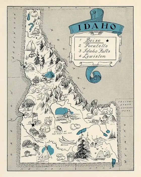
Twin Falls, Idaho: Named for Falls That Stopped Being Twins
The city and county of Twin Falls take their name from the Twin Falls of the Snake River, according to James H. Hawley's 1920 history, where a huge rock split the river into two streams. A 1937 Idaho guide reports that the Idaho Power Company took over the larger fall in 1935, leaving only the north fall.
A 1937 guide reported that the twins of Twin Falls, Idaho, were “no longer twins” after a power company took over the larger waterfall in 1935. Those Snake River falls gave the city its name, so if you go looking for the pair today, you’ll find one, and the region’s tourism office explains why.
Two streams around one huge rock
In 1920, James H. Hawley edited a multi-volume History of Idaho, and an early chapter on the state’s geography explains the name in two sentences:
“Near the northwest corner of Cassia County is the Twin Falls, from which the county and city of Twin Falls derive their name. These falls are so named because the channel of the river is divided by a huge rock into two streams, each of which plunges over a precipice 197 feet in height.”
That’s 197 feet, or about 60 m, for each stream. So the “twin” was literal: one river, one rock, two drops. Keep the date in mind, too. Hawley was writing in 1920, fifteen years before the change you’ll read about below.
The Cassia County detail can trip you up. Twin Falls County didn’t exist until February 21, 1907, when it was created from the western part of Cassia County. Hawley’s chapter on the counties says the new county’s name “is derived from the picturesque falls in the Snake River near the northeast corner of the county.” Same falls, new county line.
Not to be confused with Shoshone Falls
The bigger, more famous waterfall nearby is a different one. Hawley places “the great Shoshone Falls, sometimes called ‘The Niagara of the West,’” a few miles below Twin Falls, where the water drops 212 feet (65 m) over a semicircular cliff he puts at 950 feet (290 m) wide. The Federal Writers’ Project guide to Idaho, from 1937, puts Shoshone Falls three miles (5 km) downriver.
That same guide lists the Snake’s falls in a row, “Dry Creek, Twin, Shoshone, Pillar, Auger, and the Upper and Lower Salmon,” and says Shoshone and Twin “have been outstanding among the waterfalls of the United States.” Twin, it adds, held that rank only “before the higher one was appropriated by a power company.”
The twin that went to work
The guide’s writers didn’t hide their feelings about it. “The twins are no longer twins,” they wrote: “the larger one was taken over in 1935 by the Idaho Power Company.” They granted that the new plant was “notable for its compactness and beauty,” but called it “hardly adequate compensation” for the loss. The larger twin, they said, had been a plunge of 180 feet (55 m) carrying “considerably more than half the river.” Then the blunt part: “Today only the north fall remains.” The water didn’t vanish, the guide explains. Below the diversion dam, the river “now tumbles over wild cascades and delivers nearly its whole volume where formerly it spilled less than a third.”
Southern Idaho Tourism tells the same story in today’s terms. The city “took its name from these two waterfalls in the Snake River Canyon,” its waterfall guide says, and a dam that uses the water for hydroelectricity “diverted water away from the second waterfall.” It gives the remaining drop as 125 feet (38 m).
You’ll notice the heights don’t match: 197 feet in Hawley, 180 in the 1937 guide, 125 today. The sources don’t explain the difference.
A town built ahead of the water
The city came much later than the falls. According to “The History of Twin Falls,” a text by Paul Smith posted on the city’s website, the Twin Falls Land and Water Company was formed in 1900 to irrigate land south of the river under the Carey Act of 1894, with Ira B. Perrine credited with the rough plan. Milner Dam opened on March 1, 1905.
Hawley fills in the town itself. When the irrigated lands went on sale in 1903, he writes, the company decided a town should be established on the tract and bought school section 16 of township 10 south, range 17 east, for a townsite. S. A. Bickel, the company’s chief engineer, platted it. The first building, an office for the Twin Falls Investment Company, went up in early 1904. Robert M. McCollum moved his family into the first residence on December 18, 1904, and the first train arrived on August 7, 1905.
The town got its charter as a city of the second class on April 1, 1907. Hawley says it was “properly called the ‘Magic City’ on account of its marvelous growth.” The sources we found don’t say who picked the name for the townsite, only where the name came from.
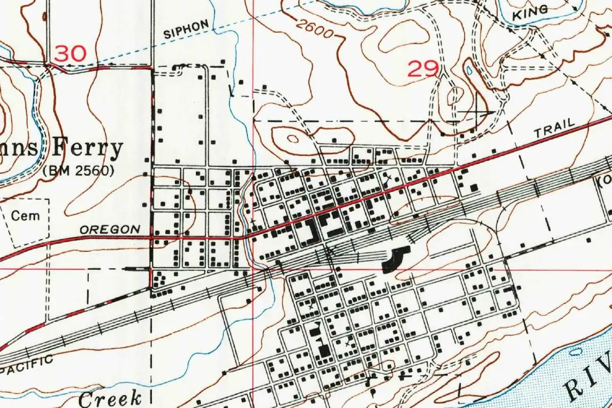
What the 1964 map shows
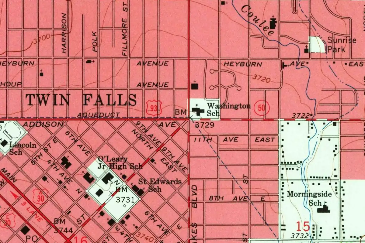
On the map at the top of this page, look for the number 16 at the lower left, at the corner of the slanted downtown grid. It’s a section number; Hawley says the company bought school section 16 of township 10 south, range 17 east, though this crop doesn’t label the township. Around the old grid, other streets run straight north and south, including three named Harrison, Polk and Fillmore. The spot elevations in this crop run from 3,700 to 3,744 feet (1,128 to 1,141 m).
Plenty of towns are named for falls. Idaho Falls sits on the same river, Great Falls is named for falls on the Missouri, and in Wichita Falls, Texas, a flood took the waterfall away. Here it was a power company, and the name stayed. There’s more on the state’s names on our Idaho page.
Quick answers
Why is it called Twin Falls, Idaho?
Because of the Twin Falls of the Snake River. Hawley’s 1920 history says a huge rock divided the river into two streams, and the city and county “derive their name” from those falls.
Is Twin Falls named after Shoshone Falls?
No. Shoshone Falls is a separate, taller waterfall a few miles downriver, three miles (5 km) below Twin Falls, according to the 1937 Idaho guide.
Why is there only one waterfall at Twin Falls?
The 1937 guide says the Idaho Power Company took over the larger fall in 1935, and that “only the north fall remains.” Southern Idaho Tourism says a hydroelectric dam diverted water from the second fall.
When was Twin Falls, Idaho, founded?
The first building on the townsite went up in early 1904, according to Hawley, and the first train arrived on August 7, 1905. The city received its charter on April 1, 1907.
Key dates
- 1900The Twin Falls Land and Water Company is formed to irrigate land south of the Snake River.
- 1904The first building goes up on the townsite, an office for the investment company, according to Hawley.
- 1905Milner Dam opens on March 1, and the first train reaches Twin Falls on August 7.
- 1907Twin Falls County is created on February 21, with the city as county seat; the city gets its charter on April 1.
- 1935The Idaho Power Company takes over the larger of the two falls, according to the 1937 Idaho guide.
Things to do in Twin Falls, Idaho
Shoshone Falls
The Snake River drops 212 feet (65 m) over a fall 900 feet (274 m) wide, often referred to as the Niagara of the West. The land was donated to the city in 1932 on condition that it be kept as a public park.
Twin Falls (the waterfall)
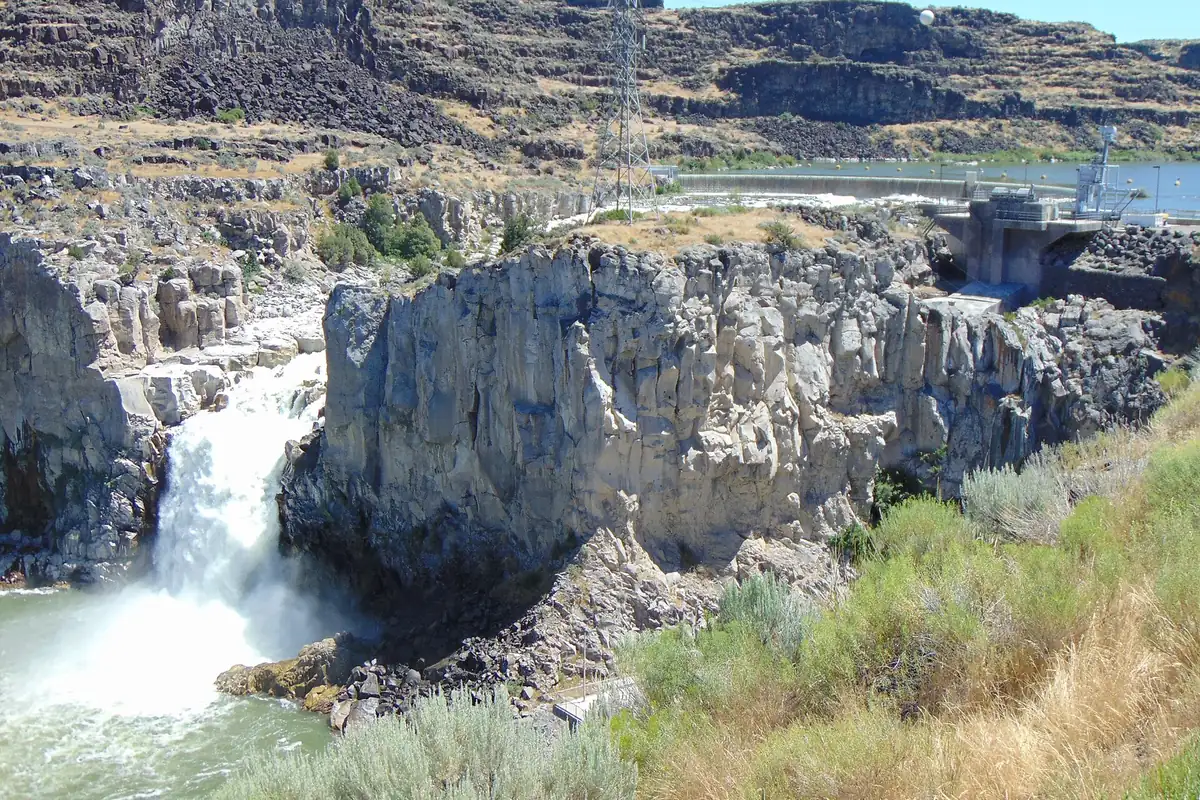
The fall the city is named for, where water drops 125 feet (38 m) to the river below. A hydroelectric dam diverted water from the second fall, and the region's tourism office says the best time to see it is March through early June, before water is diverted for other uses.
Perrine Coulee Falls
A waterfall southwest of the I.B. Perrine Bridge that flows year-round and falls 200 feet (61 m) to the water below. You can see it from the Snake River Canyon Rim Trail above or from Centennial Park below.
Auger Falls Heritage Park
A park in the Snake River Canyon, managed by the Twin Falls Parks and Recreation Department, with over 20 miles (32 km) of mild trails, wildlife, rock climbing and a close look at Auger Falls.
Herrett Center for Arts and Science
A College of Southern Idaho museum with artifacts and natural history specimens of the prehistoric American continents, an observatory and the Faulkner Planetarium, which it calls Idaho's largest.
Getting there
Open Twin Falls in Google Maps
Opens in a new tab. The pin is the center of Twin Falls in the USGS place-name record.
The closest airports, Amtrak stations and intercity bus stops, measured in a straight line from the center of Twin Falls.
Airports
- Joslin Field/Magic Valley Regional (TWF) Twin Falls 6 mi 9 km
- Friedman Memorial (SUN) Hailey 66 mi 105 km
- Boise Air Trml/Gowen Field (BOI) 113 mi 181 km
Intercity buses
- Salt Lake Express Twin Falls (Chevron Oasis) 2 mi 3 km
Distances are as the crow flies, not by road. We don't list schedules or fares because they change; check with the airline, Amtrak or the bus company before you go. Official data (FAA commercial service airports (2025), FAA airport locations, Amtrak stations and Intercity Bus Atlas) from the FAA and the U.S. Bureau of Transportation Statistics, checked Nov 14, 2026.
Sponsored
Staying in Twin Falls?
Compare hotels in Twin Falls, Idaho, on Expedia.
See hotels in Twin FallsWe may earn a commission if you buy through this link. It never changes what we write. Read our affiliate disclosure
Historical Sources & References
- James H. Hawley, ed., History of Idaho, vol. 1 (1920), p. 20. The quoted passage on the Twin Falls and the “huge rock,” and Shoshone Falls a few miles below. Checked against the page image.
- Hawley, History of Idaho, vol. 1, p. 681. Twin Falls County, created February 21, 1907, from western Cassia County, with its name “derived from the picturesque falls in the Snake River.” Checked against the page image.
- Hawley, History of Idaho, vol. 1, p. 763. The townsite on school section 16, Bickel’s plat, the first building and residence, the first train, the 1907 charter and the “Magic City.”
- Federal Writers’ Project, Idaho: A Guide in Word and Picture (1937), pp. 239, 242. The list of the Snake’s falls and the higher Twin “appropriated by a power company” (p. 239); “The twins are no longer twins,” the Idaho Power Company in 1935, the 180-foot plunge, “only the north fall remains” and Shoshone Falls three miles below (p. 242). Checked against the page images.
- Southern Idaho Tourism, “Southern Idaho’s Spectacular Waterfalls”. The city named for “these two waterfalls,” the dam that diverted the second, and the 125-foot drop.
- Paul Smith, “The History of Twin Falls” (City of Twin Falls). The Twin Falls Land and Water Company (1900), the Carey Act, I. B. Perrine and the opening of Milner Dam on March 1, 1905.
- City of Twin Falls, “Shoshone Falls”. Height and width of Shoshone Falls and the 1932 land donation.
- GNIS feature 398273 (U.S. Geological Survey). The federal place-name record for Twin Falls, Twin Falls County, with its coordinates.
- U.S. Geological Survey, Twin Falls sheet (1964). The 1:24,000 map that the image at the top of this page was cropped from.
Spot something wrong, or know more? Tell us here. You can also email us or use our contact page. Corrections are noted here with their date, never made silently.