Wichita Falls, Texas, and the Falls That Washed Away
Wichita Falls, Texas, got its name from a small waterfall on the Wichita River, about five feet high, that sat on the 1876 town plat and was later washed away in a flood. The river, like Wichita County, was named for the Wichita people. The city built a new, 54-foot cascade in 1987.
A waterfall on the town plat
There haven’t been natural falls in Wichita Falls, Texas, since a flood in the 1800s washed away the small waterfall on the Wichita River it’s named for. The cascade you can see there now was built in 1987, and the town kept its name the whole time in between.
The Handbook of Texas, the state historical association’s encyclopedia, picks up the story in July 1876. That’s when a surveyor named M. W. Seeley mapped out a townsite on the Wichita River for the heirs of John A. Scott of Mississippi. As Seeley platted it, the town included a few named streets, a town square and “the location of a small waterfall on the Wichita River that was later washed away.” The Handbook’s entry on the river gives its size: a “five-foot waterfall,” about 1.5 meters, that “subsequently washed away.”
Five feet isn’t much of a waterfall. But on a prairie river in north Texas, a ledge of falling water was a landmark, and it was something a new town could put on its map and in its name.
Where “Wichita” comes from
The second word explains the falls. The first one is older. “The Wichita was named for the Wichita Indians,” the Handbook says of the river, and the legislature named Wichita County for them too when it created the county on February 1, 1858. The Wichitas and Taovayas, Caddoan peoples, had moved into the area from present-day Kansas and Nebraska in the middle of the 1700s, according to the county’s Handbook entry.
They were right where the city is now. The river entry says there was “a large Indian village at the site of present Wichita Falls as late as 1841, when the Texan Santa Fe Expedition crossed the stream there.”
In 1905 the U.S. Geological Survey printed Henry Gannett’s list of place-name origins, and it ties it all together in one entry. It groups the Kansas and Texas uses of the name with a single bracket:
“Wichita; county, and city in Sedgwick County, in Kansas, and county and river in Texas; Wichita Falls; town in Wichita County, Texas. Named for the Indian tribe.”
That’s why Wichita, Kansas, and Wichita Falls share a first word. Neither one is named for the other; both go back to the same people. Gannett doesn’t say what the word means, and we won’t guess either.
The poker game that wasn’t
There’s a famous story about how the land changed hands. According to tradition, Scott won the tract in a poker game in 1837. The Handbook says that isn’t what happened: “In fact, Scott acquired the tract by purchasing Texas land certificates, which he packed away and promptly forgot.” His heirs found the certificates years later, and that’s what led them to hire Seeley.
Seeley’s plat came with a drawing that was even more hopeful. It showed an imaginary lake, a steamboat on the river and warehouses full of cotton. The Handbook is blunt about that, too: “The town never became a steamboat shipping center.” What made the town was the railroad. Residents offered the Fort Worth and Denver Railway land along its route, and the first train pulled in on September 27, 1882. The city adopted the 26th as its birthday, the county’s Handbook entry says, so you’ll see both dates.
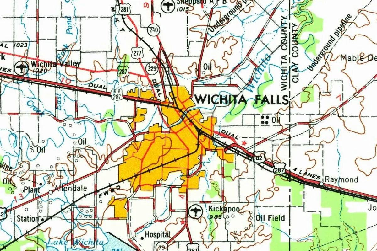
By then the town already had a post office, opened in 1879 with Charles G. Converse as postmaster. Wichita Falls became the county seat in November 1883 and was incorporated on July 29, 1889. You can follow the same railroad, marked FW&D, through the orange-shaded city on the 1954 map at the top of this page.
The falls you can see today
So when did the original falls disappear? The city’s own page on the falls says only that they were washed away “in a flood in the 1800’s,” and the Handbook doesn’t give a year either; it just says “later.” If you find a version with an exact date and a dramatic flood story, ask where it came from.
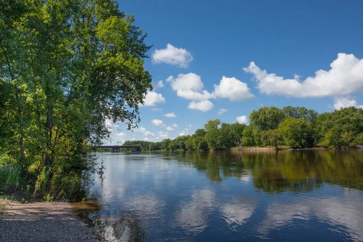
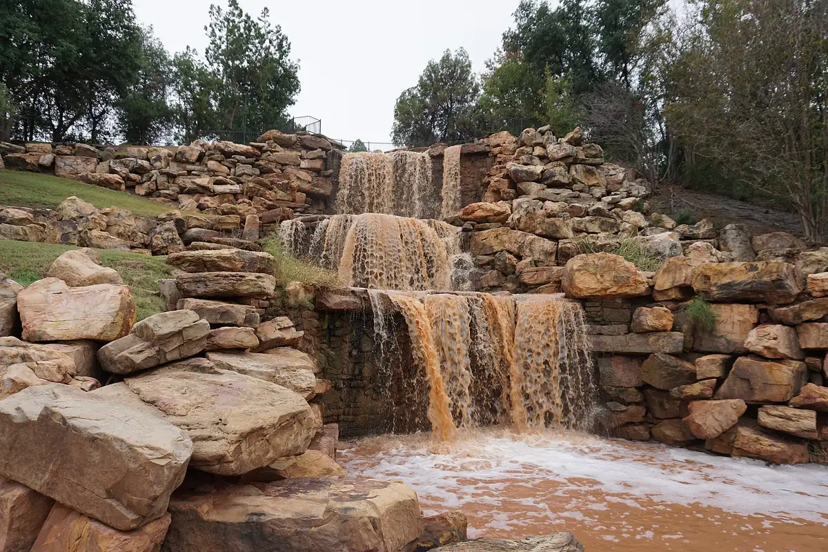
For decades, a city called Wichita Falls had no falls. That changed in 1987, when, the city says, “a new falls was constructed upstream.” It’s a 54-foot (16 m) “multi-level cascade” on the south bank of the river, and it’s the one in the photo at the bottom of this page. It’s man-made, it’s taller than the original by roughly ten times, and it’s not in the same spot. It does give visitors what the name promises, though.
Quick answers
Why is Wichita Falls called Wichita Falls?
It was named for a small waterfall, about five feet (1.5 m) high, on the Wichita River. The falls were on M. W. Seeley’s town plat of July 1876, and the river itself was named for the Wichita people.
What happened to the original falls?
A flood washed them away sometime “in the 1800’s,” the city says. Neither the city nor the Handbook of Texas pins down the year.
Are the falls in Wichita Falls today real?
They’re real water, but they’re man-made. The city built the 54-foot (16 m) cascade in 1987, upstream from where the original falls had been.
Did someone win Wichita Falls in a poker game?
That’s the legend. The Handbook of Texas says John A. Scott actually bought Texas land certificates for the tract, forgot about them, and his heirs found them years later.
Key dates
- 1841The Texan Santa Fe Expedition crosses the river at a large Indian village on the site of the future city.
- 1858February 1: the legislature establishes Wichita County, named for the Wichita people.
- 1876July: M. W. Seeley plats the townsite, including the spot of a small waterfall on the Wichita River.
- 1879A post office opens, with Charles G. Converse as the first postmaster.
- 1882September 27: the first Fort Worth and Denver train arrives, and the sale of town lots booms.
- 1883November: Wichita Falls becomes the seat of Wichita County.
- 1889July 29: Wichita Falls is officially incorporated.
- 1987The city builds a new, man-made falls on the south bank of the Wichita River.
Getting there
Open Wichita Falls in Google Maps
Opens in a new tab. The pin is the center of Wichita Falls in the USGS place-name record.
The closest airports, Amtrak stations and intercity bus stops, measured in a straight line from the center of Wichita Falls.
Airports
- Sheppard AFB/Wichita Falls Municipal (SPS) 5 mi 8 km
- Lawton-Fort Sill Regional (LAW) 45 mi 73 km
- Dallas-Fort Worth International (DFW) 109 mi 176 km
Amtrak trains
- Gainesville station (GLE) 80 mi 129 km
- Ardmore station (ADM) 80 mi 129 km
Intercity buses
- Greyhound Wichita Falls Travel Center under 1 mi 0.3 km
Distances are as the crow flies, not by road. We don't list schedules or fares because they change; check with the airline, Amtrak or the bus company before you go. Official data (FAA commercial service airports (2025), FAA airport locations, Amtrak stations and Intercity Bus Atlas) from the FAA and the U.S. Bureau of Transportation Statistics, checked Nov 13, 2026.
Sponsored
Staying in Wichita Falls?
Compare hotels in Wichita Falls, Texas, on Expedia.
See hotels in Wichita FallsWe may earn a commission if you buy through this link. It never changes what we write. Read our affiliate disclosure
Historical Sources & References
- Henry Gannett, The Origin of Certain Place Names in the United States (USGS, 1905), p. 324. The bracketed entry for Wichita in Kansas and Texas and for Wichita Falls, “Named for the Indian tribe.”
- Kenneth E. Hendrickson Jr., “Wichita Falls, TX,” Handbook of Texas Online. The poker-game tradition and the land certificates, Seeley’s plat of July 1876 with “a small waterfall on the Wichita River that was later washed away,” the steamboat drawing, the post office of 1879, the first train on September 27, 1882, the county seat in 1883 and incorporation in 1889.
- “Wichita River,” Handbook of Texas Online. The city “named for a five-foot waterfall that subsequently washed away,” the river named for the Wichita Indians, and the village at the site in 1841.
- Brian Hart, “Wichita County,” Handbook of Texas Online. The Wichitas and Taovayas, the county established on February 1, 1858, and named for the Wichita Indians, and the city’s birthday of September 26, 1882.
- City of Wichita Falls, “The Falls”. The original falls washed away “in a flood in the 1800’s” and the 54-foot man-made cascade built upstream in 1987.
- GNIS feature 1376776 (U.S. Geological Survey). Wichita County is where the federal list files the city; the old map is centered on its point.
- U.S. Geological Survey, Wichita Falls sheet (1954). The map at the top of this page.
Spot something wrong, or know more? Tell us here. You can also email us or use our contact page. Corrections are noted here with their date, never made silently.