Cairo, Illinois: Egypt's Capital or a Man Called Dr. Cairo?
Most sources say Cairo is named for Cairo, Egypt, Edward Callary writes, because it lies where the Ohio meets the Mississippi, much as Cairo, Egypt, lies along the Nile. The name dates to an 1818 charter. Later claims credit a man named Cairo instead. Locally it's pronounced KER-oh, Callary says.
Cairo, Illinois, got its name from an 1818 charter, and most sources say it was borrowed from Cairo, Egypt, for a site where two big rivers meet. Not everyone agreed. Two later accounts gave the credit to a man who supposedly carried the name himself.
A city chartered before it existed
The name is older than the town. The Federal Writers’ Project guide to Illinois, published in 1939, says the first attempt at settlement came in 1818, “when John G. Comegys, a St. Louis merchant, obtained from the Territorial Legislature an act incorporating the city and the bank of Cairo.” John M. Lansden, whose history of the city came out in 1910, dates that act to January 9, 1818, and calls Comegys “a resident of Baltimore,” with eight partners from Kaskaskia, St. Louis and Virginia.
Lansden noticed something about the plan they drew. Eight of its streets “bear the names of his eight co-incorporators,” he wrote, “but no street is given his own name.”
The plan didn’t get far. “When Comegys died about 1820, his scheme perished with him,” the WPA guide says. The settlement that lasted began in 1837, when the state incorporated the Cairo City and Canal Company. Edward Callary’s Place Names of Illinois adds that the post office opened on November 8, 1837, as Mouth of Ohio and was changed to Cairo on September 16, 1839.
Two rivers and the Nile
The usual explanation is geography. The WPA guide says the city “was so named because its site was presumed to resemble that of Cairo, Egypt.” Callary puts it this way: “According to most sources, Comegys named the community for Cairo, Egypt, because it lies at the confluence of the Ohio and Mississippi rivers, much as Cairo, Egypt, lies along the Nile.” He adds that “for a number of years before Cairo was founded, the Mississippi River was known as the American Nile, and that may indeed have inspired the original site owners.”
That nickname turns up downriver too. Memphis, Tennessee, got its Egyptian name in the same years, and an 1820 notice about it called the Mississippi “the American Nile.” Henry Gannett found the Egyptian capital popular well beyond Illinois. “Cairo,” his 1905 entry reads, “fourteen places in the country bear the name of the capital of Egypt.”
The man called Cairo
Callary also records a dissent. “In 1940, however, Barry Gilbert claimed that his grandfather, Miles Gilbert, one of the incorporators of the Cairo City and Canal Company, told him that ’people were mistaken in thinking that it was named Cairo because of the rivers, but that it had been named for a man who was known as ‘Dr. Cairo’ and who called himself Care-o.’”
An older version had appeared in the town’s own paper. On July 15, 1897, The Citizen ran a story headlined “How Cairo Was Named,” based on an interview with a visitor, Dr. Louis N. Cairo. He said his father, Louis F. Cairo, was born in Cairo, Egypt, and opened a whiskey trading post at the point around 1780, and that river men’s phrase “Let’s Go Down to Cairo’s” became the place’s name. The reporter noted that Dr. Cairo looked “about sixty years of age,” though he said he’d been born at the point on August 20, 1823.
Callary calls the Egypt explanation the one in “most sources,” and adds that “a likely Dr. Cairo has yet to be found.” The WPA guide gives the Egypt version too. But both stories made it into print, so this page counts the origin as disputed.
How to say it
Callary writes that “the local pronunciation is regularly [KER o], but outside of southern Illinois one is as likely as not to hear [KAY ro].”
Cairo and Little Egypt
The name may have reached beyond the town. The WPA guide credits Comegys with “a lasting contribution to Illinoisana in his choice of the name Cairo, for as a result ‘Egypt’ has become the popular name of southern Illinois.” Southern Illinois University’s Special Collections is more careful. It says the region “became known as ‘Egypt’ in the 1830s,” gives the two best-known explanations, one about grain sent north after the winter of 1831-32 and one a northern insult, and concludes that the origin “may remain a mystery.” It does note that “some southern Illinois towns, such as Cairo and Thebes, are named for cities in Egypt.”
A Union base on the point
The WPA guide says Cairo got its city charter in 1857, after the Illinois Central opened its line to Chicago (the same railroad that named Centralia). Charles Dickens had visited on April 9, 1842, and used Cairo, the guide says, as “the prototype of the nightmare City of Eden” in Martin Chuzzlewit. In the war, the point was fortified as Camp Defiance, and Ulysses S. Grant made his headquarters at Cairo in September 1861. Fort Defiance State Park now sits on that tip of land.
The 1931 map
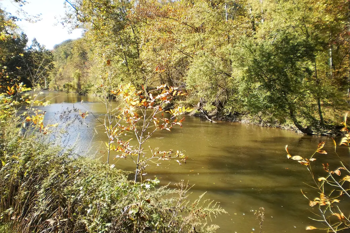
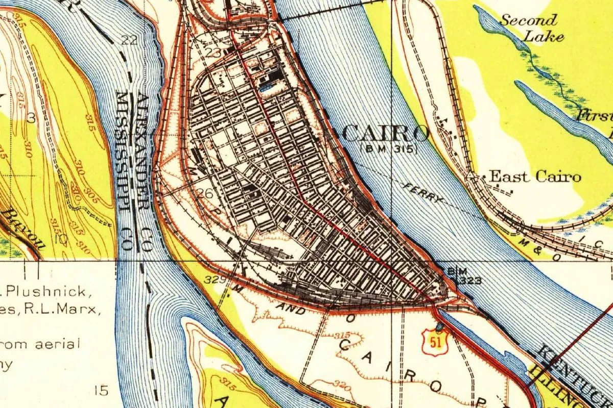
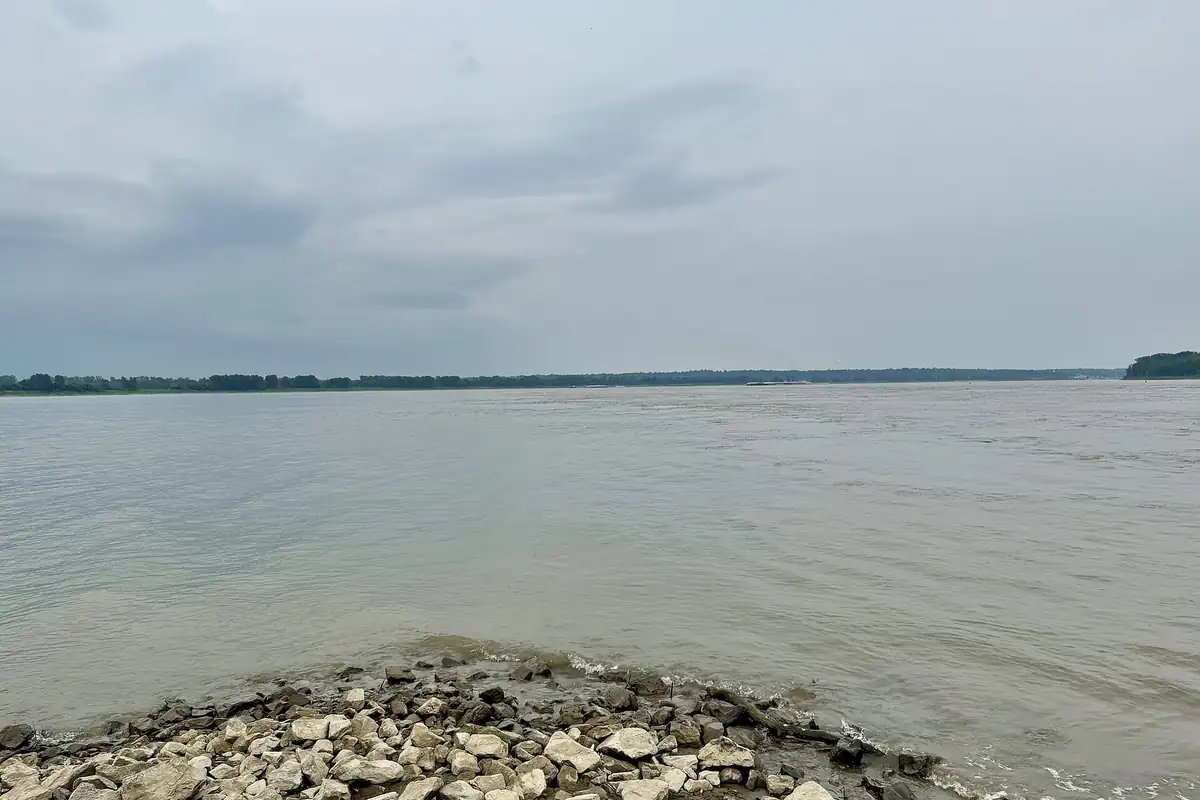
The map at the top of this page comes from the Geological Survey’s Cairo sheet of 1931. Cairo fills a narrow point of land, with East Cairo and a ferry line across the river to the east and the Kentucky state line at the bottom. The meeting of the two rivers, just past the tip, is in the photo below.
Quick answers
Why is it called Cairo, Illinois?
Most sources say it’s named for Cairo, Egypt, Callary writes, because it lies where the Ohio meets the Mississippi, much as Cairo, Egypt, lies along the Nile. The name dates to the 1818 act incorporating the city and bank of Cairo.
How do you pronounce Cairo, Illinois?
KER-oh, locally. Callary writes that the local pronunciation is “regularly [KER o],” while outside southern Illinois you’re as likely to hear “[KAY ro].”
Was Cairo named after a person?
Two later accounts said so. In 1897 a Dr. Louis N. Cairo told the local paper the town was named for his father, and in 1940 Barry Gilbert said it was named for a “Dr. Cairo.” Callary treats the Egypt version as the one in most sources.
Who named Cairo?
Most sources credit John G. Comegys, Callary writes. The WPA guide says Comegys obtained the 1818 act that incorporated the city and bank of Cairo.
Key dates
- 1818The territorial legislature incorporates the city and bank of Cairo on January 9, with John G. Comegys among the incorporators.
- 1820Comegys dies about this year, and his town plan dies with him, the WPA guide says.
- 1837A post office opens as Mouth of Ohio, and the state incorporates the Cairo City and Canal Company.
- 1839The post office is renamed Cairo on September 16.
- 1842Charles Dickens visits Cairo on April 9.
- 1857Cairo gets a city charter.
- 1861Ulysses S. Grant sets up his headquarters at Cairo in September.
- 1897The Cairo Citizen prints Dr. Louis N. Cairo's story that the town was named for his father.
- 1940Barry Gilbert says his grandfather told him the town was named for a "Dr. Cairo."
Things to do in Cairo, Illinois
Fort Defiance State Park
On Cairo Point, the southern tip of Illinois, between the Ohio and the Mississippi. It's the lowest point in the state, at 279 feet (85 m), and the DNR says the two rivers' currents stay separate for about a mile (1.6 km) below where they meet.
Magnolia Manor
A 14-room brick mansion in the Italianate style, built in 1869 and run as a museum by the Cairo Historical Association, with stories of local river lore.
Horseshoe Lake State Fish and Wildlife Area
A 10,200-acre (4,128 ha) area 7 miles (11 km) north of Cairo, around a 2,400-acre (971 ha) shallow lake, with picnicking, camping, boating and fishing.
Cairo Custom House Museum
Built in 1872 to collect tariffs on river trade, and later home to a federal court and a post office. The Park Service says its exhibits include Civil War pieces, a desk Ulysses S. Grant used in the city and a replica of the gunboat U.S.S. Cairo.
Getting there
Open Cairo in Google Maps
Opens in a new tab. The pin is the center of Cairo in the USGS place-name record.
The closest airports, Amtrak stations and intercity bus stops, measured in a straight line from the center of Cairo.
Airports
- Barkley Regional (PAH) Paducah 23 mi 36 km
- Cape Girardeau Regional (CGI) 27 mi 43 km
- St Louis Lambert International (STL) St. Louis 137 mi 220 km
Amtrak trains
- Fulton station (FTN) 37 mi 59 km
- Carbondale station (CDL) 50 mi 80 km
Intercity buses
- Greyhound Cape Girardeau Leming Lane 29 mi 47 km
- FlixBus Paducah KY (PAD) 33 mi 54 km
- Executive Transportation Amtrak Connecting Service · Carbondale 50 mi 80 km
Distances are as the crow flies, not by road. We don't list schedules or fares because they change; check with the airline, Amtrak or the bus company before you go. Official data (FAA commercial service airports (2025), FAA airport locations, Amtrak stations and Intercity Bus Atlas) from the FAA and the U.S. Bureau of Transportation Statistics, checked Nov 16, 2026.
Sponsored
Staying in Cairo?
Compare hotels in Cairo, Illinois, on Expedia.
See hotels in CairoWe may earn a commission if you buy through this link. It never changes what we write. Read our affiliate disclosure
Historical Sources & References
- Edward Callary, Place Names of Illinois, “Cairo” (University of Illinois Press blog, 2008). The pronunciation, “most sources,” the “American Nile,” Barry Gilbert’s 1940 claim, “a likely Dr. Cairo has yet to be found” and the post office dates.
- Federal Writers’ Project, Illinois: A Descriptive and Historical Guide (1939), pp. 171-173. Comegys and the 1818 act, the name “presumed to resemble that of Cairo, Egypt,” “Egypt” for southern Illinois, the Cairo City and Canal Company, Dickens, the 1857 charter, Camp Defiance and Grant. The passage on p. 171 was checked against the page image.
- John M. Lansden, A History of the City of Cairo, Illinois (1910), p. 33; p. 36. The act of January 9, 1818, Comegys of Baltimore and his partners, and the streets named for everyone but him. Checked against the page images.
- “How Cairo Was Named,” The Citizen, July 15, 1897 (ILGenWeb transcription). Dr. Louis N. Cairo’s story.
- Southern Illinois University Carbondale, “A Place Called ‘Egypt’”. The nickname from the 1830s and its two explanations.
- Henry Gannett, The Origin of Certain Place Names in the United States (1905), p. 63. Fourteen places named for the capital of Egypt. Checked against the page image.
- Fort Defiance State Park; Magnolia Manor; Horseshoe Lake; Cairo Custom House Museum. The details in the things-to-do list.
- GNIS feature 424699 (U.S. Geological Survey). Cairo’s entry in the federal names database, in Alexander County, with its coordinates.
- U.S. Geological Survey, Cairo sheet (1931). The 1:62,500 map that the image at the top of this page was cropped from.
Spot something wrong, or know more? Tell us here. You can also email us or use our contact page. Corrections are noted here with their date, never made silently.