Silver City, New Mexico: The 1870 Strike Behind the Name
Silver City is named for silver. A few settlers were farming beside springs known as La Cienega de San Vicente when silver ore turned up nearby in 1870. Within weeks a new town sprang up, and a 1975 National Register nomination says it was 'soon appropriately named, "Silver City."' No source names who chose it.
Silver found next to a marsh
Silver City, New Mexico, grew up in 1870 beside a spring-fed marsh called La Cienega de San Vicente and took its name from the silver found nearby. Before the town, there were the springs and a handful of settlers who’d planned to farm beside them.
The clearest account of the founding is in a 1975 nomination of the H. B. Ailman House to the National Register of Historic Places. “Sometime in late 1868 or early 1869,” it says, “several men, including John and James Bullard and A. J. Hurlbut, settled along the springs known since the Spanish period as ‘La Cienega de San Vicente’ (the marsh of St. Vincent).”
Those springs weren’t empty land. The same nomination says they lay near the Spanish Santa Rita copper mine, with its adobe fort built in 1804, and had long been a camping site for the Apache. A federal summary from the Advisory Council on Historic Preservation goes further back: Mimbres and Mogollon peoples lived in the valley first, followed by Apache bands, Spanish explorers and Mexican colonists.
A campsite by the springs
The springs show up in at least one earlier story. Ralph Emerson Twitchell’s Leading Facts of New Mexican History, published in 1917, describes a colony led by Dr. R. Anderson that set out in the spring of 1868 to settle the Gila River valley. On its march from Pinos Altos, he writes, “the first camp was made at San Vincente Springs, now Silver City, diagonally opposite the Centennial saloon.” “San Vincente” is Twitchell’s spelling.
Farmers interrupted by silver
A second nomination, written in 1976 for the Silver City Historic District, tells the founding as a farming plan gone sideways. Early in 1869, it says, a group of prospectors that included John Bullard, his brother James, John Swisshelm and William Milby “decided to defy the Apaches and farm the area adjacent to La Ciénega de San Vicente.” The would-be farmers “were soon interrupted, however, by the discovery of silver ore in substantial quantities and the farm lands became the site of Silver City.”
The Ailman House nomination gives the strike a name and a finder. “In 1870 the rich Chloride Flat silver strike was made by James S. Campbell,” it says, “and within a few weeks a new town sprang up slightly to the north, soon appropriately named, ‘Silver City.’”
A third nomination, for the Historic District at nearby Pinos Altos, tells it from the older mining camp’s side. In 1870, it says, “Captain John Bullard and his brother James, Joe Yankie, Elijah Weeks, and others found silver ore near the marshy spot known as La Cienega de San Vicente. Within days, a camp sprang up, destined to become Silver City.”
So you’ll find two versions of who found the silver: Campbell at Chloride Flat in one, Bullard’s party in the other. They agree on the year and the metal.
Who picked the name?
None of these sources says. “Soon appropriately named” is as close as the Ailman House nomination comes, and the other two don’t take it further. We didn’t find a document from 1870 that records a vote or a person choosing it, so this page doesn’t name one.
John Bullard didn’t live long in the town he helped start. According to the Ailman House nomination, he was killed by Apaches near Clifton, Arizona, in 1871 and was the first resident buried in the Silver City cemetery.
A grid in the mountains
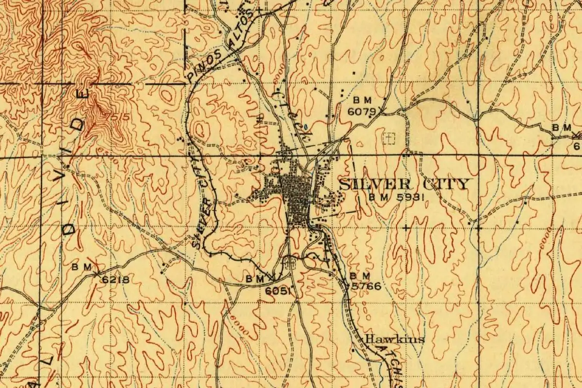
Building went quickly. The Ailman House nomination says that within a year Silver City had 100 permanent buildings, “fronting streets laid out in the standard gridiron pattern, totally foreign to New Mexico at that period.” Even the brick was made locally, in a large kiln north of town.
The Historic District nomination says the brick buildings and the rigid street grid gave Silver City the look of “a real American town,” and that it set up a strong municipal government and, in 1874, a public school system, the first in New Mexico. That same year it replaced Pinos Altos as the seat of Grant County, which had been formed from Doña Ana County on January 30, 1868.
Twitchell records that Silver City “became an incorporated town by special act of the legislature February 15, 1878.” The Advisory Council calls it the oldest incorporated community in New Mexico and says it still runs under that 1878 territorial charter.
Freight wagons, then a railroad
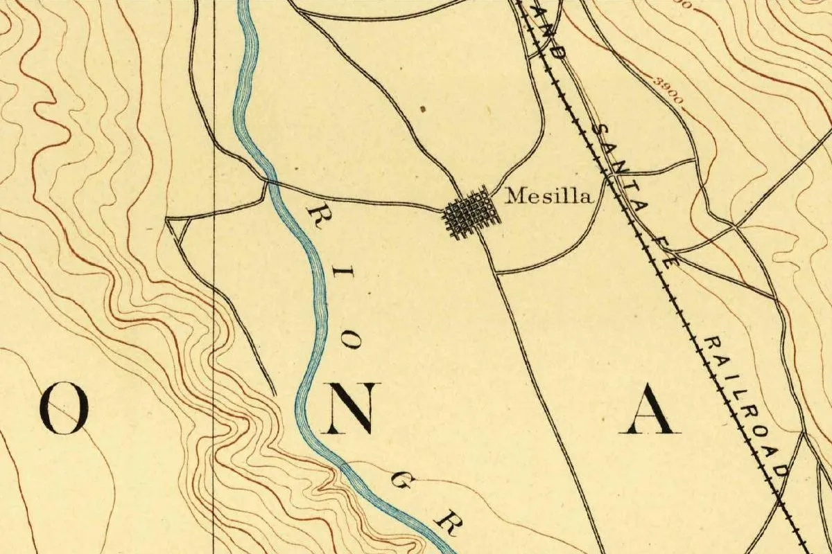
For its first years, Silver City sat at the end of a long haul. Before the railroad, the Historic District nomination says, all merchandise and machinery had to be freighted 100 miles (161 km) west from Las Cruces or La Mesilla on the Rio Grande, at $1.25 per hundredweight. A stage ticket cost $25 to Las Cruces and $100 to Santa Fe.
That changed in 1883, when the 47-mile (76 km) Silver City, Deming and Pacific Railroad was built north from the main line at Deming. Silver prices fell after the Sherman Act was repealed in 1893, and the nomination says Silver City suffered like every western mining town, though by then its economy was sturdy enough to carry on.
Main Street becomes the Big Ditch
Water also did the town real damage. On July 21, 1895, two floods, one with a crest 12 feet (3.7 m) high and 300 feet (91 m) wide, “created a huge ditch out of Main Street,” the Ailman House nomination says, washing away hotels and stores. Main Street was never rebuilt, and the channel is still known as the Big Ditch.
The Ailman House sat west of the flood and came through undamaged. Henry B. Ailman had arrived in 1871 as a prospector, struck silver at the Naiad Queen mine in Georgetown in 1874, and built the house in 1881. Since 1967 it has held the Silver City Museum.
On the 1909 map at the top of this page, you can see how tight that street grid was compared with everything around it. Other towns in the state are on our New Mexico page.
Quick answers
Why is Silver City, New Mexico, called Silver City?
Because of the silver ore found nearby in 1870. Within weeks a new town grew up, and a 1975 National Register nomination says it was “soon appropriately named, ‘Silver City.’”
What was the place called before Silver City?
The springs and marsh there were known as La Cienega de San Vicente, a name the Ailman House nomination translates as “the marsh of St. Vincent.” Twitchell calls the spot San Vincente Springs.
Who found the silver at Silver City?
The sources differ. The Ailman House nomination credits James S. Campbell with the Chloride Flat strike, while the Pinos Altos nomination says Captain John Bullard, his brother James and others found the ore.
When was Silver City incorporated?
On February 15, 1878, by special act of the territorial legislature, according to Twitchell. The Advisory Council on Historic Preservation says the town still operates under that charter.
Key dates
- 1868January 30: Grant County is formed from Doña Ana County.
- 1869Late 1868 or early 1869: John and James Bullard, A. J. Hurlbut and others settle by La Cienega de San Vicente.
- 1870Silver ore is found nearby, and a new town called Silver City springs up within weeks.
- 1874Silver City replaces Pinos Altos as the county seat and starts a public school system.
- 1878February 15: The territorial legislature incorporates Silver City by special act.
- 1883The 47-mile Silver City, Deming and Pacific Railroad reaches town from Deming.
- 1895July 21: Floods tear out Main Street, leaving the channel still called the Big Ditch.
Things to do in Silver City, New Mexico
Silver City Museum
The museum is in the H. B. Ailman House, an 1881 home built by a miner who struck it rich and became a merchant and banker. Its collections hold well over 20,000 objects and about 17,000 photographs.
Gila Cliff Dwellings National Monument
Rooms built by Mogollon people in the late 1200s inside caves above Cliff Dweller Creek. They left around 1300, and most of the walls you see are original, some still carrying fingerprints more than 700 years old.
Gila Wilderness
Created in June 1924 at the urging of Aldo Leopold, it was the world's first designated wilderness. At 559,688 acres (about 2,265 square kilometers), it's also the largest wilderness area in New Mexico.
City of Rocks State Park
The park takes its name from volcanic rock formations about 34.9 million years old. Pinnacles up to 40 feet (12 m) tall, separated by lanes that look like city streets, fill an area of about one square mile (2.6 km²) at an elevation of 5,200 feet (1,585 m).
Getting there
Open Silver City in Google Maps
Opens in a new tab. The pin is the center of Silver City in the USGS place-name record.
The closest airports, Amtrak stations and intercity bus stops, measured in a straight line from the center of Silver City.
Airports
- El Paso International (ELP) 130 mi 209 km
- Show Low Regional (SOW) 143 mi 231 km
Amtrak trains
- Lordsburg station (LDB) 38 mi 61 km
- Deming station (DEM) 46 mi 74 km
Intercity buses
- Limousine Express Lordsburg 39 mi 62 km
- Greyhound Lordsburg W Wabash St 39 mi 62 km
Distances are as the crow flies, not by road. We don't list schedules or fares because they change; check with the airline, Amtrak or the bus company before you go. Official data (FAA commercial service airports (2025), FAA airport locations, Amtrak stations and Intercity Bus Atlas) from the FAA and the U.S. Bureau of Transportation Statistics, checked Nov 14, 2026.
Sponsored
Staying in Silver City?
Compare hotels in Silver City, New Mexico, on Expedia.
See hotels in Silver CityWe may earn a commission if you buy through this link. It never changes what we write. Read our affiliate disclosure
Historical Sources & References
- National Register nomination, H. B. Ailman House (1975). The Bullards and Hurlbut at “La Cienega de San Vicente” (the marsh of St. Vincent); Santa Rita and the Apache campsite; Campbell’s Chloride Flat strike and the town “soon appropriately named”; Bullard’s death in 1871; the street grid and brick kiln; the 1874 county seat; the 1895 floods; Ailman and his 1881 house.
- National Register nomination, Silver City Historic District (1976). Bullard, Swisshelm and Milby’s plan to farm, “interrupted” by silver ore; “a real American town”; the 1874 school system; the 1883 railroad; freight from Las Cruces or La Mesilla and stage fares.
- National Register nomination, Pinos Altos Historic District. Bullard’s party finding silver near La Cienega de San Vicente in 1870, and the camp “destined to become Silver City.”
- Advisory Council on Historic Preservation, Preserve America: Silver City. Mimbres, Mogollon and Apache history; the oldest incorporated community in New Mexico, still under its 1878 charter.
- Ralph Emerson Twitchell, The Leading Facts of New Mexican History, vol. III (1917), p. 257. Incorporation “by special act of the legislature February 15, 1878.”
- Ralph Emerson Twitchell, The Leading Facts of New Mexican History, vol. IV (1917), p. 306. The 1868 colony’s first camp “at San Vincente Springs, now Silver City.”
- GNIS feature 920706 (U.S. Geological Survey). The town’s official entry in the national names system, in Grant County.
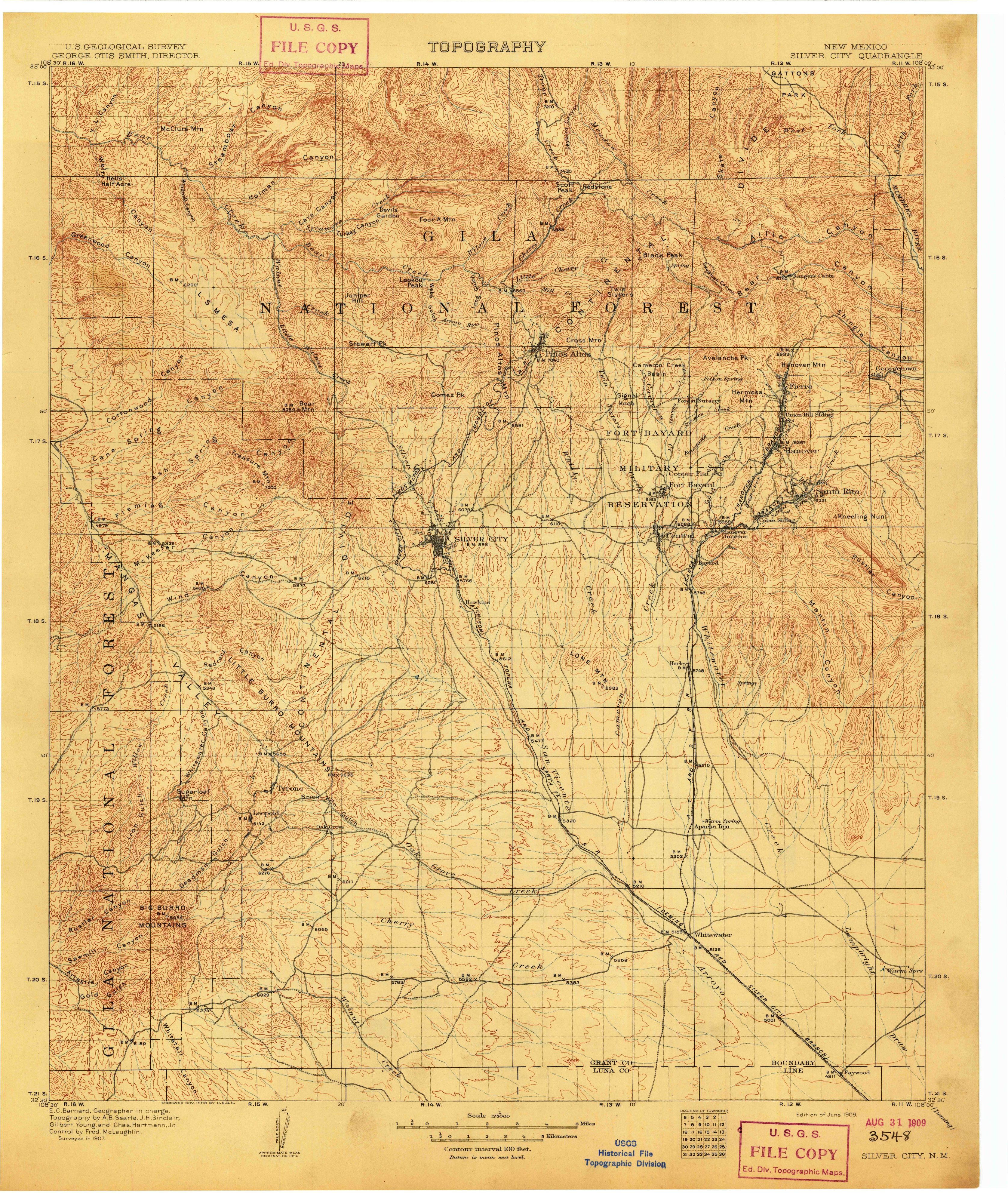
- U.S. Geological Survey, Silver City quadrangle (1909). The 1:125,000 sheet, surveyed in 1907, that the map at the top of this page was cropped from.
Sponsored
Put this 1909 map on your wall
The 1909 USGS Silver City sheet is in the public domain. Download the full-size scan for free, then have it printed on canvas with CanvasOnTheCheap.
Print a map on canvasDownload the full-size mapWe may earn a commission if you buy through this link. It never changes what we write. Read our affiliate disclosure
Spot something wrong, or know more? Tell us here. You can also email us or use our contact page. Corrections are noted here with their date, never made silently.