Las Cruces, New Mexico: Which Crosses Gave It Its Name?
Las Cruces is Spanish for "the crosses." The city's history exhibit says the 1849 town site lay near a stand of crosses marking the graves of travelers and soldiers. Other accounts tie the name to people killed in Apache attacks, or to a crossing or crossroads, and the visitors bureau says no one knows exactly how the name was chosen.
Las Cruces, New Mexico, means “the crosses” in Spanish, but which crosses gave the town its name is still an open question. The city’s own history exhibit points to a cluster of grave crosses near the town site, and its visitors bureau admits, in so many words, that “no one knows exactly how Las Cruces was selected.”
A stand of crosses by the road
Start with the version the city tells. Its online exhibit, Las Cruces: Crossroads of History, says the site for the new American town lay “six miles south of Doña Ana near a stand of crosses,” and that those crosses marked “the graves of travelers and soldiers.” Six miles is about 10 km. The exhibit’s conclusion is short: “The landmark crosses gave the town its name.”
That’s a clean story, and it may well be right. But notice what it doesn’t say. It doesn’t name anyone buried there, and it doesn’t say who first called the spot Las Cruces. Visit Las Cruces, the city’s tourism office, is more careful. Its history page says most historians conclude the name comes from the Spanish for “the crosses,” while saying plainly that nobody knows how it was picked.
A cross Susan Magoffin saw in 1847
The eyewitness people cite most is Susan Shelby Magoffin, who rode down this stretch of the road with her husband on a trading expedition in the winter of 1847, and her diary was published by Yale in 1926. On Friday, February 12, after camping about 10 miles (16 km) from Doña Ana, she wrote:
“Yesterday we passed over the spot where a few years since a party of the Apaches attacked Gen. Armijo as he returned from the Pass with a party of troops, and killed some fourteen of his men, the graves of whom, marked by a rude cross, are now seen”
“The Pass” was El Paso. Magoffin doesn’t say the place was called Las Cruces, and she describes one rude cross, not a field of them. So it’s fair to ask whether she saw the same graves. Robert Julyan, in The Place Names of New Mexico, thinks the surveyors later picked a site near an old burial ground whose crosses were likely the ones Magoffin had seen. “Likely” is his word, and it’s the right one. A National Park Service article on the city’s oldest neighborhood also mentions that some scholars point to Magoffin, and says the name is generally assumed to refer to the graves of settlers who died in Apache attacks.
Or maybe it was a crossing
There’s a second idea, and it’s not about graves at all. The same Park Service article adds that “others contend the name simply refers to the area as a crossing or crossroads.” The town grew up where El Camino Real, the old royal road between Mexico and Santa Fe, ran along the Rio Grande, so the idea isn’t strange. It’s also not the reading most sources favor, and the Park Service doesn’t say who holds it.
And then there’s a wrinkle that pushes the name back more than 150 years. Julyan writes that the scholar Adolph Bandelier found a Spanish report from 1693 in the archives of Mexico City describing raids at Los Organos, with the raiders moving on to a place called Las Cruces. If that reading is right, a spot with this name existed along the river long before the American town, and the people who laid out the town in 1849 may have simply borrowed it. None of the sources here says whether the 1693 Las Cruces and the 1849 one are the same patch of ground. That’s why this page calls the origin disputed.
Laid out with a rawhide rope
The town itself is easier to pin down. After the war with Mexico ended in 1848, the United States took control of southern New Mexico, and settlers crowded into the valley looking for land. Visit Las Cruces says local leaders asked the U.S. Army for help. Julyan names one of them, Don Pablo Melendres, who asked Lieutenant Delos Bennett Sackett of the First Dragoons to lay out a new town south of crowded Doña Ana.
The city’s exhibit dates the survey to 1849. Sackett’s men divided the new town into 84 blocks. They used a rawhide rope as a measure and set aside one block each for a church and a cemetery, and then family leaders drew lots to see which property they’d own. Julyan says the community dates from 1848, so you’ll see both years. The Park Service adds that the Army’s plat was signed by Doña Ana County Sheriff Samuel Bean, and that the town was bordered on the west by the acequia madre, the main irrigation ditch, and on the east by El Camino Real.
“The small town of Cruces”
Within two years the place was turning up in a traveler’s journal. John Russell Bartlett, the U.S. commissioner sent to survey the new border with Mexico, rode north from El Paso in January 1851. On a 56-mile (90 km) trip to Doña Ana, he noted that “the only intermediate town is Las Cruces, eight miles from Doña Ana.” That’s about 13 km.
In April he came through again and wrote: “Passed the small town of Cruces, a recently established place, eight miles from Doña Ana.” He used both forms, Las Cruces and plain Cruces, in the same book. He never says where the name came from, which tells you something too. To a busy commissioner in 1851, it was just the name of a new town on the road.
The town on the 1893 map
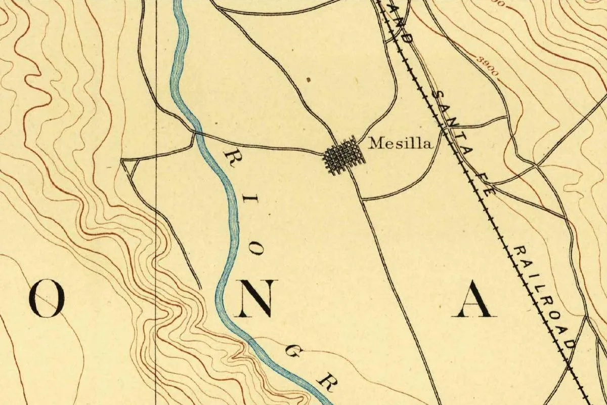
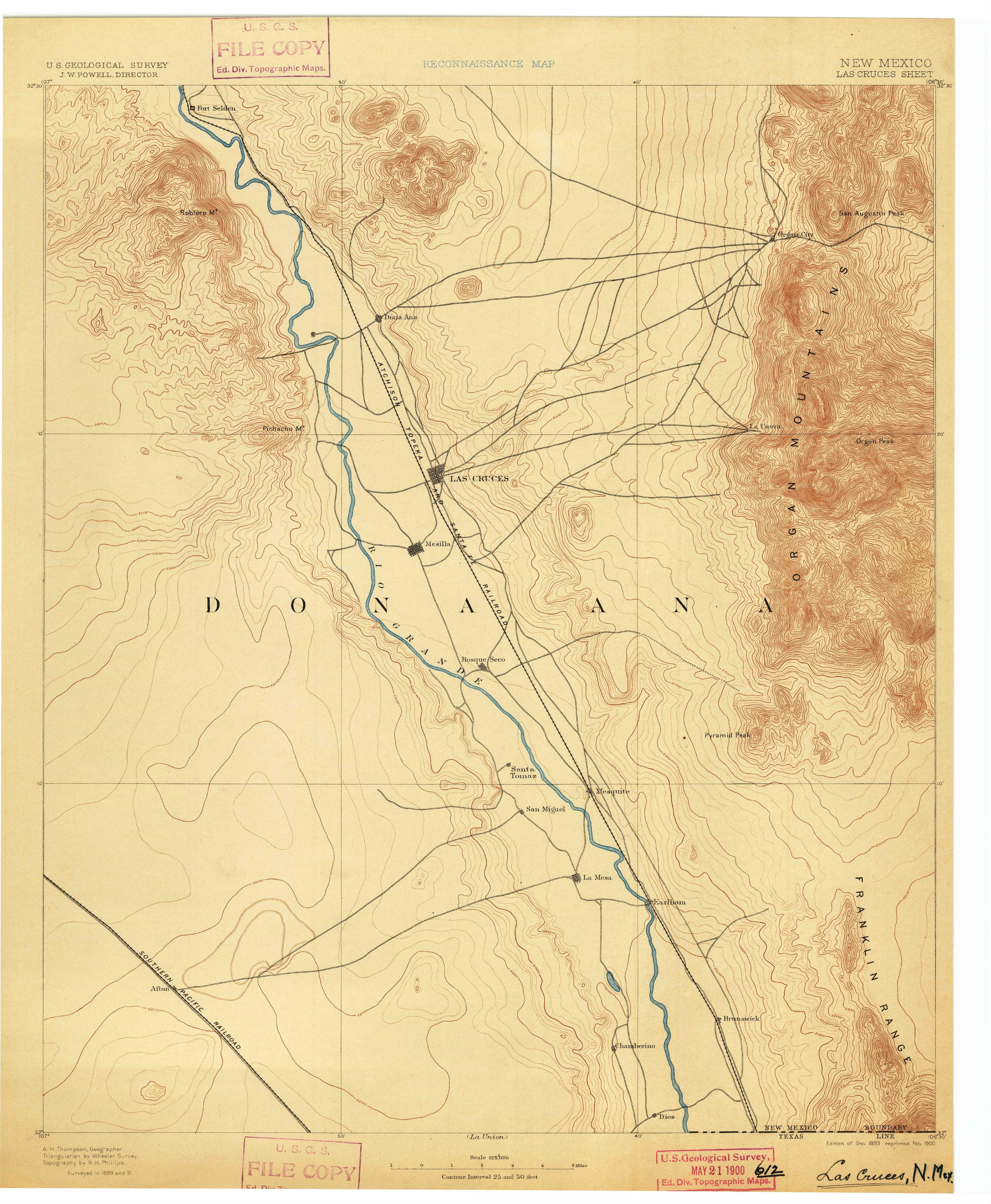
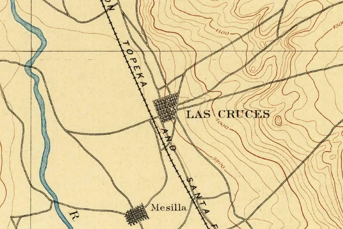
The map at the top of this page was surveyed in 1889 and 1891 and printed in December 1893. By then the railroad had arrived. The city says the first Atchison, Topeka & Santa Fe train pulled in on April 26, 1881, and on the map the tracks run right past the grid of streets labeled LAS CRUCES. Mesilla sits on its own grid a little to the southwest, and the Rio Grande wanders along the left edge.
The map doesn’t explain the name, of course. It just shows what was left of the story by then: a railroad town with two Spanish words on it that every source translates the same way. If you want to see where the city fits in the long line of Spanish names along this river, the stories of Albuquerque and Santa Fe, at the far end of the old royal road, are good next stops. There’s more on the state itself on our New Mexico page.
Quick answers
What does Las Cruces mean in English?
“The crosses.” The city’s history exhibit and its visitors bureau both give that translation, and no source here disputes the words themselves.
What crosses is Las Cruces named after?
Nobody can say for sure. The city points to crosses marking the graves of travelers and soldiers near the 1849 town site. Other accounts link the name to people killed in Apache attacks, possibly the graves Susan Magoffin passed in 1847, and some say it meant a crossing or crossroads.
Was Las Cruces named before the town was founded?
Possibly. Robert Julyan writes that a Spanish report from 1693 mentions a place called Las Cruces in this stretch of the river, more than 150 years before the Army laid out the town.
Who laid out Las Cruces?
U.S. Army surveyors led by Lieutenant Delos Bennett Sackett, in 1849 according to the city. They divided the town into 84 blocks, measuring with a rawhide rope.
Key dates
- 1847Susan Magoffin passes graves of soldiers killed by Apaches, "marked by a rude cross," on the road below Doña Ana.
- 1849Army surveyors under Lt. Delos Bennett Sackett lay out Las Cruces in 84 blocks, according to the city.
- 1851Boundary commissioner John Russell Bartlett passes "the small town of Cruces, a recently established place."
- 1881The first Atchison, Topeka & Santa Fe train reaches Las Cruces on April 26.
Things to do in Las Cruces, New Mexico
Las Cruces Railroad Museum
A city museum in the historic Santa Fe Railroad depot that tells the railroad history of Las Cruces and how the trains changed southern New Mexico.
New Mexico Farm & Ranch Heritage Museum
A museum about at least 4,000 years of growing food in this region, told through indoor and outdoor exhibits, demonstrations, oral histories and objects.
Organ Mountains-Desert Peaks National Monument
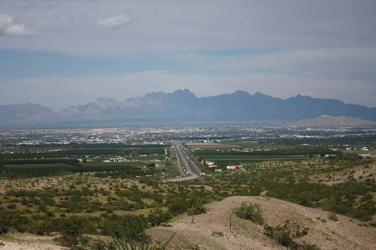
Public land right on the east side of Las Cruces, where the steep, angular Organ Mountains rise in rocky spires above the Chihuahuan Desert floor.
Mesquite Historic District
The neighborhood laid out by the U.S. Army after 1848, bordered by the acequia madre and El Camino Real. Mesquite Street still roughly follows the old royal road.
Getting there
Open Las Cruces in Google Maps
Opens in a new tab. The pin is the center of Las Cruces in the USGS place-name record.
The closest airports, Amtrak stations and intercity bus stops, measured in a straight line from the center of Las Cruces.
Airports
- El Paso International (ELP) 42 mi 68 km
- Roswell Air Center (ROW) 147 mi 237 km
Amtrak trains
- El Paso station (ELP) 42 mi 67 km
- Deming station (DEM) 57 mi 92 km
Intercity buses
- Greyhound Las Cruces NM (LCR) under 1 mi 0.8 km
- Limousine Express Las Cruces 1 mi 2 km
- Limousine de Mexico El Paso (Limo Express) 42 mi 68 km
Distances are as the crow flies, not by road. We don't list schedules or fares because they change; check with the airline, Amtrak or the bus company before you go. Official data (FAA commercial service airports (2025), FAA airport locations, Amtrak stations and Intercity Bus Atlas) from the FAA and the U.S. Bureau of Transportation Statistics, checked Nov 14, 2026.
Sponsored
Staying in Las Cruces?
Compare hotels in Las Cruces, New Mexico, on Expedia.
See hotels in Las CrucesWe may earn a commission if you buy through this link. It never changes what we write. Read our affiliate disclosure
Historical Sources & References
- City of Las Cruces, “Las Cruces: Crossroads of History”. The 1849 town site “six miles south of Doña Ana near a stand of crosses” marking “the graves of travelers and soldiers,” and “The landmark crosses gave the town its name”; Sackett’s 84 blocks, the rawhide rope, the church and cemetery blocks and the drawing of lots; the first AT&SF train on April 26, 1881.
- Visit Las Cruces, “About Las Cruces, NM”. “No one knows exactly how Las Cruces was selected,” and most historians derive it from the Spanish for “the crosses”; the settlers after 1848 and the Army’s help.
- National Park Service, “New Mexico: Mesquite Historic District”. The name “assumed to reference” gravesites of settlers who died in Apache attacks; scholars who point to Magoffin; “others contend” it meant a crossing or crossroads; Sheriff Samuel Bean’s plat, the acequia madre and El Camino Real.
- Robert Julyan, The Place Names of New Mexico (1998), via the New Mexico Office of the State Historian. The 1693 Spanish report found by Bandelier; Pablo Melendres and Lieutenant Sackett; the old burial ground whose crosses were likely the ones Magoffin saw; the community dated to 1848.
- Susan Shelby Magoffin, Down the Santa Fe Trail and into Mexico (1926), p. 202. The quoted entry of February 12, 1847, about the graves of Armijo’s men “marked by a rude cross.” The previous page has her camp “10 miles from Don Llana [Doña Ana].”
- John Russell Bartlett, Personal Narrative, vol. 1 (1854), p. 154. January 13, 1851: “The only intermediate town is Las Cruces, eight miles from Doña Ana,” on a 56-mile ride.
- John Russell Bartlett, Personal Narrative, vol. 1 (1854), p. 200. April 20, 1851: “Passed the small town of Cruces, a recently established place.”
- GNIS feature 899715 (U.S. Geological Survey). The national names database entry for Las Cruces, Doña Ana County, with its coordinates.
- U.S. Geological Survey, Las Cruces sheet (1893). The 1:125,000 reconnaissance map, surveyed in 1889 and 1891, that the image at the top of this page was cropped from.
Sponsored
Put this 1893 map on your wall
The 1893 USGS Las Cruces sheet, in a 1900 reprint, is in the public domain. Download the full-size scan for free, then have it printed on canvas with CanvasOnTheCheap.
Print a map on canvasDownload the full-size mapWe may earn a commission if you buy through this link. It never changes what we write. Read our affiliate disclosure
Spot something wrong, or know more? Tell us here. You can also email us or use our contact page. Corrections are noted here with their date, never made silently.