Tucumcari, New Mexico: After Six-Shooter Siding
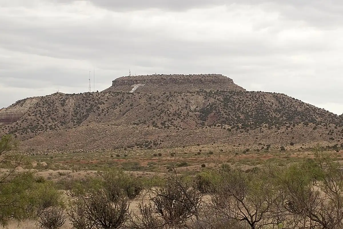
Tucumcari, New Mexico, was a rail camp called Six-Shooter Siding before it borrowed a nearby mountain’s name, and nobody’s sure what that name means. The camp’s nickname is a lot easier to guess.
Six-Shooter Siding
New Mexico’s Federal Writers’ Project guide, in its 1962 edition, says Tucumcari “was only a small trading point for cattlemen, until the Rock Island arrived in 1901; in 1903, when Quay County was organized, this was made the county seat.”
The first name came with the track crews. T. M. Pearce’s 1965 dictionary New Mexico Place Names says that in “construction camp days in 1901, the name was Six-Shooter Siding,” and in another spot he lists “Six Shooter Siding (Quay). See Tucumcari.” He has some fun with it, too: “Into what category Six Shooter Siding falls may be left to the imagination.” Pearce also lists a post office called Douglas, entered under Guadalupe County, open in 1901 and 1902 and then “changed to Tucumcari.”
David F. Myrick’s history of the state’s railroads tells the switch in one line: “Originally named Six-Shooter Siding, the people chose to call their settlement Tucumcari, borrowing the name from a nearby mountain.”
A name older than the railroad
The mountain’s name was on the land long before the Rock Island. In 1853, Lt. A. W. Whipple’s survey party, looking for a railroad route to the Pacific near the 35th parallel, came down to “the well known Rio Tucumcari, called by Mexicans, on account of its wide and fertile valley, ‘Plaza Larga.’” Whipple added that “the Tucumcari hills, near by, are remnants of the great Llano Estacado.”
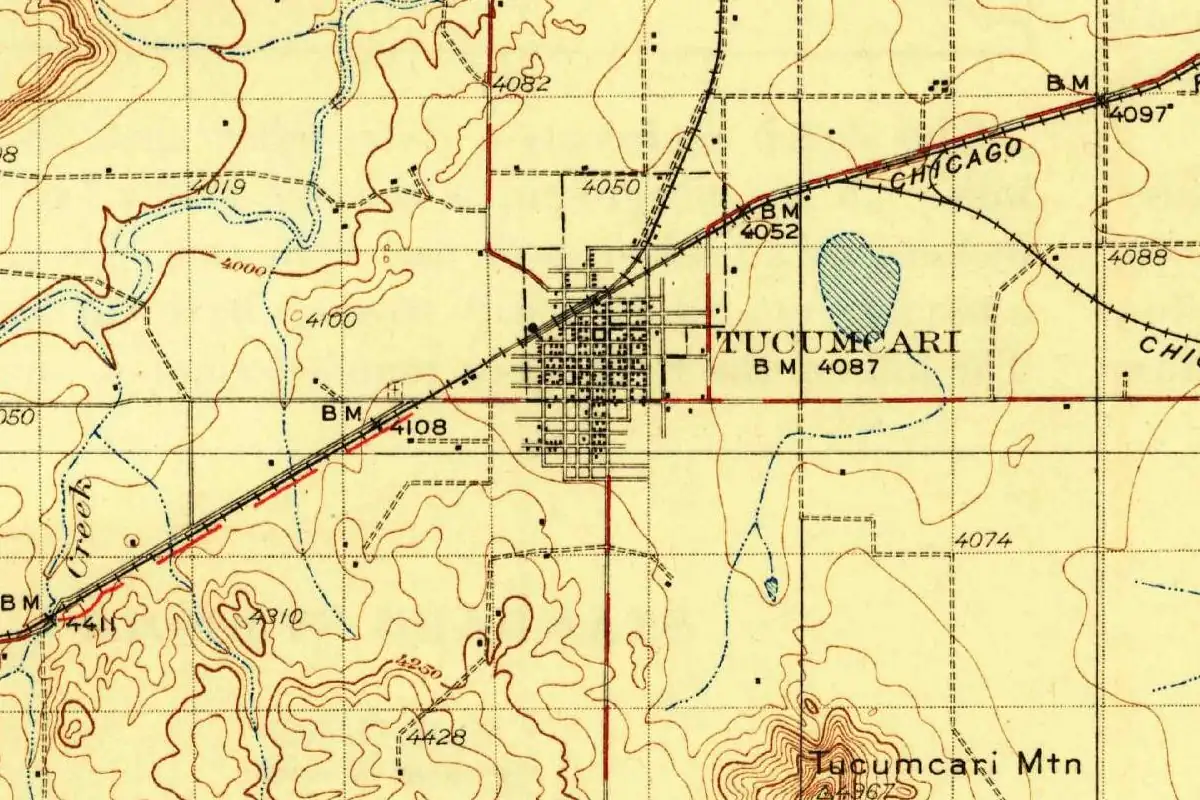
You can find the mountain on the 1930 survey map, drawn in tight contour lines at the bottom edge, south of the town’s grid and the tracks. By the federal gazetteer’s coordinates, Tucumcari Mountain is about 3 miles (5 km) south-southeast of the town center.
What does the word mean?
Here the books stop short. Right after the line about the mountain, Myrick writes: “The background of the name is speculative.”
Pearce’s dictionary goes further, but we could read only part of his entry. In that part he says the “Tucumcari area, however, is Comanche territory and Comanche phrases have linguistic support,” and goes on to a Comanche phrase for “two fires.” The “however” suggests he weighed other ideas first. Since we didn’t see the whole entry, this article doesn’t list them or pick a winner. If you’ve heard a single sure translation of Tucumcari, treat it with care.
Quick answers
What does Tucumcari mean?
Nobody knows for certain. Myrick calls the background of the name “speculative,” and Pearce’s dictionary says Comanche phrases “have linguistic support” without settling the question in the part we could read.
What was Tucumcari’s old name?
Six-Shooter Siding. Pearce puts that name in the railroad’s construction camp days of 1901, and Myrick says only that the town was “originally named Six-Shooter Siding.” Pearce also lists a post office called Douglas in 1901 and 1902.
Was Tucumcari named after Tucumcari Mountain?
Yes. Myrick writes that the people chose the name Tucumcari, “borrowing the name from a nearby mountain.” Whipple’s survey recorded a Rio Tucumcari and Tucumcari hills here in 1853.
Key dates
- 1853Whipple's railroad survey reaches "the well known Rio Tucumcari" and notes the Tucumcari hills nearby.
- 1901The Rock Island arrives; in its construction camp days the place is called Six-Shooter Siding.
- 1901-1902A post office called Douglas operates here before it's changed to Tucumcari.
- 1903Quay County is organized, with Tucumcari as its county seat.
Getting there
Open Tucumcari in Google Maps
Opens in a new tab. The pin is the center of Tucumcari in the USGS place-name record.
The closest airports, Amtrak stations and intercity bus stops, measured in a straight line from the center of Tucumcari.
Airports
- Clovis Regional (CVN) 63 mi 102 km
- Rick Husband Amarillo International (AMA) 114 mi 184 km
Amtrak trains
- Las Vegas station (LSV) 89 mi 143 km
Intercity buses
- Greyhound Tucumcari Mcdonald'S 1 mi 2 km
Distances are as the crow flies, not by road. We don't list schedules or fares because they change; check with the airline, Amtrak or the bus company before you go. Official data (FAA commercial service airports (2025), FAA airport locations, Amtrak stations and Intercity Bus Atlas) from the FAA and the U.S. Bureau of Transportation Statistics, checked Nov 6, 2026.
Sponsored
Staying in Tucumcari?
Compare hotels in Tucumcari, New Mexico, on Expedia.
See hotels in TucumcariWe may earn a commission if you buy through this link. It never changes what we write. Read our affiliate disclosure
Historical Sources & References
- David F. Myrick, New Mexico’s Railroads: A Historical Survey (1990 ed.). Read only in search excerpts: the change from Six-Shooter Siding to Tucumcari, borrowed “from a nearby mountain,” and “The background of the name is speculative.”
- T. M. Pearce, ed., New Mexico Place Names (1965). Read only in search excerpts: Six-Shooter Siding in the “construction camp days in 1901,” the Douglas post office of 1901-02, and the line on Comanche phrases.
- Federal Writers’ Project, New Mexico: A Guide to the Colorful State, rev. ed. (1962), p. 312. Tucumcari as a trading point for cattlemen until the Rock Island arrived in 1901, and county seat of Quay County from 1903.
- A. W. Whipple, preliminary report, Reports of Explorations and Surveys for a Pacific railroad, vol. 3 (1856), p. 12. “The well known Rio Tucumcari,” called “Plaza Larga” by Mexicans, and “the Tucumcari hills.”
- GNIS feature 915909 (U.S. Geological Survey). The national register of place names lists Tucumcari in Quay County, with no note on its history.
Spot something wrong, or know more? Tell us here. You can also email us or use our contact page. Corrections are noted here with their date, never made silently.