Why Is It Called Beacon, NY? Revolutionary Signal Fires
Beacon is named for the signal fires burned on Mount Beacon during the Revolutionary War, which a city report says warned George Washington at Newburgh that British forces were coming. The name was chosen when two villages, Fishkill Landing and Matteawan, joined as one city. Governor William Sulzer signed the law on May 15, 1913.
Beacon, New York, is named for signal fires lit on Mount Beacon in the Revolution; it became a city in 1913, when Fishkill Landing and Matteawan joined. The name looks back more than a century from the city it was given to.
Why is it called Beacon, New York?
The answer is on the mountain behind town. A history of the city charter, written for Beacon’s Charter Commission in 2017, says the name “was subsequently adopted, after the display of signal fires on Beacon Mountain during the revolutionary war to warn General George Washington in Newburgh across the Hudson of the approach of the British forces.” The Advisory Council on Historic Preservation also traces the name to the signal fires on top of the 1,540-foot (469 m) mountain behind the city.
A resolution the New York State Senate passed for the city’s centennial in 2013 adds who picked it. It says “the name Beacon was voted upon by the citizens of Matteawan and Fishkill Landing,” as a reminder of the fires on Mount Beacon in the Revolution.
The fires were remembered long before the city existed. Frank Hasbrouck’s 1909 History of Dutchess County notes “the monument on North Beacon to commemorate the burning of signal fires on North and South Beacons during the War of the Revolution, erected by Melzingah Chapter Daughters of the American Revolution, July 4th, 1900.” So the mountain had two peaks with the name, and a monument to the fires, 13 years before the new city took that name.
Beacon, NY history: Fishkill Landing, Matteawan and the city of 1913
Before 1913 there were two villages. Fishkill Landing sat on the Hudson and incorporated in 1864; Matteawan lay inland and incorporated in 1886. A marker from the William G. Pomeroy Foundation says Chestnut Street divided them, and they shared one Main Street. The Advisory Council says both were first settled in 1709.
Their old names had their own stories. For Fishkill, Henry Gannett goes back to the early Dutch: vischkill, “fish creek.” For Matteawan he gives an Indian name “meaning ‘good fur,’ or ‘enchanted skin,’” from early days, when the area was famous for its pelts.
Joining them took years. The charter history says voters in the two villages decided on March 15, 1910, by about two to one, to unite and ask for a city charter, for a city that still had no name, with a small piece of the hamlet of Glenham thrown in. Then the bill stalled in Albany. Governor Charles Evans Hughes vetoed it. It came back the next year, backed by Dutchess County’s new state senator, Franklin Delano Roosevelt, and Governor John A. Dix vetoed it too. In 1913 Governor William Sulzer signed a separate act that created the City of Beacon. The Senate resolution dates his signature to May 15, 1913, and the charter history cites a July 1, 1913, story in the New York Times headlined “City of Beacon is Born.”
Other towns have been named at the moment they merged. In Pennsylvania, the boroughs of Mauch Chunk and East Mauch Chunk signed on in 1954 to merge as Jim Thorpe, after the Olympic champion. On the Oregon coast, five beach towns that merged in 1965 became Lincoln City, a name picked in a newspaper and radio contest.
In the 1800s the place became a factory town, and the Advisory Council says it was known as “The Hat Making Capital of the US,” with nearly 50 hat factories at its peak. The council also says the Mount Beacon Incline Railway carried an estimated 3 million people to the summit between 1902 and 1975. Beacon sits on the Hudson’s east shore in New York’s Dutchess County, 60 miles (97 km) north of New York City, the council says.
Beacon on the 1917 and 1920 maps
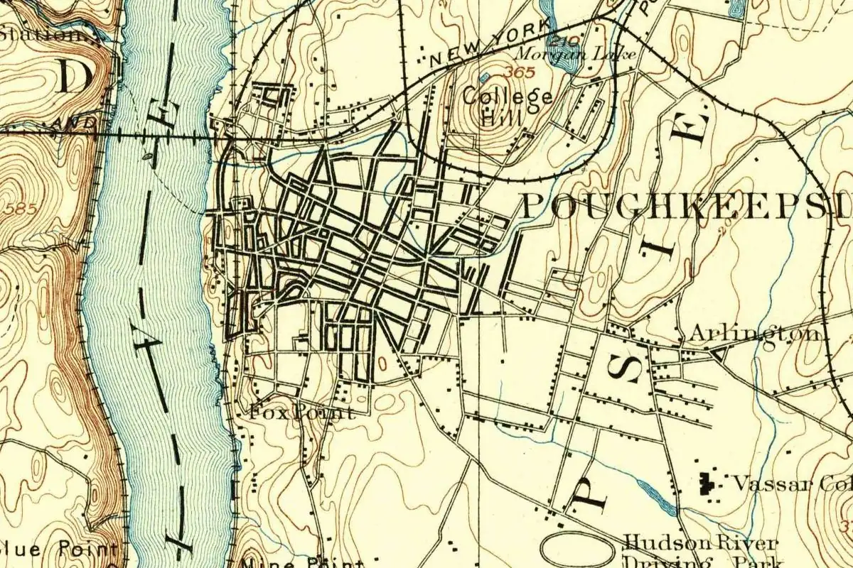
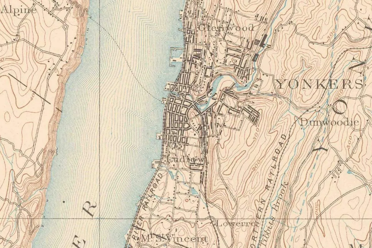
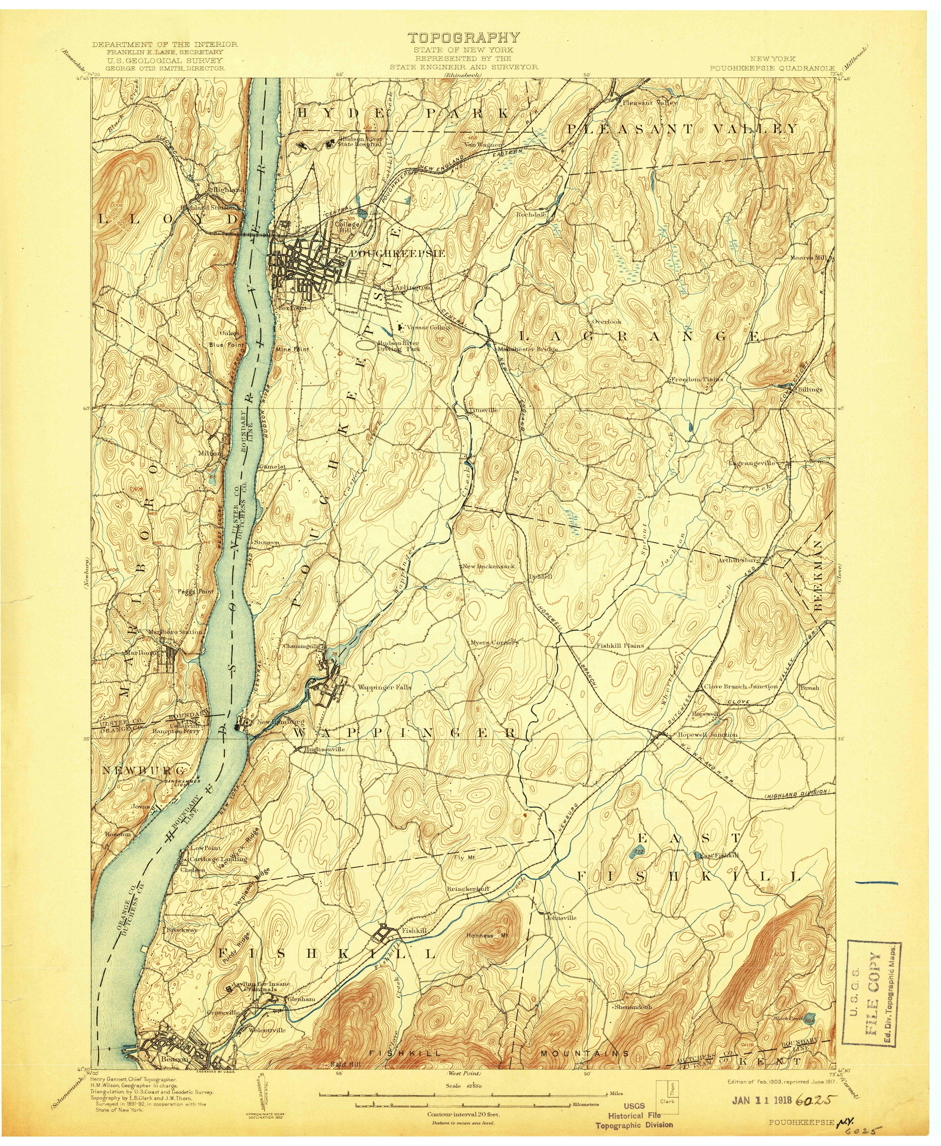
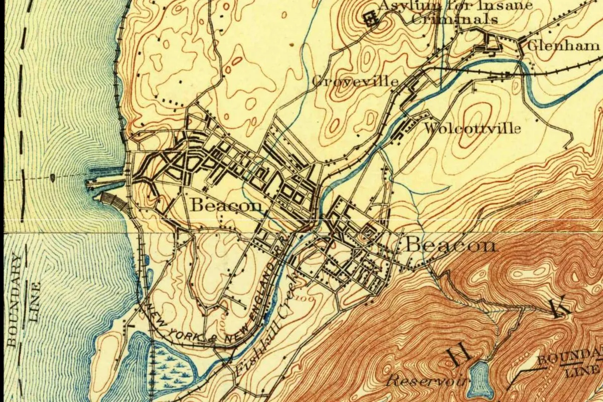
Beacon falls right on the line between two Geological Survey sheets, so the map at the top joins two of them. The northern part comes from the Poughkeepsie quadrangle, a 1:62,500 sheet whose margin names Henry Gannett (chief topographer), H. M. Wilson (geographer in charge) and the topographers E. B. Clark and J. W. Thom, and reads “Surveyed in 1891-92, in cooperation with the State of New York.” This one is a reprint: “Edition of Feb. 1903, reprinted June 1917.” The southern part comes from the West Point quadrangle, “Surveyed 1890-91,” in an “Edition of Sept. 1901, reprinted 1920.”
Those reprints matter here. The Poughkeepsie sheet’s 1913 reprint still showed the two old villages. By the June 1917 reprint the new name had taken their place, and in the joined crop Beacon appears twice, once on each sheet. Look for Fishkill Creek and the New York and New England Railroad running between them, Glenham and Groveville to the north, and a reservoir in the mountains to the southeast.
Quick answers
What is Beacon, New York, named after?
The signal fires lit on Mount Beacon during the Revolutionary War, according to the city, the State Senate and the Advisory Council on Historic Preservation.
What was Beacon, New York, called before 1913?
It was two villages, Fishkill Landing on the river and Matteawan inland, plus a small piece of the hamlet of Glenham.
When did Beacon, New York, become a city?
In 1913. The voters agreed to merge in 1910, and Governor William Sulzer signed the law on May 15, 1913, according to the State Senate.
Key dates
- 1709Matteawan and Fishkill Landing are first settled, according to the ACHP.
- 1864Fishkill Landing, on the river, incorporates as a village.
- 1886Matteawan, inland along Fishkill Creek, incorporates as a village.
- 1900July 4: the Daughters of the American Revolution put up a monument on North Beacon to the Revolutionary signal fires.
- 1902The Mount Beacon Incline Railway opens; it carries riders up the mountain until 1975.
- 1910March 15: voters in Fishkill Landing and Matteawan back joining as one city, by about two to one.
- 1913May 15: Governor William Sulzer signs the law that creates the City of Beacon.
- 1917A June reprint of the Poughkeepsie map sheet labels the town Beacon; the 1913 reprint still showed the old village names.
Things to do in Beacon, New York
Mount Beacon Park
A 15-acre (6 ha) Scenic Hudson park whose steep trail starts on a staircase along the route of the old Beacon Incline Railway; about a mile on, you can climb 60 feet (18 m) up the fire tower on South Mount Beacon.
Madam Brett Park
A 12-acre (5 ha) park on Fishkill Creek where Catheryna Brett, the city's first European settler, ran a grain mill, next to the ruins of the Tioronda Hat Works and the wildlife of Fishkill Marsh.
Long Dock Park
A 19-acre (8 ha) riverfront park on a peninsula made in the 1800s so rail cars could be ferried over the Hudson, with a sculpture by George Trakas and a restored red barn that houses Scenic Hudson's River Center.
Beacon Historical Society
Founded in 1976, the society shares the city's past through exhibitions, collections, programs and books from its home at 61 Leonard Street.
Getting there
Open Beacon in Google Maps
Opens in a new tab. The pin is the center of Beacon in the USGS place-name record.
The closest airports, Amtrak stations and intercity bus stops, measured in a straight line from the center of Beacon.
Airports
- New York Stewart International (SWF) Newburgh 7 mi 11 km
- Westchester County (HPN) White Plains 33 mi 53 km
- Laguardia (LGA) New York 51 mi 81 km
Amtrak trains
- Poughkeepsie station (POU) 14 mi 23 km
- Croton-Harmon station (CRT) 22 mi 36 km
Intercity buses
- ShortLine Hudson Broadway & Robinson Ave 3 mi 4 km
- OurBus Fishkill, NY 4 mi 7 km
- Adirondack Trailways Trailways · Newburgh 5 mi 8 km
Distances are as the crow flies, not by road. We don't list schedules or fares because they change; check with the airline, Amtrak or the bus company before you go. Official data (FAA commercial service airports (2025), FAA airport locations, Amtrak stations and Intercity Bus Atlas) from the FAA and the U.S. Bureau of Transportation Statistics, checked Nov 21, 2026.
Sponsored
Staying in Beacon?
Compare hotels in Beacon, New York, on Expedia.
See hotels in BeaconWe may earn a commission if you buy through this link. It never changes what we write. Read our affiliate disclosure
Historical Sources & References
- City of Beacon Charter Commission, Draft Report (2017), pp. 4-5. The vote of March 15, 1910, Glenham, the name from the signal fires, the vetoes by Hughes and Dix, Sulzer’s signature, Chapter 539 of the Laws of 1913, and the Times story of July 1, 1913.
- New York State Senate, Resolution J1740 (2013). Sulzer’s signature on May 15, 1913, and the citizens’ vote on the name.
- Frank Hasbrouck, ed., The History of Dutchess County (1909), p. 326. The DAR monument of 1900 to the signal fires on North and South Beacon. Checked against the page image.
- Advisory Council on Historic Preservation, Beacon. Settlement in 1709, the city of 1913, the name from the fires, the hat factories and the Incline Railway.
- William G. Pomeroy Foundation, “Dividing Line”. Chestnut Street between the two villages and their incorporation years.
- Henry Gannett, The Origin of Certain Place Names in the United States (1905), pp. 126 and 203. Fishkill and Matteawan. Checked against the page images.
- Scenic Hudson, Mount Beacon Park, Madam Brett Park and Long Dock Park; the Beacon Historical Society. The details in the things-to-do list.
- U.S. Geological Survey, GNIS feature 977521. Beacon’s federal record.
- Poughkeepsie quadrangle, edition of 1903, reprinted June 1917 and West Point quadrangle, edition of 1901, reprinted 1920. The two sheets the map at the top was joined and cropped from.
Sponsored
Put this 1917 map on your wall
The Geological Survey's Poughkeepsie sheet, in a 1917 reprint that already calls the new city Beacon, is in the public domain. Download the full-size scan for free, then have it printed on canvas with CanvasOnTheCheap.
Print a map on canvasDownload the full-size mapWe may earn a commission if you buy through this link. It never changes what we write. Read our affiliate disclosure
Spot something wrong, or know more? Tell us here. You can also email us or use our contact page. Corrections are noted here with their date, never made silently.