Two Guns, Arizona: Named by a Route 66 Showman
Two Guns, Arizona, is named for a showman’s stage name: Harry Miller called himself Chief Two-Gun Crazy Thunder and his Route 66 stop Fort Two Guns. Before that, the cluster of buildings where the highway crosses Canyon Diablo was called Canyon Lodge, and the man who founded it, E. M. Cundiff, was shot dead by Miller in 1926.
Canyon Lodge comes first
In July 1924, the Coconino Sun in Flagstaff reported “ambitious plans” to “make a town where the Flagstaff-Winslow highway crosses Canyon Diablo.” A stone garage and a restaurant were already open beside the bridge, a frame store was going up, and a dam was going in to hold water in the canyon. All of it, the paper said, belonged to E. M. Cundiff, who had come up from the southern part of the state and bought a homestead relinquishment.
The same story said Harry E. Miller, “(Crazy Thunder),” was getting ready to move there from the cliff dwellings at Walnut Canyon, where he’d been running a museum. He had leased frontage along the highway and planned a museum, a Gila monster farm and daily dances for tourists. In January 1925, supplies came through the Leupp post office for “the new postoffice at Canyon Lodge (near Canyon Diablo),” with Cundiff as postmaster. By March, the paper was calling Canyon Lodge “the hustling new settlement that has sprung up at Canyon Diablo,” with Cundiff as its founder and Miller running a zoo and museum.
The bridge itself was older. A 1987 inventory form for the National Park Service says the state had the Canyon Diablo Bridge built over the winter of 1914-15 and opened it to traffic on March 17, 1915, on the Old Trails Highway that later became U.S. 66.
The shooting at Canyon Lodge
The two men didn’t stay neighbors for long. On March 3, 1926, Miller shot and killed Cundiff at Miller’s home at Canyon Lodge, “40 miles east of Flagstaff,” which is about 64 km, the Sun reported. A coroner’s jury called it justifiable homicide. The Winslow Mail described “a feud of long standing” between them. The two papers called the dead man E. M. or Elmer Cundiff; the 2020 history from the Arizona Department of Transportation that we cite below calls him Earle.
Miller was tried for murder in Flagstaff anyway, in June 1926, before a packed courtroom. The Sun said he rented the grounds for his zoo, museum and home from Cundiff, and that “the sympathies of the spectators seem to be with Miller.” The jury acquitted him after less than two hours.
The newspapers of the time called Miller an Apache chief. The transportation department’s history is more careful: it says Miller “claimed to be full-blooded Apache.” We don’t have a source that settles it either way.
Where “Two Guns” shows up
Miller’s own name is where the “two guns” come from. In late August 1926, a classified ad in the Winslow Mail offered to buy “all kinds of young animals for my zoo at Canyon Lodge.” It was signed “Chief Two-Gun Crazy Thunder.” That December, the Flagstaff paper introduced one of his letters this way:
“Harry (Indian) Miller, the Apache chief, who prefixes “Two-Gun” to his Indian name, “Crazy Thunder,” spins a little soliliquoy”
So in 1926, Two-Gun was part of what Miller called himself, not yet the name of the place. That changed over the next few months. In January 1927, the Sun quoted “Chief Two-Guns Crazy-Thunder” from “his latest Fort Two-Gun Bulletin.” In February the same paper still called it his “Canyon Lodge bulletin.” Then, on April 22, 1927, the Sun used the new name twice in one issue. One story covered a court case over sign boards “erected by Miller between Winslow and Two Guns at Canyon Diablo,” and another page printed a letter from Miller written at his “Fort Two Guns.”
The new name stuck. When the transcontinental footrace came through in March 1928, the Douglas Daily Dispatch had runners finishing a lap “from Flagstaff to Two-Gun Camp” and running the next one, 24.1 miles (38.8 km), “from Two Gun camp to Winslow.”
What about William S. Hart?
You’ll often read that Miller named the place after William S. Hart, the silent-film cowboy. You’ll find it in the Arizona Department of Transportation’s 2020 blog post, which says Miller “named the town in honor of Western silent film actor William Surrey Hart, also known as Two Gun Bill.” The same post says Miller claimed he’d worked with Hart, and it tells you to “take it with a grain of salt.”
None of the 1920s newspapers we read mention Hart. They do show Miller using “Two-Gun” for himself first and for his place a few months later. So the safe answer is that Two Guns took its name from Miller’s stage name. Whether he borrowed that stage name from Hart, as the transportation department’s post says, we can’t confirm: we haven’t found anything from the time that backs it up.
The cave story
Miller also sold a darker legend. The transportation department’s post says he “gave tours of the Apache Death Cave,” and it repeats the story behind the name: that in 1878 Navajos lit a sagebrush fire near the entrance of a cave Apaches were using, and 42 Apaches died. We haven’t found any record from the 1870s for that event, and the post doesn’t cite one. Treat it as a roadside legend, not as Navajo or Apache history.
A stop the guidebooks passed by
Two Guns didn’t make it into the first big Arizona reference books. Will C. Barnes’s Arizona Place Names of 1935 has no Two Guns entry in the full-text search of archive.org. The WPA’s 1940 guide to Arizona drove right past on US 66 and stopped only for the canyon, which it said was 225 feet (69 m) deep and 500 feet (152 m) wide and was “so named because travelers experienced great difficulty in crossing it.”
Miller kept at it into the 1930s. In 1931, newspapers reported that he’d been badly hurt by one of his own animals, though they didn’t agree on which one: the Nogales International said a pet mountain lion clawed him at “his Two Guns Painted Desert trading post,” while the Coolidge Examiner said it was a bobcat that had once “occupied a cage by itself at Two Guns” before he moved it to a second trading post east of Holbrook. Jack Rittenhouse’s 1946 guide to Highway 66 summed up Two Guns in a few words: “One establishment, offering gas, lunchroom, and curios.”
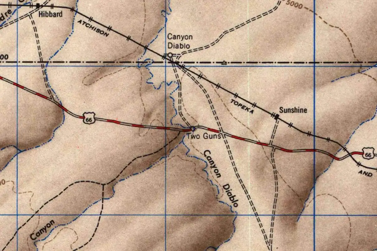
The Park Service’s 1987 form says the 1915 bridge was abandoned in the 1930s, and its location map marks a Two Guns exit on the interstate. The 1947 Geological Survey map at the top of this page still shows Two Guns as a dot on U.S. 66, between Winslow to the east and Flagstaff to the west.
What’s left
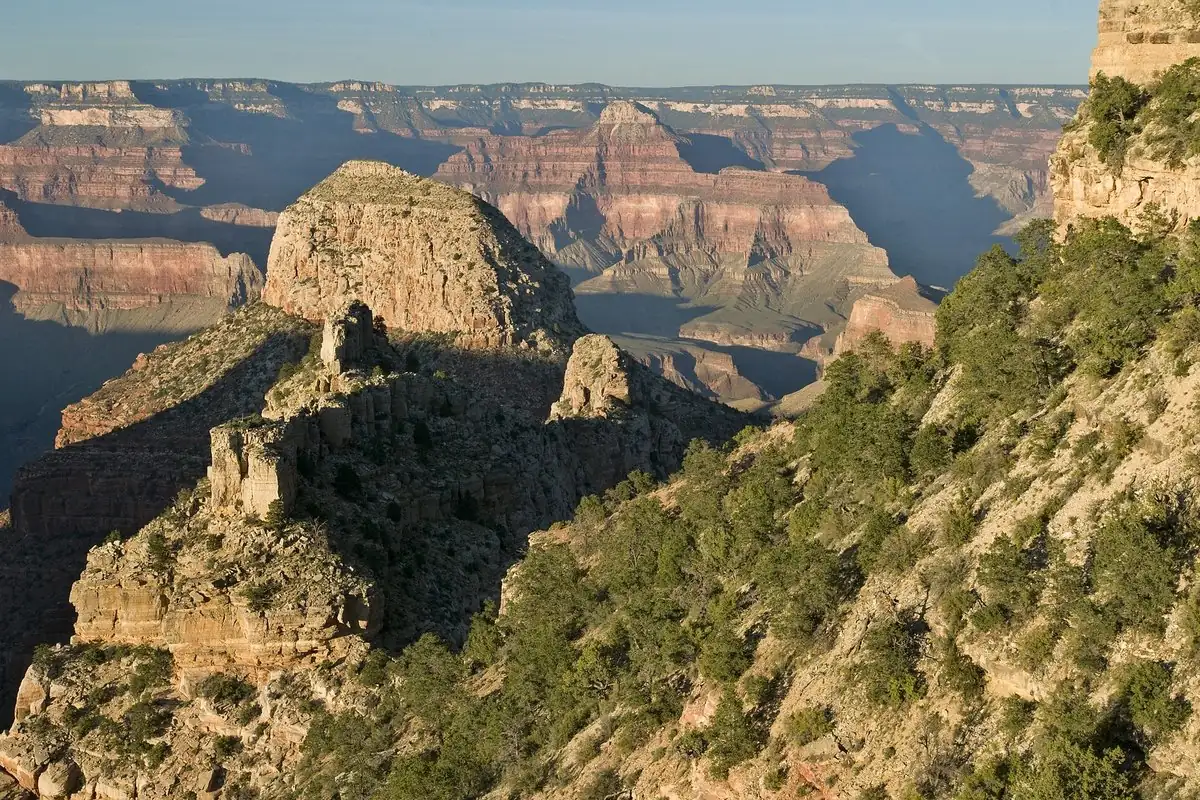
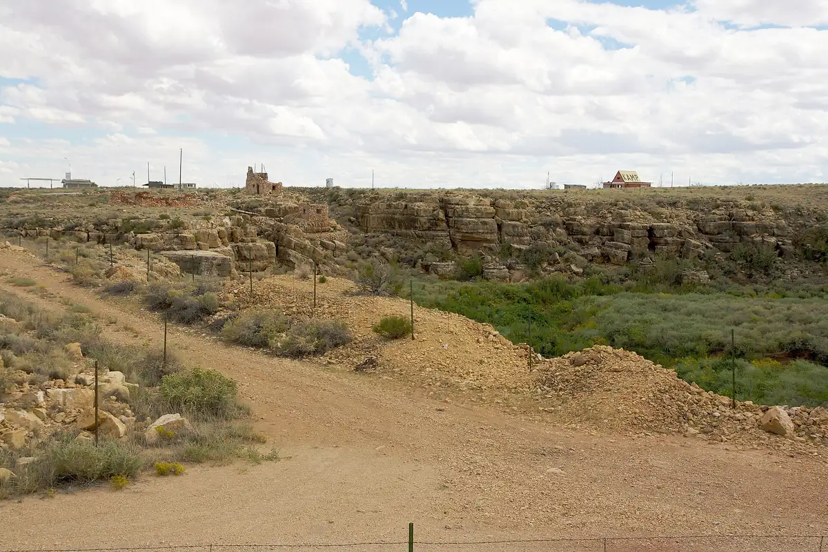
What’s there now is a set of stone ruins on the rim of Canyon Diablo, like the ones in the 2008 photo below, near Interstate 40 in Arizona. If you’re driving past, keep in mind that nothing we read says the ruins are open to visitors, so this is a story to read, not a place to wander into. The name outlasted almost everything else Miller built there: a stage name he was using by 1926 is still on the federal map.
Quick answers
Who named Two Guns, Arizona?
Harry E. “Indian” Miller, who ran a zoo and museum there in the 1920s. He called himself Chief Two-Gun Crazy Thunder in 1926, and by April 1927 his place was “Fort Two Guns.”
Was Two Guns named after William S. Hart?
Not that anyone can show. A 2020 Arizona Department of Transportation post says Miller named it for Hart, “Two Gun Bill,” but the same post says to take Miller’s claim that he worked with Hart “with a grain of salt,” and the 1920s newspapers we read never mention Hart.
What was Two Guns called before?
Canyon Lodge. That’s what the Coconino Sun called the settlement E. M. Cundiff started at the Canyon Diablo bridge in 1924, and the post office being set up there in 1925.
Is the Apache Death Cave story true?
Nobody has shown it is. The story of 42 Apaches dying in the cave in 1878 is retold by the Arizona Department of Transportation, which says Miller gave tours there, and we found no record from the 1870s to support it.
Key dates
- 1915The Canyon Diablo Bridge opens to traffic on March 17, carrying the Old Trails Highway across the canyon.
- 1924E. M. Cundiff builds a garage, restaurant and store where the Flagstaff-Winslow highway crosses Canyon Diablo; Harry E. Miller plans to move there.
- 1925Supplies arrive for a new post office at Canyon Lodge, with Cundiff as postmaster.
- 1926Miller shoots and kills Cundiff on March 3; a jury acquits him in June.
- 1927The Coconino Sun prints "Fort Two-Gun Bulletin" in January and "Two Guns at Canyon Diablo" in April.
- 1928Runners in the transcontinental footrace stop at "Two-Gun Camp."
- 1947The U.S. Geological Survey's Flagstaff sheet labels Two Guns on U.S. 66.
Getting there
Open Two Guns in Google Maps
Opens in a new tab. The pin is the center of Two Guns in the USGS place-name record.
The closest airports, Amtrak stations and intercity bus stops, measured in a straight line from the center of Two Guns.
Airports
- Flagstaff Pulliam (FLG) - Flagstaff 33 mi 52 km
- Prescott Regional/Ernest A Love Field (PRC) 82 mi 131 km
- Phoenix Sky Harbor International (PHX) 128 mi 205 km
Amtrak trains
- Winslow station (WLO) 23 mi 38 km
- Flagstaff station (FLG) 32 mi 51 km
Intercity buses
- Greyhound Flagstaff AZ - Greyhound Station (FGG) 31 mi 50 km
- Route 66 Express Amtrak Connecting Service · Flagstaff 32 mi 51 km
- FlixBus Flagstaff Train Station 32 mi 51 km
Distances are as the crow flies, not by road. We don't list schedules or fares because they change; check with the airline, Amtrak or the bus company before you go. Official data (FAA commercial service airports (2025), FAA airport locations, Amtrak stations and Intercity Bus Atlas) from the FAA and the U.S. Bureau of Transportation Statistics, checked Nov 11, 2026.
Sponsored
Staying in Two Guns?
Compare hotels in Two Guns, Arizona, on Expedia.
See hotels in Two GunsWe may earn a commission if you buy through this link. It never changes what we write. Read our affiliate disclosure
Historical Sources & References
- “Canyon Diablo to Have Snake Dances, Museum and Gila Monster Farm,” The Coconino Sun (July 25, 1924). p. 1: plans to “make a town where the Flagstaff-Winslow highway crosses Canyon Diablo”; Cundiff’s garage, restaurant and store; Harry E. Miller “(Crazy Thunder)” moving from Walnut Canyon with a museum and Gila monster farm.
- “Leupp Department,” The Coconino Sun (January 9, 1925). p. 6: supplies for “the new postoffice at Canyon Lodge (near Canyon Diablo),” with Postmaster E. M. Cundiff.
- “Big Things Planned for Canyon (Diablo) Lodge,” The Coconino Sun (March 13, 1925). p. 3: Canyon Lodge, “the hustling new settlement”; Miller’s zoo and museum; Cundiff “the founder.”
- “Indian Miller Kills E. M. Cundiff at Canyon Lodge,” The Coconino Sun (March 5, 1926). p. 1: the shooting at Canyon Lodge, “40 miles east of Flagstaff,” and the coroner’s verdict of justifiable homicide.
- “‘Crazy Thunder’ Miller Kills Elmer Cundiff at Canyon Lodge,” The Winslow Mail (March 5, 1926). p. 1: “a feud of long standing.”
- “Indian Miller Held Not Guilty Murder Cundiff,” The Coconino Sun (July 2, 1926). p. 1: the acquittal after less than two hours; Miller rented the grounds for his zoo, museum and home from Cundiff. Also online: the trial report of June 25, 1926, p. 1, on the spectators’ sympathies.
- Classified notice, The Winslow Mail (August 27, 1926). p. 7: “WILL BUY all kinds of young animals for my zoo at Canyon Lodge. Chief Two-Gun Crazy Thunder.”
- Column items on Miller, The Coconino Sun (December 17, 1926). p. 8: the quotation about Miller, “who prefixes ‘Two-Gun’ to his Indian name.” Also online: January 21, 1927, p. 8, “Chief Two-Guns Crazy-Thunder” and his “Fort Two-Gun Bulletin,” and February 11, 1927, p. 8, his “Canyon Lodge bulletin.”
- “Indian Miller Wins Sign Wrecking Case,” The Coconino Sun (April 22, 1927). p. 8: sign boards “erected by Miller between Winslow and Two Guns at Canyon Diablo.” Also online: the same issue, p. 10, Miller writing from his “Fort Two Guns.”
- Footrace reports, Douglas Daily Dispatch (March 20, 1928). p. 7: “24.1 miles from Two Gun camp to Winslow.” Also online: March 23, 1928, p. 10, the lap “from Flagstaff to Two-Gun Camp.”
- “Trading Post Man Attacked By Pet Lion,” Nogales International (August 1, 1931). p. 2: Miller clawed at “his Two Guns Painted Desert trading post.” Also online: The Coolidge Examiner, July 31, 1931, p. 1, the animal that “occupied a cage by itself at Two Guns.”
- Writers’ Program, Arizona: A State Guide (1940). Tour 2 (US 66), p. 316: Canyon Diablo, 225 feet deep and 500 feet wide, “so named because travelers experienced great difficulty in crossing it.” The guide doesn’t mention Two Guns.
- Jack D. Rittenhouse, A Guide Book to Highway 66 (1946). Entry “Two Guns”: “One establishment, offering gas, lunchroom, and curios.” A lending-library book, read in search excerpts without the page number.
- Will C. Barnes, Arizona Place Names (1935). No Two Guns entry turns up in the full-text search of this lending-library copy.
- Clayton B. Fraser, “Canyon Diablo Bridge,” inventory form (National Park Service, 1987). The bridge “just west of Two Guns,” built in the winter of 1914-15, opened March 17, 1915, and abandoned in the 1930s; a location map with a Two Guns exit.
- John LaBarbera, “Two Guns’ sordid history off I-40,” Arizona Department of Transportation (September 17, 2020). The Hart story (“also known as Two Gun Bill”), Miller’s claim to have worked with Hart and the advice to “take it with a grain of salt”; Miller “claimed to be full-blooded Apache”; Miller “gave tours of the Apache Death Cave”; the cave story (1878, 42 Apaches dead); Cundiff’s first name as Earle.
- U.S. Geological Survey, Flagstaff sheet (1947). The map at the top of this page, the oldest in the USGS historical collection that labels Two Guns.
- GNIS feature 24665, Two Guns (U.S. Geological Survey). The Geological Survey’s names database lists Two Guns as a populated place in Coconino County, on the Meteor Crater map sheet, with its coordinates.
Sponsored
Gear up for your next road trip
Explore rooftop tents, vehicle awnings and outdoor gear from TOPOAK Overland.
Shop TOPOAK overlanding gearWe may earn a commission if you buy through this link. It never changes what we write. Read our affiliate disclosure
Spot something wrong, or know more? Tell us here. You can also email us or use our contact page. Corrections are noted here with their date, never made silently.