Sonora, California: A Gold Camp Named for Mexican Miners
Sonora is named for the miners from the state of Sonora, Mexico, who settled on Woods Creek in the gold rush. The camp was known as Sonorian Camp or Sonora Camp before the name was shortened. The city dates the settlement to 1848, and the county historical society dates the Woods Creek camp to March 1849.
Sonora, California, carries the name of a Mexican state, brought to the gold fields by miners from Sonora who set up camp on Woods Creek. The city’s own history calls it the “Queen of the Southern Mines,” and the name of the camp went through a few spellings before it settled.
Miners from Sonora
The City of Sonora’s short history says the town “was established in 1848 by miners emigrating from the State of Sonora, Mexico.” It adds that “the early settlement was often referred to as the Sonoran Camp.” Long before that, the city says, the spot had been a winter camping place for the Mi-wuk people.
The Tuolumne County Historical Society tells the same story with a different word for the miners. Some of the first to reach the county, it says, were discharged veterans of the Mexican War and “miners from the state of Sonora, Mexico known as Sonoranians.” As more miners arrived and friction with the Americans grew, the Sonoranians were pushed off their diggings. On March 17, 1849, the society says, they moved to a new camp on Woods Creek, on what’s now the site of Sonora High School. The city dates “the first documented discovery” in Woods Creek to the same day.
Sonorian Camp
The oldest of these accounts is a county history published in San Francisco in 1882. It describes a party of Mexican miners who, “pushing up Woods’ Creek beyond the Crossing, located Sonorian Camp — a name afterwards changed to Sonora.” All its people, the book says, “were of Spanish extraction, until the arrival of the first Americans, who came most probably in the spring of 1849.”
The same book credits a store-keeper with making the name official. Early in 1849, R. S. Ham had made himself the first alcalde, an officer “called by the Mexican term Alcalde” who kept the peace and tried offenders. When a cook from the steamer Oregon was accused of theft and Ham was expected to hang him, the miners elected James Frazier, “a store-keeper on Sonorita Gulch,” in Ham’s place. The book says “the first act of Alcalde Frazier being to name the new place Sonora Camp, or in the uncouth habit of the Americans, ‘Sonorian Camp.’”
By summer the name was on official paper. The book prints a tally list from an election held “at the office of the Alcalde of the Sonora Camp, in the San Joaquin District,” on August 1, 1849.
Shortened to Sonora
The historical society says the camp, swelled by Sonoranians and others, “became known as Sonoranian Camp. Later this was shortened to Sonora.” The old Indian trail that ran between the diggings, it adds, became Washington Street, so if you walk that street today, you’re following it.
The city gives the dates that followed. “The first record of Sonora organizing as a town was on November 7, 1849.” Tuolumne County was set up as one of California’s original 27 counties on February 18, 1850, and Sonora was incorporated as a city on May 1, 1851.
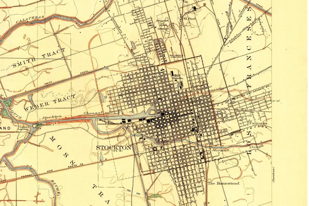
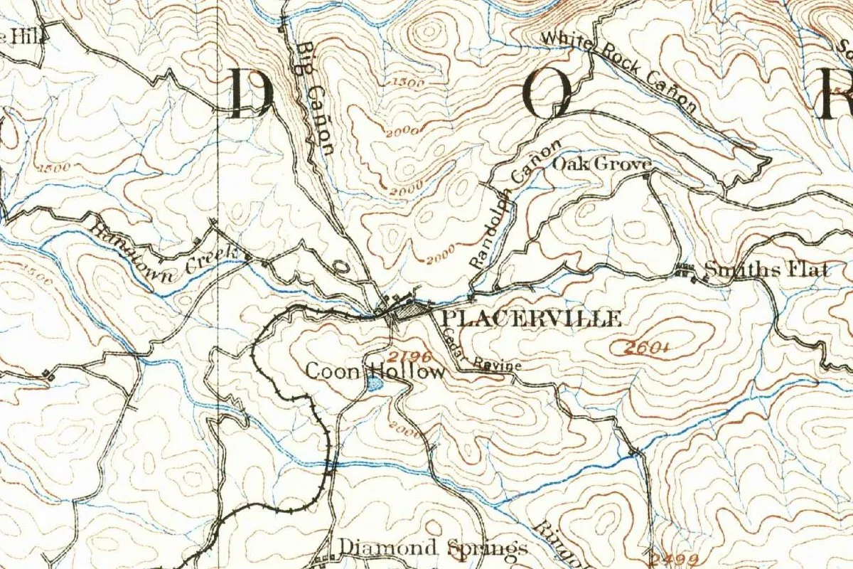
Placerville, another gold camp, was Old Dry Diggings and then Hangtown before it settled on a word for placer gold. Sonora’s name came from the people who dug there instead. California’s gold fields turn up in other towns’ stories, too: the prospector who found placer gold at Idaho Springs, Colorado, in 1859 had experience in the California gold fields. And the state of Sonora itself turns up in the story of Crawford, Nebraska: one of the two men credited with that town’s name, Captain Emmet Crawford, was shot by Mexican troops in Sonora in 1886.
Sonora on the 1893 map
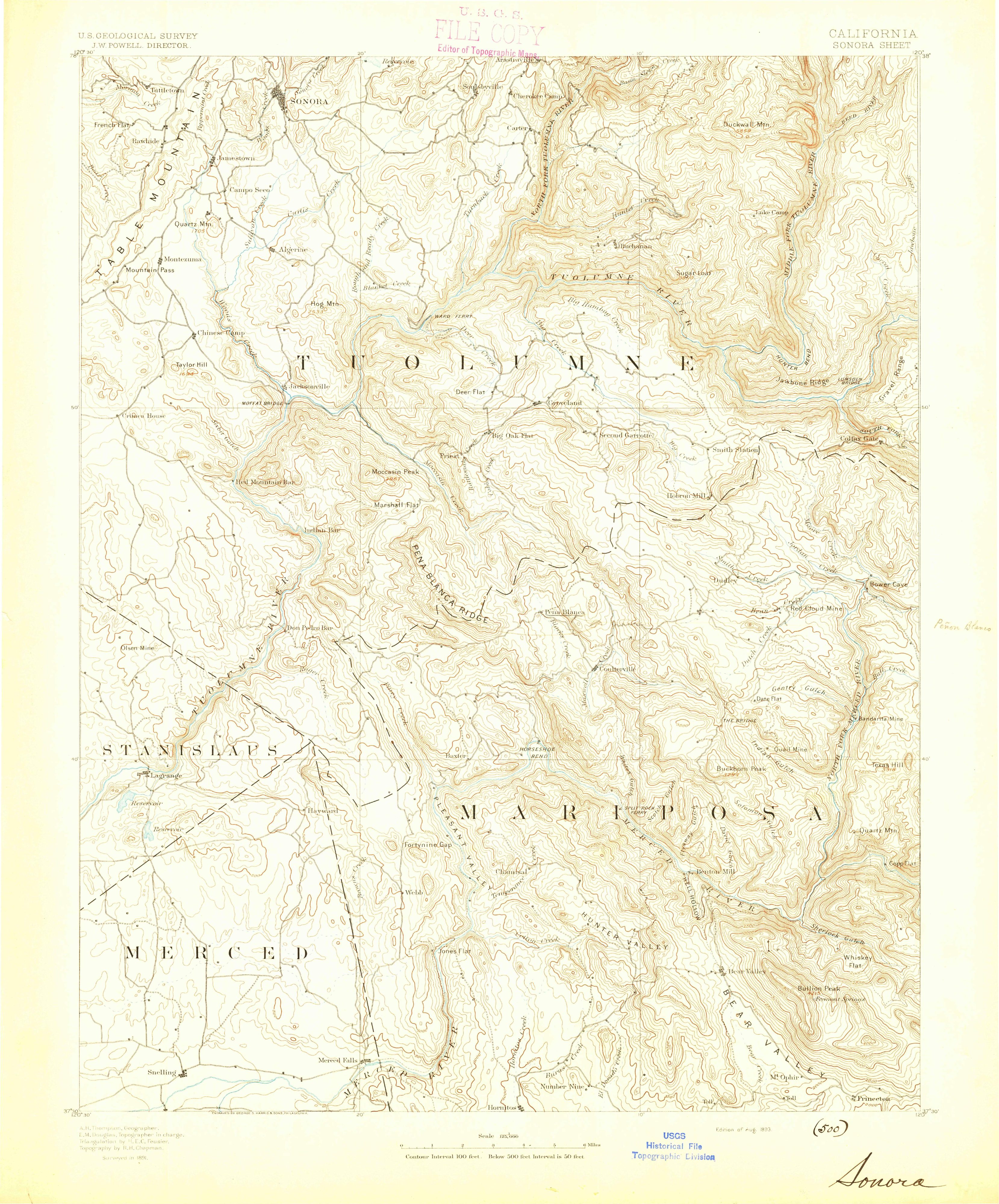
The map at the top of this page is the Geological Survey’s Sonora sheet at 1:125,000, in its “Edition of Aug. 1893.” The margin credits A. H. Thompson as geographer, E. M. Douglas as topographer in charge, triangulation by H. E. C. Feusier and topography by R. H. Chapman, “Surveyed in 1891,” and says the sheet was engraved by George S. Harris & Sons of Philadelphia. On the full sheet, the town sits right against the top edge, near the upper left corner, and the sheet takes its name from it.
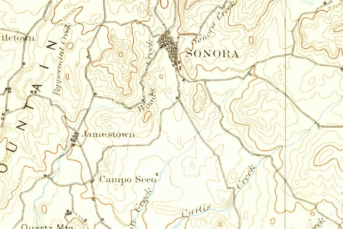
In this detail, SONORA is lettered beside a dark block of town, with Sonora Creek and Woods Creek close by. Jamestown and Campo Seco sit to the south, and Quartz Mtn is at the bottom left. The contour lines are drawn every 100 feet (30 m).
Quick answers
Why is Sonora, California, called Sonora?
It’s named for the miners from the state of Sonora, Mexico, who settled there during the gold rush, according to the city and the county historical society.
What was Sonora called before?
Sonorian Camp or Sonora Camp, in the 1882 county history; the city says Sonoran Camp, and the historical society says Sonoranian Camp.
When was Sonora founded?
The city says 1848. The historical society dates the Woods Creek camp to March 17, 1849, and the city was incorporated on May 1, 1851.
Key dates
- 1848Miners from the state of Sonora, Mexico, establish the settlement, according to the City of Sonora.
- 1849The Sonoranians move to a new camp on Woods Creek on March 17; Alcalde James Frazier names it Sonora Camp; on November 7 Sonora organizes as a town.
- 1850Tuolumne County is established on February 18.
- 1851Sonora is incorporated as a city on May 1.
- 1893The Geological Survey issues its Sonora sheet, surveyed in 1891.
Things to do in Sonora, California
Tuolumne County Museum
Tuolumne County's history museum on Bradford Street. It stands where the county kept its jail for more than a century, from 1857 until 1961.
Sonora Fire Museum
A museum of the town's volunteer firefighters, who date to the 1850s, with old photographs and keepsakes. Among the featured pieces is a hand-pumped engine from 1876.
Columbia State Historic Park
A Gold Rush town three miles (5 km) north of Sonora that was once known as the "gem of the southern mines."
Railtown 1897 State Historic Park
A state park in Jamestown, 3 miles (5 km) south of Sonora, where old steam trains still run and you can see the roundhouse and repair shops where they were kept up.
Getting there
Open Sonora in Google Maps
Opens in a new tab. The pin is the center of Sonora in the USGS place-name record.
The closest airports, Amtrak stations and intercity bus stops, measured in a straight line from the center of Sonora.
Airports
- Stockton Metro (SCK) 47 mi 76 km
- Sacramento International (SMF) 82 mi 132 km
Amtrak trains
- Modesto station (MOD) 36 mi 58 km
- Turlock-Denair station (TRK) 39 mi 63 km
Intercity buses
- Gold Runner Yosemite - Crane Flat 36 mi 57 km
- Rapid Connection Modesto Rapid Connection 41 mi 66 km
- Greyhound Modesto Bus Stop 41 mi 67 km
Distances are as the crow flies, not by road. We don't list schedules or fares because they change; check with the airline, Amtrak or the bus company before you go. Official data (FAA commercial service airports (2025), FAA airport locations, Amtrak stations and Intercity Bus Atlas) from the FAA and the U.S. Bureau of Transportation Statistics, checked Nov 18, 2026.
Sponsored
Staying in Sonora?
Compare hotels in Sonora, California, on Expedia.
See hotels in SonoraWe may earn a commission if you buy through this link. It never changes what we write. Read our affiliate disclosure
Historical Sources & References
- A History of Tuolumne County, California (1882), pp. 5 and 12-15. The Mexican miners and Sonorian Camp, Alcalde Frazier’s Sonora Camp, and the election of August 1, 1849. Checked against the page images.
- City of Sonora, “Short History”. The miners from Sonora in 1848, the Sonoran Camp, March 17, 1849, and the dates of 1849, 1850 and 1851.
- Tuolumne County Historical Society, “Sonora: Crossroads of Tuolumne County”. The Sonoranians, the Woods Creek camp, Sonoranian Camp shortened to Sonora, Washington Street, and the two museums.
- Columbia State Historic Park and Railtown 1897 State Historic Park. The parks listed above.
- Sonora’s GNIS entry, feature 1659815 (U.S. Geological Survey). The city’s listing as a populated place in Tuolumne County, with its coordinates.
- U.S. Geological Survey, Sonora sheet (August 1893). The 1:125,000 sheet the map at the top was cropped from.
Sponsored
Put this 1893 map on your wall
The Geological Survey's 1893 Sonora sheet, surveyed in 1891, with the old camp on Woods Creek at its top edge, is in the public domain. Download the full-size scan for free, then have it printed on canvas with CanvasOnTheCheap.
Print a map on canvasDownload the full-size mapWe may earn a commission if you buy through this link. It never changes what we write. Read our affiliate disclosure
Spot something wrong, or know more? Tell us here. You can also email us or use our contact page. Corrections are noted here with their date, never made silently.