Galena, Kansas: A Town Named for Lead Ore
Galena, Kansas, is named for galena, the lead ore that brought the town into being. In the spring of 1877, a few young men building a diving board at a swimming hole pulled some stones out of the creek bank and found they were lumps of lead. Within two months the farm around that hole was a mining town of a couple of thousand people.
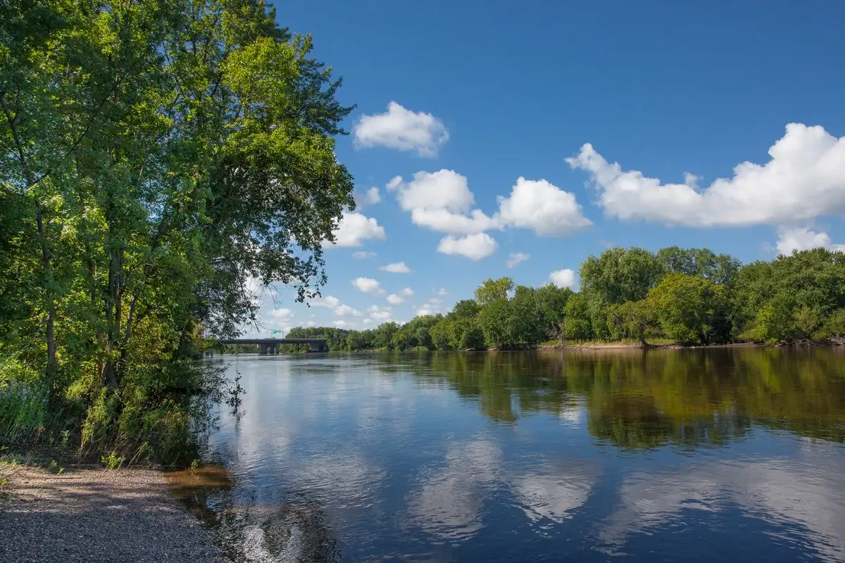
Boulders in the swimming hole
The fullest telling comes from William G. Allison’s 1904 History of Cherokee County. On a Sunday afternoon in the spring of 1877, he writes, four young men named Moll, Evans, Fry and Moorland went swimming in a “hole” at the north end of the Moll farm. To anchor a spring-board they had to dig one end into the bank, and some of the stones they pulled out were strangely heavy:
“Upon examining them they proved to be boulders of lead. They took these up to the Moll home and showed them to the owner of the land.”
The news spread fast. Within days, Allison says, mine owners came over from Joplin, just across the Missouri line, and Egidius Moll sold them 40 acres for $700. He even promised to buy the land back if they didn’t sell $700 worth of ore within a year. He never had to. Allison guessed those 40 acres, known in 1904 as the “Hoy Forty” after one of the buyers, had produced about $2,000,000 in ore by 1904.
The same book prints a second version, in a 1904 letter from Chas. E. Topping, an early settler: in April 1877, he wrote, two men walking out of Joplin, John Shoe and John McAllen, stopped to swim in Short Creek, dove for the heaviest stone and came up with “a chunk of lead.” Either way, it was swimmers who found it.
William G. Cutler’s 1883 History of the State of Kansas adds the land deal that made the town. The Galena Mining & Smelting Company bought 120 acres of Moll’s land that spring for $10,000 and laid out a town right away. Lots sold as fast as they were staked, and “in the space of about two months the place numbered a population of between two and three thousand.”
Why “Galena”?
Galena is the name of the mineral itself, the ore that lead is smelted from. The 1939 WPA guide to Kansas puts it in a single parenthesis, “GALENA (Lat. lead ore),” and Allison makes the same point with more feeling. The name “would never attach to the place,” he wrote, “were it not for the fact that it designates the physical quality which makes it the greatest lead and zinc mining region in the world.”
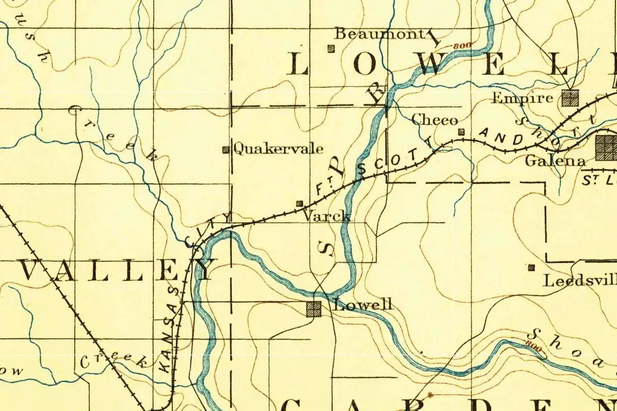
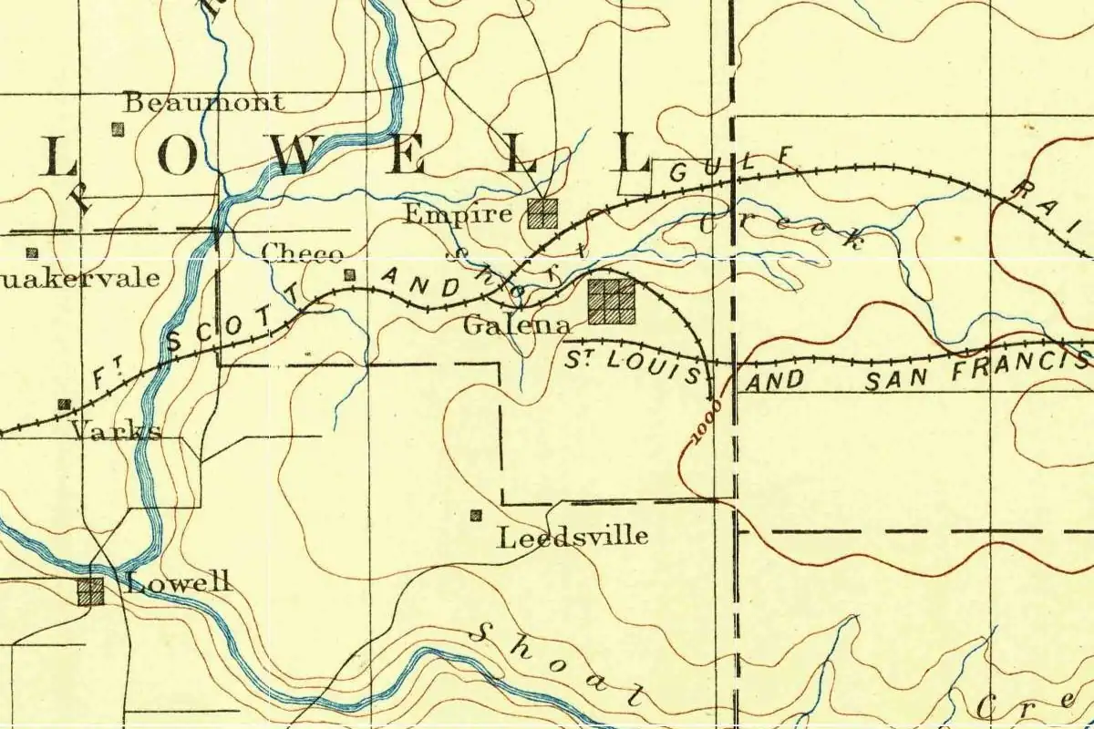
What we couldn’t find is the person who picked it. None of the sources we read names who chose “Galena” or when exactly it was first used. The post office records come closest. The Kansas Historical Society’s list shows a Leedsville post office opening on May 8, 1876, and the same office becoming Galena on May 25, 1877, a few weeks after the lead was found. Oddly, the 1886 Geological Survey map at the top of this page still shows a Leedsville dot south of town, so the old name seems to have stayed with that spot even after the post office took the new one.
The town also had a second name for a while. Cutler says it sat on Short Creek, “a name sometimes given to the diggings,” and the railroad station was called Short Creek too. Two of the early papers were the Short Creek Banner and the Short Creek Republican.
Galena against Empire City
Galena wasn’t the only town that came out of the rush. Just across Short Creek, Empire City grew up at almost the same time. According to the WPA guide, most of the early mines were north of the creek, so Empire City’s people built a timber stockade 10 feet (3 m) high and about half a mile (0.8 km) long to keep Galena from having a direct route to the diggings. Galena’s residents burned it down. A 1904 letter in Allison’s book, from Chas. E. Topping, who came to the camp in June 1877, says a court declared the stockade unlawful and that “many people in Galena, to this day, have a prejudice against Empire.”
The two towns were incorporated the same summer. Allison gives Galena’s date as June 19, 1877. In the long run, Galena won: Empire City faded as the mining moved south and east, and it was annexed to Galena in 1911.
Route 66 through the chat piles
Galena’s mines also gave it a place on Route 66. The National Park Service says the road through this corner of Kansas was paved in 1923 to serve the mining district, which is why it was chosen for the new highway in 1926. Its Galena page says the local roads got a hard surface of chat, the crushed waste rock from the mines, as early as 1904. Kansas ended up with fewer than 14 miles (23 km) of Route 66, and it’s the only state the interstate bypassed completely in 1961.
The landscape the road ran through was startling. The WPA writers said the smelters, mills and chat piles around Galena “have destroyed the original beauty of the country,” and that the ground north of Short Creek was so undermined that cave-ins were common. Today the Park Service lists a 1.2-mile (1.9 km) stretch east of town, with a curving 1920s viaduct over the railroad tracks, as the Kansas Route 66 Historic District-East Galena. Galena is the first of three Kansas stops on the old road, followed by Riverton and Baxter Springs, and the rest of the route is in our Route 66 towns collection.
Not the only Galena
The same ore gave its name to towns all over the American lead country, so if you search for Galena you’ll find several, including the old lead-mining town in Illinois. This one is the Kansas Galena in Cherokee County, in the far southeast corner of the state, right on the Missouri line.
Quick answers
What does Galena mean?
It’s the name of a mineral, the main ore of lead. The 1939 WPA guide to Kansas glosses the town’s name simply as “lead ore.”
Why is Galena, Kansas, called Galena?
Because it was founded on lead. In the spring of 1877, young men found boulders of lead ore in a swimming hole on the Moll farm, and a mining company laid out a town there within weeks. Allison’s 1904 county history says the name fits “the greatest lead and zinc mining region in the world.”
When was Galena, Kansas, founded?
In 1877. Lead was found that spring, the Galena Mining & Smelting Company laid out the town, the post office took the name Galena on May 25, and the city was incorporated on June 19.
Is Galena, Kansas, on Route 66?
Yes. It’s the first Kansas town the road reaches from Missouri, and the Park Service lists a 1.2-mile (1.9 km) stretch of the old highway east of town in the National Register.
Key dates
- 1876May 8: A post office called Leedsville opens in Cherokee County.
- 1877Spring: Young men building a diving board at a swimming hole on Egidius Moll's land pull out boulders of lead.
- 1877May 25: The Leedsville post office is renamed Galena. On June 19, Galena is incorporated as a city of the third class.
- 1911Empire City, Galena's rival across Short Creek, is annexed to Galena.
- 1923The road through Galena is paved for the mines. In 1926 it becomes part of Route 66.
- 1961The interstate that replaces Route 66 bypasses Kansas completely.
Getting there
Open Galena in Google Maps
Opens in a new tab. The pin is the center of Galena in the USGS place-name record.
The closest airports, Amtrak stations and intercity bus stops, measured in a straight line from the center of Galena.
Airports
- Joplin Regional (JLN) 9 mi 15 km
- Northwest Arkansas Ntl (XNA) Bentonville 58 mi 93 km
Intercity buses
- Jefferson Lines Joplin (Road Ranger) 13 mi 21 km
Distances are as the crow flies, not by road. We don't list schedules or fares because they change; check with the airline, Amtrak or the bus company before you go. Official data (FAA commercial service airports (2025), FAA airport locations, Amtrak stations and Intercity Bus Atlas) from the FAA and the U.S. Bureau of Transportation Statistics, checked Nov 10, 2026.
Sponsored
Staying in Galena?
Compare hotels in Galena, Kansas, on Expedia.
See hotels in GalenaWe may earn a commission if you buy through this link. It never changes what we write. Read our affiliate disclosure
Historical Sources & References
- William G. Allison, History of Cherokee County, Kansas, and Representative Citizens (1904), pp. 159-161 and 167-168. The swimming-hole story (“Upon examining them they proved to be boulders of lead”), the sale of the “Hoy Forty” for $700, incorporation on June 19, 1877, and the line about the name: “The name ‘Galena’ would never attach to the place […] were it not for the fact that it designates the physical quality which makes it the greatest lead and zinc mining region in the world.” Also Chas. E. Topping’s 1904 letter (pp. 167-168): the stockade, the court’s ruling and a second account of the discovery.
- William G. Cutler, History of the State of Kansas (1883), Cherokee County, Galena. The Galena Mining & Smelting Company’s purchase of Moll’s 120 acres for $10,000 in the spring of 1877, a population of “between two and three thousand” in about two months, and Short Creek as the name of the diggings and the railroad station.
- Kansas Historical Society, Kansas Post Offices, 1828-1961, Cherokee County. Leedsville, May 8, 1876, to May 25, 1877, “Name change to Galena”; Galena from May 25, 1877; Empire City from July 6, 1877.
- Federal Writers’ Project, Kansas: A Guide to the Sunflower State (1939), pp. 440-441. “GALENA (Lat. lead ore)”; the chat piles that “destroyed the original beauty of the country”; the stockade burned by Galena’s residents; Empire City annexed in 1911.
- National Park Service, “Kansas: Route 66 Historic District-East Galena”. The 1.2-mile district and its viaduct, chat surfacing as early as 1904, and road work in 1922 and 1923.
- National Park Service, “Route 66: Kansas”. Fewer than 14 miles of Route 66 in Kansas, paved in 1923 for the mines, and the only state completely bypassed by the interstate in 1961.
- U.S. Geological Survey, Joplin sheet (1886). The map at the top of this page, with Galena, Empire and Leedsville.
- GNIS feature 469360, Galena (U.S. Geological Survey). The official name, county and coordinates of the town.
Sponsored
Gear up for your next road trip
Explore rooftop tents, vehicle awnings and outdoor gear from TOPOAK Overland.
Shop TOPOAK overlanding gearWe may earn a commission if you buy through this link. It never changes what we write. Read our affiliate disclosure
Spot something wrong, or know more? Tell us here. You can also email us or use our contact page. Corrections are noted here with their date, never made silently.