Elizabeth City, North Carolina: Which Elizabeth Was It?
No one knows for certain. The North Carolina Gazetteer says the town was probably named for Elizabeth Tooley, wife of Adam Tooley, on whose land it was laid out. Henry Gannett wrote in 1905 that it honors Queen Elizabeth of England, and the 1939 WPA guide gives both. It was Redding in 1793 and Elizabeth Town in 1794.
Elizabeth City, North Carolina, may be named for Elizabeth Tooley, whose plantation became the town and who ran a grog shop there, or for a queen. The question goes back to 1794, when the little port first took the name Elizabeth Town. The sources split on which Elizabeth, so you’ll find both answers in print.
The Narrows of Pasquotank
The town sits on the Pasquotank River, and the water came first. North Carolina: A Guide to the Old North State, written by the Federal Writers’ Project and published in 1939, says settlers from Bermuda were building ships on the river “As early as 1666.” Pasquotank County, “named for an Indian tribe in the region,” became a precinct in 1672.
By 1722, the guide says, trading vessels called and customs inspections were held “at the Narrows of Pasquotank, as the town site was then called.” What turned the landing into a town was the swamp to the north. “The West India trade, spurred by the cutting of the Dismal Swamp Canal in 1790, and the attendant swarm of ‘shingle-getters’ who came to grub out the swamp timber, led to the formation of the town.”
The port that grew up there was busy. In the early 1800s, the guide says, “ocean-going vessels crowded the docks where Negro slaves loaded shingles, barrel staves, and ship parts to be exported to the West Indies, or unloaded cargoes of molasses, rum, sugar, and tropical fruits.” Three shipyards built and repaired sailing vessels, and the guide notes that many of the builders, blacksmiths and caulkers were enslaved. If you wonder why a swamp mattered so much to a town, the guide’s answer is that the canal and the shingle-getters working its timber led to the town in the first place.
The canal tied the place to Virginia. Stagecoaches stopped there regularly, the guide says, “traveling along the canal bank from Norfolk, Va.”
Redding, then Elizabeth Town
The town’s first name didn’t last. The City of Elizabeth City says it was “incorporated in 1793 as the town of ‘Redding’ by the North Carolina General Assembly.” The legislature changed the name to Elizabeth Town in 1794 and to Elizabeth City in 1801, and the city dates those acts to December 2, 1793, December 13, 1794, and November 16, 1801. The city’s page doesn’t say who the name honors.
The spelling of that first name wobbles. The city writes Redding. The WPA guide writes Reading. The North Carolina Gazetteer, edited by William S. Powell and Michael Hill, uses Redding for the 1793 incorporation and says the name was changed from “Reading” in 1794.
In 1799, before it became a city, the town replaced Nixonton, known as Old Town, as the county seat.
The case for Elizabeth Tooley
The land itself points to one woman. The WPA guide says “The 50-acre Narrows Plantation of Adam and Elizabeth Tooley was conveyed to the town commissioners to be laid off in small tracts and assigned by lot.”
The Gazetteer leans her way, with a hedge. Its entry says the town was “Probably named for Elizabeth Tooley, wife of Adam Tooley, on whose land the town was est.”
Elizabeth Tooley also turns up in the guide’s walking tour of the town. At 112 South Water Street, it marks the “SITE OF TOOLEY’S GROG SHOP,” where “Elizabeth Tooley catered to the Dismal Swamp ‘shingle-getters.’” Her tippling house was one of several, the guide says, also called “doggeries” or “three-cent shops.” So if she’s the one, the city carries the name of a landowner who poured drinks for the swamp’s shingle-getters.
The case for the queen
Henry Gannett’s 1905 entry doesn’t mention her. It reads, in full: “Elizabeth City; county in Virginia, and town in Pasquotank County, North Carolina, named for Queen Elizabeth of England.” He put the North Carolina town in the same line as the old Virginia county of the same name, the county that early settler Adam Thoroughgood represented, as the story of Norfolk, Virginia, tells it.
A royal Elizabeth wouldn’t be out of place in this corner of the map. Virginia, just over the line, is itself named for Queen Elizabeth I.
The WPA writers didn’t pick. The name, they wrote, “was changed to Elizabeth Town, either in honor of Elizabeth Tooley or of Queen Elizabeth.”
Another American Elizabeth had its question answered more cleanly. Elizabeth, New Jersey, is named for Lady Elizabeth Carteret, the wife of one of that colony’s proprietors. In North Carolina, Charlotte is named for a queen, Charlotte, the wife of George III. For Elizabeth City, the sources give two candidates.
The 1948 map
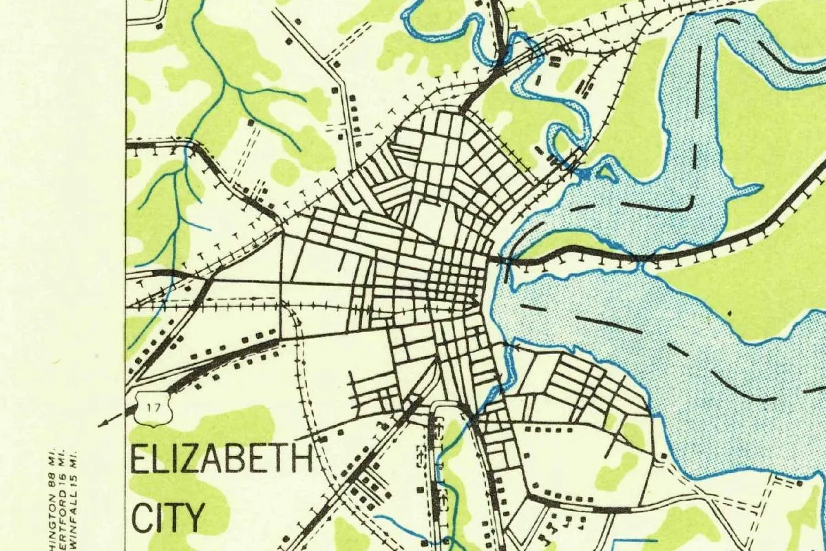
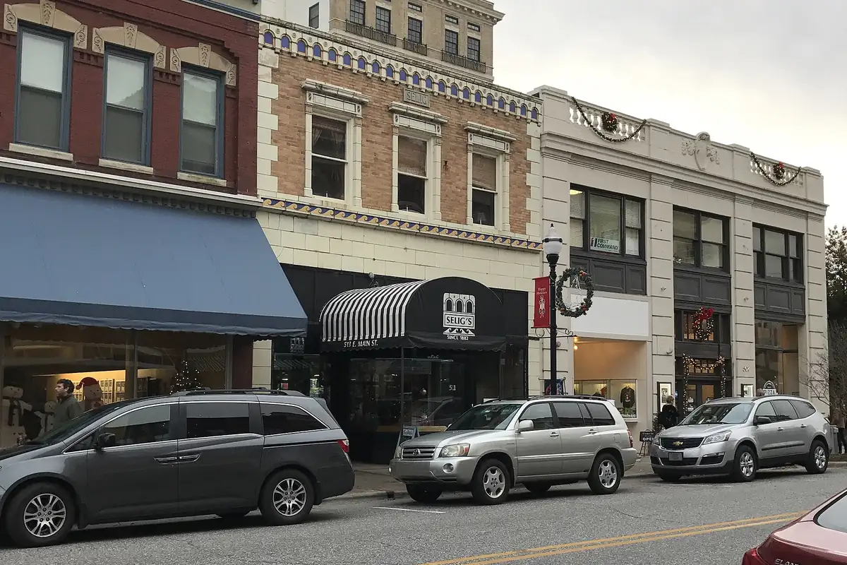
The map at the top of this page isn’t a Geological Survey original. It’s an Army Map Service sheet, compiled from 1940 aerial photographs, issued as a 1941 map, copied in 1947, and dated 1948, and this copy is the edition “reprinted from military edition for civil use” and sold by the Geological Survey. The city’s grid fills the west bank of the river, with railroads and roads fanning out and a rail line crossing the water to the east. The photo below shows storefronts on Main Street in today’s downtown.
Quick answers
Who is Elizabeth City, North Carolina, named after?
Possibly Elizabeth Tooley, whose family’s land became the town, as the North Carolina Gazetteer says is probable. Gannett (1905) names Queen Elizabeth of England, and the 1939 WPA guide gives both.
What was Elizabeth City called before?
Redding, or Reading. It was incorporated under that name in 1793, became Elizabeth Town in 1794 and Elizabeth City in 1801, by acts of the General Assembly.
Who was Elizabeth Tooley?
The wife of Adam Tooley. The WPA guide says their 50-acre Narrows Plantation was laid off into town lots, and that she kept a grog shop on Water Street for the Dismal Swamp shingle-getters.
Key dates
- 1666Settlers from Bermuda take up shipbuilding on the Pasquotank River, the 1939 WPA guide says.
- 1722Customs inspections are held at the Narrows of Pasquotank, the old name of the town site.
- 1790The cutting of the Dismal Swamp Canal brings trade and shingle-getters to the Narrows.
- 1793The General Assembly incorporates the town as Redding on December 2.
- 1794An act of December 13 renames it Elizabeth Town.
- 1799The town replaces Nixonton as county seat of Pasquotank County.
- 1801An act of November 16 makes the name Elizabeth City.
Things to do in Elizabeth City, North Carolina
Museum of the Albemarle
A state museum on South Water Street, run by the North Carolina Department of Natural and Cultural Resources, on the history of the Albemarle region. Its permanent exhibit shows the North Carolina Shad Boat, the official state historic boat, first built in the early 1880s by George Washington Creef of Roanoke Island.
Dismal Swamp State Park
A park in Camden County that opens up the Great Dismal Swamp, which the state calls the largest remaining swamp in the eastern United States, with a history tied to George Washington, the Underground Railroad and Prohibition. The 22-mile (35 km) Dismal Swamp Canal draws paddlers.
Dismal Swamp Canal Welcome Center
A welcome center on U.S. 17 in South Mills, beside the Dismal Swamp Canal, with trails, exhibits and ranger-led programs. It points visitors to the swamp's history and its wildlife, from black bears to bobcats.
Port Discover
A hub for hands-on STEM learning and exploration at 611 East Main Street in Elizabeth City.
Getting there
Open Elizabeth City in Google Maps
Opens in a new tab. The pin is the center of Elizabeth City in the USGS place-name record.
The closest airports, Amtrak stations and intercity bus stops, measured in a straight line from the center of Elizabeth City.
Airports
- Norfolk International (ORF) 42 mi 67 km
- Newport News/Williamsburg International (PHF) 59 mi 96 km
Amtrak trains
- Norfolk station (NFK) 38 mi 61 km
- Newport News station (NPN) 59 mi 95 km
Intercity buses
- Greyhound Elizabeth City Edgewood Dr 3 mi 4 km
- OurBus Virginia Beach, VA (Indian River Park & Ride Lot, located near the intersection of Indian River Rd. & Reon Dr.) 36 mi 58 km
- Virginia Breeze, Operated by Academy Virginia Breeze · Norfolk (Park & Ride) 38 mi 61 km
Distances are as the crow flies, not by road. We don't list schedules or fares because they change; check with the airline, Amtrak or the bus company before you go. Official data (FAA commercial service airports (2025), FAA airport locations, Amtrak stations and Intercity Bus Atlas) from the FAA and the U.S. Bureau of Transportation Statistics, checked Nov 17, 2026.
Sponsored
Staying in Elizabeth City?
Compare hotels in Elizabeth City, North Carolina, on Expedia.
See hotels in Elizabeth CityWe may earn a commission if you buy through this link. It never changes what we write. Read our affiliate disclosure
Historical Sources & References
- William S. Powell and Michael Hill, eds., The North Carolina Gazetteer, “Elizabeth City” (NCpedia). Redding in 1793, “Reading” to Elizabeth Town in 1794, Elizabeth City in 1801, and “Probably named for Elizabeth Tooley.”
- City of Elizabeth City, “About”. Incorporation as Redding in 1793 and the acts of 1793, 1794 and 1801.
- Federal Writers’ Project, North Carolina: A Guide to the Old North State (1939), p. 191. The Bermudians of 1666, the county’s name, the Narrows of Pasquotank, the canal of 1790, the Tooley plantation, “either in honor of Elizabeth Tooley or of Queen Elizabeth,” the county seat in 1799 and the stagecoaches from Norfolk. Checked against the page image.
- Federal Writers’ Project (1939), p. 194. Tooley’s Grog Shop at 112 South Water Street. Checked against the page image.
- Henry Gannett, The Origin of Certain Place Names in the United States (1905), p. 116. “Named for Queen Elizabeth of England.” Checked against the page image.
- Museum of the Albemarle; Dismal Swamp State Park; Dismal Swamp Canal Welcome Center; Port Discover. The details in the things-to-do list.
- GNIS feature ID 1025307 (U.S. Geological Survey). Elizabeth City in the national gazetteer, in Pasquotank County, with its coordinates.
- Army Map Service, Elizabeth City sheet (1948), civil reprint. The 1:62,500 map that the image at the top of this page was cropped from.
Spot something wrong, or know more? Tell us here. You can also email us or use our contact page. Corrections are noted here with their date, never made silently.