Nags Head, North Carolina: A Lantern Legend, No Known Origin
Nobody knows. The National Register nomination for the town's old beach cottages says the origin 'remains unknown' and lists three ideas: the shape of the island, places with the same name in England, and a light tied to a nag's head to lure boats ashore. The North Carolina Gazetteer says the name is on maps as early as 1738.
Nags Head, North Carolina, has a name nobody can explain, and one of its most popular stories, a lantern hung on a horse to lure ships ashore, is a legend. It’s a good legend, and you’ll find it in the reference books. But each of them is careful to call it a story, and none of them knows where the name really came from.
The lantern on the nag
The North Carolina Gazetteer, edited by William S. Powell and Michael Hill, starts by admitting the problem: “Numerous legends exist explaining the origin of the name.” Then it tells the favorite:
“One of the most popular tells of natives who tied lanterns around the necks of ponies (‘nags’), which were driven up and down the beach at night. The motion of the lanterns resembled that of a vessel at anchor and lured ships at sea into the shore, where they were wrecked and easily robbed.”
The town’s own land use plan of 1976 tells it too, quoting Bill Sharpe’s A New Geography of North Carolina from 1954:
“Residents of the coast once stripped wrecked vessels of their cargo, and some say Bankers even tried to lure ships to their doom. This accomplished by hanging a lighted lantern, around the neck of a horse and leading the nag along the beach, the bobbing light persuading mariners offshore to believe it came from a boat riding at safe anchorage…”
Note the “some say.” The plan goes on, noting that Sharpe himself later raised a doubt: “there is some doubt as to the credibility of this story, yet, no one seems to know the true origin of the name ‘Nags Head.’” No source here names a ship that was lost this way, and this page won’t invent one.
A legend that sticks to a town name isn’t unique to the Outer Banks. In Belfast, Maine, an old local tradition says the name was settled with a penny toss.
The shape of the island, or a name from England
The National Register nomination for the Nags Head Beach Cottage Row Historic District, written by Catherine W. Cockshutt of the state’s Division of Archives and History, puts the lantern story beside two others and doesn’t pick one:
“The origin of the name Nags Head remains unknown: some claim it comes from the shape of the island, others cite as source places of the same name in England, and still others assert that it came from early settlers’ habit of tying a light to a nag’s head, who walked the beach at night to lure boats to their doom and thus enrich salvagers.”
The Gazetteer adds that “Nags Head as a place name appears in various parts of England, the Channel Islands, and the West Indies,” but it doesn’t say this one came from any of them. York, Nebraska, has a similar puzzle on a bigger scale: several Yorks have been proposed for it, and none has been proven.
On the maps by 1738
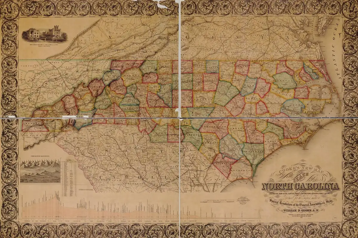
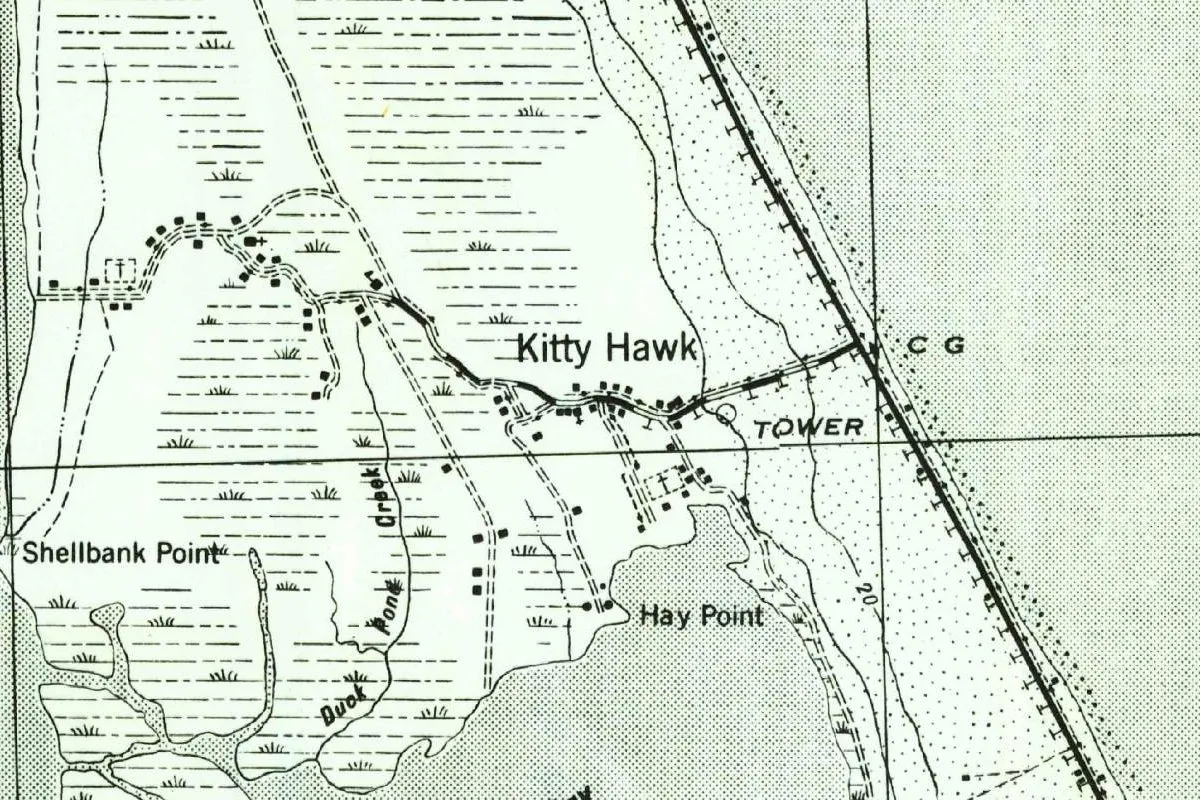
The name is old. The Gazetteer says it “appears on maps of the area as early as 1738,” without naming the map. That’s the same year the Gazetteer gives for Chickehauk, the early form of Kitty Hawk, farther up the Outer Banks. Both names were on paper long before anyone built a summer cottage here.
A summer resort since the 1830s
The Gazetteer calls Nags Head “a popular summer resort since the 1830s.” The nomination tells how that began, and it flags the story as tradition: “Tradition claims that in about 1830, Francis Nixon, a wealthy Perquimans County planter, explored the area” for a place to escape the summer fevers of the mainland. “He is said to have bought 200 acres, paying fifty cents an acre.” That’s about 81 hectares.
By 1838 a large hotel, “said to accommodate 200 guests,” stood on the sound side, the nomination says. Before the Civil War, the resort filled mostly with planters and merchants from the Albemarle and the other northeastern counties of North Carolina. Confederate troops used the hotel as a command post and set fire to it in 1862 as they retreated from Roanoke Island. After the war, families started building along the ocean, and some moved their cottages across the sand on rollers.
A lifesaving station opened at Nags Head in 1874, the Gazetteer says. The town was incorporated in 1923, lost its charter in 1949, and was incorporated again in 1961.
A restricted Army map of 1943
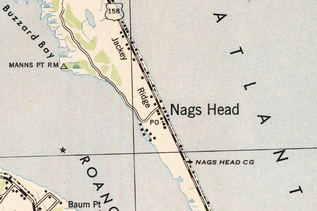
The map at the top of this page comes from the Roanoke Island quadrangle, which the 649th Engineers compiled for the War Department in 1942 from Air Corps photographs. This copy was printed in 1943 at Fort Belvoir, Virginia, and stamped “RESTRICTED,” a marking cancelled in 1946. It shows Nags Head as a row of buildings on U.S. 158, with a post office and the Nags Head Coast Guard station. North of the post office, you’ll see the label “Jackey Ridge,” spelled just that way.
Quick answers
Where does the name Nags Head come from?
Nobody knows. The National Register nomination for the town’s historic beach cottages says the origin “remains unknown” and lists three ideas: the shape of the island, places of the same name in England, and a light tied to a nag’s head.
Is the lantern-and-horse story true?
No source proves it. The North Carolina Gazetteer calls it one of numerous legends, and the town’s 1976 land use plan, passing along Bill Sharpe’s own later doubt, says there is “some doubt as to the credibility of this story.”
How old is the name Nags Head?
The North Carolina Gazetteer says the name appears on maps of the area as early as 1738.
Key dates
- 1738The name Nags Head appears on maps of the area, according to The North Carolina Gazetteer.
- 1830About this time, tradition says, Francis Nixon, a Perquimans County planter, explores the area for a summer home.
- 1838A hotel said to hold 200 guests stands on the sound side.
- 1862Confederate troops retreating from Roanoke Island set fire to the hotel.
- 1874The Nags Head lifesaving station is established, later a Coast Guard station.
- 1923Nags Head is incorporated. The charter is repealed in 1949.
- 1943The Army prints the Roanoke Island quadrangle, marked restricted, showing Nags Head.
- 1961Nags Head is incorporated again.
- 1976The town's land use plan says no one seems to know the true origin of the name.
Things to do in Nags Head, North Carolina
Jockey's Ridge State Park
Home to the tallest living sand dune system on the Atlantic coast, with hang gliding lessons from a private concessionaire, a sound-side area on Roanoke Sound for swimming and paddling, and the eastern end of the Mountains-to-Sea State Trail.
Jennette's Pier
An ocean fishing pier in Nags Head run by the North Carolina Aquariums, for anglers of all skill levels, with a pier house and full ADA access.
Nags Head Woods Preserve
One of the largest remaining maritime forests on the East Coast, The Nature Conservancy says, with 8 trails from 0.2 to 3 miles (0.3 to 4.8 km) long through wooded dunes, ponds and brackish marsh.
Bodie Island Light Station
The lighthouse at the northern end of Cape Hatteras National Seashore, the third built for this stretch of coast, which first showed its light through a first-order Fresnel lens on October 1, 1872.
Getting there
Open Nags Head in Google Maps
Opens in a new tab. The pin is the center of Nags Head in the USGS place-name record.
The closest airports, Amtrak stations and intercity bus stops, measured in a straight line from the center of Nags Head.
Airports
- Norfolk International (ORF) 72 mi 116 km
- Newport News/Williamsburg International (PHF) 94 mi 152 km
Amtrak trains
- Norfolk station (NFK) 71 mi 115 km
- Newport News station (NPN) 95 mi 152 km
Intercity buses
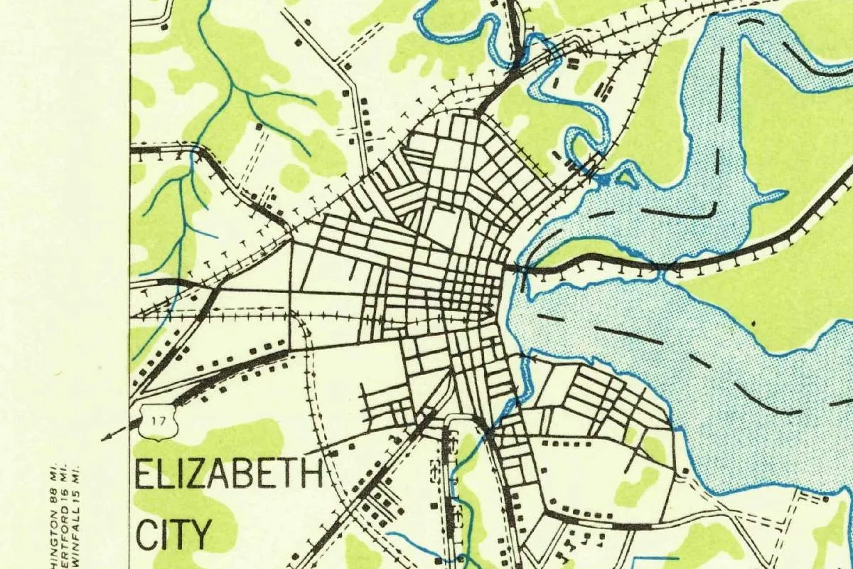
- Greyhound Elizabeth City Edgewood Dr 39 mi 63 km
Distances are as the crow flies, not by road. We don't list schedules or fares because they change; check with the airline, Amtrak or the bus company before you go. Official data (FAA commercial service airports (2025), FAA airport locations, Amtrak stations and Intercity Bus Atlas) from the FAA and the U.S. Bureau of Transportation Statistics, checked Nov 17, 2026.
Sponsored
Staying in Nags Head?
Compare hotels in Nags Head, North Carolina, on Expedia.
See hotels in Nags HeadWe may earn a commission if you buy through this link. It never changes what we write. Read our affiliate disclosure
Historical Sources & References
- Catherine W. Cockshutt, National Register nomination, Nags Head Beach Cottage Row Historic District. The name that “remains unknown” and its three explanations, Francis Nixon’s 200 acres (81 ha) around 1830 as “tradition,” the hotel of 1838, its burning in the Civil War, and the cottages on the ocean side. Checked against the page image.
- The North Carolina Gazetteer, “Nags Head,” via NCpedia. “Numerous legends,” the lanterns on the ponies, maps of 1738, the English, Channel Islands and West Indies names, the resort of the 1830s, incorporation in 1923, 1949 and 1961, and the lifesaving station of 1874.
- Town of Nags Head, Land Use Plan (1976). Bill Sharpe’s 1954 account of the lantern on the horse, and “no one seems to know the true origin of the name” (p. 23).
- Jockey’s Ridge State Park; Jennette’s Pier; Nags Head Woods Preserve; Bodie Island Light Station. The details in the things-to-do list.
- GNIS feature 1021599 (U.S. Geological Survey). Nags Head’s listing as a populated place in Dare County and its coordinates.
- Roanoke Island quadrangle, printed 1943. The sheet the map at the top was cropped from, compiled by the 649th Engineers in 1942, printed by the 30th Engineer Battalion at Fort Belvoir in 1943, with its “RESTRICTED” stamp cancelled in 1946.
Spot something wrong, or know more? Tell us here. You can also email us or use our contact page. Corrections are noted here with their date, never made silently.