Round Rock, Texas: The Rock Is Still in Brushy Creek
Round Rock, Texas, is named for a large limestone rock in Brushy Creek, at an old crossing. The settlement and its post office were called Brushy Creek until postal officials asked for a new name. On August 24, 1854, it became Round Rock, the name suggested by postmaster Thomas C. Oatts and blacksmith Jacob Harrell.
A post office that needed a new name
The rock that gave Round Rock, Texas, its name is still sitting in Brushy Creek, and the people who’ve described it can’t agree on its shape. The town was called Brushy Creek until 1854, when the postmaster, Thomas C. Oatts, was asked for a new name and came up with Round Rock, after the big limestone rock where he and his neighbor Jacob Harrell liked to fish.
Clara Stearns Scarbrough’s entry on the town in the Handbook of Texas starts the story in the spring of 1848. That’s when Harrell, who had been a blacksmith in Austin, about 16 miles (26 km) to the south, set up his shop on the north bank of Brushy Creek. A settlement grew around the crossing, and it took the creek’s name. Oatts became its first postmaster in 1851.
Then the mail got in the way. The City of Round Rock says “Brushy” kept getting confused with another nearby place called Brushy, and the postal service noticed. Postal officials asked Oatts to send in another name, and on August 24, 1854, the town officially became Round Rock. The Handbook credits the choice to Oatts and Harrell together, “who often fished together from a large anvil-shaped limestone rock in Brushy Creek near their dwellings.”
How exactly the idea struck is another matter. The city says nobody knows whether Oatts thought of it while fishing on the rock or while watching a mail stagecoach roll past it. So if you run into a version with a tidy moment of inspiration, someone filled in a blank.
An hourglass, an anvil or a table?
Four years after the name change, a young college graduate named John H. McLean, later a Methodist preacher, rode through on a pony on his way home from Austin. He wrote about the trip decades later, in a memoir printed in 1918:
“Our first day out from Austin we passed through Round Rock taking its name from a huge round rock rising from the rock bed of Brushy Creek, resembling an hour glass in shape.”
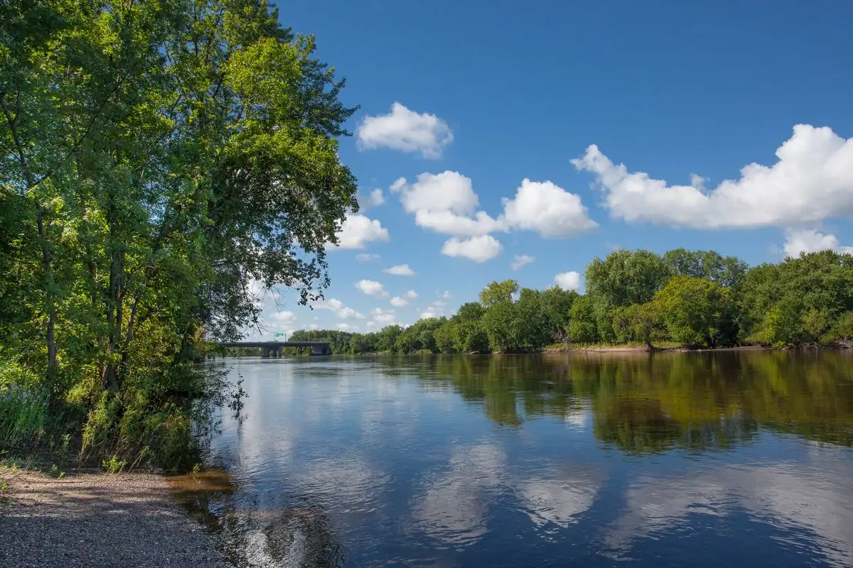
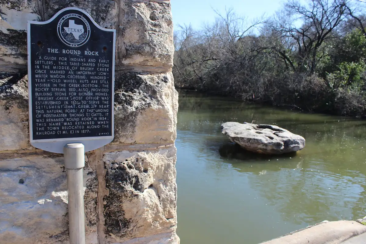
That’s the oldest description of the rock we could find, and it’s already tying the town to it. It also doesn’t match the others. The Handbook calls the rock “anvil-shaped.” The Texas Historical Commission marker set up beside the creek in 1975 calls it a “table-shaped stone.” Three descriptions, one rock. The photo near the bottom of this page shows it from the bank, so you can make up your own mind.
What everyone agrees on is why the rock mattered. The marker says it guided Native Americans and early settlers and “once marked an important low-water wagon crossing,” with old wheel ruts still visible in the creek bottom. The Handbook adds that the Chisholm Trail, the cattle route from Texas north to Kansas, crossed Brushy Creek near the rock. Long before it was a town’s name, the rock was a way to find the safe place to cross.
Old Round Rock and the new one
The name had one more test coming. In 1876, according to the Handbook, the International-Great Northern Railroad laid its tracks a short distance south and east of town. The community moved toward the tracks and the south bank of the creek, starting with a tent city people called “new” Round Rock, and the original site was largely abandoned. The state marker dates the move to 1877 and puts the new town 1 mile (1.6 km) east. It also says the name Round Rock “was retained” when the town moved.
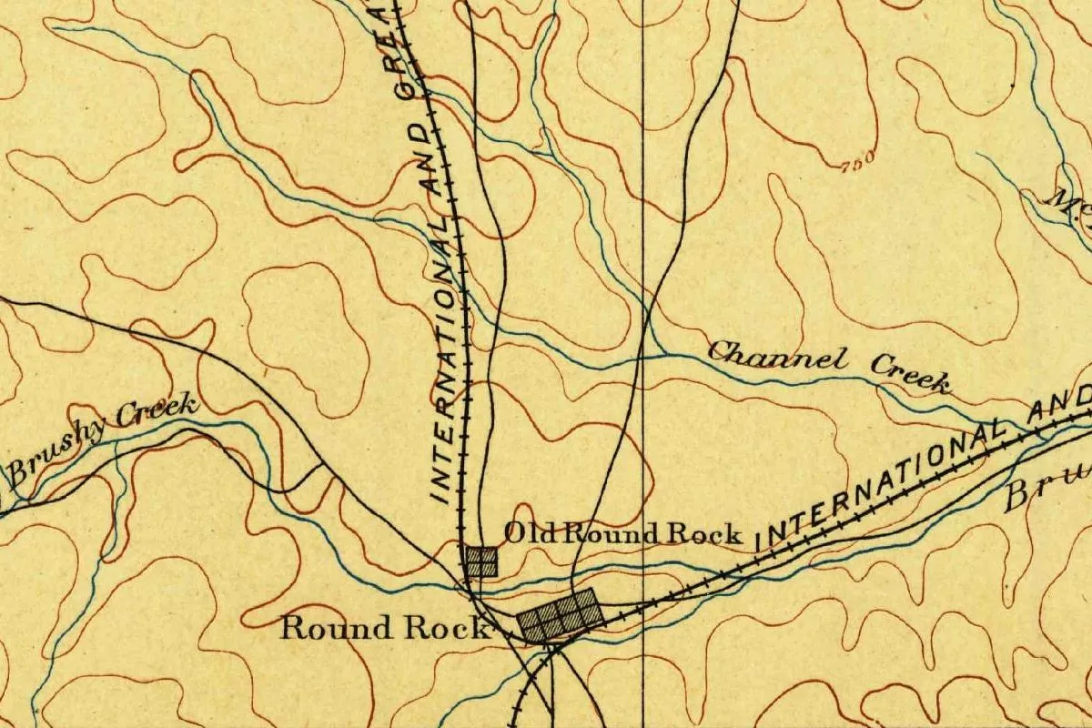
You can still see the split on the old government map at the top of this page. On the Georgetown sheet of 1893, “Old Round Rock” is a tiny square north of Brushy Creek, and “Round Rock” is a bigger grid just across the creek, right on the International and Great Northern tracks. In official records, the Handbook says, the first site went by Old Round Rock, and today the restored stone buildings there are known as Old Town.
One loose end: the city mentions an 1856 map that labeled the place “Rock Island,” and says it can’t trace where that came from. It never stuck.
The town moved a mile to meet the trains. The rock stayed where it was, and so did the name.
Quick answers
What was Round Rock, Texas, called before?
Brushy Creek. That was the settlement’s name and the name of its post office from 1851 until August 24, 1854, when it officially became Round Rock, the Handbook of Texas says.
Who named Round Rock?
Postmaster Thomas C. Oatts, after postal officials asked him for a new name. The Handbook says the name was suggested by Oatts and Jacob Harrell, who fished from the rock, and the 1975 state marker says the town was renamed “at the urging of” Oatts.
Is the round rock still there?
Yes. It’s still in Brushy Creek, next to the 1975 Texas Historical Commission marker, as the 2017 photo on this page shows.
What shape is the round rock?
It depends on who you ask. John H. McLean, who passed through in 1858, said it resembled “an hour glass”; the Handbook calls it “anvil-shaped”; the state marker calls it “table-shaped.”
Key dates
- 1848Jacob M. Harrell, formerly a blacksmith in Austin, sets up his shop on the north bank of Brushy Creek.
- 1851A post office called Brushy Creek opens, with Thomas C. Oatts as its first postmaster.
- 1854August 24: asked by postal officials for another name, the town officially becomes Round Rock.
- 1858Traveler John H. McLean passes through and describes the rock as shaped like an hourglass.
- 1876The International-Great Northern Railroad lays tracks a short way south and east, and the town starts moving toward them.
Getting there
Open Round Rock in Google Maps
Opens in a new tab. The pin is the center of Round Rock in the USGS place-name record.
The closest airports, Amtrak stations and intercity bus stops, measured in a straight line from the center of Round Rock.
Airports
- Austin-Bergstrom International (AUS) 22 mi 35 km
- Robert Gray AAF (GRK) Killeen 40 mi 64 km
Amtrak trains
- Taylor station (TAY) 17 mi 27 km
- Austin station (AUS) 17 mi 28 km
Intercity buses
- FlixBus Round Rock Carts under 1 mi 0.2 km
- Greyhound Carts Georgetown Station 7 mi 11 km
- Arrow Trailways Amtrak Connecting Service · Killeen Amtrak Station 42 mi 68 km
Distances are as the crow flies, not by road. We don't list schedules or fares because they change; check with the airline, Amtrak or the bus company before you go. Official data (FAA commercial service airports (2025), FAA airport locations, Amtrak stations and Intercity Bus Atlas) from the FAA and the U.S. Bureau of Transportation Statistics, checked Nov 13, 2026.
Sponsored
Staying in Round Rock?
Compare hotels in Round Rock, Texas, on Expedia.
See hotels in Round RockWe may earn a commission if you buy through this link. It never changes what we write. Read our affiliate disclosure
Historical Sources & References
- John H. McLean, Reminiscences of Rev. Jno. H. McLean (1918), p. 86. His 1858 ride from Austin through Round Rock, “taking its name from a huge round rock rising from the rock bed of Brushy Creek, resembling an hour glass in shape.”
- Clara Stearns Scarbrough, “Round Rock, TX,” Handbook of Texas Online. Harrell’s shop in 1848, the name Brushy Creek, Oatts as first postmaster in 1851, the official change on August 24, 1854, the “anvil-shaped limestone rock,” the Chisholm Trail crossing, the railroad of 1876, “new” Round Rock and Old Round Rock.
- City of Round Rock, “How did Round Rock get its name?”. The confusion with another place called Brushy, the postal request to Oatts in 1854, the open question of how he hit on the name, and the 1856 map that said “Rock Island.”
- Texas Historical Commission marker “The Round Rock” (1975), photo on Wikimedia Commons. The “table-shaped stone,” the low-water wagon crossing and its wheel ruts, the Brushy Creek post office of 1851, the renaming “at the urging of” Oatts in 1854, and the move along the railroad, 1 mile (1.6 km) east, in 1877.
- GNIS feature 1366966 (U.S. Geological Survey). Williamson County location and the coordinates listed for the city.
- U.S. Geological Survey, Georgetown sheet (1893). The map at the top of this page, with Old Round Rock and Round Rock labeled on either side of Brushy Creek.
Spot something wrong, or know more? Tell us here. You can also email us or use our contact page. Corrections are noted here with their date, never made silently.