Brenham, Texas: Named for a Doctor Who Never Lived There
Brenham is named for Dr. Richard Fox Brenham, a Kentucky-born physician who served the Republic of Texas and was killed in Mexico in 1843 after the Mier expedition. The community, known as Hickory Grove, took his name in 1843 or 1844; the Handbook of Texas gives both years in different entries.
Brenham, Texas, carries the name of Dr. Richard Fox Brenham, a doctor of the Texas Republic who, a 1915 history says, never lived in the town. He’d been dead about a year when the settlement took his name.
A Kentucky doctor in the new republic
The Handbook of Texas says Richard Fox Brenham was born about 1810 in Woodford County, Kentucky, and attended Transylvania College before moving to Texas. Mrs. R. E. Pennington, whose History of Brenham and Washington County came out in 1915, adds that Woodford County is “near Frankfort” and that the college was in Lexington. He arrived at Washington on the Brazos, she wrote, “just after the battle of San Jacinto,” in the spring of 1836.
He served in the Texas army from June 15 to September 15, 1836, both sources say. Pennington says his first home in Washington County was with Sanford Woodward on Woodward’s Creek, about three miles (5 km) east of today’s city, until 1839, when he moved to Austin. Then comes the line the city repeats today: “He never lived in what is called Brenham, for the place was not named for him until 1844, about one year after his death.”
Santa Fe, Mier and Salado
Then came the expeditions. In 1841, President Mirabeau B. Lamar named him one of the commissioners of the Texan Santa Fe expedition, which the Handbook says aimed to bring Santa Fe and part of the Santa Fe Trail trade under the Republic of Texas. It failed. Brenham and the others were arrested and held in Mexico City, and he was released in April 1842.
He went right back out. He joined the Somervell expedition, which took Laredo, and when Somervell ordered his men home, Brenham stayed with the volunteers who went on to Mier. They were defeated and marched toward Mexico City as prisoners. Pennington tells the escape at the hacienda de Salado this way: the men had no weapons, the first man through the door was sure to die, and Brenham volunteered, saying “he was unmarried, and being a soldier of fortune was practically alone in the world.” He was killed on February 11, 1843.
How Hickory Grove became Brenham
Before it was Brenham, the settlement was Hickory Grove. The city’s website says it “was originally known as the Hickory Grove community” and that “the name was changed to Brenham in 1844.” Pennington doesn’t call the settlement Hickory Grove, but she does describe a “Hickory Grove School,” built of cedar logs in 1840, which took its name from the hickory grove it stood in.
Pennington also says who chose the new name. When it came time to name the town, she wrote, “with one accord the patriotic women of the settlement paid tribute to the dead soldier-surgeon, and christened the little place, Brenham, in his honor.” In another chapter she put it more simply: “good women honored a hero when they gave the new town the name of Brenham.”
1843 or 1844?
You’ll see two years for the name, and both come from the same reference work. The Handbook’s entry on the town says “the Hickory Grove community changed its name in 1843 to Brenham.” Its entry on the doctor says “in 1844 the town of Brenham in Washington County was named in his honor,” which matches Pennington and the city. If you go by his death in February 1843, either year is possible, and the sources don’t settle it.
The name came just in time for a fight. Pennington says the Texas Congress ordered an election for a permanent county seat on January 31, 1844. After a runoff with Independence, Brenham won “by three votes,” thanks to J. D. Giddings, who rode to every community and spoke “in behalf of the place so recently named Brenham.” Jesse Farral and James Hurt deeded 100 acres for the townsite on April 18, 1844. The Handbook adds that Brenham was incorporated in 1858 and became a rail terminus in 1860.
The 1930 map
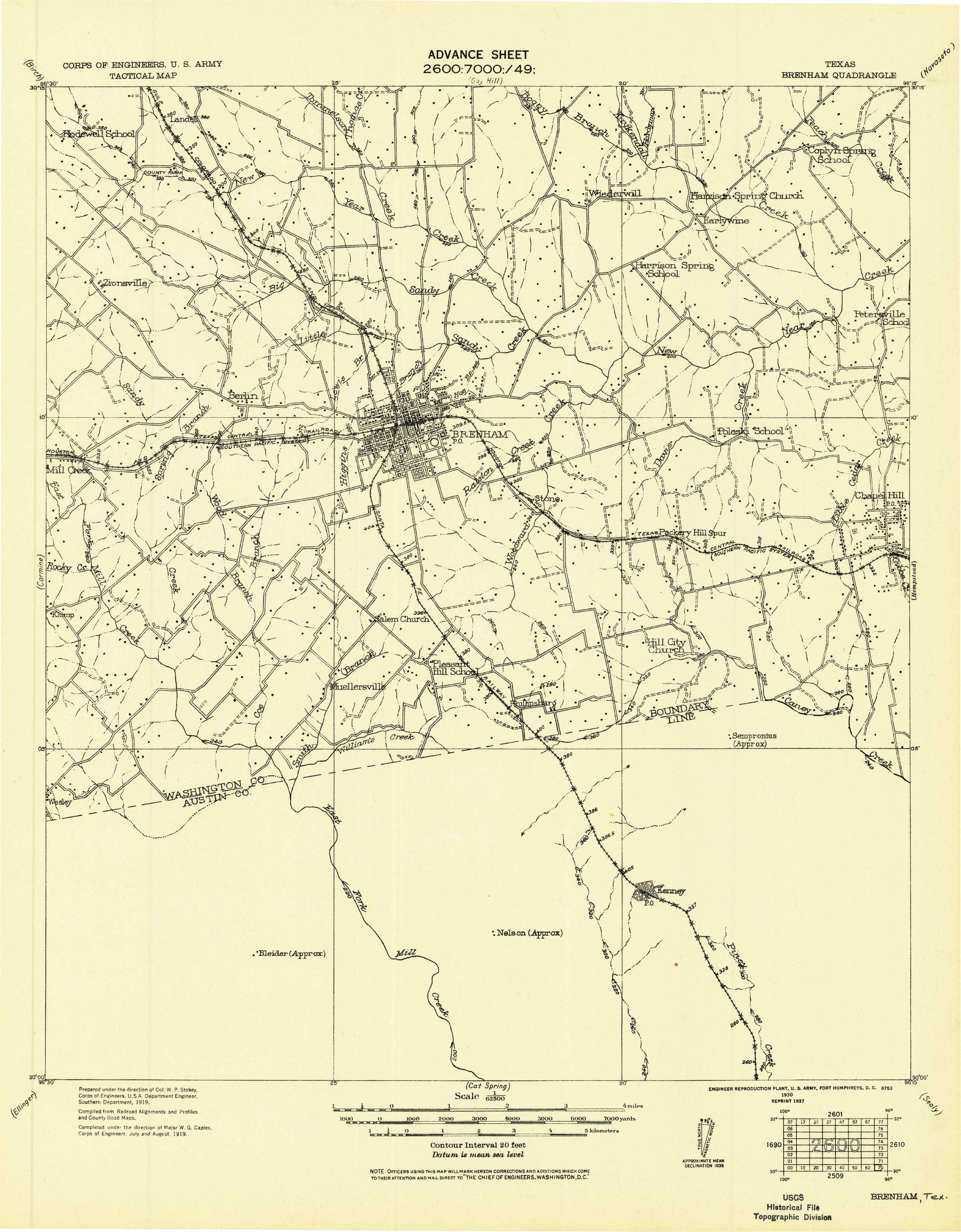
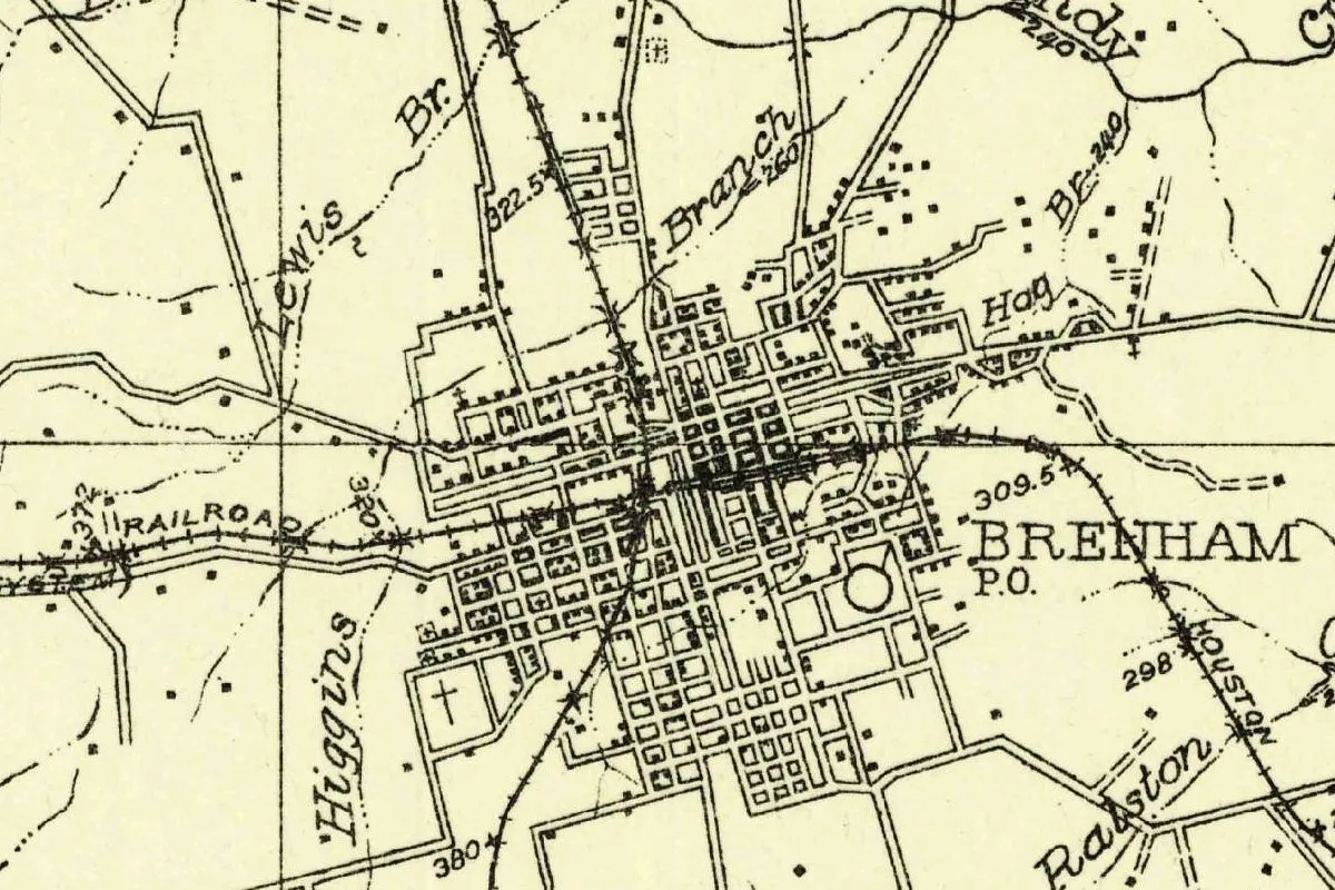
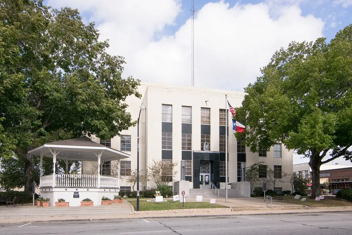
The map at the top of this page isn’t a Geological Survey sheet. It’s a tactical map of the Brenham Quadrangle made by the Army Corps of Engineers, first compiled in 1919 from railroad and county road maps, in a 1930 edition reprinted in 1937. It shows the town as a tight street grid where two railroads meet, one of them labeled HOUSTON. The Washington County Courthouse is in the photo below.
Quick answers
Who is Brenham, Texas, named after?
Dr. Richard Fox Brenham, a physician from Kentucky who served the Republic of Texas, went on the Santa Fe and Mier expeditions, and was killed at the hacienda de Salado on February 11, 1843.
Did Dr. Brenham live in Brenham?
No. Pennington wrote in 1915 that “he never lived in what is called Brenham,” and the city’s website says he “never lived inside the city limits.”
What was Brenham called before?
Hickory Grove, according to the city and the Handbook of Texas.
When did Hickory Grove become Brenham?
In 1844, according to Pennington, the city and the Handbook’s biography of the doctor. The Handbook’s entry on the town says 1843.
Key dates
- 1836Richard Fox Brenham reaches Washington on the Brazos and serves in the Texas army from June 15 to September 15.
- 1840Hickory Grove School is built of cedar logs, Pennington says.
- 1841Brenham goes as a commissioner with the Texan Santa Fe expedition and ends up a prisoner in Mexico.
- 1843Brenham is killed at the hacienda de Salado on February 11; the Handbook's town entry dates the new name to this year.
- 1844Brenham wins the county-seat election by three votes, and Farral and Hurt deed 100 acres for the townsite on April 18.
- 1858Brenham is incorporated.
- 1860The Washington County Railroad makes Brenham its terminus.
- 1907Blue Bell starts out as the Brenham Creamery Company.
- 1915Mrs. R. E. Pennington publishes her history of Brenham and Washington County.
Things to do in Brenham, Texas
Blue Bell Creameries
The ice cream company that began in Brenham in 1907 as the Brenham Creamery Company. Its Visitor Center has a self-guided tour through more than 100 years of company history, plus an Observation Deck and an Ice Cream Parlor.
Brenham Heritage Museum
A downtown museum on the history and culture of Washington County, in the former United States Post Office building, which is listed on the National Register of Historic Places.
Toubin Park cistern
A fully restored underground cistern from the 1800s in a downtown park, built to collect rainwater and fight fires. It's a State Antiquities Landmark.
Washington-on-the-Brazos State Historic Site
Where the Texas Declaration of Independence was signed on March 2, 1836, and where Dr. Brenham first arrived in Texas. The site includes the Star of the Republic Museum, Independence Hall and the Barrington Living History Farm.
Crossover Nature Trail, Hohlt Park
About 0.59 mile (0.95 km) of trails in Hohlt Park, through bog and wetland areas, grassy fields, woods and pollinator gardens.
Getting there
Open Brenham in Google Maps
Opens in a new tab. The pin is the center of Brenham in the USGS place-name record.
The closest airports, Amtrak stations and intercity bus stops, measured in a straight line from the center of Brenham.
Airports
- Easterwood Field (CLL) College Station 29 mi 47 km
- George Bush Intcntl/Houston (IAH) 64 mi 104 km
Amtrak trains
- Taylor station (TAY) 66 mi 107 km
- Houston station (HOS) 68 mi 109 km
Intercity buses
- Greyhound Navasota Circle T 24 mi 39 km
- FlixBus College Station 32 mi 51 km
Distances are as the crow flies, not by road. We don't list schedules or fares because they change; check with the airline, Amtrak or the bus company before you go. Official data (FAA commercial service airports (2025), FAA airport locations, Amtrak stations and Intercity Bus Atlas) from the FAA and the U.S. Bureau of Transportation Statistics, checked Nov 16, 2026.
Sponsored
Staying in Brenham?
Compare hotels in Brenham, Texas, on Expedia.
See hotels in BrenhamWe may earn a commission if you buy through this link. It never changes what we write. Read our affiliate disclosure
Historical Sources & References
- Carole E. Christian, “Brenham, TX,” Handbook of Texas Online. Hickory Grove, the name change “in 1843,” the county seat, incorporation in 1858, the railroad of 1860 and the Brenham Creamery Company of 1907.
- Kaye A. Walker, “Brenham, Richard Fox,” Handbook of Texas Online. His birth in Woodford County, Transylvania College, his army service, the Santa Fe, Somervell and Mier expeditions, his death on February 11, 1843, and the town named “in 1844.”
- Mrs. R. E. Pennington, The History of Brenham and Washington County (1915), pp. 19-22. Frankfort and Lexington, Woodward’s Creek about three miles (5 km) east, “He never lived in what is called Brenham,” the women who named the town, and Salado. Checked against the page images.
- Pennington, pp. 31-32; p. 48. The “good women,” the county-seat election of 1844 and Hickory Grove School. Checked against the page images.
- City of Brenham, “About the City”. Hickory Grove, 1844, and the doctor who “never lived inside the city limits.”
- Blue Bell; Visit Brenham Texas; Washington-on-the-Brazos; Hohlt Park. The details in the things-to-do list.
- GNIS feature 1331223 (U.S. Geological Survey). The names database’s entry for Brenham, in Washington County, and its coordinates.
- Corps of Engineers, Brenham Quadrangle (1930 edition). The 1:62,500 tactical map, from the Geological Survey’s historical collection, that the image at the top of this page was cropped from.
Sponsored
Put this 1930 map on your wall
The 1930 Army Corps of Engineers tactical map of Brenham, in a 1937 reprint, is in the public domain. Download the full-size scan for free, then have it printed on canvas with CanvasOnTheCheap.
Print a map on canvasDownload the full-size mapWe may earn a commission if you buy through this link. It never changes what we write. Read our affiliate disclosure
Spot something wrong, or know more? Tell us here. You can also email us or use our contact page. Corrections are noted here with their date, never made silently.