Oatman, Arizona: A Gold Camp With Olive Oatman's Name
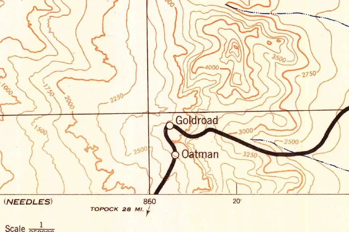
Oatman, Arizona, was a post office called Vivian until 1909, and its new name is usually credited to Olive Oatman, captured as a girl in 1851. Not every account agrees, though: one names her whole family, and a 1964 book passes along a claim that the town was named for a local mining man called John Oatman.
The girl behind the name
In 1851, Royse Oatman was taking his family west by wagon toward California when they were attacked near the Gila River. The 1857 book that made the story famous, Captivity of the Oatman Girls, says Apaches killed the parents and four of the children, left their son Lorenzo for dead, and carried off two daughters, Olive and Mary Ann. About a year later, the girls were taken to the Mohaves, who lived along the Colorado River, and Mary Ann died there. Olive was released in 1856, and the 1940 WPA guide to Arizona says she joined her brother at Fort Yuma.
Royal B. Stratton wrote the book from what Lorenzo and Olive told him, and much of it is in Olive’s voice. Here’s how she described her new home on the Colorado:
“The valley extended about thirty or forty miles, north-east by south west, and varying from two to five miles in width. Through its whole length flowed the beautiful Colorado…”
That’s the country the WPA guide puts west of Oatman, the traditional territory of the Mojave people. So when you stand on Oatman’s main street, you’re in the mountains above the valley where Olive spent most of her captivity.
Vivian, then Oatman
The town was a gold camp in the Black Mountains. Will C. Barnes’s Arizona Place Names (1935) says it was “first called Vivian according to post office records,” and the Shermans’ Ghost Towns of Arizona (1969) gives the dates: a post office opened as Vivian on March 1, 1904, and was changed to Oatman on June 24, 1909. A Phoenix paper caught the change that week, in a roundup of new Arizona post offices:
“The post office at Talkali has been changed to Rice, and Vivian to Oatman.”
The name was in use before the post office caught up. The Mohave County Miner in Kingman listed delegates from Oatman at the county Democratic convention in October 1908, and in March 1909 it mentioned a clerk at a store “at Oatman.” By October 1909, a mining company’s notice put its meeting at a store “at Vivian (name now changed to Oatman).”
Whether Vivian and Oatman were exactly the same spot is another question. The Arizona Pioneer & Cemetery Research Project puts the Vivian Mine about 2 miles (3 km) southwest of Oatman, reasons that the Vivian camp would have been near the mine, and calls it an urban legend that Oatman “was originally named Vivian after this company,” meaning the Vivian Mining Company. Barnes, for his part, describes Vivian as a station on the Mohave and Milltown Railroad about 4 miles (6 km) from Goldroad. What the paper trail shows for sure is the post office’s change of name.
Olive, her family, or John Oatman?
The Olive Oatman version
Barnes is direct about it. His entry says the town was named after “Olive Oatman of the family massacred by Apaches” on the Gila River in March 1851. Nell Murbarger’s Ghosts of the Adobe Walls (1964) says the post office was renamed “probably after Olive Oatman,” and the Shermans say the town “allegedly was named in honor of” her. None of them says who picked the name.
There’s an older clue in the mining records. In August 1901, the Mohave County Miner reported that a man who was “out in the vicinity of the Olive Oatman mine” had found the remains of a man headed for a mine “in the Boundary Cone country,” and Barnes places Boundary Cone in the Oatman district. In July 1909, a few weeks after the post office change, the Tom Reed mining company applied for a patent on a group of claims that included one called the “Olla Oatman” lode. Neither notice explains the town’s name, but they suggest Olive’s name was already on the ground in these mountains years before the camp took it.
The family version
The 1940 WPA guide tells it a little differently. It says Oatman “was named for a pioneer family,” then tells the story of the attack, and adds that the two girls were hidden at a spring half a mile (0.8 km) north of the townsite, “locally known as Ollie Oatman Spring,” where soldiers looking for them passed them by. Murbarger repeats the spring story with an “assertedly.” We didn’t find the spring or that near rescue in Stratton’s 1857 book, so treat it as local tradition.
The John Oatman version
Murbarger also adds this: “According to one authority, however, the town may have been named for John Oatman, a prominent local mining man, who claimed to be a son of Ollie and a Mohave Indian.” She doesn’t say who that authority was.
A John Oatman does turn up near the camp. In April 1922, the Arizona Republican ran a wild divorce story about John Oatman, a “wealthy Mohave Indian” with interests in the Oatman gold camp. But that story calls him the grandson of Olive Oatman, not her son, and it says nothing about the town being named for him. We found no record from 1909 that connects him to the name.
So which story wins? The Olive version is the oldest one we could read, it’s the one in Barnes’s 1935 dictionary of Arizona names, and the “Olive Oatman mine” was on record eight years before the post office was renamed. The John Oatman version rests on one unnamed authority. That’s why we call the origin disputed, while the evidence leans toward Olive.
Gold, a highway and the burros
The WPA writers found a lively camp in 1940, with 500 people strung along the foothills and “gray tiers of cyanide-mill tailings, smooth and graceful as frozen waterfalls.” U.S. 66 ran down its only street, past a raised plank boardwalk and old wooden awnings, and the nearest movie theater was in Kingman, 29 miles (47 km) over the mountains. In the early 1950s, the hairpin route from Kingman over Sitgreaves Pass was dropped for a straighter one that bypassed Oatman. Russell Olsen’s history of the road gives the year as 1952 in one place and 1953 in another. Today it’s one of the Arizona stops in our Route 66 towns collection.
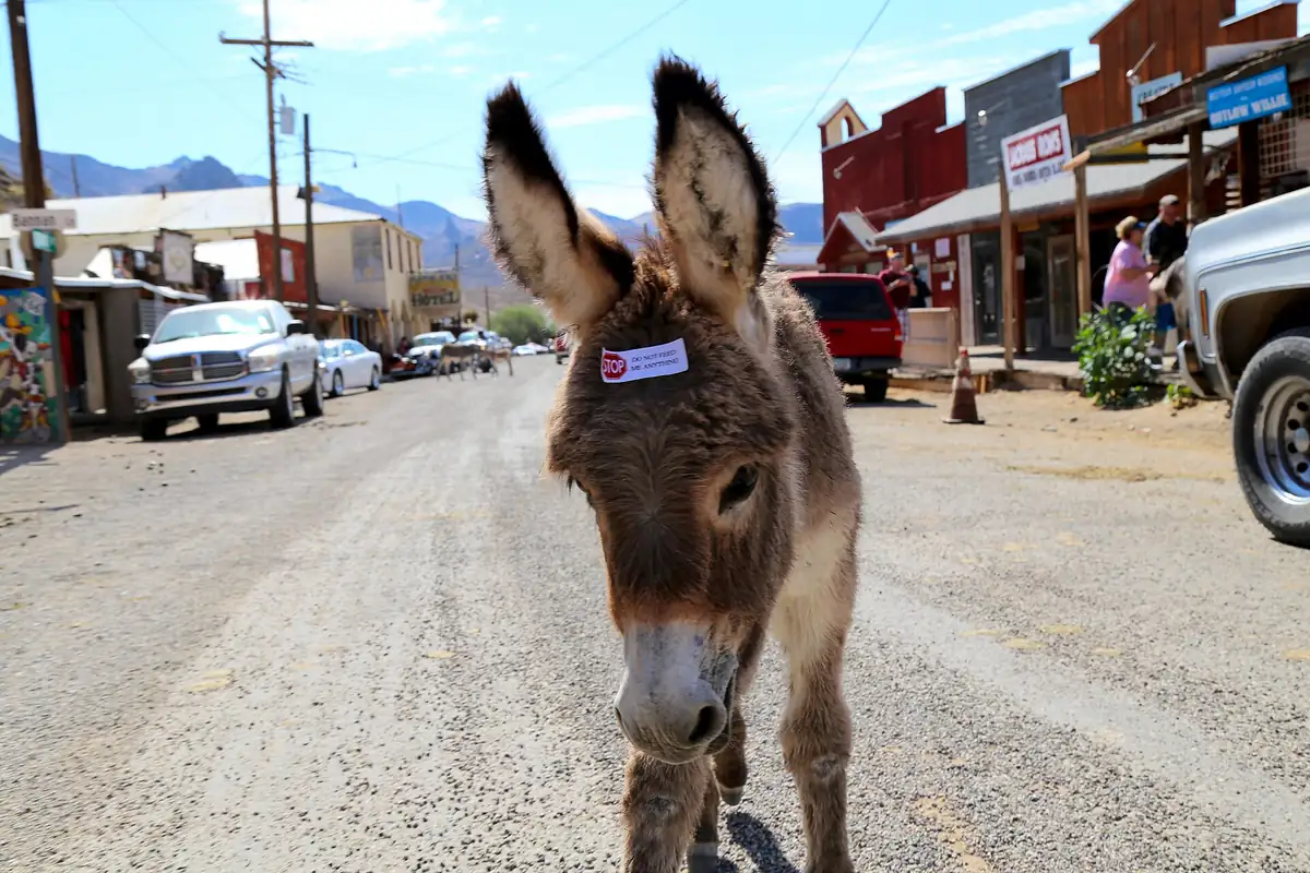
If you visit, you’ll share the street with burros. The Bureau of Land Management says the wild burros of its Black Mountain herd area are descendants of burros brought by miners and prospectors from the early 1860s, and that Oatman sits in the center of the southern half of that range. So the animals in the street go back to the miners who worked these mountains, and the name on the post office most likely goes back to a girl who spent years in the river valley to the west, nearly 50 years before the Vivian post office opened.
Quick answers
Was Oatman, Arizona, named after Olive Oatman?
It’s disputed. Barnes’s Arizona Place Names (1935) says it was named after Olive, the 1940 WPA guide says the Oatman family, and a 1964 book cites an unnamed authority who credited John Oatman, a local mining man.
What was Oatman, Arizona, called before?
Vivian. A post office opened under that name in 1904 and was changed to Oatman on June 24, 1909, though local papers were already calling the camp Oatman in 1908.
Who was John Oatman?
A Mohave man living near the Oatman gold camp. A 1922 newspaper said he claimed to be Olive Oatman’s grandson; Murbarger’s 1964 book says he claimed to be her son. No record we found ties him to the 1909 name change.
Why are there burros in Oatman?
The Bureau of Land Management says the wild burros around Oatman descend from animals brought in by miners and prospectors starting in the early 1860s.
Key dates
- 1851Apaches attack the Oatman family's wagon near the Gila River; Olive and Mary Ann Oatman are taken captive.
- 1856Olive Oatman is released from the Mohaves and rejoins her brother at Fort Yuma.
- 1901The Mohave County Miner mentions "the Olive Oatman mine."
- 1904A post office called Vivian opens on March 1.
- 1908Delegates from Oatman sit at the Mohave County Democratic convention in October.
- 1909On June 24, the Vivian post office is renamed Oatman.
Getting there
Open Oatman in Google Maps
Opens in a new tab. The pin is the center of Oatman in the USGS place-name record.
The closest airports, Amtrak stations and intercity bus stops, measured in a straight line from the center of Oatman.
Airports
- Laughlin/Bullhead International (IFP) Bullhead City 13 mi 21 km
- Boulder City Municipal (BVU) 69 mi 111 km
- Harry Reid International (LAS) Las Vegas 85 mi 136 km
Amtrak trains
- Needles station (NDL) 18 mi 29 km
- Kingman station (KNG) 22 mi 35 km
Intercity buses
- Vegas Airporter Amtrak Connecting Service · Laughlin Amtrak Bus Stop 14 mi 23 km
- FlixBus Kingman S 21 mi 34 km
- Greyhound Kingman McDonald's 25 mi 40 km
Distances are as the crow flies, not by road. We don't list schedules or fares because they change; check with the airline, Amtrak or the bus company before you go. Official data (FAA commercial service airports (2025), FAA airport locations, Amtrak stations and Intercity Bus Atlas) from the FAA and the U.S. Bureau of Transportation Statistics, checked Nov 11, 2026.
Sponsored
Staying in Oatman?
Compare hotels in Oatman, Arizona, on Expedia.
See hotels in OatmanWe may earn a commission if you buy through this link. It never changes what we write. Read our affiliate disclosure
Historical Sources & References
- Will C. Barnes, Arizona Place Names (1935). Entry Oatman, p. 305: “First called Vivian according to post office records. Named after Olive Oatman of the family massacred by Apaches” on the Gila River, March 1851; post office June 24, 1909. Entry Vivian: station on the Mohave and Milltown R. R. about 4 miles from Goldroad; post office March 1, 1904. Entry Boundary Cone: in the Oatman district. Read in archive.org’s full-text search; the book is lending-only, and the page comes from the running head.
- Writers’ Program, Arizona: A State Guide (1940). pp. 47-48: the Oatman massacre of 1851. pp. 325-327 (Tour 2): Oatman’s 500 people, the tailings, US 66 on the only street, Kingman 29 miles away, the town “named for a pioneer family,” Ollie Oatman Spring, and the Mojave territory west of town.
- R. B. Stratton, Captivity of the Oatman Girls (1857). The first San Francisco edition, “as given by Lorenzo D. and Olive A. Oatman.” p. 20: Royse Oatman, the father. pp. 60-61: the family reaches and crosses the Gila. pp. 92-93: the bones of six people found at the massacre site. pp. 132-133: the girls leave the Apaches for the Mohaves about March 1852. p. 142: Olive’s description of the Mohave valley on the Colorado. Title page: the massacre of 1851 and her “recapture in 1856.”
- Mohave County Miner, August 3, 1901, p. 3. “Perished from Thirst”: a man headed for a mine “in the Boundary Cone country” is found dead “in the vicinity of the Olive Oatman mine.”
- Mohave County Miner, October 3, 1908, p. 3. The Democratic county convention’s roll of delegates, with four from Oatman. The earliest use of Oatman as a place we found.
- Mohave County Miner, March 27, 1909, p. 2. A clerk in “Lovin Wither’s store at Oatman,” three months before the post office changed.
- Arizona Republican, June 23, 1909, p. 10. Benson correspondence on new post offices: “The post office at Talkali has been changed to Rice, and Vivian to Oatman.”
- Mohave County Miner, July 17, 1909, p. 4. The Tom Reed Gold Mines Company’s patent application, with the “Olla Oatman” lode and a post office address of “Oatman, Arizona.”
- Mohave County Miner, October 2, 1909, p. 4. A meeting “at Vivian (name now changed to Oatman).”
- Arizona Republican, April 30, 1922, p. 5. John Oatman, “wealthy Mohave Indian,” who “claims to be the grandson of Olive Oatman.”
- Nell Murbarger, Ghosts of the Adobe Walls (1964). p. 303: Vivian renamed in 1909 “probably after Olive Oatman,” Ollie Oatman Spring, and “one authority” crediting John Oatman. Read in archive.org’s full-text search; page from the book’s index.
- James E. and Barbara H. Sherman, Ghost Towns of Arizona (1969). p. 106: “P.O. est. as Vivian, March 1, 1904; changed to Oatman, June 24, 1909,” and Oatman “allegedly was named in honor of Olive Oatman.” Full-text search; page from the index.
- Henry Gannett, The Origin of Certain Place Names in the United States (1905). p. 228: only Oatmans Flat, the massacre site, “named because it was the scene of the massacre of Royce Oatman and his family.” The town isn’t in it.
- Arizona Pioneer & Cemetery Research Project, “Oatman”. The Vivian Mine 2.11 miles southwest of Oatman, the view that the town of Vivian stood near that mine, and its claim that Oatman “was originally named Vivian after this company” is an urban legend.
- Russell A. Olsen, The Complete Route 66 Lost & Found (2008). Arizona chapter introduction: in 1953 the Sitgreaves Pass road was replaced by a route “bypassing Oatman via Yucca.” Oatman entry (pp. 144-145): “When 66 was rerouted in 1952,” followed by a quotation from the Kingman Daily Miner. Read in archive.org’s full-text search.
- Bureau of Land Management, Black Mountain Herd Management Area. Burros descended from those “brought by miners and prospectors from the early 1860s,” and Oatman in the center of the herd area’s southern half.
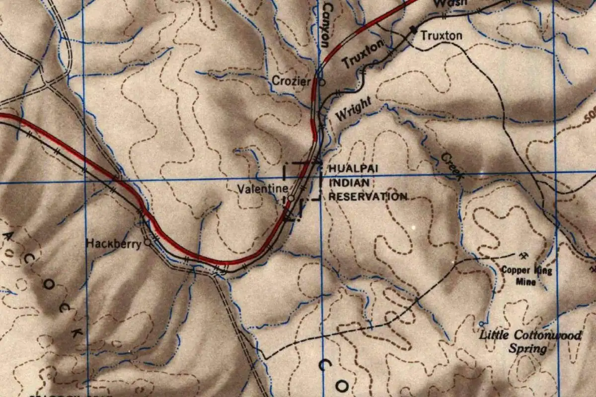
- U.S. Army Corps of Engineers, Camp Mohave sheet (1942). The map at the top of this page, the oldest sheet in the USGS collection that labels Oatman.
- GNIS feature 8901, Oatman (U.S. Geological Survey). The gazetteer’s populated-place entry for Oatman in Mohave County, with its coordinates.
Sponsored
Gear up for your next road trip
Explore rooftop tents, vehicle awnings and outdoor gear from TOPOAK Overland.
Shop TOPOAK overlanding gearWe may earn a commission if you buy through this link. It never changes what we write. Read our affiliate disclosure
Spot something wrong, or know more? Tell us here. You can also email us or use our contact page. Corrections are noted here with their date, never made silently.