Why Is It Called Morro Bay? The Rock That Named a Town
Morro Bay is named for Morro Rock, the volcanic plug, about 576 feet (176 m) tall, at the mouth of the harbor. The city credits Juan Rodríguez Cabrillo with the name El Morro, in 1542. Franklin Riley's town, founded in 1870, was simply Morro, named from the rock, and the word Bay came later. The city incorporated in 1964.
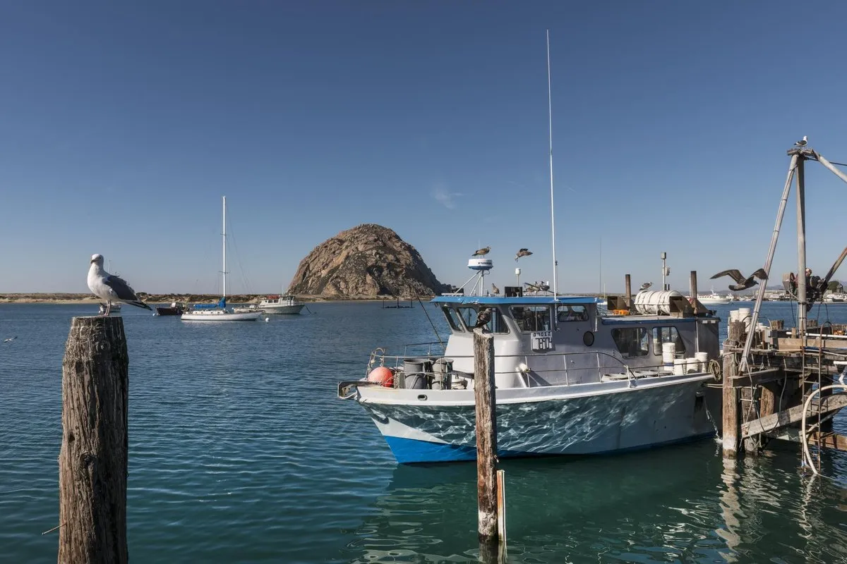
Morro Bay, California, takes its name from Morro Rock; the town began in 1870 as plain Morro, and the word Bay was added later. Three things share the name, the rock, the bay and the town, and the rock had it first.
Morro Bay name origin
Henry Gannett put it in one sentence. In 1905 he listed “Morro,” with no Bay, as a “town in San Luis Obispo County, California, named from a castellated island rock at the mouth of the bay.” The rock came first, and the town borrowed from it.
The city gives the rock’s name a date. Its page for Morro Rock Beach says the explorer Juan Rodríguez Cabrillo “named the rock ‘El Morro’ in 1542.” The city’s budget history adds that he “anchored near the rock he called ‘El Moro’” to take on supplies, and the local historical society’s timeline has Cabrillo’s party entering Estero Bay and naming the rock.
Not everyone puts Cabrillo inside the bay, though. The Morro Bay National Estuary Program says Cabrillo is “credited” with the name, but adds: “there is no record of Cabrillo entering Morro Bay.” The city’s page does say the rock served sailors as a landmark for centuries, the easiest to spot in a chain of nine peaks.
PBS SoCal quotes a description from the land side. When Gaspar de Portolá’s overland party camped nearby in September 1769, Father Juan Crespí wrote that “we saw a giant rock in the form of a morro [snout, promontory], which at high tide is isolated and separated from the coast by little less than a gunshot.”
What does morro mean in Spanish?
The sources don’t agree, and each one reads the word its own way.
- A castle. Gannett called it “a Spanish word meaning ‘castle.’”
- A round headland. Nellie Van de Grift Sanchez, in Spanish and Indian Place Names of California (1914), defined morro as “a round headland, bluff,” and pointed to the Morro Castle at Havana, which sits on such a rock. She called this one “a remarkable round rock, 600 feet high,” and insisted the name “has no reference to its grey color, as some people imagine, but refers to its shape—round like a head.”
- A crown-shaped hill. The city’s own page says: “In Spanish ‘Morro’ means crown shaped hill.”
- A Moorish hat. The estuary program says Cabrillo named it “El Moro” after “the style of hat worn by the Moors of Spain.” The San Luis Obispo Tribune repeated that in 2024, citing the estuary program.
The rock had names before Spanish ones. The Tribune says the Chumash and Salinan peoples call it Lisamu’ and Lesa’mo’, and that it holds a sacred place in both cultures.
Other towns took their names from a rock too. Little Rock, Arkansas, takes its name from a small rocky point on the Arkansas River, the little rock as opposed to a larger bluff farther up the river. And in Florida, Key West may owe its name to Cayo Hueso, Spanish for “bone island,” though that one is disputed.
Morro Bay history: Franklin Riley’s town of Morro
The town came three centuries after the name. The historical society’s timeline says Franklin Riley arrived in 1864 to take up government land. The city’s budget history says “The Town of Morro was founded in 1870 by Franklin Riley,” and PBS SoCal calls 1870 “the official year of ‘Morro’s’ founding,” adding that “the ‘Bay’ would be added later.” Neither gives the year the word was added. That same year, the timeline says, Riley built an embarcadero and the town’s first house, and a post office opened with Ezra Stocking as postmaster. In 1872 the surveyor Carolan Mathers signed a map of “Morro,” PBS says.
The rock didn’t stay the same. The estuary program says it was quarried starting in the 1800s and once stood as an island, with water flowing in and out of the bay on both sides; quarried rock dumped into the bay by accident in 1910 closed the north channel, and in 1933 the rock was joined to the shore. When the quarrying ended is a question: both the city and its historical society give 1963, and the estuary program says 1968. The city calls the rock the “Gibraltar of the Pacific” and the last of the Nine Sisters, a chain of peaks stretching between San Luis Obispo and Morro Bay.
The state bought land for Morro Bay State Park in 1934, according to the timeline. A push to incorporate failed in 1951. In July 1964, the Tribune says, the town voted for cityhood by an unofficial count of 1,505 to 746, and Morro Bay marks July 17 as its birthday as a city. That makes it the second-youngest city in California’s San Luis Obispo County, the paper says; only Atascadero, incorporated in 1979, is younger.
Morro Bay on the 1897 map
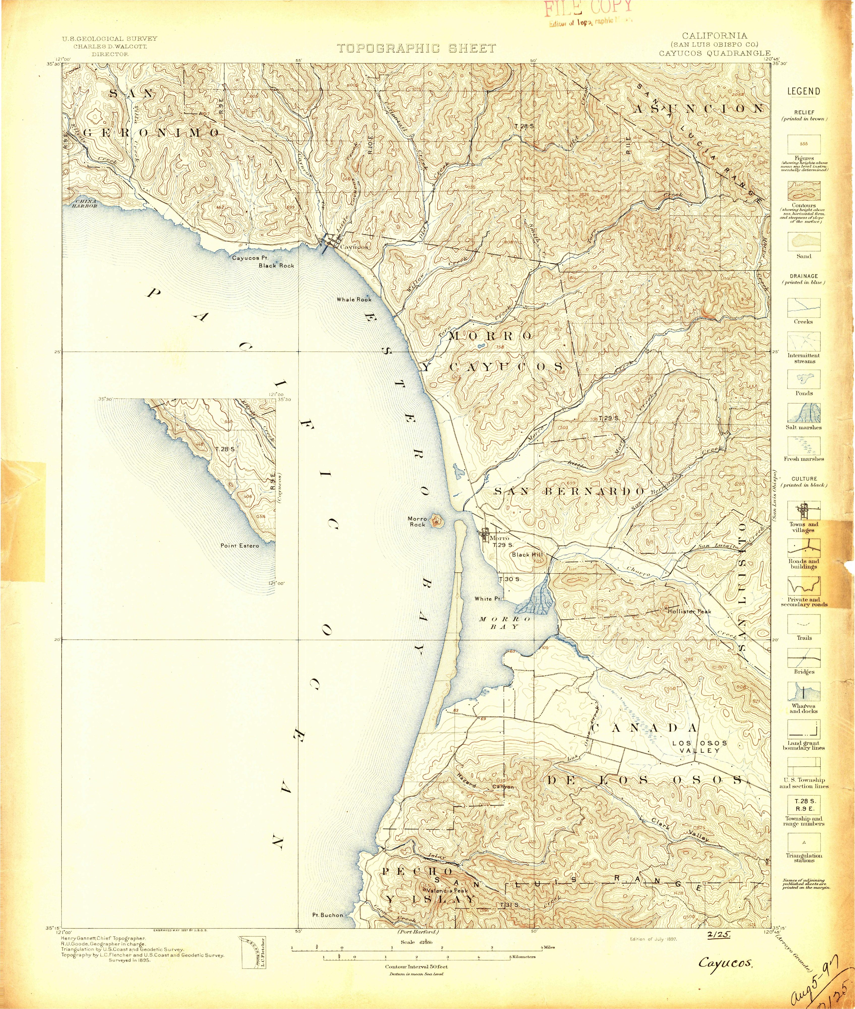
The map at the top was cropped from the Geological Survey’s Cayucos quadrangle, drawn at 1:62,500. Its margin lists Charles D. Walcott (director), Henry Gannett (chief topographer) and R. U. Goode (geographer in charge), with triangulation by the Coast and Geodetic Survey and topography by L. C. Fletcher and the Coast and Geodetic Survey. It reads “Surveyed in 1895,” “Engraved May 1897,” and “Edition of July 1897.” This is the first printing, not a reprint.
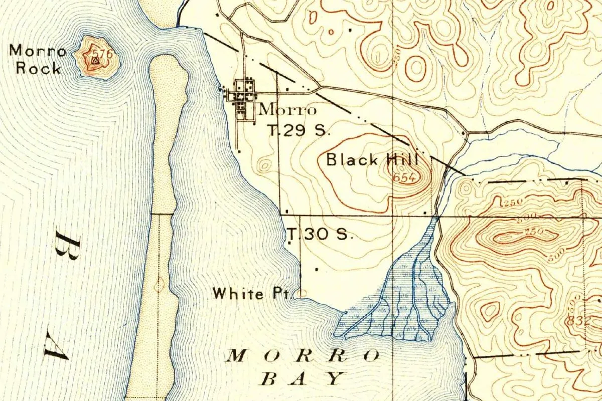
On the sheet the town is still just “Morro,” a little grid of streets on the shore. Morro Rock, marked 576, stands off by itself in the water beyond the sandspit, with no causeway to it. Black Hill, at 654, rises behind the town, and the words Morro Bay are spread across the water near White Point.
Quick answers
What is Morro Bay, California, named after?
Morro Rock. In 1905 Gannett wrote that the town of Morro was “named from a castellated island rock at the mouth of the bay.”
Who named Morro Rock in Morro Bay, California?
The city and the estuary program credit Juan Rodríguez Cabrillo, in 1542, but the estuary program says there’s no record he entered the bay.
When did Morro Bay, California, become a city?
In 1964. The Tribune says the vote ran 1,505 to 746 in the unofficial count, and the city’s birthday is July 17.
Key dates
- 1542The city says Juan Rodríguez Cabrillo names the rock El Morro; the estuary program says no record shows he entered the bay.
- 1769In September, Gaspar de Portolá's overland party camps nearby, and Father Crespí writes of a giant rock shaped like a morro.
- 1864Franklin Riley arrives to take up government land.
- 1870Riley founds the town of Morro, and its first post office opens with Ezra Stocking as postmaster.
- 1872The surveyor Carolan Mathers signs a map of Morro.
- 1897The Cayucos map sheet, surveyed in 1895, shows the town of Morro beside a Morro Rock still standing in the water.
- 1934The state acquires land for Morro Bay State Park.
- 1963Quarrying of the rock ends, by the dates of the city and of local historians; the estuary program gives 1968.
- 1964July 17: Morro Bay becomes a city, after an unofficial tally of 1,505 votes for incorporation to 746 against.
Things to do in Morro Bay, California
Morro Rock Beach
The city beach at the foot of Morro Rock, a volcanic plug about 576 feet (176 m) tall and the last of the Nine Sisters. It's protected as a sanctuary for peregrine falcons and other birds.
Morro Bay State Park
A park on the bay with the Morro Bay Museum of Natural History, a campground, an estuary and volcanic peaks, used for birdwatching, kayaking, hiking and watching wildlife.
Morro Strand State Beach
A beach park with a view of all of Estero Bay, Morro Rock included, and room for fishing, surfing, camping, kite surfing and bird-watching.
Tidelands Park
A 2-acre (0.8 ha) park where the Embarcadero ends on the south, nicknamed Pirate Park for the pirate ship in its play area, with picnic areas, a view of the rock and stairs down to the mudflats.
Getting there
Open Morro Bay in Google Maps
Opens in a new tab. The pin is the center of Morro Bay in the USGS place-name record.
The closest airports, Amtrak stations and intercity bus stops, measured in a straight line from the center of Morro Bay.
Airports
- San Luis Obispo County Regional (SBP) 15 mi 24 km
- Santa Maria Public/Capt G Allan Hancock Field (SMX) 39 mi 63 km
Amtrak trains
- San Luis Obispo station (SLO) 13 mi 20 km
- Paso Robles station (PRB) 20 mi 32 km
Intercity buses
- Gold Runner San Luis Obispo-Cal Poly 12 mi 19 km
- CLAS Amtrak Connecting Service · San Luis Obispo Amtrak Bus Stop 12 mi 19 km
- Amtrak Chartered Vehicle Amtrak Connecting Service · San Luis Obispo Amtrak Bus Stop 12 mi 19 km
Distances are as the crow flies, not by road. We don't list schedules or fares because they change; check with the airline, Amtrak or the bus company before you go. Official data (FAA commercial service airports (2025), FAA airport locations, Amtrak stations and Intercity Bus Atlas) from the FAA and the U.S. Bureau of Transportation Statistics, checked Nov 21, 2026.
Sponsored
Staying in Morro Bay?
Compare hotels in Morro Bay, California, on Expedia.
See hotels in Morro BayWe may earn a commission if you buy through this link. It never changes what we write. Read our affiliate disclosure
Historical Sources & References
- Henry Gannett, The Origin of Certain Place Names in the United States (1905), p. 215. The town of Morro, “named from a castellated island rock,” and morro as “castle.” Checked against the page image.
- Nellie Van de Grift Sanchez, Spanish and Indian Place Names of California (1914), pp. 393-394. Morro as “a round headland,” and the shape rather than the color. Checked against the page image.
- City of Morro Bay, “Morro Rock Beach”. Cabrillo and “El Morro” in 1542, “crown shaped hill,” the height, the Nine Sisters and the end of quarrying in 1963.
- City of Morro Bay, Adopted Budget 2023-24, p. 11. Cabrillo anchoring near “El Moro,” Riley’s Town of Morro in 1870, and incorporation in 1964.
- Historical Society of Morro Bay, “A Timeline”. Riley in 1864; the embarcadero, first house and post office in 1870; the state park in 1934; the failed push of 1951; the quarry closing in 1963.
- Morro Bay National Estuary Program, “Exploring Morro Bay History” (2016). The Moorish-hat reading, no record of Cabrillo in the bay, the rock as an island, and quarrying to 1968.
- Hadley Meares, PBS SoCal (2015). Crespí’s “giant rock in the form of a morro,” Riley, 1870, the later “Bay” and the Mathers map.
- David Middlecamp, The Tribune (2024). The Chumash and Salinan names and the 1964 vote.
- City of Morro Bay, Tidelands Park; California State Parks, Morro Bay State Park and Morro Strand State Beach. The details in the things-to-do list.
- U.S. Geological Survey, GNIS feature 1661062. Morro Bay’s federal record.
- Cayucos quadrangle, surveyed 1895, edition of July 1897. The sheet the map at the top was cropped from.
Sponsored
Put this 1897 map on your wall
The Geological Survey's Cayucos sheet of 1897, with the town still lettered plain Morro and Morro Rock standing alone in the water, is in the public domain. Download the full-size scan for free, then have it printed on canvas with CanvasOnTheCheap.
Print a map on canvasDownload the full-size mapWe may earn a commission if you buy through this link. It never changes what we write. Read our affiliate disclosure
Spot something wrong, or know more? Tell us here. You can also email us or use our contact page. Corrections are noted here with their date, never made silently.