San Luis Obispo, CA: Named for a Bishop Who Died at 23
San Luis Obispo takes its name from Mission San Luis Obispo de Tolosa, founded by Junípero Serra on September 1, 1772. The mission says it honors Saint Louis, Bishop of Toulouse, France, a king's son who joined the Franciscans and died at 23. The town grew up around the mission.
San Luis Obispo, California, carries the name of a Franciscan bishop of Toulouse who, according to the mission named for him, died at just 23. The city grew up around that mission, and the name came along with it.
Saint Louis, Bishop of Toulouse
The full name of the mission is San Luis Obispo de Tolosa, and the mission itself spells out who that is: Saint Louis, Bishop of Toulouse, France. It’s worth knowing because “Saint Louis” makes most Americans think of a French king or a city in Missouri. This is a different Louis.
The mission’s own history page tells his story in a few lines. Louis was born in 1274, the second son of King Charles of Naples. After his father lost a war with Spain, Louis and his brother were sent to Spain as hostages for his release. They spent seven years there, taught by Franciscan friars. Louis decided to join the order, gave up his claim to the crown of Naples once he was free, and was made Bishop of Toulouse. Poverty and disease were hitting the city hard, the mission says, and he fell ill and died “at the young age of 23.”
It closes with one more line: “He has always been very dear to the Franciscan Friars.” Junípero Serra, who founded the mission, was a Franciscan himself.
A name chosen before the place
The name was on a list before anyone picked the site. Francisco Palóu describes it in his Life of Serra, which came out in an English translation in 1913. In 1770, he writes, the viceroy and the inspector-general, José de Gálvez, asked the Franciscan college of San Fernando for thirty more friars. Ten were for new missions in Alta California, each already named: San Francisco, Santa Clara, San Gabriel, San Antonio de Padua, and “still another under the name of San Luis Obispo de Tolosa.”
So the name came first. The question was where to put it.
The bears that picked the spot
The answer had to do with bears. According to the mission, the Portolá expedition passed through the area on September 7 and 8, 1769, and its diarist, Father Juan Crespí, recorded the soldiers’ name for it: llano de los Osos, “the level of the bears,” because there were so many. Later translations of Crespí’s diary turned that into La Cañada de los Osos, “the Canyon of the Bears,” and then, the mission says, it was “further mistranslated as the Valley of the Bears.” You’ll still see that last version around.
In 1772 the young missions were running out of food. The mission says a hunting party was sent to the bear country that summer, and more than 25 mule loads of dried bear meat and seed went north to feed the missionaries, soldiers and baptized Native people. After that, Serra decided the place would make a good spot for the fifth mission.
Palóu tells how it happened. Serra was heading south to San Diego to meet with naval officers, and on the way he stopped at “the mouth of the Canyada of the Bears,” where they found good land for grain and “a beautiful clear stream of water for irrigating.” They raised a large cross and formally took possession, and Serra said Mass “in a little shelter of branches” on September 1, 1772. He left the next day, leaving Father Joseph Cavaller behind with a corporal, four soldiers and two of what Palóu calls “the Californian Indians,” on very short supplies.
Then Palóu adds why the local people were glad to see them:
“the land had been rid of these fierce animals, who had killed many of the Indians, of whom not a few of those who were still alive showed the terrible scars of their dreadful claws”
That’s from the 1913 translation of his Spanish original. Morrison and Haydon’s 1917 county history gives an earlier date for the party’s arrival, August 19, 1772, and says they spent the days until September 1 deciding the exact spot, on the north bank of San Luis Creek. The saint’s name had been settled since 1770. The place, the mission says, won out for its food and water, its mild climate and its friendly Chumash neighbors.
From mission to “the City of the Bishop”
The mission says the buildings were put up with the help of the local Chumash. The first ones were poles and branches. After fires in the early years, the builders switched to adobe and tile, and the church and the priests’ residence, the convento wing, were finished by 1794.
After Mexico’s independence the missions were secularized, and the mission says Governor Pío Pico sold San Luis Obispo’s to Captain John Wilson for $510 in 1845. Its buildings were put to whatever use the civil authorities needed. The convento wing held a school, a jail and the first county courthouse.
By then the name belonged to more than a church. Morrison and Haydon open their chapter on the city with the heading “San Luis Obispo, the City of the Bishop,” and they write that when the county was organized in 1850, San Luis Obispo was the only settlement in it. “Around the Mission clustered a few small adobe buildings.” The town was organized under state law in 1859, they say, and incorporated as a city in 1876.
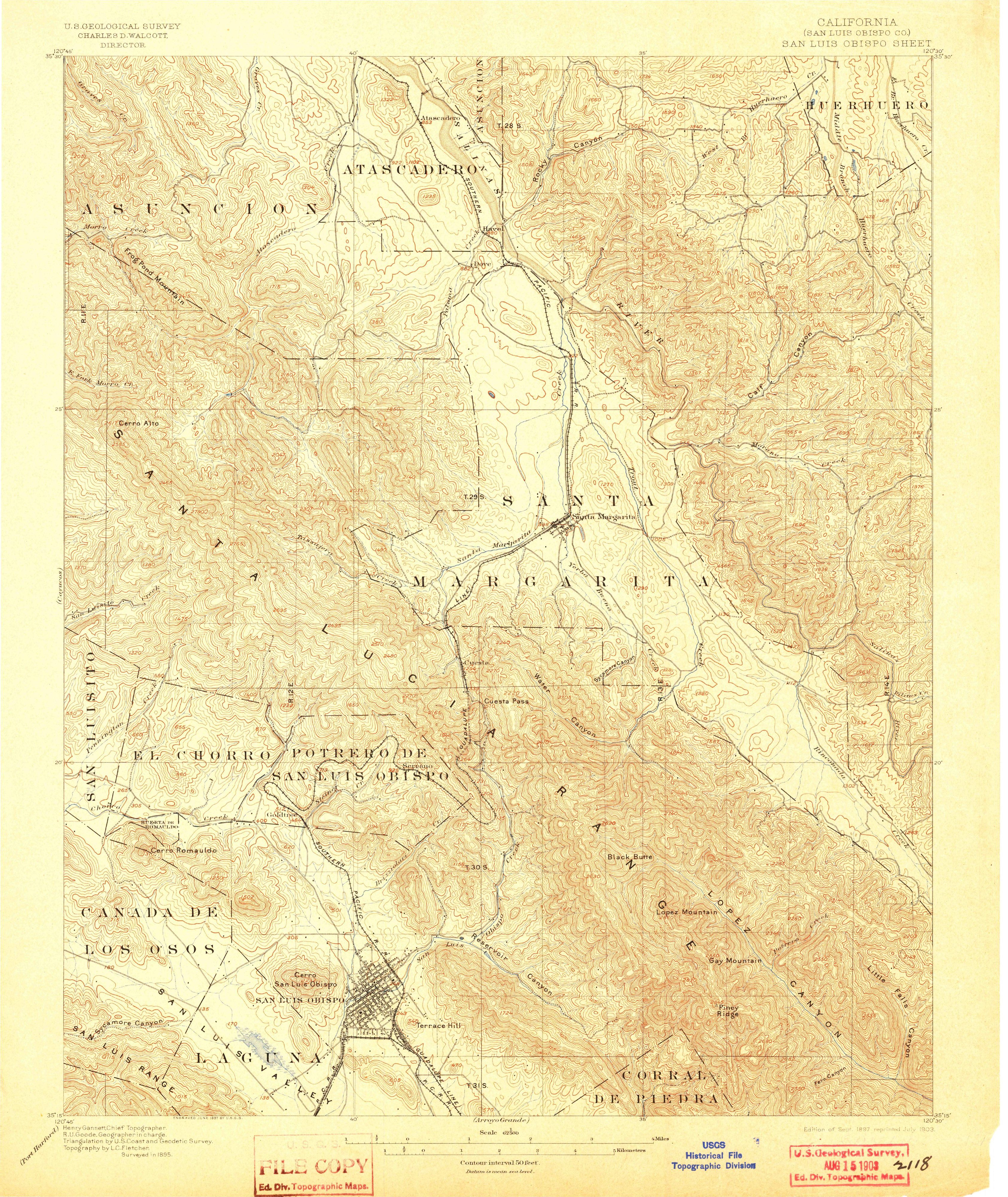
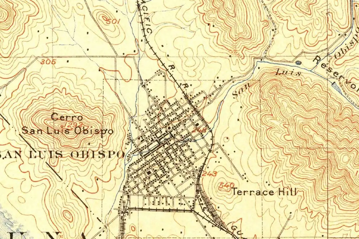
You can see the result on the 1897 map at the top of this page. The grid of streets sits between Cerro San Luis Obispo and Terrace Hill, with San Luis Creek running past it and the railroad cutting across the top.
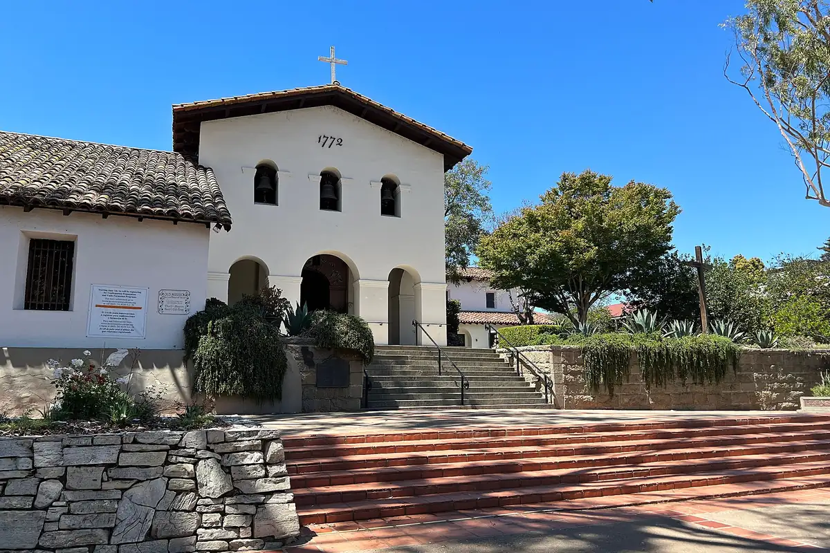
The mission itself changed shape more than once. Its front portico, added in 1794, was taken down after an earthquake weakened it, and wooden siding and a New England style belfry went on to “modernize” it. In the 1930s, under Father John Harnett, the buildings were restored to an early mission look. The portico went back up in 1933.
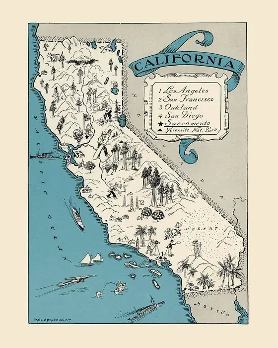
Up the coast, Monterey has its own Serra story in Palóu’s book, and San Diego is where Serra was headed when he stopped to found this mission. Santa Barbara is another California city named for a saint. There’s more on the California page.
Quick answers
Who is San Luis Obispo named after?
Saint Louis, Bishop of Toulouse. The mission founded in 1772 was San Luis Obispo de Tolosa, and the mission says its patron is Saint Louis, Bishop of Toulouse, France, who was born in 1274 and died at 23.
Who founded Mission San Luis Obispo?
Junípero Serra, on September 1, 1772. Palóu writes that Serra said the first Mass in a shelter of branches and left Father Joseph Cavaller in charge the next day.
Does San Luis Obispo mean “Valley of the Bears”?
No. The bears belong to a different place name. Crespí recorded the soldiers’ name llano de los Osos in 1769, and the mission says “Valley of the Bears” is a later mistranslation of it.
When did San Luis Obispo become a city?
In 1876. Morrison and Haydon’s 1917 county history says the town was organized under state law in 1859 and incorporated as a city in 1876.
Key dates
- 1769The Portolá expedition passes through the area on September 7-8; Crespí records the soldiers' name for it, llano de los Osos.
- 1770The viceroy and José de Gálvez ask for friars for future missions, one of them "under the name of San Luis Obispo de Tolosa."
- 1772Junípero Serra founds Mission San Luis Obispo de Tolosa on September 1, after a summer bear hunt there feeds the hungry missions.
- 1845Governor Pío Pico sells the secularized mission to Captain John Wilson for $510.
- 1859The town is organized under state law.
- 1876San Luis Obispo is incorporated as a city.
Things to do in San Luis Obispo, California
Mission San Luis Obispo de Tolosa
The fifth California mission, founded in 1772. Its museum sits in the original convento wing and holds Native Californian, mission-era and American settlement artifacts, and its gardens keep a vine that recalls the old vineyards.
History Center of San Luis Obispo County
The county's history museum and research center, grown out of the county historical society chartered in 1953, with a gallery, research room and bookstore in the historic Carnegie Library building.
Dallidet Adobe and Gardens
The adobe that Pierre Hypolite Dallidet, born in southwest France in 1823, built next to the Salazar family's adobe after marrying Ascension Salazar in 1855, now kept with its gardens by the History Center.
San Luis Obispo Railroad Museum
A nonprofit museum on the railroad history of the Central Coast, with displays on the Southern Pacific and the Pacific Coast Railway and a model railroad that recreates parts of the region in the 1920s and 1950s.
Getting there
Open San Luis Obispo in Google Maps
Opens in a new tab. The pin is the center of San Luis Obispo in the USGS place-name record.
The closest airports, Amtrak stations and intercity bus stops, measured in a straight line from the center of San Luis Obispo.
Airports
- San Luis Obispo County Regional (SBP) 3 mi 5 km
- Santa Maria Public/Capt G Allan Hancock Field (SMX) 29 mi 46 km
Amtrak trains
- San Luis Obispo station (SLO) under 1 mi 0.8 km
- Grover Beach station (GVB) 11 mi 18 km
Intercity buses
- Gold Runner San Luis Obispo under 1 mi 0.8 km
- CLAS Amtrak Connecting Service · San Luis Obispo under 1 mi 0.8 km
- Amtrak Chartered Vehicle Amtrak Connecting Service · San Luis Obispo under 1 mi 0.8 km
Distances are as the crow flies, not by road. We don't list schedules or fares because they change; check with the airline, Amtrak or the bus company before you go. Official data (FAA commercial service airports (2025), FAA airport locations, Amtrak stations and Intercity Bus Atlas) from the FAA and the U.S. Bureau of Transportation Statistics, checked Nov 14, 2026.
Sponsored
Staying in San Luis Obispo?
Compare hotels in San Luis Obispo, California, on Expedia.
See hotels in San Luis ObispoWe may earn a commission if you buy through this link. It never changes what we write. Read our affiliate disclosure
Historical Sources & References
- Mission San Luis Obispo de Tolosa, “Visit”. The fifth mission, founded by Serra on September 1, 1772, “Named after Saint Louis, Bishop of Toulouse, France”; the life of Saint Louis (born 1274, hostage in Spain, Franciscan, Bishop of Toulouse, died at 23); Crespí’s llano de los Osos and the “Valley of the Bears” mistranslation; the 1772 bear hunt; Chumash help with the buildings; the 1845 sale to John Wilson; the convento as school, jail and courthouse; the portico and the 1930s restoration.
- Palóu, Life and Apostolic Labors of the Venerable Father Junípero Serra (1913), p. 108. The 1770 request from the viceroy and Gálvez for friars for future missions, one “under the name of San Luis Obispo de Tolosa.”
- Palóu (1913), pp. 136-137. The founding at “the mouth of the Canyada of the Bears” on September 1, 1772; Mass “in a little shelter of branches”; Cavaller, the soldiers and the short supplies; the quoted passage on the bears and their claws (p. 137).
- Morrison and Haydon, History of San Luis Obispo County and Environs (1917), p. 30. The party’s arrival on August 19, 1772, and the choice of the site on the north bank of San Luis Creek.
- Morrison and Haydon (1917), pp. 136-137. “San Luis Obispo, the City of the Bishop”; the only settlement in the county in 1850, with adobes clustered around the mission; organized under state law in 1859 and incorporated as a city in 1876 (p. 137).
- GNIS feature 1652788 (U.S. Geological Survey). Federal place-name data for San Luis Obispo, San Luis Obispo County, with its coordinates.
- U.S. Geological Survey, San Luis Obispo sheet (1897). The 1:62,500 map that the image at the top of this page was cropped from.
Sponsored
Put this 1897 map on your wall
The 1897 USGS San Luis Obispo sheet, in a 1903 reprint, is in the public domain. Download the full-size scan for free, then have it printed on canvas with CanvasOnTheCheap.
Print a map on canvasDownload the full-size mapWe may earn a commission if you buy through this link. It never changes what we write. Read our affiliate disclosure
Spot something wrong, or know more? Tell us here. You can also email us or use our contact page. Corrections are noted here with their date, never made silently.