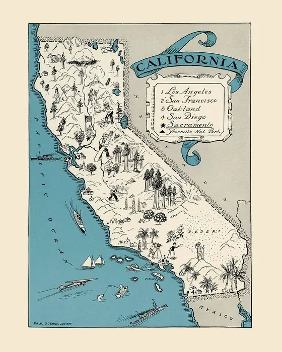
Siberia, California: A Frosty Name in the Hot Mojave
Siberia, California, a vanished siding beside Route 66, got its frosty name from the Southern Pacific in 1883, in one of the hottest parts of the Mojave. Erwin G. Gudde, author of the reference book California Place Names, thought the railroad picked it for the contrast with the desert heat, though he could only say “probably,” and we found no record from the time that gives the reason.
A Southern Pacific name from 1883
The tracks through Siberia were laid by the Southern Pacific, which finished its line across the Mojave to the Colorado River in August 1883, according to a 1929 Geological Survey report on the region. A year later the Santa Fe bought the road from Mojave to the Colorado. That’s why nearly every later source calls Siberia a Santa Fe stop.
Gudde’s book gives the name to the line’s first owner: Siberia was “named by the Southern Pacific Railroad when the original line (now Santa Fe) was built in 1883.” On the why, he hedges. “The choice of the name was probably inspired by the striking contrast in the temperature of the desert and of Siberia,” he wrote. We didn’t find a railroad letter, timetable note or newspaper item from the 1880s that explains it, so that “probably” is an expert’s reading, not the words of whoever chose the name.
The name was on the books right away. The Army’s official table of travel distances, dated December 1883 and in force from February 1, 1884, lists “Siberia, Cal.” at 127 miles (204 km) from Fort Mojave, Arizona, whose railroad station was Needles. In August 1888, when an eastbound overland passenger train ran off the rails, the Los Angeles Times placed the wreck “near Siberia Station.”
Cold names in a hot place
Siberia wasn’t the only chilly name on this stretch of track. Klondike, about 3 miles (5 km) away, kept it company, and the pair didn’t go unnoticed. In January 1937, the trade magazine Railway Age ran this item in its “Odds and Ends” column, under the headline “Cold Comfort”:
“It is strange that, in one of the hottest areas in the United States, just west of Needles, Cal., on the Atchison, Topeka & Santa Fe, two adjacent stations should be named Siberia and Klondike respectively.”
The magazine didn’t try to explain it, and its “just west” was generous: Siberia is nearly 80 miles (about 128 km) west of Needles. Two years later, the WPA guide to California, describing US 66 west of Bagdad, called them “curiously incongruous names.”
Phil Townsend Hanna’s Dictionary of California Land Names (1946) said the origin of Klondike was “unrevealed,” but saw in it “the desert dweller’s irony in bestowing names with frigid connotations such as this, Siberia and Arctic, on some of the hottest localities.” In 1991, the Los Angeles Times wrote that the railroad officials who named Bagdad in 1883 also “dubbed two nearby settlements Siberia and Klondike.” Gudde dates Klondike later: he says the Santa Fe picked that name in 1897, a choice “doubtless influenced by the discovery of rich gold deposits” in the Yukon. You’ll notice that none of these writers names a person. The railroad is as close as the record gets.
A siding, a water stop and section crews
Siberia was a working stop, not a town in the usual sense. The Geological Survey’s 1915 guidebook for passengers on the Santa Fe calls it “Siberia siding” and says that west of it “the railway makes some long, sweeping horseshoe curves” as it climbs out of the basin. Water was the constant problem. The same guide says all trains stopped at Bagdad for water and fuel oil, and the water came daily in 20 tank cars from springs at Newberry, 56 miles (90 km) west.
The 1929 report, describing conditions in 1918, says “Section crews or water stations are located at Klondike, Siberia, Bolo, and Archer, and water can be obtained at those places in an emergency.” By 1939, the WPA guide counted Siberia among the “lonely stops without accommodations” along the tracks west of Bagdad.
Route 66 and what’s left
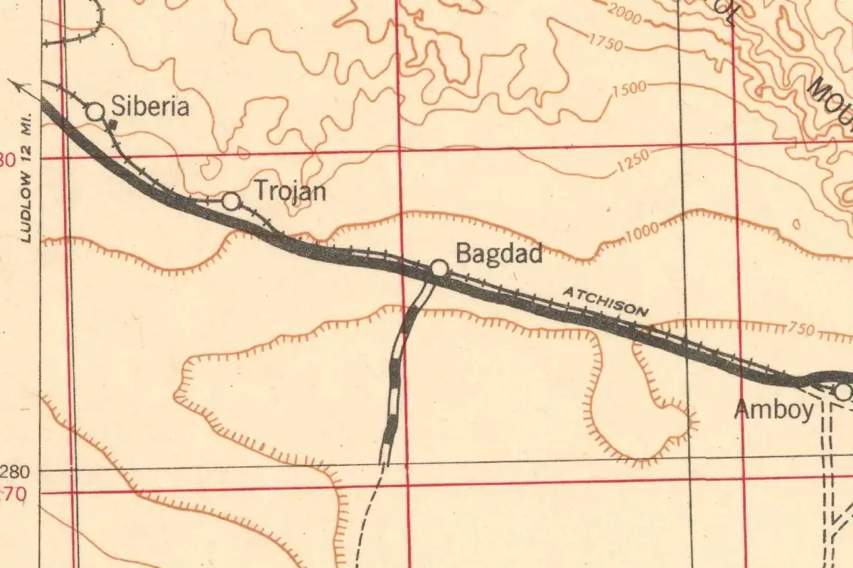
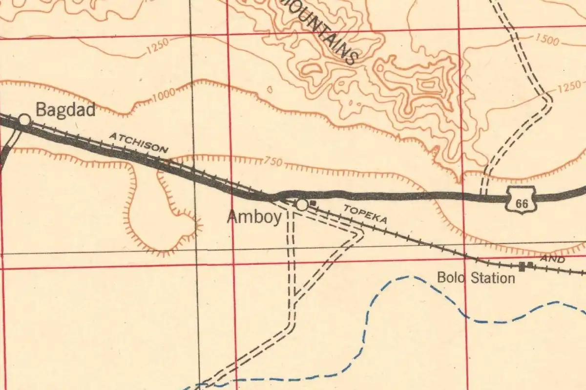
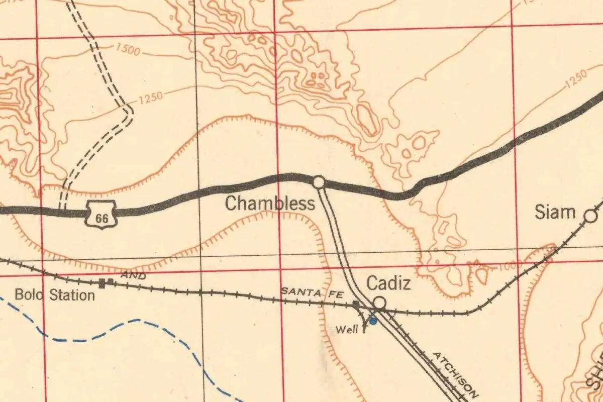
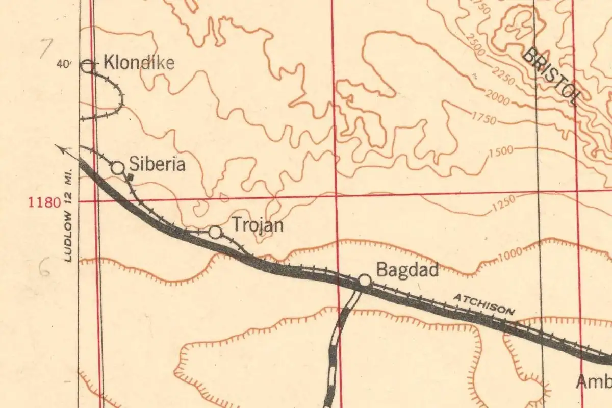
US 66 ran right past the siding. The Army’s 1942 map at the top of this page shows Siberia on the Santa Fe tracks with the highway beside them, drawn as the map’s heaviest road line, and an arrow pointing to Ludlow, 12 miles away. Some Route 66 websites say cafes and tourist camps did business here in the 1930s and 1940s. We couldn’t confirm that in an older source, and the 1939 guide’s “without accommodations” doesn’t help their case.
The end came with the interstate. The 1991 Times story says Bagdad was bypassed in 1972, when Interstate 40 opened 20 miles (32 km) to the north and this two-lane stretch of Route 66 became “a deserted, seldom-used road.” In December 1974, Mary Frances Strong wrote in Desert Magazine that “a skeletal road led south to Siberia Siding where stone ruins and two palm trees still survive.”
Reports since then don’t agree. The Road Wanderer site said in 2003 that the ruins had been gone since 2001, but the Cali49 site’s Elliot Koeppel, who visited in October 2015, still found “crumbling stone and cement block ruins of what might have been a service station, cafe or railroad building.” If you look for it, the site is about 7 miles (11 km) west-northwest of Bagdad and 12 miles (19 km) southeast of Ludlow, in San Bernardino County, on the old road between Amboy and Barstow.
The name has outlasted almost everything else. The federal gazetteer still lists Siberia as a populated place, and the Geological Survey’s modern map sheet for this patch of California desert is called the Siberia quadrangle.
Quick answers
Why is a place in the Mojave called Siberia?
No record from the 1880s that we found gives the reason. Erwin Gudde wrote that the Southern Pacific’s choice “was probably inspired by the striking contrast in the temperature of the desert and of Siberia.”
Who named Siberia, California?
The Southern Pacific Railroad, according to Gudde, when it built the line across the Mojave in 1883. The 1991 Los Angeles Times story credits “railroad officials” without naming anyone.
Was Siberia on Route 66?
Yes. The 1939 WPA guide mentions Siberia on its US 66 tour west of Bagdad, and the Army’s 1942 map shows the highway running beside the tracks there.
Is anything left of Siberia?
Very little. A Desert Magazine writer found stone ruins and two palm trees in 1974, and a visitor in 2015 found crumbling stone and cement-block walls.
Key dates
- 1883The Southern Pacific finishes its line across the Mojave to the Colorado River in August. Gudde says the railroad named Siberia when it built the line.
- 1884An Army table of distances in force from February 1 lists "Siberia, Cal." 127 miles from Fort Mojave.
- 1888August 12: An eastbound overland passenger train runs off the track "near Siberia Station."
- 1915A Geological Survey guidebook for Santa Fe passengers calls the stop "Siberia siding."
- 1937Railway Age finds it "strange" that two stations in one of the hottest areas in the country are called Siberia and Klondike.
- 1939The WPA guide to California, touring US 66, calls Siberia and Klondike "curiously incongruous names."
- 1972Interstate 40 opens to the north, and this stretch of Route 66 goes quiet.
- 1974A Desert Magazine writer finds stone ruins and two palm trees at Siberia Siding.
Getting there
Open Siberia in Google Maps
Opens in a new tab. The pin is the center of Siberia in the USGS place-name record.
The closest airports, Amtrak stations and intercity bus stops, measured in a straight line from the center of Siberia.
Airports
- Palm Springs International (PSP) 63 mi 101 km
- San Bernardino International (SBD) 80 mi 129 km
- Ontario International (ONT) 100 mi 161 km
Amtrak trains
- Palm Springs station (PSN) 60 mi 96 km
- Barstow station (BAR) 62 mi 100 km
Intercity buses
- Greyhound Desert Hot Springs Chevron 59 mi 95 km
- FlixBus Palm Springs North 59 mi 95 km
Distances are as the crow flies, not by road. We don't list schedules or fares because they change; check with the airline, Amtrak or the bus company before you go. Official data (FAA commercial service airports (2025), FAA airport locations, Amtrak stations and Intercity Bus Atlas) from the FAA and the U.S. Bureau of Transportation Statistics, checked Nov 10, 2026.
Sponsored
Staying in Siberia?
Compare hotels in Siberia, California, on Expedia.
See hotels in SiberiaWe may earn a commission if you buy through this link. It never changes what we write. Read our affiliate disclosure
Historical Sources & References
- Erwin G. Gudde, California Place Names, 3rd ed. (1969). Entry “Siberia”: named by the Southern Pacific Railroad “when the original line (now Santa Fe) was built in 1883,” and “The choice of the name was probably inspired by the striking contrast in the temperature of the desert and of Siberia.” Entry “Klondike”: named “by the Santa Fe in 1897.” Read through the Internet Archive’s search inside the book.
- Phil Townsend Hanna, The Dictionary of California Land Names (1946). Entry “Klondike”: the origin is “unrevealed,” with “the desert dweller’s irony in bestowing names with frigid connotations such as this, Siberia and Arctic.”
- War Department, Official Table of Distances (1884), p. 114. Under Fort Mojave, Arizona (railroad station Needles): “Siberia, Cal.” at 127 miles. The table is dated December 1883 and took effect February 1, 1884.
- Los Angeles Times, August 13, 1888. Associated Press report of August 12: the eastbound overland passenger train “ran off the track near Siberia Station.”
- N. H. Darton and others, Guidebook of the Western United States, Part C: The Santa Fe Route (1915), pp. 155-156. Water and fuel oil at Bagdad, the tank-car trains from Newberry, and “West of Siberia siding the railway makes some long, sweeping horseshoe curves.”
- David G. Thompson, The Mohave Desert Region, California (1929). p. 20: the Southern Pacific line finished to the Colorado River in August 1883 and bought by the Santa Fe a year later; p. 690: “Section crews or water stations are located at Klondike, Siberia, Bolo, and Archer.”
- Railway Age, January 23, 1937, p. 199. “Cold Comfort,” the item quoted above on Siberia and Klondike.
- Federal Writers’ Project, California: A Guide to the Golden State (1939), Tour 12, p. 611. West of Bagdad on US 66, “lonely stops without accommodations, which bear such curiously incongruous names as Siberia and Klondike.”
- Mary Frances Strong, “Roses and Bottles Along the National Old Trail,” Desert Magazine, December 1974, p. 33. “At another junction, a skeletal road led south to Siberia Siding where stone ruins and two palm trees still survive.”
- Charles Hillinger, “Bagdad Fades Into the Desert–in California,” Los Angeles Times (1991). The 1883 railroad officials “who dubbed two nearby settlements Siberia and Klondike,” and Interstate 40’s opening in 1972.
- The Road Wanderer, “Ludlow Area & Mojave Desert”. The 2003 update saying the Siberia ruins had been removed since 2001, and the claim of cafes and tourist camps in the 1930s and 1940s.
- Elliot Koeppel, “Rt 66 - Siberia, Cal,” Cali49 (2015). The October 2015 visit and the “crumbling stone and cement block ruins.”
- U.S. Army Corps of Engineers, Amboy sheet (1942). The map at the top of this page, the oldest topographic map we found with Siberia on it.
- GNIS feature 1661437, Siberia (U.S. Geological Survey). The national gazetteer’s entry for Siberia, still filed as a populated place on the Siberia map sheet, with its coordinates.
Sponsored
Gear up for your next road trip
Explore rooftop tents, vehicle awnings and outdoor gear from TOPOAK Overland.
Shop TOPOAK overlanding gearWe may earn a commission if you buy through this link. It never changes what we write. Read our affiliate disclosure
Spot something wrong, or know more? Tell us here. You can also email us or use our contact page. Corrections are noted here with their date, never made silently.