Sanibel, Florida: A Spanish Harbor or Queen Isabella?
Nobody knows for sure. A 2021 study of the island, citing a 1987 history, traces Sanibel to a harbor on Spanish maps called Puerto de S. Nivel in 1765, with the spelling Sanibel by 1775. The U.S. Fish and Wildlife Service tells another story, that Ponce de León named it for Queen Isabella in 1513, but calls the history unclear.
Sanibel, Florida, could be named for a harbor that Spanish maps called Puerto de S. Nivel, though a better-known story credits Ponce de León and a queen. The city and the island share the name, and so does the question of where it came from.
What does Sanibel mean?
The best paper trail runs through old maps. A 2021 botanical study of the island by George J. Wilder and his co-authors includes a short appendix on the name, drawn from a 1987 history of the island by Dormer. In their account, “Sanibel” is a worn-down form of Puerto de S. Nivel, the name of a harbor at the island’s southeastern tip, which they translate as “South Plane Harbor.”
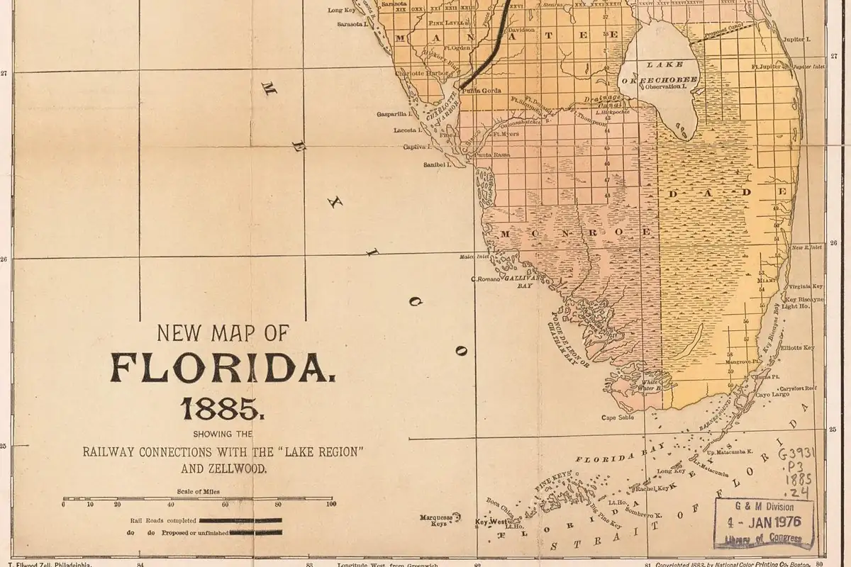
The sequence they give is easy to follow. The first map with the harbor’s name dates from 1765. A map of 1768 writes Puerto de S. Nibel, since b and v could stand in for each other, and another map that same year has Puerto de Sn. Nibel, as if the S stood for a saint. In 1774 Bernard Romans wrote both Sanybel and San Ybell. And by 1775 a map shows Sanibel, the spelling that lasted.
The Sanibel Historical Museum and Village agrees on the harbor. Its timeline, under the year 1513, says Ponce de León visited an area “noted on charts as ‘S. Nivel’” and calls that the origin of the island’s name. It doesn’t say which chart, though, and the study puts the earliest map with the name more than 250 years after that voyage.
Romans turns up in another Florida name, too. His map is one of the 18th-century sources behind Boca Raton, a name that started out on Biscayne Bay.
Was Sanibel, Florida, named after Queen Isabella?
That’s the story you’re more likely to hear. In its 2010 plan for the J.N. “Ding” Darling National Wildlife Refuge, the U.S. Fish and Wildlife Service writes that Ponce de León “is believed to have discovered Sanibel Island—which he named ‘Santa Isybella’ after Queen Isabella—in 1513.” But the agency introduces it carefully, as “one story,” and it begins the paragraph by saying the history of the island’s name is unclear. When a member of the public commented that the Ponce de León naming was debatable, the agency’s answer was to add that caution, not to drop the story.
Wilder’s study agrees that Ponce de León probably came by in 1513, likely the first non-Native explorer to see the island and tie up beside it. It doesn’t connect him to the name. None of the sources we read cites a map or a document from 1513 with Santa Isybella on it.
The Spanish queen does have a place on the map elsewhere. In Texas, the road onto South Padre Island is the Queen Isabella Memorial Causeway, though that island itself is named for a priest, Padre José Nicolás Ballí. And Spanish names that later readers can’t agree on aren’t rare: in California, the old books split over whether Coronado honors four crowned martyrs or the conquistador Francisco Vásquez de Coronado.
Sanibel Island history
The Calusa lived on Sanibel and Captiva from about A.D. 500 until the late 1700s, Wilder’s study says. Then came a long stretch of false starts. In 1833 investors from New York, organized as the Florida Peninsular Land Company, laid out a town at the east end of the island and named it Sanybel, but its colonists soon left, and by 1844 nobody lived there. William Allen and his sons tried a castor bean plantation around 1869 and gave up after a hurricane.
Permanent settlement began with the lighthouse at Point Ybel in 1884, when the keeper and his assistant moved in. (The city gives 1884 as the year the light was first lit; the museum’s timeline says 1885.) In 1888 Washington opened the rest of the island to private ownership, and by May 1, 1889, the study counts 40 families. A causeway with a drawbridge reached the mainland in 1963, the museum says, and in 1974 Sanibel incorporated as a city, putting a hold on new building until it had a land use plan. The city marked its 50th anniversary in 2025.
Sanibel on the 1958 map
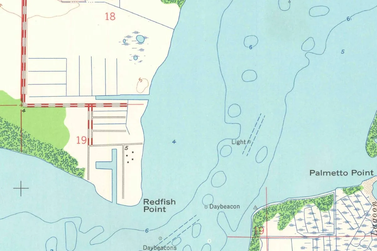
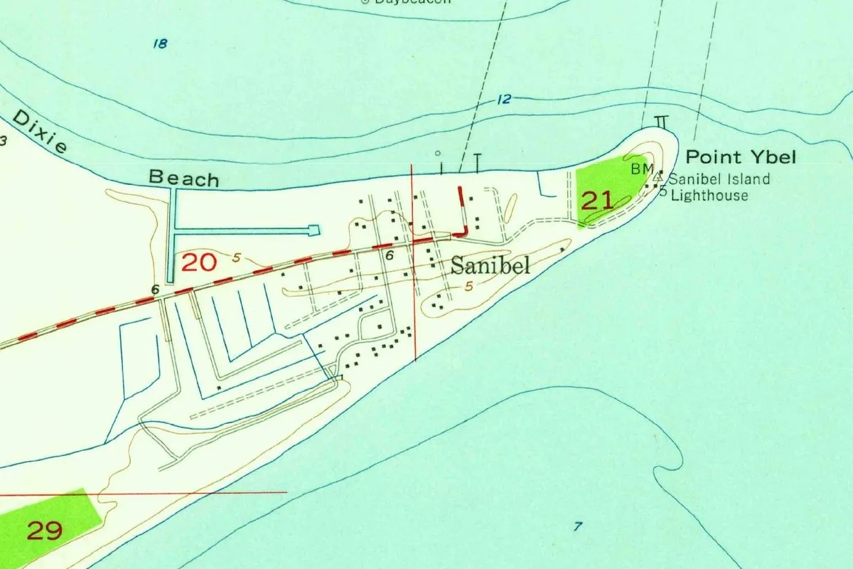
The Geological Survey’s Sanibel sheet of 1958 was drawn from aerial photographs taken in 1951 and plane-table surveys in 1958, with water depths from Coast and Geodetic Survey charts of 1956. Our copy carries a file stamp of March 19, 1959. In the crop you can see the town label Sanibel near the east end, a scatter of buildings and a single road, Dixie Beach on the bay side, and the lighthouse at Point Ybel. The study calls that point the island’s eastern tip, and it puts the old harbor of S. Nivel at the southeastern tip.
Quick answers
Where does the name Sanibel, Florida, come from?
According to Wilder’s study, citing Dormer, it comes from Puerto de S. Nivel, a harbor name on Spanish maps that the authors translate as “South Plane Harbor.” The Fish and Wildlife Service, though, calls the history of the name unclear.
Did Ponce de León discover Sanibel, Florida?
The museum says he’s said to be the first European to find the island, in 1513, and Wilder’s study calls him likely the first non-Native explorer to see it. The story that he named it Santa Isybella is one the Fish and Wildlife Service tells with caution.
When did Sanibel, Florida, become a city?
In 1974, according to the City of Sanibel, which marked 50 years as a city in 2025.
Key dates
- 1513Ponce de León, on a voyage, is said to be the first European to find the island.
- 1765The earliest map known to show Puerto de S. Nivel, according to a 2021 study.
- 1774Bernard Romans uses both Sanybel and San Ybell.
- 1775A map gives the spelling Sanibel.
- 1884The lighthouse goes up at Point Ybel.
- 1974Sanibel incorporates as a city.
Things to do in Sanibel, Florida
Lighthouse Beach Park
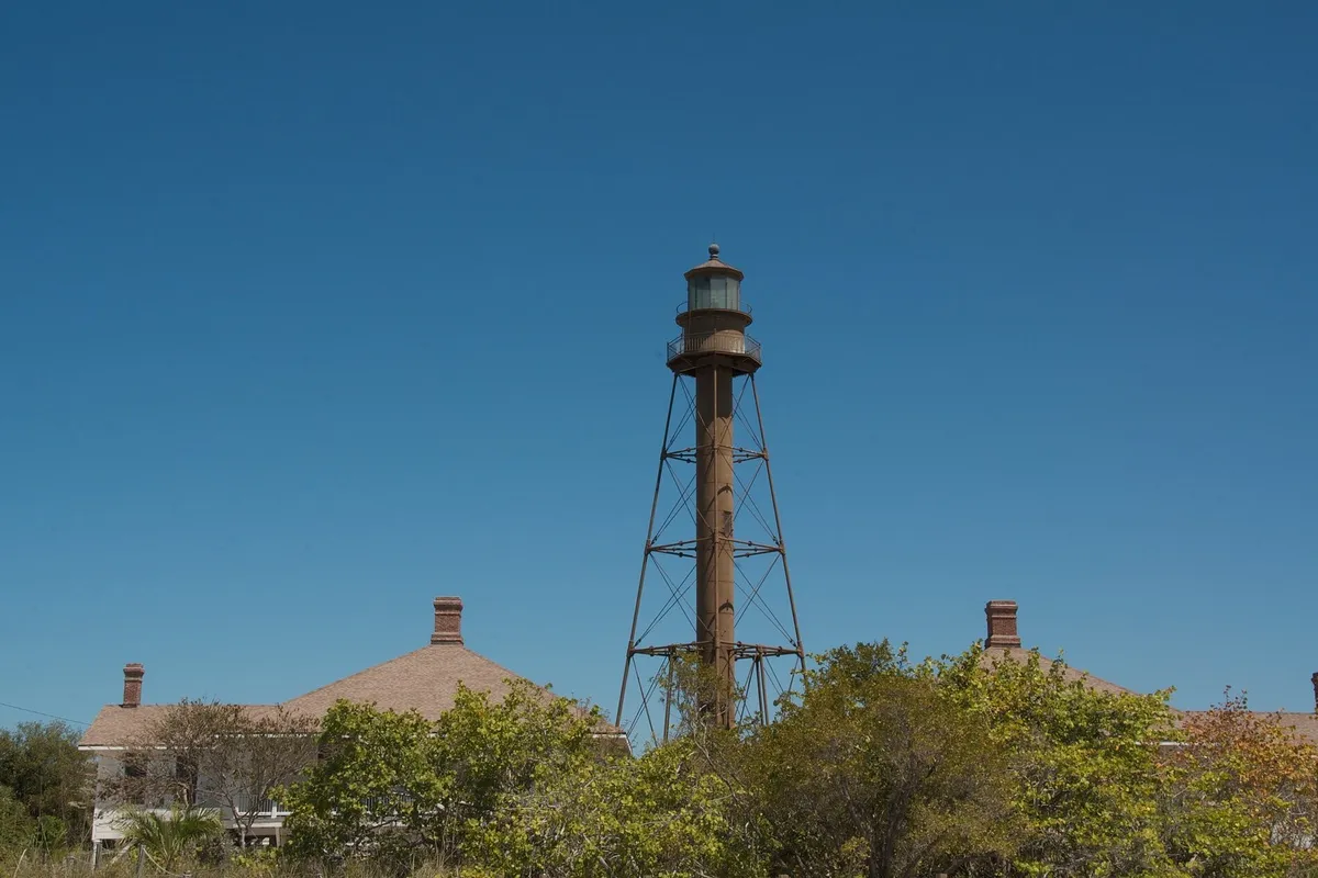
A city park at the island's east end, with a Gulf beach for swimming and shelling, bay views, and the cast-iron Sanibel Island Lighthouse, first lit in 1884. You can't go inside the lighthouse, but it's one of the most photographed sights in Southwest Florida.
J.N. "Ding" Darling National Wildlife Refuge
A refuge set up in 1945 as the Sanibel National Wildlife Refuge and renamed in 1967 for the cartoonist and conservationist Jay Norwood "Ding" Darling. Its Wildlife Drive is a one-way road of four miles (6.4 km) with trails, overlooks and an observation tower along the way.
Bailey-Matthews National Shell Museum & Aquarium
A museum of shells and the animals that make them, drawing on some 600,000 shells in its collection, with more than 60 species of live marine animals on view.
Sanibel Historical Museum and Village
A museum started in 1984 that follows the island's story from the Calusa and Spanish eras to its pioneer families, in nine historic buildings brought from their first sites and restored, along with a replica packing house.
Getting there
Open Sanibel in Google Maps
Opens in a new tab. The pin is the center of Sanibel in the USGS place-name record.
The closest airports, Amtrak stations and intercity bus stops, measured in a straight line from the center of Sanibel.
Airports
- Southwest Florida International (RSW) Fort Myers 18 mi 28 km
- Punta Gorda (PGD) 33 mi 52 km
Amtrak trains
- Sebring station (SBG) 81 mi 130 km
- Okeechobee station (OKE) 92 mi 148 km
Intercity buses
- FlixBus Fort Myers Bus Stop 16 mi 26 km
- Amtrak Chartered Vehicle Amtrak Connecting Service · Fort Myers Amtrak Bus Stop 20 mi 32 km
- Greyhound Arcadia, FL 54 mi 87 km
Distances are as the crow flies, not by road. We don't list schedules or fares because they change; check with the airline, Amtrak or the bus company before you go. Official data (FAA commercial service airports (2025), FAA airport locations, Amtrak stations and Intercity Bus Atlas) from the FAA and the U.S. Bureau of Transportation Statistics, checked Nov 21, 2026.
Sponsored
Staying in Sanibel?
Compare hotels in Sanibel, Florida, on Expedia.
See hotels in SanibelWe may earn a commission if you buy through this link. It never changes what we write. Read our affiliate disclosure
Historical Sources & References
- Wilder et al., Journal of the Botanical Research Institute of Texas, 2021, pp. 201-202, 258. The appendix on Puerto de S. Nivel and the maps of 1765 to 1775, after Dormer (1987), and the island’s history from the Calusa to 1889.
- U.S. Fish and Wildlife Service, Ding Darling refuge plan, 2010. The Santa Isybella story, the agency’s note that the name’s history is unclear, and the refuge’s dates.
- Sanibel Historical Museum and Village, “Sanibel History”. S. Nivel under 1513, the lighthouse, the 1963 causeway and the 1974 incorporation.
- City of Sanibel, “Sanibel’s 50th Anniversary”. Incorporation in 1974.
- U.S. Geological Survey, GNIS feature 290637. Sanibel in Lee County.
- Sanibel quadrangle, 1958. The sheet the map at the top was cropped from.
Spot something wrong, or know more? Tell us here. You can also email us or use our contact page. Corrections are noted here with their date, never made silently.