Outer Banks: Name, History and Things to Do
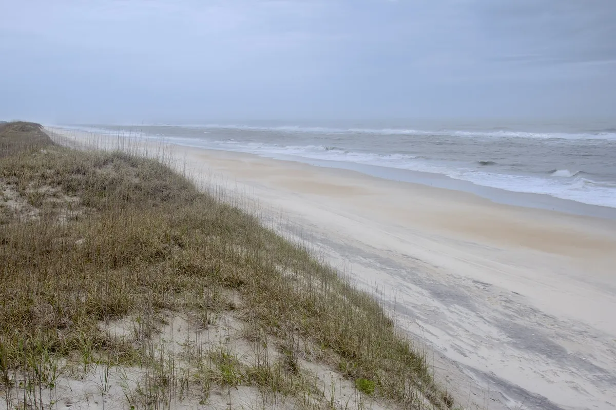
The Outer Banks were just “the Banks” in the 1800s, and the longer name may only date from the 1940s; one early example is in a Pittsburgh paper. The word “banks” is the old part: sand banks, a long thin line of them, between North Carolina’s sounds and the Atlantic. “Outer” came along much later, and it took a while to get its capital letter.
Why Is It Called the Outer Banks?
Because of what they are. In May 1860, Harper’s New Monthly Magazine ran a travel piece by Edward C. Bruce about the coast around Roanoke Island. Looking out from the island, he described “the strip of sand which shuts out the sea, and which bears the name of the Banks, from Cape Henry to Cape Fear.” So in 1860, “the Banks” could mean the whole sandy rim of the coast between those two capes.
He used the word like a local would. He wrote about “the wide part of the Banks” that “goes by the name of Body’s Island,” the place now spelled Bodie, and about a “Banks pony.” A 2015 report on the region still calls the people who live there “Bankers.”
That report, Before They Opened the Valve, was written by Marvin A. Brown of URS Corporation for the state Department of Transportation when the old bridge over Oregon Inlet was being replaced. It’s the best place to see where the longer name came from. “The term ‘Outer Banks,’” Brown writes, “may date only from the 1940s and did not commonly appear in its capitalized form until the early 1950s.” He’s leaning on an earlier study by Gabriel Francis Lee, so that’s one line of evidence, not two.
His examples come from Pittsburgh, of all places. In 1941, Kermit McFarland, a writer for The Pittsburgh Press, described going fishing at Hatteras with Johnny Mock, who edited the paper’s outdoor coverage. McFarland put the words in lowercase and in quotation marks: “Hatteras really isn’t in North Carolina, it’s in the Atlantic Ocean. But down there they say it is on the ‘outer banks.’” Five years later, Mock used the term in his own column, this time capitalized, though still inside quotation marks.
None of these sources names who coined the phrase, and none of these sources explains the “outer” in so many words. McFarland’s own sentence suggests it was already in use on the islands when he heard it: “down there they say” it.
Outer Banks History: From the Banks to the Outer Banks
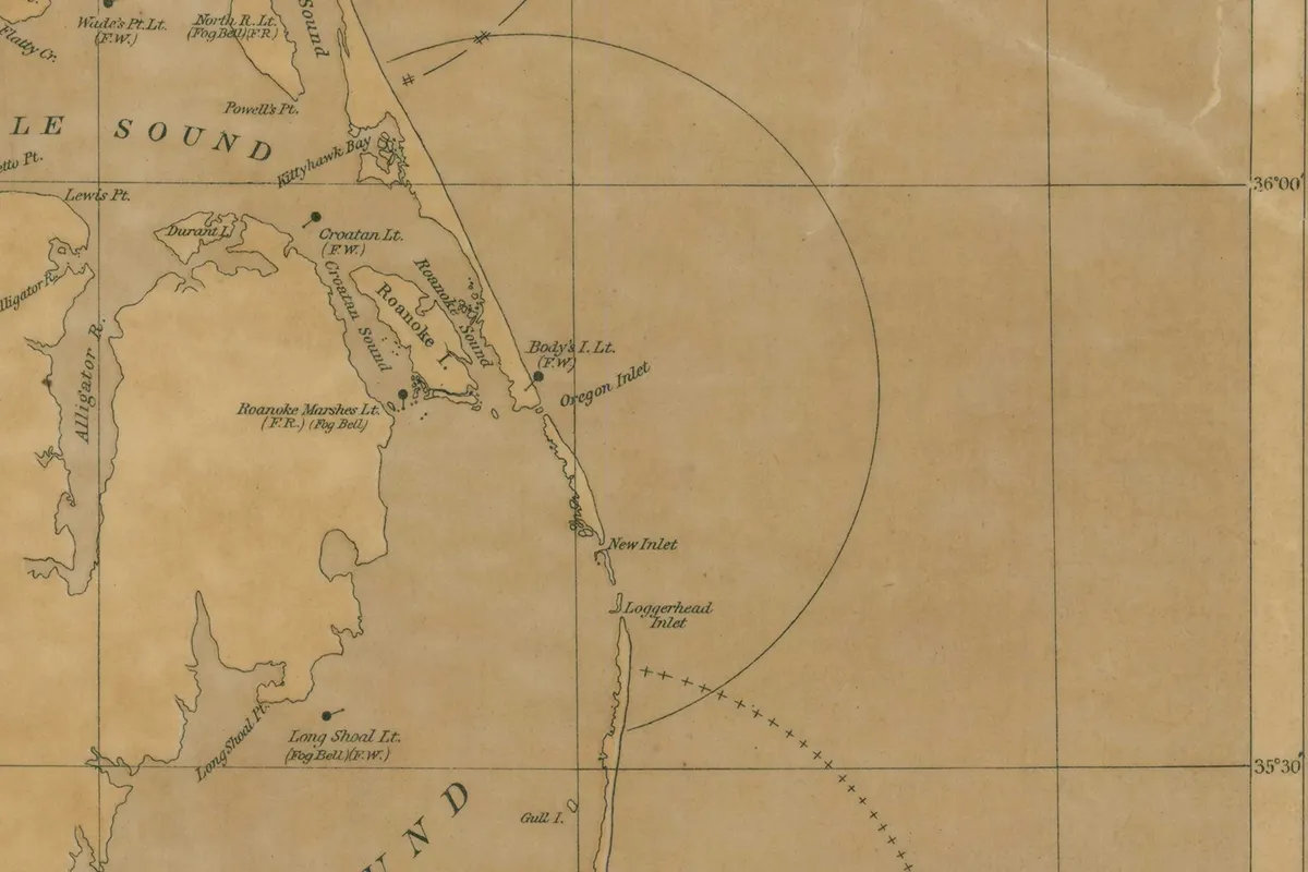
The sand itself never sat still, and the names moved with it. Bruce noted in 1860 that the old maps put an inlet across from the middle of Roanoke Island, at the spot then called Nag’s Head. People had tried to reopen it, and in 1847, he’d heard, they managed it, but a storm closed the passage again in a single day. The Park Service tells a similar story about Bodie Island. Its first two lighthouses, it says, actually stood south of Oregon Inlet, on what’s now Pea Island. The third, built north of the inlet, first showed its light on October 1, 1872.
In 1937, by Brown’s account, Cape Hatteras National Seashore came into being, on paper anyway, as “the first seashore in the national park system.” Civilian Conservation Corps crews built up dunes along the islands in the 1930s, and one economist he quotes calls that work the single most important factor in the region’s tourist economy. By 1955 the state’s own advertising office had put out a bulletin titled “The Rapidly Changing Outer Banks of North Carolina,” and the name had settled in, capital letters and all.
The federal government came later still. The U.S. Geological Survey’s place-names database lists Outer Banks as an “Island” feature in Dare County, and its record was created in 2003. There’s no Board on Geographic Names decision on it.
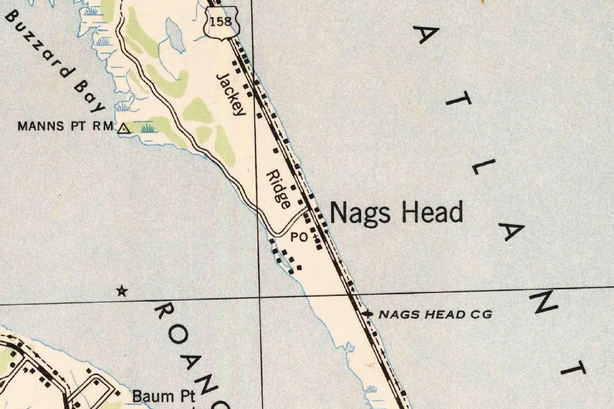
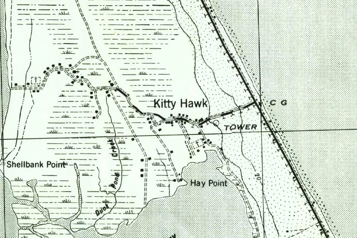
Two of this site’s town stories sit right on the old Banks. Nags Head, the place Bruce called Nag’s Head, still has no proven origin for its name, and the story of a lantern tied to a horse to draw ships onto the beach is just a legend. A little farther up the islands, the North Carolina Gazetteer finds Kitty Hawk spelled Chickehauk on maps from as early as 1738.
Visiting Outer Banks
You can still see the thing the name describes. The Park Service’s page for Cape Hatteras National Seashore talks about the beach on one side and kayaking “the sound” on the other, on islands “shaped by the forces of water, wind, and storms.” And where the Outer Banks begin depends on who you ask. Brown, who otherwise declines to pin the term down, says that once you cross the bridge from Roanoke Island to Bodie Island, you’ve “entered the Outer Banks.” Roanoke Island, inside the sound, isn’t one of the banks.
Things to Do in the Outer Banks
The two lighthouses are a good place to start, since both are tied to names in this story. The Bodie Island Lighthouse stands on Bodie Island, with Oregon Inlet to the south, Bruce’s “Body’s Island.” The Cape Hatteras Lighthouse, first lit on December 16, 1870, is, according to the Park Service, the tallest lighthouse built of brick anywhere in the country, at 198.49 feet (60.5 m) from the bottom of its foundation to the top.
Hatteras is also where the longer name first shows up in Brown’s examples, in a Pittsburgh writer’s fishing story. Brown credits Captain Ernal Foster with starting the state’s commercial sport fishing business on Hatteras Island in 1937, four years before that story ran.
Hotels in the Outer Banks and Vacation Rentals
On Hatteras Island, at least, places to stay are fairly new. A state pamphlet from 1951, quoted by Brown, could point visitors on Hatteras Island only to “a boarding house or cabins” in Buxton or the “small comfortable” Atlantic View Hotel in Hatteras Village, plus rooms in several homes. By 1953 the list had grown, but Hatteras still had far fewer choices than the “Nags Head-Manteo” area, with its hotels, cottages and motor courts. Brown’s report also includes a photo of a 1956 summer rental in the Kill Devil Hills area.
Quick answers
Why Is It Called the Outer Banks?
For the sand banks that separate North Carolina’s sounds from the ocean. In 1860, Harper’s called that “strip of sand which shuts out the sea” the Banks. The sources don’t say who added “outer,” which turns up in print in the 1940s.
What Were the Outer Banks Called Before?
The Banks. That’s the name Edward C. Bruce used in Harper’s in 1860, and the islands also went by their own names, like Bruce’s “Body’s Island,” now Bodie Island.
When Did Outer Banks Become a Regional Name?
In the 1940s, as far as a 2015 report for the state has found. It quotes “outer banks” in lowercase and quotation marks in The Pittsburgh Press in 1941, a capitalized version in 1946, and says the capitalized name wasn’t common until the early 1950s.
Is Roanoke Island Part of the Outer Banks Barrier Chain?
No. It sits in the sound behind the banks. Brown’s report says you’ve entered the Outer Banks when you cross the bridge from Roanoke Island to Bodie Island.
Key dates
- 1860Harper's describes "the strip of sand which shuts out the sea" as bearing "the name of the Banks."
- 1870December 16: the Cape Hatteras Lighthouse is lit.
- 1872October 1: the third Bodie Island Lighthouse, north of Oregon Inlet, shows its light.
- 1937Cape Hatteras National Seashore becomes, on paper, the first national seashore.
- 1941A Pittsburgh Press writer puts "outer banks" in lowercase and quotation marks.
- 1946Pittsburgh Press outdoor editor Johnny Mock capitalizes the term, still in quotation marks.
- 1955A state tourism bulletin is titled "The Rapidly Changing Outer Banks of North Carolina."
- 2003The federal place-names database creates its entry for Outer Banks.
Find it in Google Maps
Opens in a new tab. The pin is a point from the USGS place-name record, so it may not be the middle of the area.
Sponsored
Planning a visit?
Compare hotels in the area on Expedia.
See hotels nearbyWe may earn a commission if you buy through this link. It never changes what we write. Read our affiliate disclosure
Historical Sources & References
- Edward C. Bruce, “Loungings in the Footprints of the Pioneers,” Harper’s New Monthly Magazine, May 1860. “The strip of sand which shuts out the sea, and which bears the name of the Banks, from Cape Henry to Cape Fear” (p. 727 in this scan; Brown’s report cites p. 729); the old inlet at Nag’s Head, reopened in 1847 and closed by a storm in a day; “the wide part of the Banks” called “Body’s Island”; the “Banks pony.”
- Marvin A. Brown, Before They Opened the Valve: Dare County’s Outer Banks, 1865-1963 (2015). Written for the North Carolina Department of Transportation and accepted by the State Historic Preservation Office on April 16, 2015. “The term ‘Outer Banks’ … may date only from the 1940s,” after Gabriel Francis Lee’s 2008 study; McFarland’s 1941 column and Mock’s of 1946; “Bankers”; the first national seashore; the CCC dunes; the 1951, 1953 and 1955 state tourism publications; Ernal Foster and sport fishing in 1937; the bridge from Roanoke Island to Bodie Island.
- National Park Service, “Bodie Island Light Station”. The two earlier Bodie Island lights south of Oregon Inlet, on Pea Island; the third north of the inlet, lit October 1, 1872.
- National Park Service, “Cape Hatteras Light Station”. Lit December 16, 1870; the tallest of the country’s brick lighthouses, 198.49 feet.
- National Park Service, Cape Hatteras National Seashore. Islands “shaped by the forces of water, wind, and storms”; the beach and the sound.
- GNIS feature 1985747, Outer Banks (U.S. Geological Survey). Official name Outer Banks, class Island, Dare County, Rodanthe map, entry created March 11, 2003, with no Board decision (read in the Geological Survey’s North Carolina names file).
- U.S. Light House Establishment, Fifth Light House District chart, corrected to 1876 (National Archives, NAID 100306026). The map at the bottom of this page, from the records of the Office of the Chief of Engineers: Kittyhawk Bay, Roanoke Island, “Body’s I. Lt.” and Oregon Inlet.
Spot something wrong, or know more? Tell us here. You can also email us or use our contact page. Corrections are noted here with their date, never made silently.