Times Beach, Missouri: A Town Named for a Newspaper
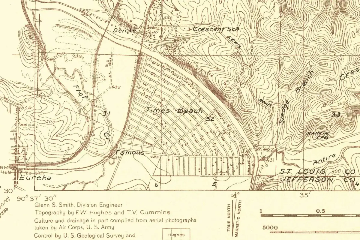
Times Beach, Missouri, started out as a newspaper giveaway. The St. Louis Times offered small lots by the Meramec River to people who paid for a subscription, and the summer resort it promoted was called Times Beach, after the paper. That name outlasted the newspaper by half a century, and then the town itself was bought out, bulldozed and buried after dioxin was found in its streets.
A lot with your subscription
St. Louis Public Radio, in a 2019 story by Mary Delach Leonard, put it simply: the town “began as a newspaper promotion in 1925 when the old St. Louis Times began offering subscribers an enticing deal.” For $67.50, you got a six-month subscription “plus a tiny lot in a summer resort next to the Meramec River that it dubbed Times Beach.” The story ran with a copy of the promotion as the paper printed it in 1925.
Missouri State Parks, which runs the land today, tells the same story with a different year. Its page for Route 66 State Park says that “in 1926, land lots in the resort area of Times Beach were offered to the public with a six-month subscription to the St. Louis Times newspaper and an additional $67.50.” So you’ll see both 1925 and 1926 depending on where you look. Both name the paper, the six-month subscription, the $67.50 and the river. They differ on the year, and on whether the $67.50 covered the subscription or came on top of it.
The ad that proves the name
The name was already being used to sell the place by the start of 1926. On January 31 of that year, the East St. Louis Daily Journal, across the Mississippi in Illinois, carried this ad:
“The TIMES BEACH CLUB OFFERS THE SEASON’S SENSATIONAL SURPRISE At ARCADIA BALLROOM WEDNESDAY EVENING, FEBRUARY 3, 1926 A Lot on Times Beach will be Given Away Absolutely FREE!”
The same ad promised that “the winner of the Times’ Movie Contest will appear in person to award the lot to the lucky person.” It never mentions the river, but it shows a lot on Times Beach was already a prize you could win at a dance.
The St. Louis Times didn’t last as long as its beach. The St. Louis Public Library says the Times and the St. Louis Star merged in 1932 to form the St. Louis Star-Times. Some later accounts credit the Star-Times, a paper that didn’t exist yet when the lots were sold.
From weekend cottages to a Route 66 town
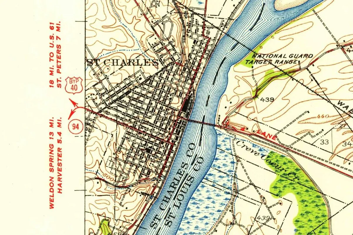
By 1931 the resort had filled in. On the U.S. Geological Survey’s 1931 map at the top of this page, Times Beach is already a tight grid of streets dotted with buildings, with a spot called Famous at its edge and Eureka just to the west. Leonard’s story says that eventually “people began building permanent homes in the community.”
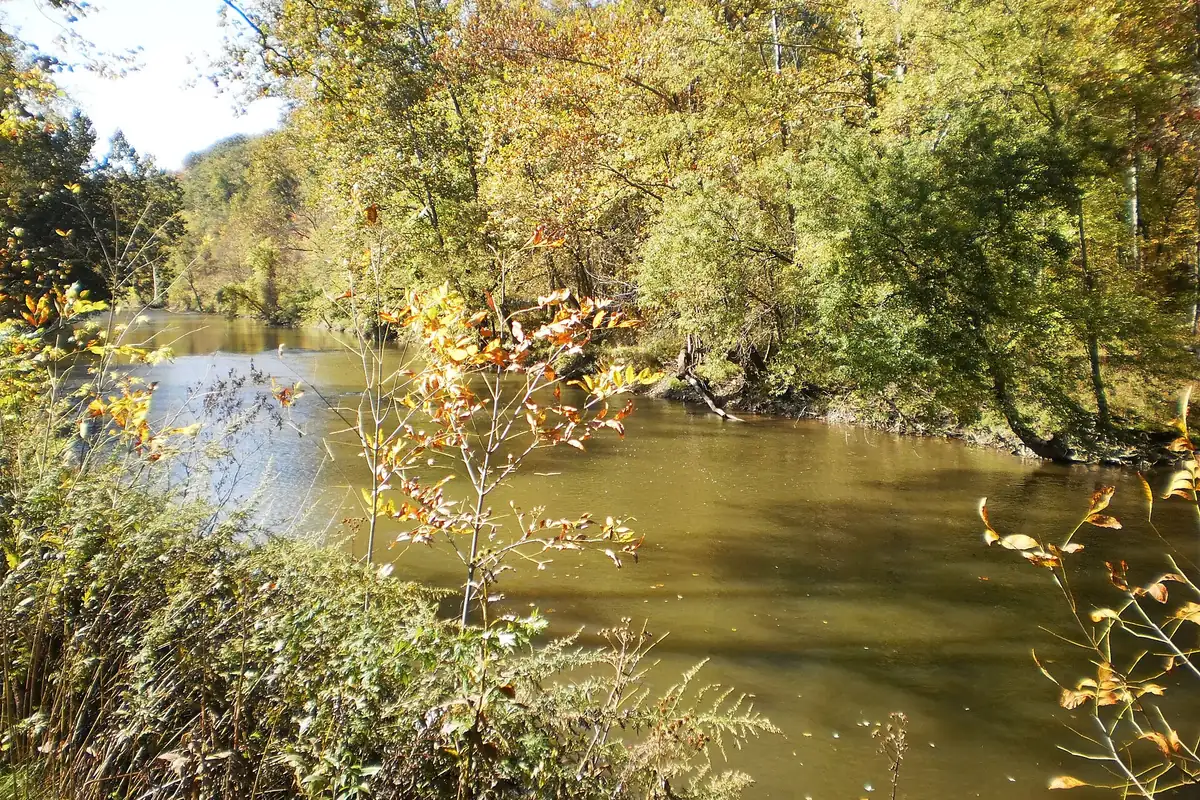
The 1941 WPA guide to Missouri doesn’t name Times Beach on its US 66 tour, but it describes the river the lots were sold on: the Meramec “serves as a weekend playground for city dwellers, and its banks are lined for great stretches with cabins perched high on stilts to clear spring floods.”
Route 66 crossed the Meramec here. A roadhouse built in 1935 at the eastern end of the bridge opened as the Bridgehead Inn, St. Louis Public Radio and Missouri State Parks say, and later became Steiny’s Inn (1946), the Bridgehead Inn again (1972) and the Galley West (1980). St. Louis Public Radio says the state picked Route 66 as the theme of the new park because the old road ran through Times Beach.
Dioxin on the dirt roads
Times Beach’s undoing began with dust. The town’s streets weren’t paved, and in the early 1970s it paid a waste oil hauler named Russell Bliss to spray them with oil to keep the dust down. The Missouri Department of Natural Resources puts the spraying from 1972 to 1976. The oil, the EPA later found, was mixed with dioxin, a toxic byproduct from a chemical plant in Verona, Missouri.
The flood came after the contamination, not before it. The EPA sampled the town’s roads in November and early December 1982, and soon afterward the Meramec flooded Times Beach and residents had to evacuate. On December 23, 1982, federal officials said the dioxin levels were dangerous and that people should stay away. The EPA’s own history says the flood spread that toxic mix beyond the roads.
In February 1983, the EPA announced a buyout of the whole town with Superfund money: 800 residential properties and 30 businesses, and more than 2,000 residents to be relocated. The town’s aldermen asked to dissolve the city, and on April 2, 1985, Gov. John Ashcroft signed the executive order that ended Times Beach as a “fourth class city.” The EPA says all residents had been relocated by the end of 1986.
A park on top of the town
You won’t find any of the old houses. The homes, churches and businesses, even the water tower, were demolished and buried in what’s now known as the “town mound,” St. Louis Public Radio says. An incinerator on the site burned dioxin-contaminated soil from Times Beach and other eastern Missouri sites until 1997, and the state opened Route 66 State Park on the former townsite in 1999. The EPA took Times Beach off its Superfund list in 2001, and a 2012 reassessment concluded that current use of the park “does not pose significant health risks to public visitors or park workers.”
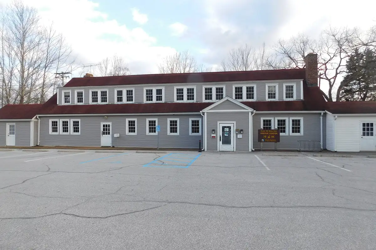
The one building left from the town is the old Bridgehead Inn, now the park’s visitor center, with a small exhibit on Times Beach. The park sits about 20 miles (32 km) southwest of St. Louis, just outside Eureka. The Route 66 bridge is still there too, but Missouri State Parks says it’s closed to cars and to people on foot. For other stops on the old road, see our Route 66 towns collection, or read how St. Louis, up the road to the northeast, got its name.
A newspaper sold this ground as a way to escape the city for a weekend. After the buyout, the park put it back to that use: trails, a picnic area and a boat launch on the Meramec.
Quick answers
Why is it called Times Beach?
Because of a newspaper. The St. Louis Times sold small lots in a Meramec River resort it called Times Beach to people who took out a six-month subscription.
When was Times Beach founded?
The newspaper promotion began in 1925, according to St. Louis Public Radio; Missouri State Parks says 1926. An ad for a free lot “on Times Beach” was in print by January 31, 1926.
Did the 1982 flood cause the dioxin contamination?
No. The dioxin came from waste oil sprayed on the town’s dirt roads in the 1970s. The December 1982 flood hit while the EPA was testing those roads, and officials feared it had spread the contamination.
Can you visit Times Beach today?
Yes, as Route 66 State Park. The town’s buildings are gone; the old Bridgehead Inn, now the visitor center, is the only one left standing.
Key dates
- 1925The St. Louis Times offers Meramec River lots at "Times Beach" with a six-month subscription, St. Louis Public Radio says (Missouri State Parks gives 1926).
- 1926January 31: An ad in the East St. Louis Daily Journal says a lot on Times Beach will be given away at a February 3 dance.
- 1931The U.S. Geological Survey's Manchester SE map shows Times Beach as a full grid of streets.
- 1935The Bridgehead Inn opens at the east end of the Route 66 bridge over the Meramec.
- 1982December: The Meramec floods the town, and on December 23 federal officials say dioxin levels are dangerous.
- 1983February: The EPA announces a federal buyout of Times Beach.
- 1985April 2: Gov. John Ashcroft signs the order that disincorporates Times Beach.
- 1986The last residents are relocated, the EPA says.
- 1997Cleanup of the site is completed.
- 1999Route 66 State Park opens on the former townsite.
- 2001The EPA deletes Times Beach from the Superfund National Priorities List.
Getting there
Open Times Beach in Google Maps
Opens in a new tab. The pin is the center of Times Beach in the USGS place-name record.
The closest airports, Amtrak stations and intercity bus stops, measured in a straight line from the center of Times Beach.
Airports
- St Louis Lambert International (STL) St. Louis 21 mi 33 km
- Scott AFB/Midamerica St Louis (BLV) Belleville 42 mi 67 km
Amtrak trains
- Kirkwood station (KWD) 12 mi 19 km
- Washington station (WAH) 22 mi 36 km
Intercity buses
- OurBus Chesterfield, MO (Chesterfield Mall - Cheesecake Factory - Mall loop) 10 mi 16 km
- Greyhound Saint Louis Lambert Field 20 mi 33 km
- Executive Transportation Amtrak Connecting Service · St. Louis 23 mi 37 km
Distances are as the crow flies, not by road. We don't list schedules or fares because they change; check with the airline, Amtrak or the bus company before you go. Official data (FAA commercial service airports (2025), FAA airport locations, Amtrak stations and Intercity Bus Atlas) from the FAA and the U.S. Bureau of Transportation Statistics, checked Nov 10, 2026.
Sponsored
Staying in Times Beach?
Compare hotels in Times Beach, Missouri, on Expedia.
See hotels in Times BeachWe may earn a commission if you buy through this link. It never changes what we write. Read our affiliate disclosure
Historical Sources & References
- Mary Delach Leonard, “20 Years Ago, Route 66 State Park Rose From the Ashes of Times Beach,” St. Louis Public Radio (via KBIA), August 26, 2019. The 1925 promotion, the $67.50 subscription with “a tiny lot in a summer resort next to the Meramec River that it dubbed Times Beach,” the 1925 ad, Russell Bliss and the 1972 spraying, the December 1982 flood and advisory, the 1983 buyout, the “town mound,” the park’s Route 66 theme and the Bridgehead Inn as the only building left.
- Missouri State Parks, Route 66 State Park, General Information. The 1926 date for the lot offer “with a six-month subscription to the St. Louis Times newspaper and an additional $67.50,” the roadhouse built in 1935 and its four names, and the closed Route 66 bridge.
- East St. Louis Daily Journal, January 31, 1926, p. 3. The Times Beach Club ad quoted above, with “A Lot on Times Beach will be Given Away Absolutely FREE!” The same ad ran on February 1 and February 3, 1926.
- St. Louis Public Library, St. Louis Star-Times Papers. The St. Louis Star and the St. Louis Times merged in 1932 to form the St. Louis Star-Times.
- Writers’ Program, Missouri: A Guide to the “Show Me” State (1941), p. 406. Tour 5 along US 66 and the Meramec as “a weekend playground for city dwellers,” lined with cabins on stilts.
- U.S. EPA, “A Town, a Flood, and Superfund”. The dioxin from Verona, the December 1982 flood, the February 1983 buyout of 800 residential properties and 30 businesses, more than 2,000 residents, the 1999 park, the 2001 deletion and the Bridgehead Inn as the only building left.
- U.S. EPA, Times Beach Superfund Site Profile. A “formerly incorporated city” that sprayed its roads in the early 1970s; all residents relocated by the end of 1986; cleanup completed in 1997; park opened in September 1999; deleted from the list in 2001.
- EPA Region 7, Site Reassessment Report, Route 66 State Park (2012), pp. 1-2 and 19. The site history, the sampling and flood sequence of 1982 and the conclusion that current use of the park does not pose significant health risks.
- Missouri Department of Natural Resources, Top Accomplishments (PUB2960). Spraying from 1972 to 1976, the December 23, 1982 announcement, the $33 million pledge of February 22, 1983, and the park’s opening in October 1999.
- Executive Order 85-9, April 2, 1985. Gov. John Ashcroft’s order approving the disincorporation of Times Beach, “a fourth class city.”
- U.S. Geological Survey, Manchester SE sheet (1931). The map at the top of this page.
- GNIS feature 758452, Times Beach (historical) (U.S. Geological Survey). Lists the place as a historical populated place in St. Louis County, with its coordinates.
Sponsored
Gear up for your next road trip
Explore rooftop tents, vehicle awnings and outdoor gear from TOPOAK Overland.
Shop TOPOAK overlanding gearWe may earn a commission if you buy through this link. It never changes what we write. Read our affiliate disclosure
Spot something wrong, or know more? Tell us here. You can also email us or use our contact page. Corrections are noted here with their date, never made silently.