Chama, New Mexico: A Tewa Pueblo's Name on a Rail Town
Chama, New Mexico, got its name from the Chama River, and the river got its name from a Tewa pueblo ruin down the valley called Tsama. The railroad town that carries it now sits, in one scholar’s words, “in the northernmost part of New Mexico.”
Tsama, the wrestling place
The man who traced it was John Peabody Harrington, who recorded Tewa place names for the Smithsonian’s Bureau of American Ethnology. His study came out in 1916. In it he lists Tsąmą as a pueblo ruin and translates the name as “wrestling pueblo ruin,” from a verb meaning “to wrestle” that the Tewa use only for something that has already happened.
He doesn’t claim to know why. His Tewa informants “thought it likely that the name Tsąmą was originally applied to the pueblo, perhaps because there was at some time in the past a wrestling contest there,” and that other spots nearby took the name from the pueblo. That “perhaps” is theirs, and it’s worth keeping.
From a pueblo to a whole river
Spanish records, Harrington says, used “Zama,” “Chama” and “San Pedro de Chama” for the whole Chama River district or for the river itself. These “evidently come from Tewa Tsąmą, name of the former Tewa pueblo.” In his reading, the Spanish took the name over for a stretch of good farmland up the valley, then for the whole river region, and only later for the river alone.
The Tewa never stretched it that far. To them, Harrington writes, Tsąmą was “properly only the name of a former Tewa pueblo and of a little round hill, a marsh, and rich bottom-lands which lie beside it.” Then he gets to the town you can visit today:
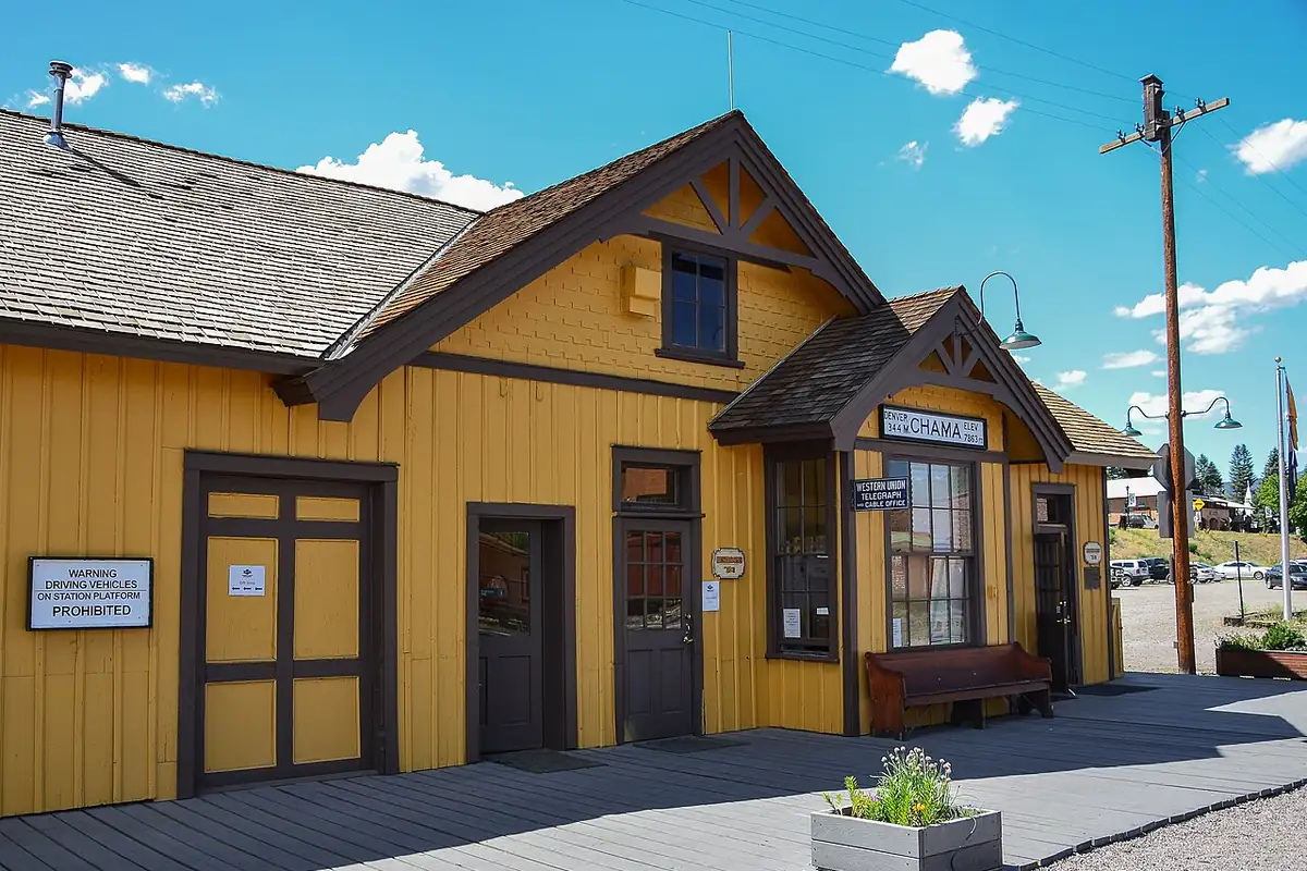
From Chama applied to the Chama River the modern town of Chama on the Denver and Rio Grande Railroad in the northernmost part of New Mexico gets its name.
So the town is named for the river, and the river for a ruin of low mounds downstream. Harrington describes the ruin as “a very large ruin consisting of low mounds,” with three courtyards you could still make out.
Where the rails came in
The state guide that the Federal Writers’ Project wrote, as revised in 1962, says the Denver and Rio Grande came into New Mexico from Antonito, Colorado, and that “a branch was also built from Antonito to Chama in Rio Arriba County, thence to Durango, Colorado…” The same guide calls Chama “a lumbering and trading center on the Chama River,” with lumber yards and a sawmill, and the shipping point for oil fields that opened in 1937 in Chromo Valley, “just over the Colorado Line.”
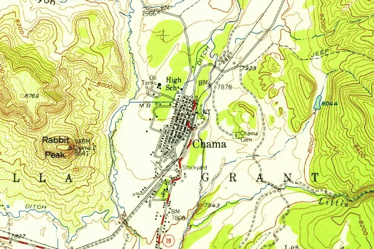
The 1955 survey map shows the whole small town squeezed between the tracks and the slopes of Rabbit Peak, with a stockyard by the line.
Quick answers
What does Chama mean?
Harrington traced it to the Tewa name Tsąmą, which he translated as “wrestling pueblo ruin.” His Tewa informants could only guess why the pueblo had that name, “perhaps” for a wrestling contest held there long ago.
Is Chama, New Mexico, named after the river?
Yes. Harrington wrote in 1916 that the town on the Denver and Rio Grande “gets its name” from the name Chama as it was applied to the Chama River.
How did the railroad reach Chama?
On a branch of the Denver and Rio Grande from Antonito, Colorado, that went on to Durango, according to the state’s Federal Writers’ Project guide.
Key dates
- 1916J. P. Harrington's study of Tewa place names traces Chama to Tsama, a former Tewa pueblo.
- 1937Oil fields open in Chromo Valley, just over the Colorado line, and Chama becomes their shipping point.
Getting there
Open Chama in Google Maps
Opens in a new tab. The pin is the center of Chama in the USGS place-name record.
The closest airports, Amtrak stations and intercity bus stops, measured in a straight line from the center of Chama.
Airports
- San Luis Valley Regional/Bergman Field (ALS) Alamosa 54 mi 86 km
- Durango-La Plata County (DRO) 67 mi 108 km
- Albuquerque International Sunport (ABQ) 129 mi 207 km
Intercity buses
- Bustang Outrider Bustang · Alamosa - Student Union 55 mi 89 km
Distances are as the crow flies, not by road. We don't list schedules or fares because they change; check with the airline, Amtrak or the bus company before you go. Official data (FAA commercial service airports (2025), FAA airport locations, Amtrak stations and Intercity Bus Atlas) from the FAA and the U.S. Bureau of Transportation Statistics, checked Nov 6, 2026.
Sponsored
Staying in Chama?
Compare hotels in Chama, New Mexico, on Expedia.
See hotels in ChamaWe may earn a commission if you buy through this link. It never changes what we write. Read our affiliate disclosure
Historical Sources & References
- John Peabody Harrington, “The Ethnogeography of the Tewa Indians,” Twenty-ninth Annual Report of the Bureau of American Ethnology (1916), pp. 147-149. Tsąmą as “wrestling pueblo ruin”; the informants’ guess about a wrestling contest; Zama, Chama and San Pedro de Chama in Spanish records; how the name spread from the pueblo to the river; and the line on the modern town of Chama.
- Federal Writers’ Project, New Mexico: A Guide to the Colorful State, rev. ed. (1962), pp. 97 and 345. The Denver and Rio Grande branch from Antonito to Chama and on to Durango; Chama as a lumbering and trading center and shipping point for the Chromo Valley oil fields opened in 1937.
- GNIS feature 902207 (U.S. Geological Survey). The Survey’s names record for Chama, in Rio Arriba County. Its history field is empty.
Spot something wrong, or know more? Tell us here. You can also email us or use our contact page. Corrections are noted here with their date, never made silently.