Madrid, New Mexico: A Coal Camp Renamed for an Older Village
Madrid took the name of an earlier Spanish settlement, according to SAH Archipedia: in 1892 the railroad's coal company set up a company town at the mining camp of Keeseville and renamed it Madrid. That older settlement was 'probably' named for a Spanish family going back to Roque Madrid in the 1600s. No period record of the choice turned up.
Madrid, New Mexico, began as a coal camp called Keeseville and took the name of an earlier Spanish settlement, probably named for a Spanish family. That’s how Regina N. Emmer tells it in her entry on the Madrid Historic District for SAH Archipedia, the Society of Architectural Historians’ online encyclopedia. You might expect a link to the capital of Spain, but none of the sources used for this page makes one.
From Keeseville to Madrid
The town you can visit today was built by a railroad. Emmer writes that in 1892, “a spur was built from the main AT&SF line at Waldo Junction, and a company town with mines, industrial processing facilities, and housing was set up at the mining camp of Keeseville, renamed Madrid after the earlier Spanish settlement.” The company was the Cerrillos Coal and Iron Company, a subsidiary of the Atchison, Topeka and Santa Fe.
The National Register nomination that John O. Baxter and Sylvia Cook prepared in 1976 (the district was listed in 1977, SAH Archipedia notes) puts it the same way, without the name: “Although there was some settlement in the area as early as 1869, Madrid did not become an established community until 1892 when subsidiaries of the Atchison, Topeka and Santa Fe Railroad built a ‘company town.’” The first miners’ cabins didn’t even start out here. The company took prefabricated houses apart at the mining town of Carthage, in three pieces each, and put them back together in Madrid, Emmer says.
The Madrid before the railroad
So where did the earlier Madrid get its name? Emmer’s answer is careful: “By 1835, coal was being dug up at the small community of Madrid, probably named after a Spanish family that traces back to Roque Madrid in the seventeenth century.” Her timeline for the district starts with “1800–1825: Settled by Madrid family.” That “probably” is as far as any source here goes, so the origin stays open.
The 1940 WPA guide to New Mexico agrees on the coal, though it says nothing about the name: “Coal was discovered here in 1835, but not until 1869, when the operation of the old placer mines nearby created a steady market, was any appreciable amount produced.” The nomination goes back further, to a brief gold strike in the Ortiz Mountains in 1828 that led to the first use of Madrid coal, and says that after the U.S. occupation of 1846 there was some demand for fuel at army posts such as Fort Marcy in Santa Fe.
A town the company owned
For most of its life, Madrid belonged to somebody. Emmer traces the owners: the Colorado Fuel and Iron Company, owned by the Rockefeller family, from 1896; then, after a 1906 fire shut the mines, the Albuquerque banker George Kaseman and his Albuquerque and Cerrillos Coal Company. Kaseman hired Oscar Huber as mine foreman in 1919. Huber put up new houses, some shipped in from the railroad town of Tucumcari, and in 1947 he bought the town and the company outright.
The company ran more than the mines. It kept a semi-professional baseball team, “whose ball park still stands,” and from 1922 it oversaw the Christmas displays Madrid became known for. From 1922 until 1941, Emmer writes, the displays were mandatory, with pay deductions covering the lights, decorations and trees the miners had to put up around their homes. Gallup grew on coal and the Santa Fe railroad too. For a contrast, there’s Kemmerer, Wyoming, a coal town that, unlike its neighbors, wasn’t run by a company.
A ghost town for sale
In 1940 the WPA writers already called it nearly a ghost town. They listed Madrid at 6,000 feet (about 1,830 m) with 50 people, “owned and operated by the Albuquerque & Cerrillos Coal Company,” and added: “Madrid today is practically a ghost town.” Huber held on longer than that. Emmer says a contract to supply coal to Los Alamos kept the mines going until the laboratory switched to natural gas in 1954. That spring, Huber advertised the “entire town” in the Wall Street Journal: “200 houses, grade and high school, power house, general store, tavern, machine shop, mineral rights, 9000 acres, excellent climate, fine industrial location.”
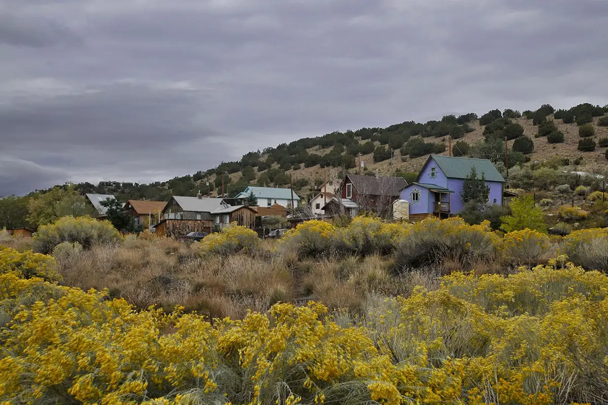
The town was largely abandoned, Emmer writes, and repopulated in the 1970s and 1980s. Today it’s a stop on the Turquoise Trail, the byway between Albuquerque and Santa Fe. If coal towns that grew up around a railroad interest you, Thurmond, West Virginia is another one.
Madrid on the 1961 map
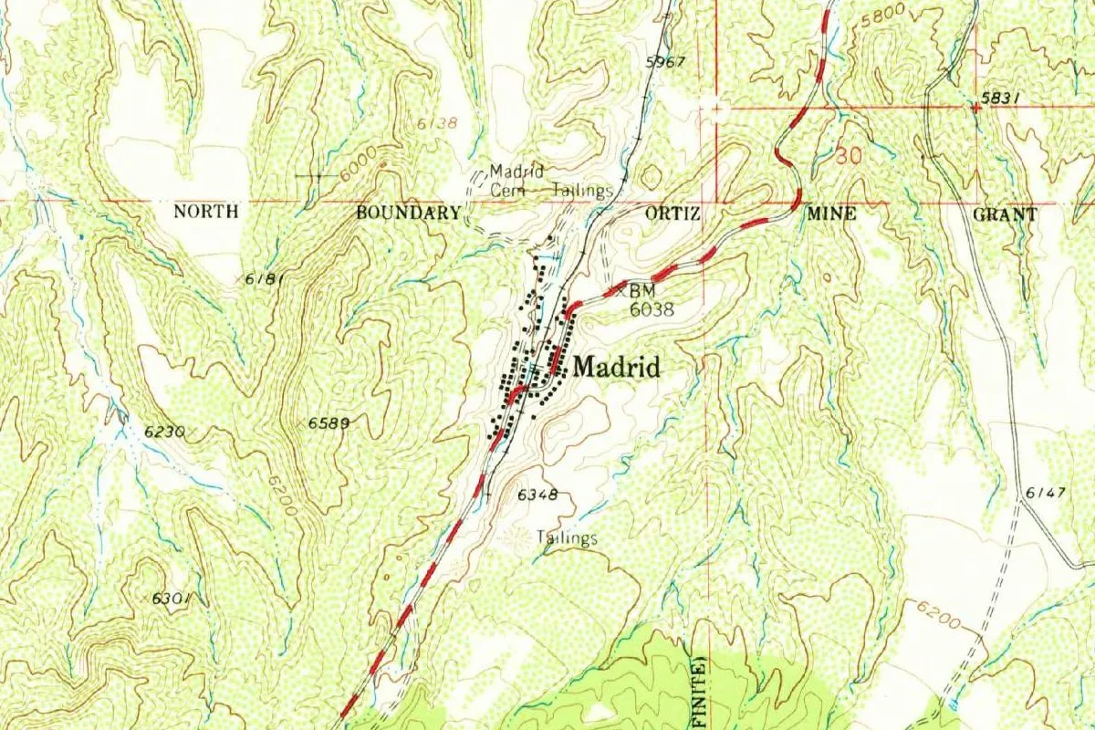
The Geological Survey’s 1961 Madrid sheet, in the 1980 reprint at the top of this page, shows the town squeezed into a narrow valley, its houses lined up along the railroad. Just north, you’ll see “Madrid Cem” and a patch marked “Tailings,” and another tailings pile sits south of town. A line labeled “North Boundary Ortiz Mine Grant” runs across the sheet. The nomination explains why that line mattered: the town lies within an area claimed by two conflicting land grants, the Ortiz Mine Grant to the south and the Mesita de Juana Lopez to the north, and “extensive litigation was necessary” before the Cerrillos Coal and Iron Company could establish title to 26,000 acres in 1884-5.
Quick answers
Is Madrid, New Mexico, named after Madrid, Spain?
Not according to any source found for this page. SAH Archipedia says the coal camp was renamed after an earlier Spanish settlement of Madrid, which was “probably” named for a Spanish family descended from Roque Madrid.
What was Madrid, New Mexico, called before?
Keeseville. SAH Archipedia says the company town of 1892 was set up “at the mining camp of Keeseville, renamed Madrid.”
Is Madrid, New Mexico, a ghost town?
It was close. The 1940 WPA guide called it “practically a ghost town,” the mines closed in 1954, and the town was repopulated in the 1970s and 1980s, according to SAH Archipedia.
Key dates
- 1835Coal is being dug at the small community of Madrid, per SAH Archipedia and the 1940 WPA guide.
- 1869Some settlement in the area, says the National Register nomination; the WPA guide dates steady coal production from this year.
- 1892A railroad spur reaches the camp of Keeseville, which becomes a company town renamed Madrid.
- 1896The Colorado Fuel and Iron Company acquires Madrid.
- 1922The company starts overseeing the Christmas displays, mandatory for miners until 1941.
- 1947Oscar Huber buys the town and the coal company.
- 1954The last mines close, and the whole town is advertised for sale in the Wall Street Journal.
- 1977The Madrid Historic District is listed on the National Register of Historic Places.
Things to do in Madrid, New Mexico
Turquoise Trail National Scenic Byway
The byway through Madrid, about 50 miles (80 km) along NM 14 between Albuquerque and Santa Fe, with the view from Sandia Crest and the old mining towns of Golden, Madrid and Cerrillos, which the Turquoise Trail Association says now come alive with art, crafts, theater, music, museums and restaurants.
Oscar Huber Memorial Ballpark
The ballpark of Madrid's company baseball team, which the Turquoise Trail Association calls one of the last standing minor league ballparks of its kind in the United States. It holds events through the year.
Cerrillos Hills State Park
New Mexico's 34th state park, a day-use park off the Turquoise Trail, with more than 1,100 years of mining history along 5 miles (8 km) of trails and views of the Sandia, Ortiz, Jemez and Sangre de Cristo mountains, at 5,900 to 6,100 feet (1,800 to 1,860 m).
Sandia Crest
The end of the byway's Sandia Crest spur: NM 536 heads west from NM 14 until the road ends at the crest. The Turquoise Trail Association puts the trail's highest point there, at 10,600 feet (3,231 m), overlooking Albuquerque and the Rio Grande Valley.
Getting there
Open Madrid in Google Maps
Opens in a new tab. The pin is the center of Madrid in the USGS place-name record.
The closest airports, Amtrak stations and intercity bus stops, measured in a straight line from the center of Madrid.
Airports
- Santa Fe Regional (SAF) 15 mi 24 km
- Albuquerque International Sunport (ABQ) 36 mi 58 km
Amtrak trains
- Lamy station (LMY) 16 mi 26 km
- Albuquerque station (ABQ) 36 mi 58 km
Intercity buses
- Roadrunner Shuttle Amtrak Connecting Service · Lamy 16 mi 26 km
- Limousine Express Santa Fe 20 mi 32 km
- Greyhound Bernalillo Bus Station 23 mi 36 km
Distances are as the crow flies, not by road. We don't list schedules or fares because they change; check with the airline, Amtrak or the bus company before you go. Official data (FAA commercial service airports (2025), FAA airport locations, Amtrak stations and Intercity Bus Atlas) from the FAA and the U.S. Bureau of Transportation Statistics, checked Nov 17, 2026.
Sponsored
Staying in Madrid?
Compare hotels in Madrid, New Mexico, on Expedia.
See hotels in MadridWe may earn a commission if you buy through this link. It never changes what we write. Read our affiliate disclosure
Historical Sources & References
- Regina N. Emmer, “Madrid Historic District,” SAH Archipedia. Keeseville renamed Madrid in 1892, the earlier community “probably named after a Spanish family that traces back to Roque Madrid,” coal by 1835, the cabins from Carthage, the owners from 1896 to 1947, houses from Tucumcari, the ballpark, the Christmas displays, Los Alamos and the 1954 sale ad.
- John O. Baxter and Sylvia Cook, National Register nomination, Madrid Historic District (1976). Settlement as early as 1869, the 1828 gold strike, Fort Marcy, the company town of 1892, and the land-grant litigation.
- Federal Writers’ Project, New Mexico: A Guide to the Colorful State (1940), p. 396. The elevation of 6,000 feet (about 1,830 m), 50 people, coal in 1835 and 1869, and “practically a ghost town.” Checked against the page image.
- Turquoise Trail Association and its history page; Recreation.gov, Turquoise Trail; Cerrillos Hills State Park. The details in the things-to-do list, including the 50 miles (80 km) of the byway and the 10,600 feet (3,231 m) at Sandia Crest.
- GNIS feature 899746 (U.S. Geological Survey). Madrid’s listing as a populated place in Santa Fe County and its coordinates.
- Madrid quadrangle, 1961, reprinted 1980. The sheet the map at the top was cropped from, with a benchmark of 6038 feet (1,840 m).
Spot something wrong, or know more? Tell us here. You can also email us or use our contact page. Corrections are noted here with their date, never made silently.