Chimayo, New Mexico: A Tewa Name for Obsidian or a Hill?
Chimayo comes from a Tewa name. J. P. Harrington translated it in 1920 as 'good obsidian,' though he noted that no flaking stone is known at the place. The National Park Service says the Tewa named the area Tsi-Mayoh after one of four sacred hills above the valley, the one behind El Santuario.
Chimayo, New Mexico, kept the name of a vanished Tewa pueblo that stood where its famous church is now, and the experts don’t agree on what the word means. One reading points to a kind of stone. The other points to a hill.
A pueblo under the church
The Spanish name comes from the Tewa one, John Peabody Harrington wrote in 1916, in his study of Tewa geography for the Bureau of American Ethnology’s annual report. His Tewa sources told him the place had been a pueblo. “The Indians say that Chimayo used to be a Tewa Indian pueblo,” he wrote, and “this pueblo was situated where the church now is.”
They told him something else about that spot. There used to be a pool there, Harrington recorded, and “the earth or mud of this pool has healing properties.” He added notes from a Doctor Hewett, who said the shrine “was originally an Indian shrine,” that “in a grotto is the curative earth,” and that pilgrims came “from all over the Southwest.”
Four years later, in the journal American Anthropologist, Harrington put it in one line: “The church at the hamlet, which is, by the way, famous as a shrine, stands on the site of the long vanished pueblo of Tsimayó.”
Obsidian or a hill?
Harrington gave the meaning twice, in slightly different words. In 1916 he translated it as “flaking stone of superior quality,” with tsi meaning flaking stone of any kind, as he put it. In 1920 he made it shorter: Tsimayó, “good obsidian.”
He also admitted the problem. “Just why the name was originally applied has been forgotten,” he wrote in 1916. “No obsidian or other flaking stone is known to exist at the place.” So if you went looking for the stone in the name, his notes say you wouldn’t find it there.
The other reading is about a landmark. SAH Archipedia’s entry on the village, by Regina N. Emmer, says Chimayó takes its name “from a Tewa name for a local landmark, the hill of Tsi Mayoh.” The National Park Service puts it this way: “The Tewa Indians named Chimayo as ‘Tsi-Mayoh,’ after one of four sacred hills above the valley, which lies directly behind El Santuario de Chimayo.” A New Mexico Senate memorial of 2025 repeats that the Tewa named the area after one of those four hills.
Harrington’s 1916 entry ties the name to a hill, too, but the other way around: the place, he wrote, “gives the name also to a mountain or hill,” which he translated as “mountain of the flaking stone of superior quality.” The Park Service and Archipedia have the hill naming the place. With two readings and support for each, this page counts the origin as disputed.
The name traveled farther than most Tewa names. “The famous Chimayó blankets have caused the name Chimayó to be circulated more widely than perhaps any other of Tewa origin,” Harrington wrote in 1920.
The village and the shrine
The village was founded around 1730, according to SAH Archipedia, which calls its Plaza del Cerro, “Plaza of the Hill,” “the best and only preserved extant example of a fortified village in New Mexico.” The Park Service says the site was “a place of worship since before its construction in 1813,” and that a larger shrine, the one standing now, replaced the first chapel in 1816. Archipedia also gives 1816.
The Park Service calls El Santuario the “Lourdes of America” and says thousands of pilgrims walk to it from Santa Fe and other starting points during Holy Week.
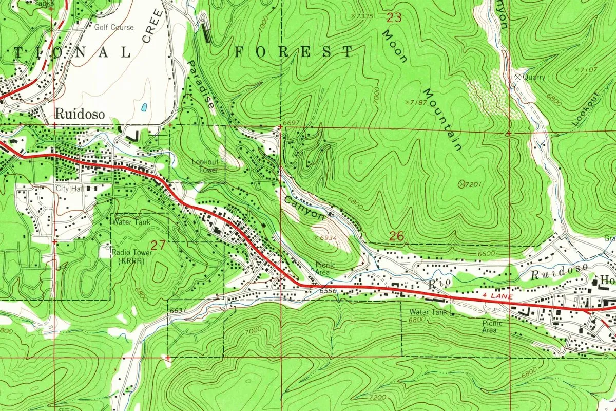
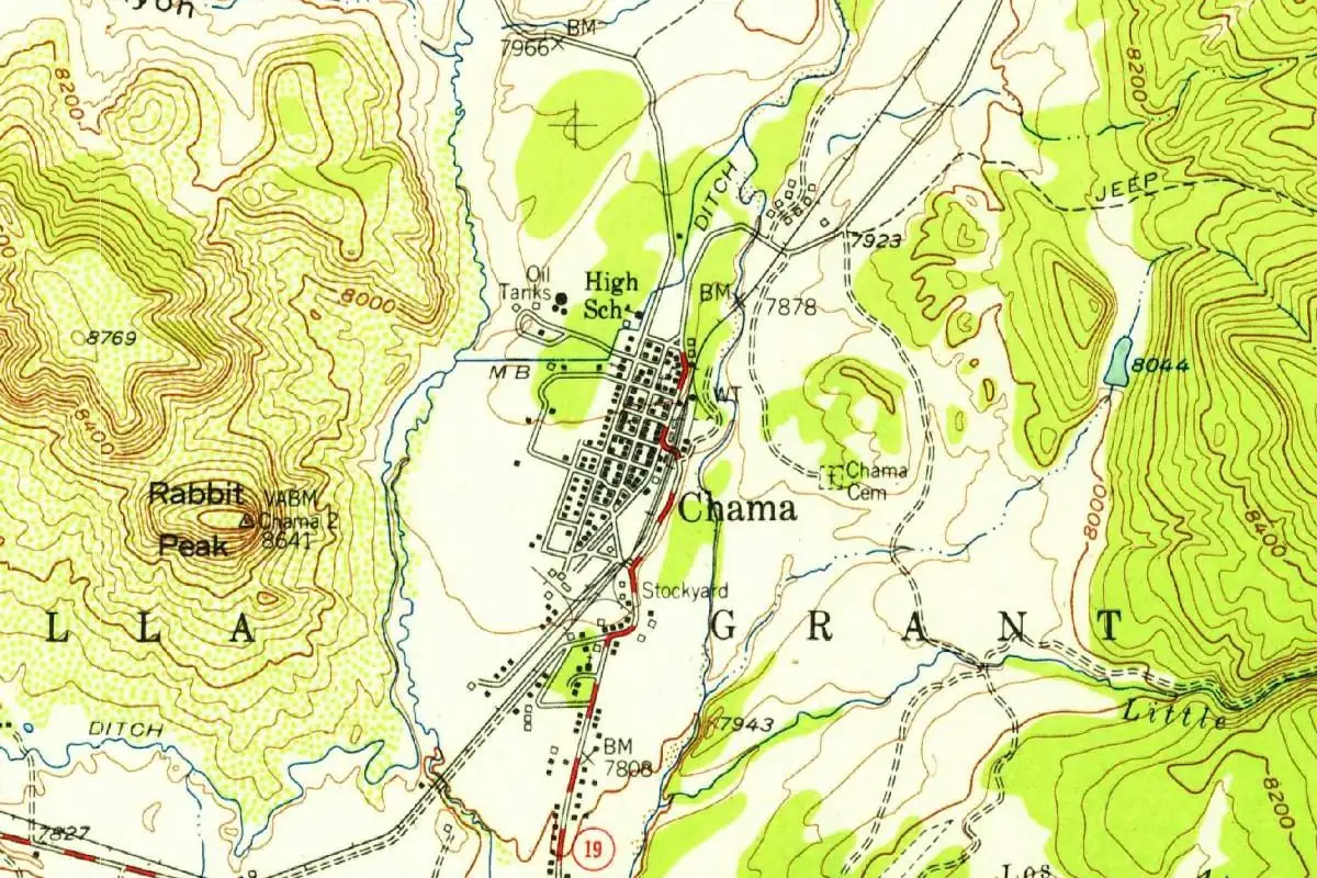
Chimayo isn’t the only Tewa name on the map of northern New Mexico. Chama is named for a river whose name Harrington traced to a former Tewa pueblo, and Taos carries a Spanish form of the Tewa name of the pueblo next door.
Other names on the map point to a stone or to healing water, too. Flint, Michigan, is named for a river whose Indigenous name historical sources read as “river of the flint.” And Eureka Springs, Arkansas, took its name from a spring that sick people camped beside in the hope of a cure.
The 1953 map
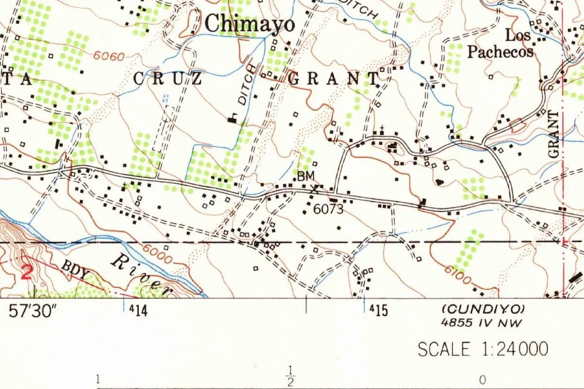
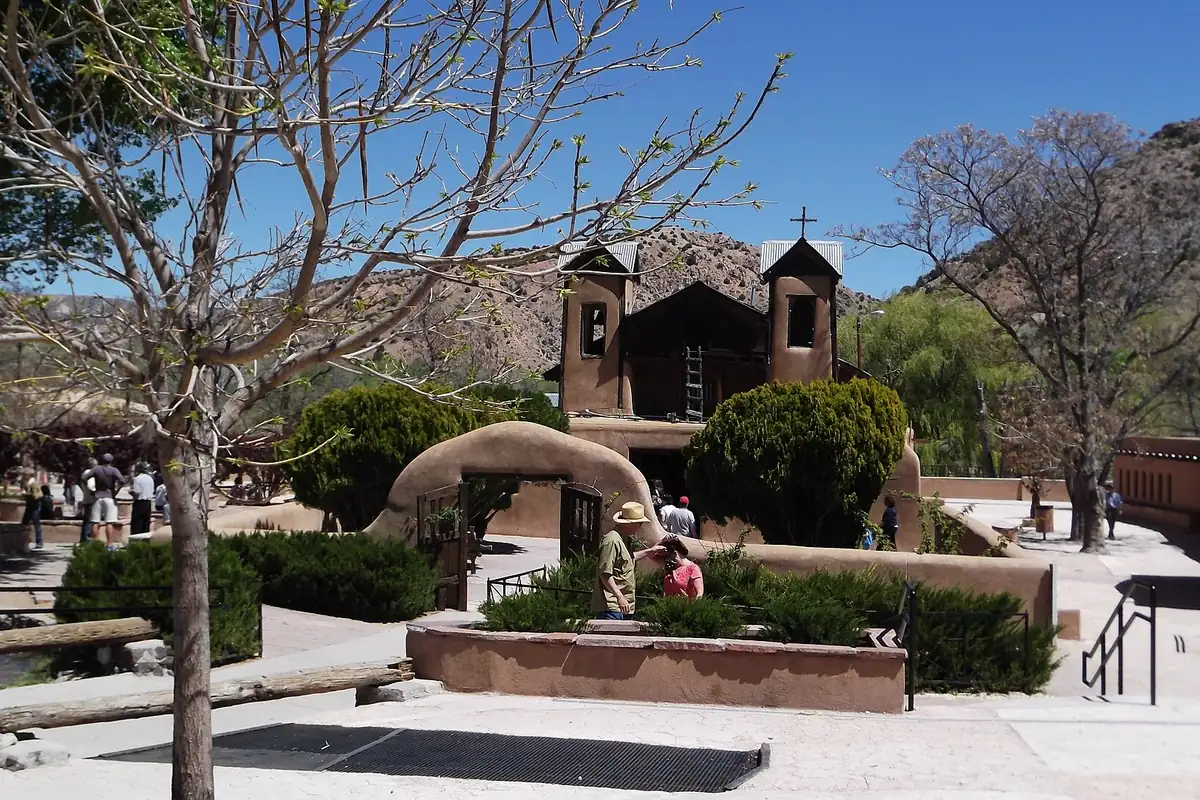
The map at the top of this page comes from the Geological Survey’s Chimayo quadrangle of 1953, at the larger scale of 1:24,000. You can see the settlement spread along its irrigation ditches, with orchards marked in green and the boundary of the Santa Cruz Grant running through. El Santuario and the hill behind it are in the photo below.
Quick answers
What does Chimayo mean?
It depends on the source. J. P. Harrington translated the Tewa name as “good obsidian” (1920) or “flaking stone of superior quality” (1916). The National Park Service says the Tewa named it after Tsi-Mayoh, one of four sacred hills above the valley.
What language is Chimayo?
Tewa. Harrington wrote in 1916 that the Spanish name Chimayo comes from the Tewa one.
Was there a pueblo at Chimayo?
Harrington’s Tewa sources told him there was, and that it stood “where the church now is.” In 1920 he wrote that the church stands on the site of “the long vanished pueblo of Tsimayó.”
Why is the Santuario de Chimayó famous?
For the earth that people believe heals. Harrington recorded in 1916 that the mud of an old pool there “has healing properties,” and the Park Service says more than 300,000 pilgrims visit each year.
Key dates
- 1730Chimayó is founded around this year, SAH Archipedia says.
- 1813A first chapel goes up at El Santuario, the National Park Service says.
- 1816The larger shrine that stands today replaces it.
- 1916J. P. Harrington publishes his study of Tewa place names, with the Tewa name of Chimayo and the story of the pueblo under the church.
- 1920Harrington translates the Tewa form as "good obsidian" in American Anthropologist.
- 2025A New Mexico Senate memorial says the Tewa named the area Tsi-Mayoh after one of four sacred hills.
Things to do in Chimayo, New Mexico
El Santuario de Chimayó
The adobe shrine, built in 1816 to replace a chapel begun in 1813, and now a National Historic Landmark run by the Archdiocese of Santa Fe. The Park Service says more than 300,000 pilgrims come each year, many on foot during Holy Week, and that the Tsi Mayoh hill is right behind it.
Chimayó Museum
A museum on the old Plaza del Cerro, run by the Chimayó Cultural Preservation Association, with artifacts, photographs and exhibits on the village's history.
Centinela Traditional Arts
The Trujillo family's weaving studio and shop, in business since 1982. The studio says Irvin Trujillo was named a National Heritage Fellow in 2007, and it offers classes in Rio Grande weaving.
Ortega's Weaving
A family weaving shop on the Plaza del Cerro that describes its work as nine generations of New Mexico weaving, with rugs, blankets, coats and vests.
Getting there
Open Chimayo in Google Maps
Opens in a new tab. The pin is the center of Chimayo in the USGS place-name record.
The closest airports, Amtrak stations and intercity bus stops, measured in a straight line from the center of Chimayo.
Airports
- Santa Fe Regional (SAF) 28 mi 45 km
- Albuquerque International Sunport (ABQ) 76 mi 123 km
Amtrak trains
- Lamy station (LMY) 36 mi 58 km
- Las Vegas station (LSV) 50 mi 80 km
Intercity buses
- Roadrunner Shuttle Amtrak Connecting Service · Santa Fe Amtrak Bus Stop 14 mi 23 km
- Limousine Express Santa Fe 25 mi 40 km
- Greyhound Cuba Main St 57 mi 91 km
Distances are as the crow flies, not by road. We don't list schedules or fares because they change; check with the airline, Amtrak or the bus company before you go. Official data (FAA commercial service airports (2025), FAA airport locations, Amtrak stations and Intercity Bus Atlas) from the FAA and the U.S. Bureau of Transportation Statistics, checked Nov 17, 2026.
Sponsored
Staying in Chimayo?
Compare hotels in Chimayo, New Mexico, on Expedia.
See hotels in ChimayoWe may earn a commission if you buy through this link. It never changes what we write. Read our affiliate disclosure
Historical Sources & References
- John Peabody Harrington, “The Ethnogeography of the Tewa Indians” (1916), pp. 341-342. The Tewa name and its translation, “has been forgotten,” the pueblo where the church is, the healing mud, Dr. Hewett’s notes and the hill north of Chimayo. Pages 341 and 342 checked against the page images.
- John P. Harrington, “Old Indian Geographical Names around Santa Fe, New Mexico” (1920), p. 346. “Good obsidian,” the blankets, and the church on “the long vanished pueblo of Tsimayó.” Checked against the page image.
- Regina N. Emmer, “Chimayó, Plaza del Cerro,” SAH Archipedia. The founding around 1730, the hill of Tsi Mayoh, the fortified plaza and the date 1816 for El Santuario.
- National Park Service, “El Santuario de Chimayo”. Tsi-Mayoh and the four sacred hills, the dates 1813 and 1816, the pilgrims and the Holy Week walks.
- New Mexico Senate Memorial 24 (2025). The Tewa name “Tsi-Mayoh” for one of four sacred hills.
- Chimayó Museum; Centinela Traditional Arts; Ortega’s Weaving. The details in the things-to-do list.
- GNIS feature 928711 (U.S. Geological Survey). Chimayo’s entry in the federal names database, in Rio Arriba County, with its coordinates.
- U.S. Geological Survey, Chimayo quadrangle (1953). The 1:24,000 map that the image at the top of this page was cropped from.
Spot something wrong, or know more? Tell us here. You can also email us or use our contact page. Corrections are noted here with their date, never made silently.