Zanesville, Ohio: Named for the Man Behind Zane's Trace
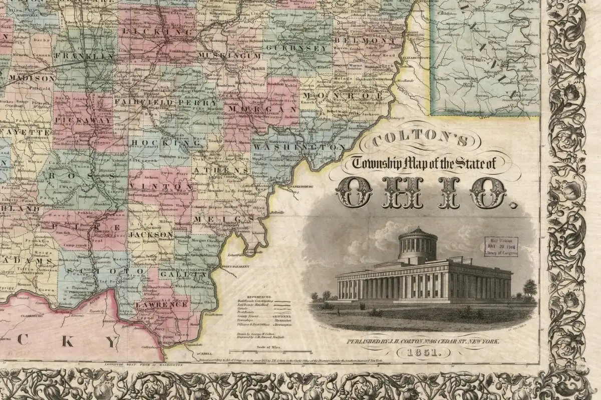
Zanesville is named for Ebenezer Zane, who opened a road from Wheeling toward Kentucky in the late 1790s and was granted land at the Muskingum crossing. His brother Jonathan and son-in-law John McIntire bought that tract. Henry Howe wrote that it was first called Westbourn; J. Hope Sutor answered in 1905 that the early name was Zanetown.
Zanesville, Ohio, is named for Ebenezer Zane, who cut a road through the Ohio woods in the 1790s and was granted land where it crossed the Muskingum. That much nobody disputes. What the place was called before it was Zanesville is another story, and one 1905 historian spent two pages taking apart the version everybody had been repeating.
A road from Wheeling
The road came first. J. Hope Sutor’s Past and Present of the City of Zanesville and Muskingum County, from 1905, says that on May 17, 1796, Congress authorized Ebenezer Zane, “of Wheeling, Virginia,” to lay out a road from his settlement to Limestone, now Maysville, Kentucky. Wheeling was in Virginia then; today it’s Wheeling, West Virginia.
The next year Zane set out with Jonathan Zane, his brother, John McIntire, his son-in-law, and a crew that included John Green and William McCulloch. Sutor says the axmen blazed trees and cleared brush along the old Indian trail, while Green handled the pack horses and McIntire, who wasn’t much good with an ax, hunted for the crew. The road only had to be passable on horseback. The City of Zanesville’s history calls it Zane’s Trace, and says Zane was to be paid with three tracts of 640 acres (259 ha) and the right to run ferries where the road crossed the big rivers. McCulloch and Henry Crooks were running ferries on the Muskingum in 1797, the city says.
Sutor fills in the paperwork. On February 14, 1800, President John Adams signed the grant of three tracts, each a mile (1.6 km) square, at the crossings of the Muskingum, the Hocking and the Scioto. Zane and Elizabeth, his wife, sold the Muskingum tract on December 19, 1800, to Jonathan Zane and John McIntire for $100. Henry Howe’s Historical Collections of Ohio (1847) tells it as a family gift: the Muskingum tract was the least valuable of the three, and Zane handed it to his brother and McIntire for helping open the road.
Westbourn or Zanetown?
Howe’s book is where the old name comes from. He wrote that in 1799 “Messrs. Zane and M’Intire laid out the town, which they called Westbourn,” and that it kept that name until the postmaster general set up a post office called Zanesville, after which “the village soon took the same name.”
Sutor wasn’t having it. That story, he wrote, had “been accepted without question” and repeated so often “that it is necessary to submit proofs of its positive inaccuracy.” His proofs:
- When the mail contract to carry letters from Marietta to the Muskingum ferry was made in 1798, the postmaster general called the stop Zanetown.
- The ferryman, William McCulloch, became postmaster on January 1, 1801, with a commission for the office “at Zanesville.”
- The plat of Springfield, across the river, was recorded on July 27, 1801, and it already marks Zanesville on the opposite bank.
- The Zanesville plat itself wasn’t filed until April 28, 1802, and it uses the name Zanesville.
- Gen. Rufus Putnam’s 1804 map shows the town as “Zane-ville.”
“The name of Westbourn does not appear in any public record nor in any private correspondence of the period,” Sutor concluded, “and Mr. Howe is therefore incorrect…” He was honest about the gap, though: “The date of the change from Zanetown to Zanesville has not been discovered,” but he thought it probably happened when McCulloch became postmaster.
Henry Gannett’s whole verdict on the city, from 1905, fits in one line: “named for Ebenezer Zane, who, with John McIntire, founded the city.” He also lists Zanesfield in Logan County, named for Col. Isaac Zane, so watch the first names.
A rival across the river
The town across the Muskingum had a name history of its own. Ohio Magazine says Dr. Increase Mathews came out from Massachusetts in 1801 at the urging of Rufus Putnam, his uncle and the settler of Marietta. The town Mathews helped found was first called Springfield and was renamed Putnam in 1814, after the uncle. It joined Zanesville in 1872. Putnam’s Marietta was known as far off as Georgia: Lucian Lamar Knight wrote in 1913 that Marietta, Georgia, was probably named for Putnam’s pioneer town, one of several explanations for that city’s name.
The two towns competed for bigger prizes, too. Sutor says the Putnam people raised money and put up a stone building of two stories in 1808, hoping it would be the state house; Visit Zanesville dates the same Stone Academy to 1809. Zanesville, where McIntire and others put up a building of their own, won anyway. Sutor says the act moving the capital passed on February 19, 1810, and that Zanesville was the capital of Ohio between October 1, 1810, and May 1, 1812. The legislature then went back to Chillicothe, and in 1816 to Columbus, a site picked while it was meeting in Zanesville.
The bridge you can cross and stay put
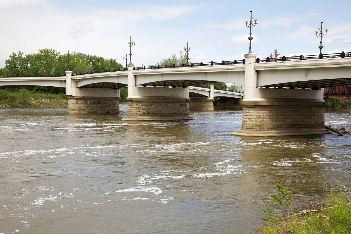
You can’t talk about Zanesville without the Y-Bridge. The city’s history says the first one was built across the mouth of the Licking where it joins the Muskingum, and the local paper reported on November 16, 1814, that it was “now passable.” Floods, ice and heavy traffic wore out one bridge after another, and the fifth was dedicated in 1984. Zanesville itself had been incorporated as a town earlier in 1814, on January 21, Sutor says. Visit Zanesville says Ripley’s Believe It or Not once called it “the only bridge in the world which you can cross and still be on the same side of the river.”
Zanesville on the 1910 map
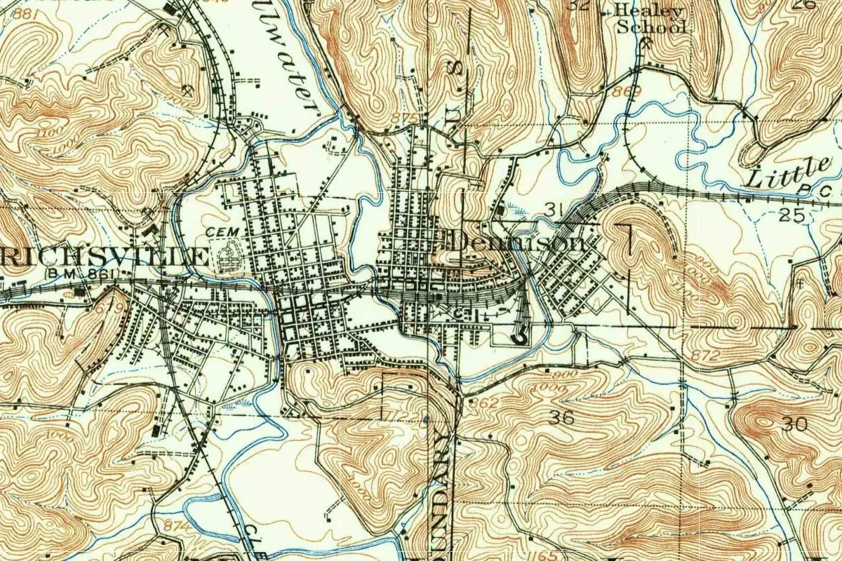
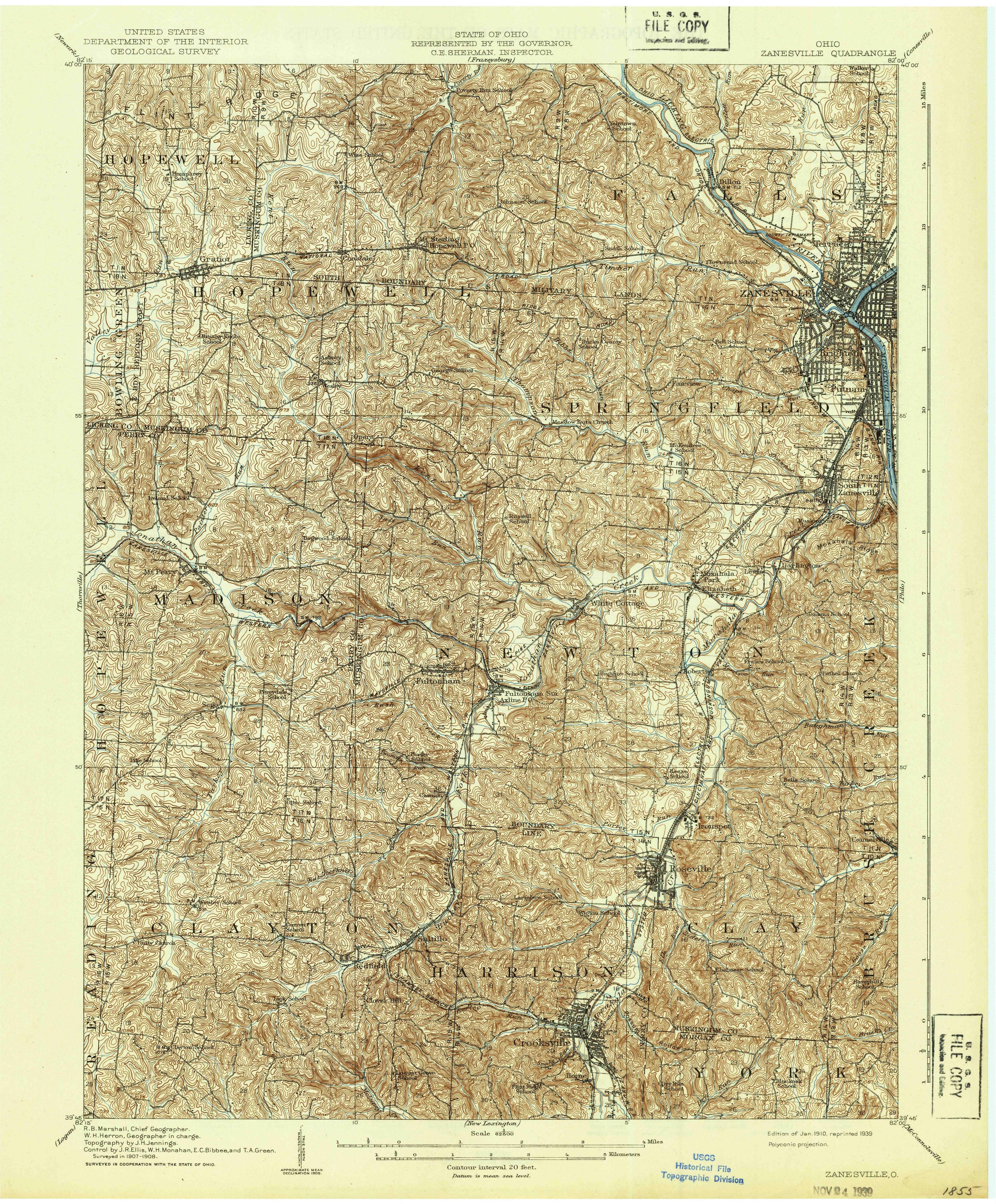
The map at the top comes from the Zanesville quadrangle, surveyed in cooperation with the State of Ohio. R. B. Marshall is chief geographer and W. H. Herron geographer in charge, with topography by J. H. Jennings and control by J. R. Ellis, W. H. Monahan, E. C. Bibbee and T. A. Green. It says “Surveyed in 1907-1908,” and the margin reads “Edition of Jan. 1910, reprinted 1939,” with a stamp of November 24, 1939. So this is a 1939 reprint of the January 1910 edition.
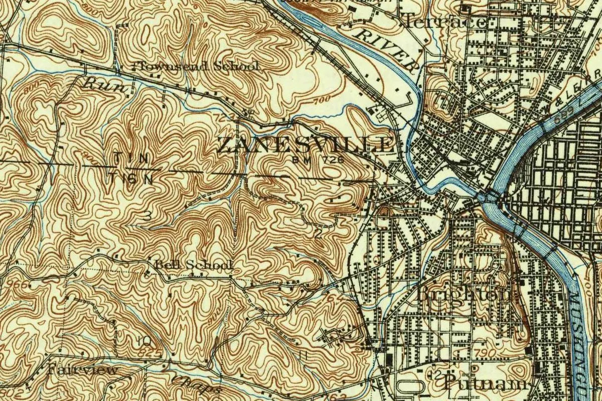
In the crop, ZANESVILLE sits at bench mark 726. Terrace is across the river from the label, and Brighton and Putnam lie to the south. The rivers meet at the Y-shaped bridge junction, and MUSKINGUM is lettered at the right edge. Townsend School, Bell School and Fairview are marked outside town, along with the railroad labeled W & L E R R.
Quick answers
Who is Zanesville, Ohio, named after?
Ebenezer Zane of Wheeling, according to Gannett. The city’s history credits Zane with the road it calls Zane’s Trace, and Gannett names John McIntire as cofounder.
What was Zanesville’s original name?
Howe (1847) said Westbourn. Sutor (1905) said that name appears in no record of the time and that the postmaster general called the place Zanetown in 1798.
Was Zanesville ever the capital of Ohio?
Yes. Sutor says the capital sat there from October 1, 1810, until May 1, 1812.
Why is the Y-Bridge famous?
Because it forks in the middle. Visit Zanesville quotes Ripley’s: it’s the bridge “you can cross and still be on the same side of the river.”
Key dates
- 1796On May 17 Congress authorizes Ebenezer Zane of Wheeling to mark out a road to Limestone, Kentucky.
- 1797Zane's party cuts the road; Henry Crooks and William McCulloch run ferries on the Muskingum.
- 1798The postmaster general calls the mail stop at the Muskingum ferry Zanetown, Sutor says.
- 1800Zane's land at the crossing is granted in February and sold in December to Jonathan Zane and John McIntire for $100.
- 1801McCulloch becomes postmaster on January 1; on July 27 the plat of Springfield, later Putnam, across the river, is recorded.
- 1802The plat of Zanesville is filed for record on April 28.
- 1810Zanesville becomes Ohio's capital on October 1 and holds the post until May 1, 1812.
- 1814The first Y bridge opens; Zanesville is incorporated as a town, and Springfield is renamed Putnam.
- 1872Putnam is merged into Zanesville, Ohio Magazine says.
- 1910The Geological Survey and the State of Ohio issue the Zanesville quadrangle; this copy is a 1939 reprint.
Things to do in Zanesville, Ohio
Y-Bridge
The Y-shaped bridge over the meeting of the Licking and Muskingum rivers, now on its fifth bridge since the first one opened in 1814. Ripley's Believe It or Not called it the one bridge in the world that leaves you on the bank where you began.
Stone Academy
A stone building in the Putnam Historic District put up as Putnam's bid to be the state capital, later a center of antislavery meetings and a stop on the Underground Railroad, now a museum of Muskingum County history.
Dr. Increase Mathews House
The one-story sandstone house that one of Putnam's founders built in 1805, widely thought to be the county's oldest house, now a history museum with exhibits on Zane Grey, Morgan's Raid and the city's manufacturing past.
Zanesville Museum of Art
An art museum that grew out of a 1933 cultural survey commissioned by Edward M. and Klara K. Ayers, with ties to the region's history as a center of art pottery and ceramics.
Getting there
Open Zanesville in Google Maps
Opens in a new tab. The pin is the center of Zanesville in the USGS place-name record.
The closest airports, Amtrak stations and intercity bus stops, measured in a straight line from the center of Zanesville.
Airports
- John Glenn Columbus International (CMH) 47 mi 75 km
- Rickenbacker International (LCK) Columbus 49 mi 79 km
Amtrak trains
- Alliance station (ALC) 83 mi 134 km
- South Shore-South Portsmouth station (SPM) 98 mi 158 km
Intercity buses
- GoBus Zanesville under 1 mi 1 km
- Greyhound Cambridge Marathon 23 mi 38 km
- Barons Bus Lines Cambridge 24 mi 38 km
Distances are as the crow flies, not by road. We don't list schedules or fares because they change; check with the airline, Amtrak or the bus company before you go. Official data (FAA commercial service airports (2025), FAA airport locations, Amtrak stations and Intercity Bus Atlas) from the FAA and the U.S. Bureau of Transportation Statistics, checked Nov 18, 2026.
Sponsored
Staying in Zanesville?
Compare hotels in Zanesville, Ohio, on Expedia.
See hotels in ZanesvilleWe may earn a commission if you buy through this link. It never changes what we write. Read our affiliate disclosure
Historical Sources & References
- Henry Gannett, The Origin of Certain Place Names in the United States (1905), p. 333. “Named for Ebenezer Zane, who, with John McIntire, founded the city”; Zanesfield for Col. Isaac Zane. Checked against the page image.
- Henry Howe, Historical Collections of Ohio (1847), pp. 384-385. The Muskingum tract given to Jonathan Zane and McIntire, the ferries and “Westbourn.” Checked against the page image.
- J. Hope Sutor, Past and Present of the City of Zanesville and Muskingum County (1905). The act of 1796 and the road party (pp. 77-78), the grant of 1800 and the sale to Jonathan Zane and McIntire, the case against Westbourn, Zanetown and the plats (pp. 86-87), and the capital years (pp. 34-35). Checked against the page images.
- City of Zanesville, “History”. Zane’s Trace, the three tracts and the ferries, Crooks and McCulloch in 1797, the first Y bridge of 1814 and the fifth of 1984.
- Ohio Magazine, Dr. Increase Mathews House. Mathews and Rufus Putnam, Springfield renamed Putnam in 1814, and the merger of 1872.
- Visit Zanesville, Y Bridge and Stone Academy; Zanesville Museum of Art. Ripley’s, the Stone Academy of 1809 and the details in the things-to-do list.
- U.S. Geological Survey, GNIS feature 1071002. Zanesville in Muskingum County.
- Zanesville quadrangle, surveyed 1907-08, edition of January 1910, reprinted 1939. The sheet the map at the top was cropped from.
Sponsored
Put this 1910 map on your wall
The Geological Survey's 1910 Zanesville sheet, surveyed in 1907-08 with the State of Ohio and reprinted in 1939, is in the public domain. Download the full-size scan for free, then have it printed on canvas with CanvasOnTheCheap.
Print a map on canvasDownload the full-size mapWe may earn a commission if you buy through this link. It never changes what we write. Read our affiliate disclosure
Spot something wrong, or know more? Tell us here. You can also email us or use our contact page. Corrections are noted here with their date, never made silently.