Hinton, West Virginia: The Hintons' Name on Ballengee Land
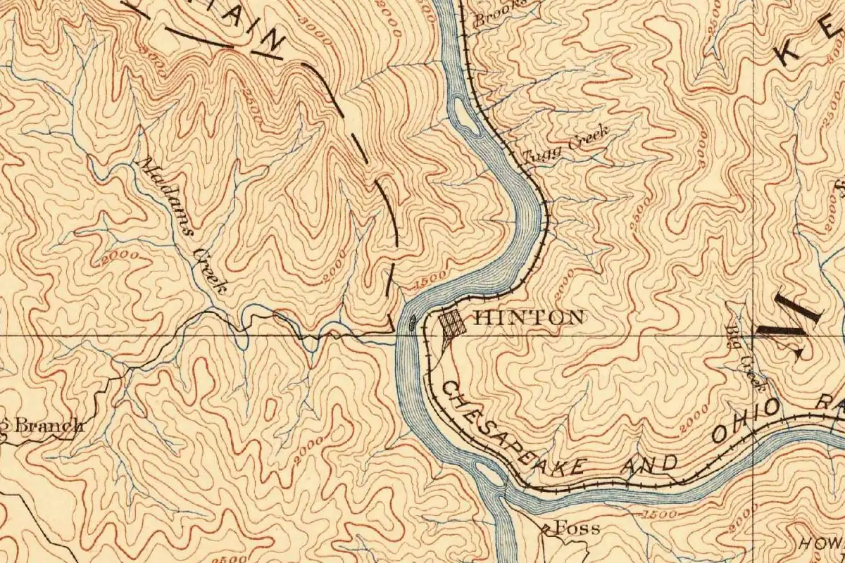
Hinton, West Virginia, kept the name of John “Jack” Hinton’s family, even though the railroad built the town on land it bought from the Ballengees. His wife got a name on the map too: the tract they lived on became Avis.
Two families at the mouth of the Greenbrier
Before the railroad, this was farm and timber country where the Greenbrier River runs into the New. The National Park Service says the Ballengee family got there first, before 1778, and owned all the land that would later become Hinton. John Hinton came in 1835 and settled on a 175-acre tract he’d bought from Henry and Rachel Ballengee. His second wife was Avis, and that tract is “now known as Avis, after his second wife.”
James H. Miller, writing about Summers County in 1908, calls him Captain Jack Hinton and “the first settler in the county.” People crossed the river at Hinton’s Ferry. So when the railroad capitalist Collis P. Huntington toured the line for the Chesapeake and Ohio, the family name was already on the crossing.
Bought by Huntington
Miller is clear about whose ground the town stands on. He writes that Huntington, around the time he was securing the right-of-way, “purchased … the land on which Hinton is built” from the administrator of Isaac Ballengee’s estate, in the railroad’s name, and later moved it into his Central Land Company. “He did the same at Huntington,” Miller adds, meaning the city that carries his own name.
Stephen D. Trail’s e-WV entry also puts the town on Ballengee land, though it names a different seller: it says the C&O bought the site in 1871 from a son of the first Ballengee settler. The town was laid out in 1874 and lots were sold. By 1892 the railroad’s roundhouse and car shop there employed 540 men.
Whose land was it?
Here the sources split. Hinton, Henry Gannett wrote in 1905, was “named for the former owner of the town site.” The West Virginia Blue Book says the city was “named for John (Jack) Hinton, prominent lawyer of Summers County and husband of Avis Gwinn Hinton, pioneer, who owned the land upon which the city is now located.” The 1941 state guide goes further and says John Hinton settled and laid out the town in 1831.
Miller and the encyclopedia, though, put the railroad’s town on Ballengee land, and the Park Service puts the Hintons on the Avis tract next door. You’ll also see two different portraits of the man: a pioneer captain in Miller, a lawyer in the Blue Book. The sources that name anyone agree on the Hinton family, and that’s the part that matters for the name. On the land itself, Miller is the one to trust: he wrote from Summers County in 1908 and names the man who sold it, Rufus Pack, administrator of Isaac Ballengee’s estate. If you’re wondering why the town wasn’t called Ballengee instead, none of them says.
Quick answers
Who was Hinton, West Virginia, named after?
John “Jack” Hinton, the West Virginia Blue Book says. The Park Service and Miller (1908) describe him as an early settler at the mouth of the Greenbrier, and Gannett (1905) says the town took the name of the former owner of its site.
What is Avis in Hinton?
It’s the tract where John and Avis Hinton lived. The Park Service says it’s “now known as Avis, after his second wife,” and Miller printed her picture with the caption “for whom Avis was named.”
Did the railroad build Hinton?
Yes, on land it bought. Miller says Collis P. Huntington bought the site from the Ballengee estate for the Chesapeake and Ohio, and e-WV says the town was laid out in 1874.
Key dates
- 1835John Hinton moves his family to a 175-acre tract at the mouth of the Greenbrier, bought from Henry and Rachel Ballengee.
- 1871The Chesapeake and Ohio buys the future town site from a son of Isaac Ballengee.
- 1874Hinton is laid out and lots go on sale.
- 1892The C&O's roundhouse and car shop at Hinton employ 540 men.
Getting there
Open Hinton in Google Maps
Opens in a new tab. The pin is the center of Hinton in the USGS place-name record.
The closest airports, Amtrak stations and intercity bus stops, measured in a straight line from the center of Hinton.
Airports
- Roanoke/Blacksburg Regional (Woodrum Field) (ROA) 56 mi 89 km
- West Virginia International Yeager (CRW) Charleston 62 mi 99 km
Amtrak trains
- Hinton station (HIN) under 1 mi 0.3 km
- Alderson station (ALD) 14 mi 22 km
Intercity buses
- Greyhound Beckley Intermodal Parking Garage 18 mi 29 km
- Barons Bus Lines Beckley 21 mi 34 km
- Virginia Breeze, Operated by Dillon's Virginia Breeze · Blacksburg (Transit Center) 40 mi 64 km
Distances are as the crow flies, not by road. We don't list schedules or fares because they change; check with the airline, Amtrak or the bus company before you go. Official data (FAA commercial service airports (2025), FAA airport locations, Amtrak stations and Intercity Bus Atlas) from the FAA and the U.S. Bureau of Transportation Statistics, checked Nov 6, 2026.
Sponsored
Staying in Hinton?
Compare hotels in Hinton, West Virginia, on Expedia.
See hotels in HintonWe may earn a commission if you buy through this link. It never changes what we write. Read our affiliate disclosure
Historical Sources & References
- Henry Gannett, The Origin of Certain Place Names in the United States (1905), p. 157. “Named for the former owner of the town site.”
- James H. Miller, History of Summers County (1908). Huntington’s purchase of “the land on which Hinton is built” from the administrator of Isaac Ballengee’s estate, and “He did the same at Huntington” (p. 127); Captain John Hinton, “the first settler in the county” (pp. 603-604); Avis Hinton, second wife of “Captain Jack Hinton,” and her picture captioned “for whom Avis was named” (pp. 663-664).
- Federal Writers’ Project, West Virginia: A Guide to the Mountain State (1941), pp. 457-458. “Settled and laid out by John Hinton in 1831,” the C&O division terminal from 1871, and incorporation in 1880.
- National Park Service, “Hinton, WV”. The Ballengees, there before 1778; John Hinton (1788-1858) and his move in 1835 to the 175-acre tract “now known as Avis, after his second wife”; Hinton’s Ferry.
- West Virginia Blue Book 2012, Municipal Register, p. 706. “Named for John (Jack) Hinton, prominent lawyer of Summers County and husband of Avis Gwinn Hinton.”
- Stephen D. Trail, “Hinton,” e-WV: The West Virginia Encyclopedia. The C&O’s purchase in 1871 from a son of Isaac Ballengee, the town laid out in 1874, and the roundhouse and car shop with 540 men by 1892.
- GNIS feature 1551458 (U.S. Geological Survey). The government’s name index lists Hinton in Summers County, with its map point.
Spot something wrong, or know more? Tell us here. You can also email us or use our contact page. Corrections are noted here with their date, never made silently.