Spooner, Wisconsin: Named for the Railroad's Lawyer
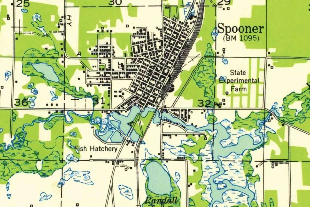
Spooner, Wisconsin, is named for John C. Spooner, but in 1883 he wasn’t a senator yet: he was the lawyer for the railroad that built the town. His seat in the Senate came two years later.
First there was Chandler
The tracks reached this part of northwest Wisconsin in 1879. The state Department of Natural Resources, in a history note on the local watershed, says the railhead that year “became a little town called Chandler.” Then, in 1882 and 1883, “the railroad and Chandler’s population were moved south a couple of miles,” about 2 miles (3 km), “to become the settlement of Spooner.”
Chandler had a senator’s name already. William H. Stennett’s 1908 book on the place names of the Chicago & North Western and the Omaha Road says it was named for Zachariah Chandler, a U.S. senator from Michigan “who owned land in this vicinity.”
“The attorney of the road”
The new town needed its own name, and the railroad picked its lawyer’s. The Friends of the Spooner Railroad Park quote a local newspaper of July 27, 1883: “The new town at the Division has been named Spooner, after Col. John C. Spooner, the attorney of the road.” We haven’t seen that newspaper page, so you’re getting the wording as the park gives it.
Stennett agrees on the man and adds who chose him. The place “was started in 1883 and was named for United States Senator John C. Spooner, of Wisconsin, by E. W. Winter, the then general manager of the railroad that runs through the place.” Stennett was writing in 1908, after Spooner’s years in the Senate, so that’s the title he used.
Why the railroad liked him
Spooner had earned it. The Wisconsin court system’s short biography says he moved to Hudson in 1870 and quickly became general counsel for the Western Wisconsin Railroad, the leading line in that corner of the state. In 1874 he won a U.S. Supreme Court case that mattered to railroads everywhere, about land grants that Congress had promised them.
The DNR note puts it in local terms: Spooner “made possible the mergers” that formed the Chicago, St. Paul, Minneapolis and Omaha, and his work helped the company secure the land grants it needed to keep building through northwest Wisconsin. Only in 1885 was he elected to the U.S. Senate. So when you see Spooner on a map, you’re looking at a thank-you note from a railroad to its lawyer.
Quick answers
Where does the name Spooner, Wisconsin, come from?
From John Coit Spooner, the railroad’s attorney. He later served as a U.S. senator from Wisconsin, starting in 1885.
Was Spooner named for a senator?
Not yet. An 1883 newspaper, as the Spooner Railroad Park quotes it, called him “the attorney of the road.” Stennett’s 1908 book calls him Senator Spooner because by then he was one.
What was the town before Spooner?
The railhead was at Chandler, named for Michigan senator Zachariah Chandler. The DNR says the railroad and Chandler’s people moved about 2 miles (3 km) south in 1882 and 1883 to start Spooner.
Key dates
- 1870John C. Spooner moves to Hudson and becomes general counsel for the Western Wisconsin Railroad.
- 1879The tracks reach the area, and the railhead becomes a little town called Chandler.
- 1883The railroad's new division town is named Spooner.
- 1885Spooner is elected to the U.S. Senate.
Getting there
Open Spooner in Google Maps
Opens in a new tab. The pin is the center of Spooner in the USGS place-name record.
The closest airports, Amtrak stations and intercity bus stops, measured in a straight line from the center of Spooner.
Airports
- Chippewa Valley Regional (EAU) Eau Claire 69 mi 111 km
- Duluth International (DLH) 72 mi 116 km
- Minneapolis-St Paul International/Wold-Chamberlain (MSP) 92 mi 148 km
Amtrak trains
- St. Paul-Minneapolis station (MSP) 84 mi 135 km
- Red Wing station (RDW) 92 mi 149 km
Intercity buses
- Jefferson Lines Hinckley 52 mi 83 km
- Indian Trails Brule 53 mi 85 km
Distances are as the crow flies, not by road. We don't list schedules or fares because they change; check with the airline, Amtrak or the bus company before you go. Official data (FAA commercial service airports (2025), FAA airport locations, Amtrak stations and Intercity Bus Atlas) from the FAA and the U.S. Bureau of Transportation Statistics, checked Nov 6, 2026.
Sponsored
Staying in Spooner?
Compare hotels in Spooner, Wisconsin, on Expedia.
See hotels in SpoonerWe may earn a commission if you buy through this link. It never changes what we write. Read our affiliate disclosure
Historical Sources & References
- William H. Stennett, A History of the Origin of the Place Names Connected with the Chicago & North Western and Chicago, St. Paul, Minneapolis & Omaha Railways (1908), entries “Chandler” and “Spooner”. Chandler, “named for Hon. Zachariah Chandler, United States Senator from Michigan, who owned land in this vicinity”; Spooner, “started in 1883” and named for John C. Spooner “by E. W. Winter, the then general manager of the railroad.”
- Friends of the Spooner Railroad Park, “Spooner’s Rail History”. The newspaper item of July 27, 1883, naming the town “after Col. John C. Spooner, the attorney of the road,” and the depots, shops and roundhouse that followed. We read the park’s quotation, not the newspaper.
- Wisconsin Department of Natural Resources, “Watershed History Note” (2011). The tracks in 1879, the railhead town of Chandler, the move “south a couple of miles” in 1882-1883, and Spooner’s role in the Omaha mergers and land grants.
- Wisconsin Court System, “Great Wisconsin Lawyers: John Coit Spooner”. His move to Hudson in 1870, his work as general counsel for the Western Wisconsin Railroad, the 1874 Supreme Court case on land grants, and his election to the Senate in 1885.
- GNIS feature 1574568 (U.S. Geological Survey). Spooner’s listing in the national names database, in Washburn County.
Spot something wrong, or know more? Tell us here. You can also email us or use our contact page. Corrections are noted here with their date, never made silently.