Evansville, Indiana: McGary's Town, General Evans's Name
Evansville is named for General Robert M. Evans. Hugh McGary bought the riverfront land in 1812, but the town took Evans's name. One account says McGary chose it in 1814 to win the general's support; Joseph Elliott's 1897 history says it came with the bigger town Evans helped lay out in 1816-1817.
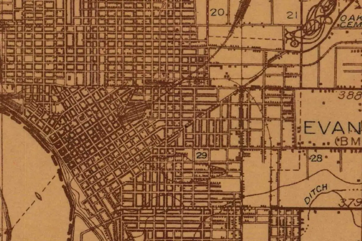
McGary’s land, Evans’s name
Hugh McGary bought the Ohio River land and fought to build a town on it, yet Evansville, Indiana, carries the name of his friend, General Robert M. Evans. The old county histories agree on the general. Where they part ways is on when, and why, his name went up.
It’s a good example of how a founder doesn’t always get the town. McGary did the hard part early. Evans showed up with the name that stuck.
A ferry, a county seat and 100 acres
McGary came over from Kentucky. On March 27, 1812, he bought much of the land the city now covers from the federal government, according to an account that Frank M. Gilbert reprinted in his 1910 History of the City of Evansville and Vanderburg County. Gilbert didn’t name the writer; he called it “a recently published account” of McGary’s life. That writer said McGary wasn’t the first white settler on the spot, but the ones before him had been driven back across the Ohio.
At first McGary just ran a ferry across the river, “known for miles about as McGary’s ferry.” In 1813 the territorial legislature created Warrick County, a huge stretch of southern Indiana that took in his land. McGary’s site was far from the middle of it, so he made the county commissioners an offer: 100 acres, donated to the county, if they’d put the county seat there. It worked. On June 14, 1814, the county court ordered the new seat laid off into lots.
The 1814 version: a name to win a friend
Here’s where the name comes in, in the first version. The account in Gilbert’s book says:
“The embryonic city was named in honor of General Robert M. Evans, a distinguished soldier and citizen of Gibson county, who had up to this time, in no way identified himself with the place.”
The writer’s explanation is plain politics. Evans and McGary had been “friends and neighbors,” and McGary “doubtless took this means of enlisting his support and interest in the welfare of the town.” In other words, you name the town after the man whose backing you want.
It didn’t save the county seat. A few months later the legislature carved Posey County out of the west end of Warrick, which left Evansville stuck at one end of the county. The seat moved to a new town called Darlington, about 13 miles (21 km) east. The same law let people who’d bought lots in Evansville cancel their deeds and get their money back. “By this act the town was practically legislated out of existence,” the account says.
The 1817 version: the general lays it out
Joseph P. Elliott tells it differently in his 1897 History of Evansville and Vanderburgh County. Elliott built his book around the reminiscences of the pioneers.
In his telling, nothing much happened after Darlington got the seat until 1816 and 1817. Then General Evans, “who was then a resident of New Harmony,” and James W. Jones, who owned the part of the site north of what’s now Main Street, proposed to McGary that the three of them re-plat the town “on a grand scale.” McGary had sold off some parcels in the meantime, which caused trouble, so Evans ran another survey. “It seems that the survey took precedence,” Elliott writes, “and the town was named Evansville in his honor.”
Elliott adds that Evans had plats of the bigger town printed and sent around the Wabash country, to Vincennes and New Harmony, and settlers started heading for Evansville.
One general, two dates
So which is it, 1814 or 1817? You’ll find both in print, and we couldn’t open an original plat or court record to settle it. The two accounts don’t fight over the man, though. Both say Robert M. Evans.
Henry Gannett, who compiled the U.S. Geological Survey’s 1905 book on the origins of American place names, kept it to one line on page 122: Evansville was “named for Gen. Robert Evans, who laid it out.” That fits Elliott’s survey story best, but it’s short enough to fit either.
There’s a small mismatch on where Evans lived, too. Gilbert’s account calls him a citizen of Gibson County; Elliott puts him in New Harmony, over in Posey County, by 1816. Neither one changes the answer.
A new county, named for a judge
The town got its county seat back the long way around. In 1818 the legislature split Warrick County again and formed a new county from its western part, approved January 7, 1818. Elliott says it was named for Judge Henry Vanderburgh, a territorial judge of Indiana. This time Evans and McGary moved fast: they offered the state’s commissioners 100 lots and $500 in cash, and the commissioners fixed the permanent seat of justice at Evansville. That’s why you’ll see “Vanderburgh County” on the map today, and why Gilbert’s title spells it the older way, “Vanderburg.”
The old map at the top of this page shows what grew from all that surveying. The oldest blocks run at an angle along the bend of the Ohio, and the later streets to the east square up to the compass. It’s one city with two street grids, a bit like a town with a founder’s story and a general’s name.
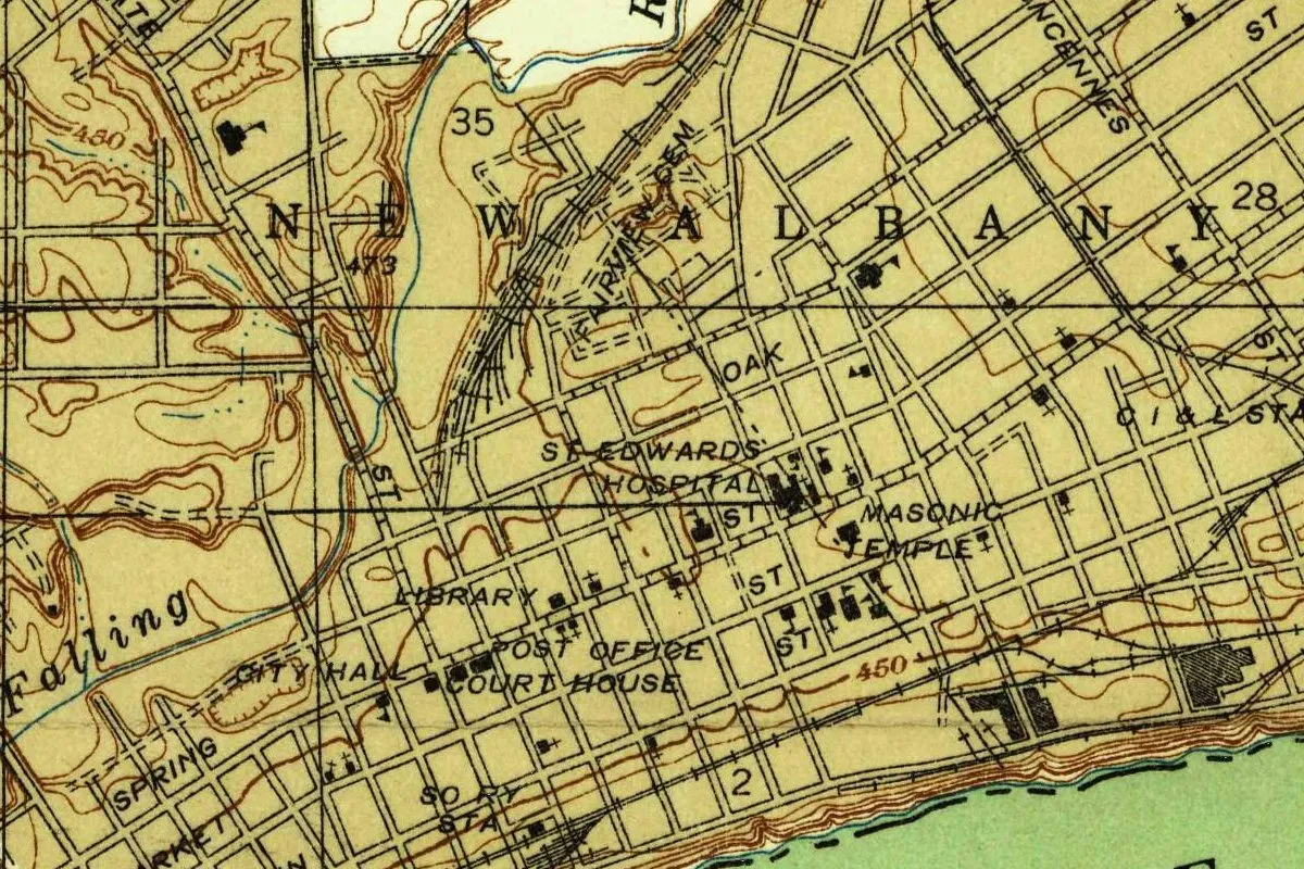
Up the Ohio, the founders of New Albany went the other way and named their 1813 town for a city back home in New York. More Hoosier name stories are on our Indiana page.
Quick answers
Who is Evansville, Indiana, named after?
General Robert M. Evans. The 1897 and 1910 county histories and Henry Gannett’s 1905 roster of name origins for the U.S. Geological Survey all name him.
Who founded Evansville?
Hugh McGary is the founder in both county histories. He bought the land in 1812, ran a ferry and got the first county seat placed there in 1814. Evans and James W. Jones joined him to re-plat the town around 1816 and 1817, according to Elliott.
When did Evansville get its name?
The sources differ. The account Gilbert reprinted puts the name at the 1814 county seat, chosen by McGary to win Evans’s support; Elliott connects it to the survey Evans made around 1816-1817.
Where does the name Vanderburgh County come from?
From Judge Henry Vanderburgh, a territorial judge of Indiana. The county was formed out of Warrick County in 1818, Elliott writes.
Key dates
- 1812Hugh McGary buys much of the future city's land from the federal government on March 27.
- 1813The legislature creates Warrick County, which then takes in the site.
- 1814The county court orders the new county seat laid off into lots on June 14; within months the seat is moved to Darlington.
- 1816Around 1816 and 1817, General Robert M. Evans and James W. Jones join McGary to re-plat a bigger town, Elliott writes.
- 1818Vanderburgh County is formed out of Warrick County, approved January 7, and named for Judge Henry Vanderburgh.
Things to do in Evansville, Indiana
USS LST-325
A World War II tank landing ship docked on the Evansville riverfront, billed as the only operational LST in its wartime configuration afloat in U.S. waters. Guided tours take you through the ship, a reminder of the big part the city played in wartime production.
Angel Mounds State Historic Site
A Mississippian town on the Ohio River, settled around A.D. 1100 and left by 1450, with 11 earthen mounds across 600 acres and an interpretive center. The name comes from a 20th-century farmer, not the city's builders.
Evansville Museum of Arts, History & Science
The city's museum on the riverfront, with a permanent collection of more than 30,000 objects, from fine and decorative art to historic documents, photographs and anthropology, plus the Koch Immersive Theater and Planetarium.
Willard Library
A library that calls itself the oldest public library in Indiana, known for its special collections. Its Regional and Family History Center upstairs is the place to dig into Evansville's past.
Getting there
Open Evansville in Google Maps
Opens in a new tab. The pin is the center of Evansville in the USGS place-name record.
The closest airports, Amtrak stations and intercity bus stops, measured in a straight line from the center of Evansville.
Airports
- Evansville Regional (EVV) 5 mi 8 km
- Veterans Airport of Southern Illinois (MWA) Marion 81 mi 130 km
- Nashville International (BNA) 137 mi 220 km
Amtrak trains
- Du Quoin station (DQN) 92 mi 148 km
- Carbondale station (CDL) 92 mi 148 km
Intercity buses
- Greyhound Evansville IN (EVN) under 1 mi 1 km
- Miller Transportation Evansville under 1 mi 1 km
Distances are as the crow flies, not by road. We don't list schedules or fares because they change; check with the airline, Amtrak or the bus company before you go. Official data (FAA commercial service airports (2025), FAA airport locations, Amtrak stations and Intercity Bus Atlas) from the FAA and the U.S. Bureau of Transportation Statistics, checked Nov 14, 2026.
Sponsored
Staying in Evansville?
Compare hotels in Evansville, Indiana, on Expedia.
See hotels in EvansvilleWe may earn a commission if you buy through this link. It never changes what we write. Read our affiliate disclosure
Historical Sources & References
- Henry Gannett, The Origin of Certain Place Names in the United States (1905), p. 122. “Evansville; city in Vanderburg County, Indiana, named for Gen. Robert Evans, who laid it out.”
- Joseph P. Elliott, A History of Evansville and Vanderburgh County, Indiana (1897), pp. 60-61. Warrick County in 1813; the 1814 split and the seat at “Darlington”; Evans, “then a resident of New Harmony,” and James W. Jones proposing in 1816-1817 to re-plat the town; Evans’s survey and “the town was named Evansville in his honor”; the printed plats; Vanderburgh County, approved January 7, 1818, named for Judge Henry Vanderburgh; the offer of 100 lots and $500 that brought the county seat to Evansville.
- Frank M. Gilbert, History of the City of Evansville and Vanderburg County, vol. 1 (1910), pp. 59-60. A “recently published account” of McGary: the land purchase of March 27, 1812, McGary’s ferry, the 100-acre donation, the June 14, 1814, order to lay out lots, the name “in honor of General Robert M. Evans, a distinguished soldier and citizen of Gibson county,” the move of the seat to Darlington, 13 miles east, and the law that let lot buyers cancel their deeds.
- GNIS feature 434258 (U.S. Geological Survey). Evansville’s entry in the national names database, a populated place in Vanderburgh County, with the coordinates used for the map.
- U.S. Geological Survey, Henderson sheet (1914). The 1:48,000 quadrangle, named for Henderson, Kentucky, across the river, that the map at the top of this page was cropped from.
Spot something wrong, or know more? Tell us here. You can also email us or use our contact page. Corrections are noted here with their date, never made silently.