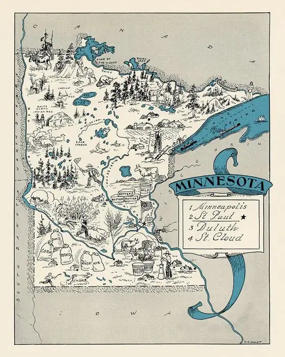
Grand Marais, Minnesota: The Great Marsh Behind the Harbor
Grand Marais is French for "a great marsh," Warren Upham wrote in 1920. The name came "in the early fur-trading times" from a marsh of twenty acres (8 ha) or less, nearly at the level of Lake Superior, at the head of the little bay and harbor where the village grew.
Grand Marais, Minnesota, is French for “great marsh,” yet the marsh at the head of its harbor covered 20 acres (8 ha) or less. The name is older than the town. It came from the fur trade, and Warren Upham went to Grand Marais in person to ask about it.
The marsh Upham came to ask about
Upham, compiling Minnesota Geographic Names for the state historical society, gathered Cook County’s name stories “during my visit in August, 1916, at Grand Marais, the county seat,” he wrote, from the county auditor, Thomas I. Carter, and a handful of other officials and residents.
His entry is specific about the marsh. “Grand Marais township received this French name, meaning a great marsh, in the early fur-trading times, referring to a marsh, twenty acres or less in area, nearly at the level of Lake Superior, situated at the head of the little bay and harbor which led to the settlement of the village there.”
So the “great” marsh was about 8 hectares at most. Upham does give it a smaller neighbor: elsewhere on the shore, he says, Little Marais “was named by the early French voyageurs for its little marsh, in contrast with the larger marsh of Grand Marais, in Cook county.”
Two bays and an Ojibwe name
Upham also describes the shape of the place. “Another small bay on the east, less protected from storms is separated from the harbor by a slight projecting point and a short beach.” The Ojibwe name for the bay, he says, quoting Gilfillan, comes from those two bays: it means “the great duplicate water; a parallel or double body of water like a bayou.”
The same book traces one more local name to the town’s first settlers. Devil Track Lake and its river, north of town, carry a translation that Upham says “dates from the settlement of Grand Marais by Henry Mayhew and others in 1871.” Gilfillan’s version of the Ojibwe name meant the spirits’ “walking-place-on-the-ice,” and Upham adds that it was “without the supremely evil idea that is given in the white men’s translation.”
Grand Marais isn’t the only French name that describes the land. You’ll find the same habit at Terre Haute, Indiana, the “high land” on the Wabash; at The Dalles, Oregon, named for the boatmen’s word for the Columbia’s rapids; and at Boise, Idaho, named for a wooded river.
Fur traders, then a harbor town
Traders were here before the settlers. Upham notes that John Godfrey, of Detroit, “had a trading post at Grand Marais during several years, up to 1858.” The settlement Upham dates to 1871 came after that.
By 1938, the WPA’s Minnesota: A State Guide found Grand Marais, the seat of Cook County, “the center of a large summer-tourist traffic.” The writers singled out the harbor: “This village has an excellent natural harbor, often filled with acres of floating logs to be converted into wood pulp; commercial fishing is the predominant industry.” The village still had a fur-trading post, they added.
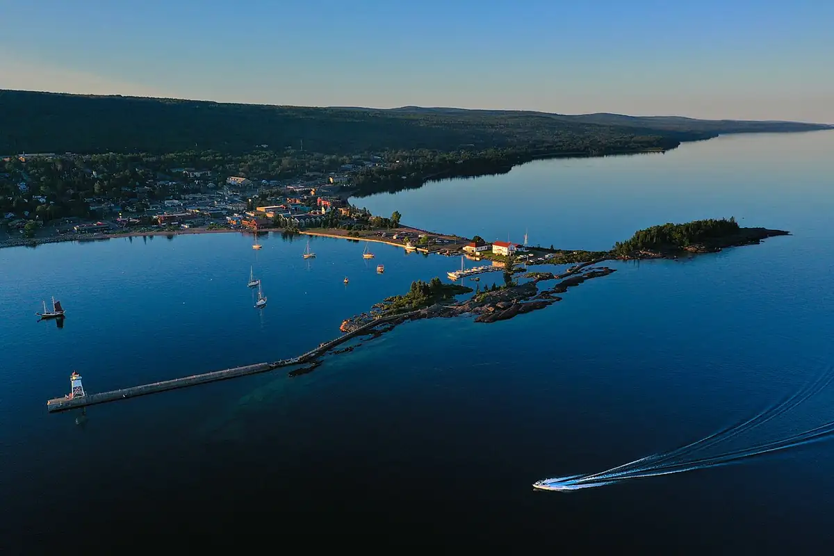
That harbor is the one in the photo below, on Minnesota’s stretch of the Lake Superior shore.
The 1954 map, revised in 1964
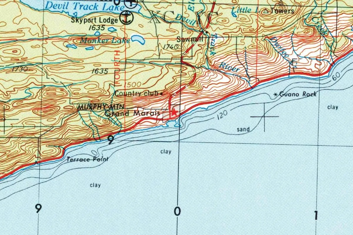
The map at the top of this page comes from the Two Harbors sheet, a 1:250,000 map prepared by the Army Map Service of the Corps of Engineers, compiled in 1955 and dated 1954. The Geological Survey gave it a “limited revision” in 1964, and the copy shown is the Geological Survey’s 1975 printing. At that scale, Grand Marais is just a red star on the shore, but you can pick out Devil Track Lake and the Devil Track River to the north, and the lake bottom is marked “clay” and “sand” offshore.
Quick answers
What does Grand Marais mean?
“A great marsh.” Upham (1920) says it’s French and refers to a marsh at the head of the little bay and harbor.
Where was the marsh at Grand Marais?
At the head of the harbor. Upham describes it as “twenty acres or less in area” (8 ha or less), “nearly at the level of Lake Superior.”
Who named Grand Marais?
No one by name. Upham says only that the French name came “in the early fur-trading times.” He credits the early French voyageurs with naming Little Marais in contrast to it.
When was Grand Marais settled?
In 1871, by Henry Mayhew and others, Upham says. John Godfrey’s trading post had operated there for several years, up to 1858.
Key dates
- 1858John Godfrey of Detroit closes out several years of running a trading post at Grand Marais.
- 1871Henry Mayhew and others settle Grand Marais.
- 1916Warren Upham visits Grand Marais in August to collect the origins of Cook County's names.
- 1920Upham's Minnesota Geographic Names explains Grand Marais as French for 'a great marsh.'
Things to do in Grand Marais, Minnesota
Cook County Historical Society
The society runs five historic sites in Grand Marais and in the village once called Chippewa City, or Nishkwakwansing, which it translates as 'at the edge of the forest,' and offers public tours at all five.
Grand Marais Art Colony
It began in 1947, when Birney Quick, an instructor at the Minneapolis School of Art, opened The Outdoor School of Painting at Grand Marais for an eight-week summer session. Its home, Founders Hall, is the former St. John's Catholic Church building.
North House Folk School
Founded in 1997 by a handful of locals passionate about traditional craft, the school settled into two old forest service buildings on the harbor, the Red Building and the Blue Building, and now hosts over 350 classes a year.
Grand Portage National Monument
A fur trade depot reconstructed in its historic location, with a Heritage Center on the fur trade and Anishinaabe culture. It tells of the partnership between the Grand Portage Anishinaabe and the North West Company, and the park service says it's the first of its units co-managed with a Tribal Nation.
Getting there
Open Grand Marais in Google Maps
Opens in a new tab. The pin is the center of Grand Marais in the USGS place-name record.
The closest airports, Amtrak stations and intercity bus stops, measured in a straight line from the center of Grand Marais.
Airports
- Houghton County Memorial (CMX) Hancock 95 mi 153 km
- Duluth International (DLH) 107 mi 173 km
Distances are as the crow flies, not by road. We don't list schedules or fares because they change; check with the airline, Amtrak or the bus company before you go. Official data (FAA commercial service airports (2025), FAA airport locations, Amtrak stations and Intercity Bus Atlas) from the FAA and the U.S. Bureau of Transportation Statistics, checked Nov 17, 2026.
Sponsored
Staying in Grand Marais?
Compare hotels in Grand Marais, Minnesota, on Expedia.
See hotels in Grand MaraisWe may earn a commission if you buy through this link. It never changes what we write. Read our affiliate disclosure
Historical Sources & References
- Warren Upham, Minnesota Geographic Names (1920), p. 135. Upham’s visit to Grand Marais in August 1916 and the people he asked. Checked against the page image.
- Upham (1920), p. 136. “A great marsh,” the marsh of twenty acres (8 ha) or less, the two bays and Gilfillan’s translation of the Ojibwe name. Checked against the page image.
- Upham (1920), p. 144. Devil Track, Gilfillan’s version and the settlement by Henry Mayhew and others in 1871. Checked against the page image.
- Upham (1920), p. 147. John Godfrey’s trading post at Grand Marais, up to 1858. Checked against the page image.
- Upham (1920), p. 294. Little Marais, named for its little marsh in contrast with the larger marsh of Grand Marais. Checked against the page image.
- Federal Writers’ Project, Minnesota: A State Guide (1938), p. 285. The county seat, the summer-tourist traffic, the harbor full of logs, commercial fishing and the fur-trading post. Checked against the page image.
- Cook County Historical Society; Grand Marais Art Colony; North House Folk School; Grand Portage National Monument. The details in the things-to-do list.
- GNIS feature ID 656425 (U.S. Geological Survey). Grand Marais in the national gazetteer, in Cook County, with its coordinates.
- Army Map Service, Two Harbors sheet (1954). The 1:250,000 sheet, with the Geological Survey’s limited revision of 1964, in its 1975 printing, that the map at the top of this page was cropped from.
Spot something wrong, or know more? Tell us here. You can also email us or use our contact page. Corrections are noted here with their date, never made silently.