Blowing Rock, North Carolina: The Wind That Blows Back
Blowing Rock is named for the Blowing Rock, a cliff over the Johns River Gorge. Margaret Morley (1913) and the 1939 WPA guide explain that the gorge's rocky walls form a flume, so the northwest wind sweeps up hard enough to send light objects back. A lovers' legend, told three different ways, explains the same wind.
Blowing Rock, North Carolina, takes its name from a cliff where, as a 1913 book put it, “whatever is thrown over the rock is hurled back again.” That’s the claim, anyway. The same writer added that she’d heard of visitors watching their belongings vanish into the trees below on a calm day.
A flume for the northwest wind
The town is named for the rock, and the rock for its wind. Margaret W. Morley explained it in The Carolina Mountains in 1913. Near the village, she wrote, “at the beginning of those green knobs between which one looks to the lowlands, is a high cliff, the real Blowing Rock, so named because the rocky walls at this point form a flume through which the northwest wind sweeps with such force that whatever is thrown over the rock is hurled back again.”
Then she passed along two stories. “It is said that there are times when a man could not jump over, so tremendous is the force of the wind,” Morley went on. “It is also said that visitors, having heard the legend of the rock, have been seen to stand there in a dead calm and throw over their possessions and watch them more in anger than in mirth as they, obedient to the law of gravity instead of that of fancy, disappeared beneath the tree-tops far below.”
Snow that falls upside down
The Federal Writers’ Project guide to North Carolina, published in 1939, describes the Blowing Rock as “an immense cliff (3,656 alt.) overhanging the JOHNS RIVER GORGE with its valley 2,000 to 3,000 feet below.” That’s 1,114 m up, with the valley 610 to 914 m down. Then it gives the same explanation Morley did: the gorge’s rocky walls form a flume “through which the northwest wind at times sweeps with such force that it returns to the sender light objects cast over the void.”
The guide adds that this “current of air flowing upward prompted the Ripley cartoon about ‘the only place in the world where snow falls upside down.’”
The attraction at the rock uses nearly the same wording today. Its page on the name calls the Blowing Rock “an immense cliff 4,000 feet above sea level, overhanging Johns River Gorge 3,000 feet below,” which is 1,219 m above the sea and 914 m above the gorge floor. Morley also gave the village’s height as “four thousand feet above sea-level.”
One wind, three legends
The rock has a love story, but it doesn’t come in one version. You’ll find at least three.
The 1939 guide says two warriors fought all day over a chieftain’s daughter. When the stronger one threw his rival over the cliff, she realized the loser was the one she loved, “and she implored the God of the Winds to save him. The Wind caught up the warrior and lifted him through the air to safety. Since that day the Wind has returned any object tossed over the gorge.”
The Town of Blowing Rock’s history tells it as two “star-crossed lovers,” one Cherokee and one Catawba. When a reddening sky called the brave back to his tribe, he leaped from the gorge’s edge, and as the maiden begged the Great Spirit for help, “The famous winds of the John’s River Gorge blew her lover back into her arms.”
The attraction’s own legend page gives the maiden a Chickasaw father, who brought her to the rock to keep her away from a white man’s admiration, and makes her lover a Cherokee brave. He leaps, she prays daily, and one evening “a gust of wind blew her lover back onto The Rock and into her arms.” The page itself treats it lightly: for people of other days, it says, this was explanation enough for the winds.
From hotels to a town
People came to the ridge long before the name was fixed on a town. The town’s history says the Moravian Bishop August Gottlieb Spangenberg visited the area in 1752 (the Moravians also founded the Salem of Winston-Salem), and that the Greenes, the first family to settle in Blowing Rock, were there by the mid-1800s.
Summer visitors followed. The Watauga Hotel was built in 1884, and the Green Park Hotel opened in 1891. In between, on March 11, 1889, Blowing Rock was chartered and incorporated, with “Uncle Joe Clarke” as its first mayor and a permanent population of just over 300. The 1939 guide says the village was developed in the late 1880s, when stagecoaches on rough mountain roads were the only way in.
The rock itself became an attraction too. Its website gives 1933 as its start and bills it as “North Carolina’s Oldest Travel Attraction.”
The 1936 map
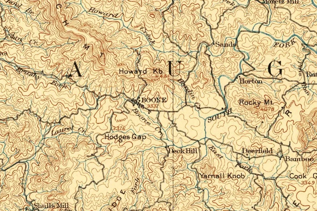
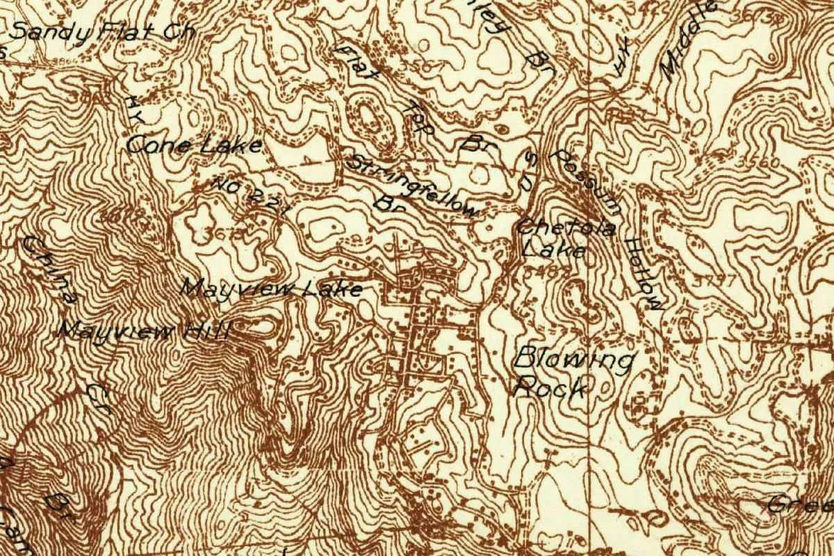
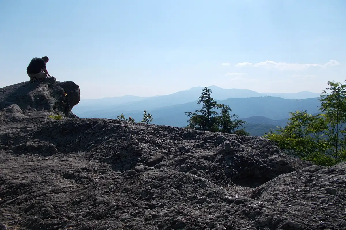
The map at the top of this page comes from the Geological Survey’s Blowing Rock sheet of 1936, printed in brown. The town’s streets sit among tight contour lines, with Cone Lake, Chetola Lake and Mayview Lake nearby. The 1939 guide puts the entrance to the Moses H. Cone Memorial Park in Blowing Rock and calls Cone, who lived from 1857 to 1908, an industrialist from Greensboro. His family gave the estate to the National Park Service in 1949, the Park Service says. The cliff itself isn’t labeled in this crop, but you can see it in the photo below.
Quick answers
Why is it called Blowing Rock?
For the cliff. Morley (1913) and the 1939 WPA guide say the walls of the Johns River Gorge form a flume, and the northwest wind sweeps up through it hard enough to send light objects back.
What is the legend of Blowing Rock?
A lovers’ story with three versions. The 1939 guide has two warriors and the God of the Winds, the town has Cherokee and Catawba lovers, and the attraction has a Chickasaw maiden and a Cherokee brave, all saved by the wind.
Does the wind really blow things back up?
Sometimes, by the old accounts. The 1939 guide says the wind does it “at times” and with “light objects,” and Morley wrote of visitors who tossed their things over on a calm day and watched them fall.
When was Blowing Rock incorporated?
On March 11, 1889, according to the town’s history.
Key dates
- 1752Moravian Bishop August Gottlieb Spangenberg visits the Blowing Rock area, the town's history says.
- 1884The Watauga Hotel is built; it adds cottages in 1888.
- 1889Blowing Rock is chartered and incorporated on March 11, with "Uncle Joe Clarke" as its first mayor.
- 1891The Green Park Hotel opens.
- 1913Margaret W. Morley explains that the cliff is named for a wind that hurls back whatever is thrown over it.
- 1933The Blowing Rock attraction dates itself to this year: "Since 1933."
- 1939The WPA's North Carolina guide describes the cliff, the Ripley cartoon and a legend of the God of the Winds.
- 1949The Cone family donates its estate to the National Park Service, and Julian Price Memorial Park is donated too.
Things to do in Blowing Rock, North Carolina
The Blowing Rock
The cliff that named the town, which calls itself North Carolina's oldest travel attraction. It stands about 4,000 feet (1,219 m) above sea level over the Johns River Gorge, and its rock is gneiss that the attraction says is 1,055 million years old.
Moses H. Cone Memorial Park
Moses H. Cone and his wife, Bertha, built Flat Top Manor as a summer retreat at the turn of the 20th century, and the family gave the estate to the National Park Service in 1949. You can walk its carriage trails, see the historic manor and stop at the Southern Highland Craft Guild shop.
Julian Price Memorial Park
A 4,200-acre (1,700 ha) park on the Blue Ridge Parkway, next to the Cone estate, centered on the 47-acre (19 ha) Price Lake. Elevations run from 3,000 to 4,000 feet (914 to 1,219 m), with paddling, fishing and hiking along Boone Fork Creek.
Blowing Rock Art & History Museum
Known as BRAHM, the museum lives by four words, curate, preserve, educate and inspire, and shows changing exhibitions along with a growing permanent collection.
Getting there
Open Blowing Rock in Google Maps
Opens in a new tab. The pin is the center of Blowing Rock in the USGS place-name record.
The closest airports, Amtrak stations and intercity bus stops, measured in a straight line from the center of Blowing Rock.
Airports
- Tri-Cities (TRI) Bristol/Johnson/Kingsport 47 mi 76 km
- Asheville Regional (AVL) 68 mi 110 km
- Charlotte/Douglas International (CLT) 76 mi 122 km
Amtrak trains
- Gastonia station (GAS) 66 mi 107 km
- Kannapolis station (KAN) 74 mi 119 km
Intercity buses
- Sunway Charters Boone 5 mi 9 km
- Greyhound Newton Citgo 38 mi 61 km
- Virginia Breeze, Operated by Dillon's Virginia Breeze · Bristol (Park & Ride) 43 mi 69 km
Distances are as the crow flies, not by road. We don't list schedules or fares because they change; check with the airline, Amtrak or the bus company before you go. Official data (FAA commercial service airports (2025), FAA airport locations, Amtrak stations and Intercity Bus Atlas) from the FAA and the U.S. Bureau of Transportation Statistics, checked Nov 16, 2026.
Sponsored
Staying in Blowing Rock?
Compare hotels in Blowing Rock, North Carolina, on Expedia.
See hotels in Blowing RockWe may earn a commission if you buy through this link. It never changes what we write. Read our affiliate disclosure
Historical Sources & References
- Margaret W. Morley, The Carolina Mountains (1913), p. 353. The “real Blowing Rock,” the flume and the northwest wind, visitors throwing their things over “in a dead calm,” and the village “four thousand feet above sea-level” (1,219 m). Checked against the page image.
- Federal Writers’ Project, North Carolina: A Guide to the Old North State (1939), pp. 419-420. The cliff at 3,656 feet (1,114 m) over a valley 2,000 to 3,000 feet (610 to 914 m) below, “at times,” the Ripley cartoon, the legend of the God of the Winds, the village developed in the late 1880s, and Moses H. Cone as a “Greensboro industrialist.” The quoted passage on p. 420 was checked against the page image.
- Town of Blowing Rock, “History”. Spangenberg in 1752, the Cherokee and Catawba lovers, the Greenes, the Watauga and Green Park hotels, the incorporation of March 11, 1889, and “Uncle Joe Clarke.”
- The Blowing Rock, “How The Blowing Rock Got Its Name”; “The Legend of The Blowing Rock”; “The Origin of The Blowing Rock”. The cliff at 4,000 feet (1,219 m) over a gorge 3,000 feet (914 m) below, the Chickasaw and Cherokee legend, “Since 1933” and the 1,055-million-year-old gneiss.
- Moses H. Cone Memorial Park; Julian Price Memorial Park; Blowing Rock Art & History Museum. The details in the things-to-do list, including the 1949 donations.
- GNIS feature 1009487 (U.S. Geological Survey). The Survey’s own listing for Blowing Rock, in Watauga County, with its coordinates.
- U.S. Geological Survey, Blowing Rock sheet (1936). The 1:48,000 map that the image at the top of this page was cropped from.
Spot something wrong, or know more? Tell us here. You can also email us or use our contact page. Corrections are noted here with their date, never made silently.