Mount Airy, North Carolina: Three Stories Behind the Name
The origin is uncertain. The town's 1985 National Register nomination says it's most commonly traced to Jonathan Unthank's plantation, Mount Airy, set beside the stage road in the early 1800s. It also gives two other possibilities: a settler named Mount marked on a 1749 map, and an 1819 will naming another Mount Airy plantation.
Nobody has settled where Mount Airy, North Carolina, got its name, though the most accepted answer is a plantation called Mount Airy on the old stage road. The clearest statement of the problem comes from the town’s National Register nomination, written in 1985: “The origin of Mount Airy’s name is uncertain.” Then, in its footnotes, it gives you two more candidates.
A plantation on the stage road
The settlement grew up between Lovills Creek and the Ararat River, on the main north-south road from Salem, North Carolina, into Virginia. It was a place where travelers stopped for the night. That’s where the most common story starts. Patricia S. Dickinson, who wrote the nomination for the state’s Division of Archives and History, put it this way:
“It is most commonly accepted that the town is named after Jonathan Unthank’s plantation ‘Mount Airy,’ established in the early 1800s beside the stage road about a mile east of the Ararat River crossing. The Unthank house became a favorite stopping place for travellers on the stage road. The post-rider found it a convenient mail distribution point also. Eventually the name of the plantation became associated with the settlement and when a post office was established in February, 1832, it was designated, Mount Airy.”
A mile is about 1.6 km. The Blue Ridge National Heritage Area tells the same story with the same caution: the origin “is uncertain, but local tradition holds that it came from the ‘Mount Airy’ plantation.”
Why would Unthank pick that name? The nomination only guesses. Unthank, who lived from 1758 to 1843 or so, married Sarah Franklin, a daughter of Jesse Franklin, later governor and U.S. senator. Unthank may have chosen it, the footnote suggests, “because of its location with a fine view of the Blue Ridge Mountains.” It adds that a well-known Virginia house called Mount Airy, built around 1760 on the Rappahannock River, “may have been known to Franklin and his daughter.”
Mount Airy wouldn’t be the only town named for a plantation. Valdosta, Georgia, took its name from Governor George Troup’s plantation. And out on the prairie, Ashland, Nebraska, borrowed the name of Henry Clay’s Kentucky estate.
A settler named Mount
The second story goes back further. The nomination says that by 1749 a map drawn by Joshua Frye and Peter Jefferson showed seven settlers with sizeable acreage on the Ararat River. On that map, its footnote says, “the mysterious notation ‘Mount’ appears where the present town is located.”
What does it mean? The footnote offers one reading, carefully hedged. “An early settler named Mount married a Susannah Stewart for whose family Stewart’s Creek, which joins the Ararat River south of town, is named; this map’s notation may designate his land.” If that’s right, the name might have started with a family, not a hilltop. Nobody quoted here says so for certain.
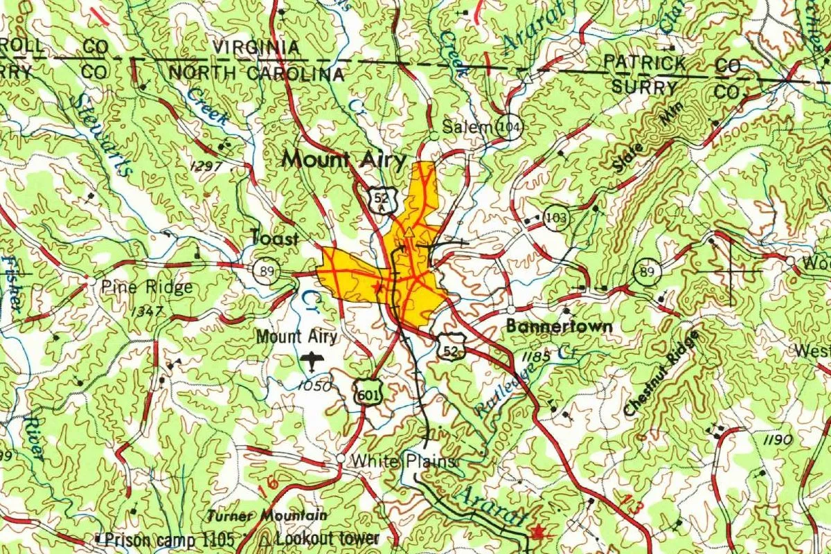
You can still find that creek on the map at the top of this page, where it’s spelled Stewarts Creek and runs down the west side.
Thomas Perkins’s will of 1819
The third candidate is the only one with a dated document that uses the full name. “Or the name may date from 1819,” the nomination says, “when Thomas Perkins willed his plantation, located just east of the Ararat River, ‘including the seat which I now have called and known by the name of Mount Airy’ to his son Constantine.” The will is in Will Book 3, page 138, at the Surry County courthouse in Dobson.
So there were two plantations called Mount Airy in the sources, Unthank’s and Perkins’s, both east of the river. The nomination doesn’t try to reconcile them, and this page won’t either. What the sources agree on is the end of the story: by February 1832 the post office carried the name.
Granite City and Mayberry
Mount Airy was incorporated in May 1885 with 800 people, a score of stores, seven tobacco factories and three churches, according to the nomination. Then the railroad came. The Mount Airy Museum of Regional History says the first Cape Fear and Yadkin Valley train arrived on May 28, 1888.
The same year, Thomas Woodruff, an English-born builder from Greensboro, bought the “Flat Rock,” a granite deposit about half a mile (0.8 km) east of downtown. Until the railroad came, the nomination says, it was “nearly worthless real estate,” and settlers who tried to till the soil there “found their plowshares bent and broken.” Commercial quarrying began in 1889. The nomination says stone from the quarry went into the gold bullion depository at Fort Knox and the Wright Brothers Memorial, which stands on the coast in Kill Devil Hills, next door to Kitty Hawk. The same stone went into several state government buildings in Raleigh, the capital of North Carolina. The nomination calls the quarry “the largest open-faced granite quarry in the world.” It went on the National Register in 1980. The Blue Ridge National Heritage Area says the quarry gave the town its nickname, “Granite City.”
The other nickname comes from television. Andy Griffith was born in Mount Airy in 1926, the Surry Arts Council says, and the heritage area calls the town “the model for the small town of ‘Mayberry’” on his show.
Mount Airy on the 1953 map
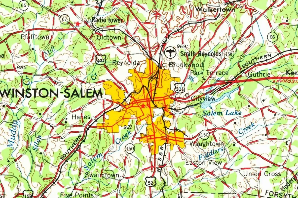
The map at the top comes from the Winston-Salem sheet, which the Army Map Service compiled in 1953 and the Geological Survey gave a limited revision in 1962; this copy came off the Survey’s presses in Reston, Virginia, in 1974. Winston-Salem is the big city on the sheet, well to the southeast. Mount Airy sits about halfway up the sheet, just below the dashed line where North Carolina meets Virginia, with the Ararat River curling below town and Stewarts Creek off to the west. You’ll also spot a tiny place called Salem just north of town, not to be confused with the Moravian Salem the old road led to.
Quick answers
Where does the name Mount Airy, North Carolina, come from?
Nobody knows for sure. The most commonly accepted answer is Jonathan Unthank’s Mount Airy plantation on the stage road, but the town’s National Register nomination also points to a “Mount” on a 1749 map and to Thomas Perkins’s 1819 will.
Why might the plantation have been called Mount Airy?
The nomination only guesses: perhaps for its fine view of the Blue Ridge Mountains, or after a well-known Virginia house of the same name on the Rappahannock River.
When did Mount Airy get its name?
The name was in use by 1819, when Thomas Perkins’s will mentioned a seat called Mount Airy. The post office opened under that name in February 1832.
Was Mount Airy the model for Mayberry?
The Blue Ridge National Heritage Area says so: it calls the town the model for the small town of Mayberry on The Andy Griffith Show. Griffith was born there in 1926.
Key dates
- 1749A map by Joshua Frye and Peter Jefferson shows seven settlers on the Ararat River and the notation "Mount" where the town now stands.
- 1819Thomas Perkins wills his plantation east of the Ararat River, "called and known by the name of Mount Airy," to his son Constantine.
- 1832February: a post office opens under the name Mount Airy.
- 1885May: the town of Mount Airy is incorporated, with a population of 800.
- 1888The Cape Fear and Yadkin Valley Railroad reaches town, and Thomas Woodruff buys the granite deposit known as the Flat Rock.
- 1926Andy Griffith is born in Mount Airy.
- 1953The Army Map Service compiles the Winston-Salem sheet that shows the town; the Geological Survey revises it in 1962, and this copy is printed in 1974.
- 1980The granite quarry is placed on the National Register of Historic Places.
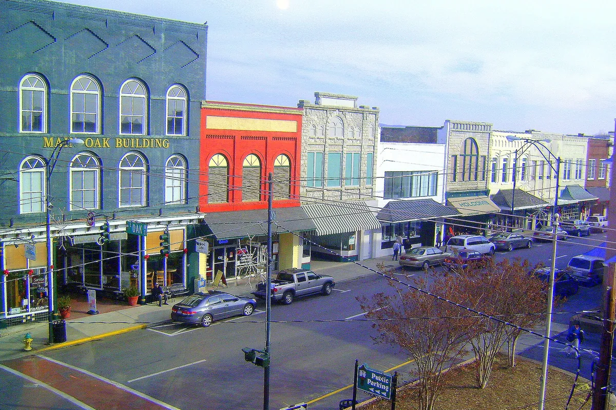
Things to do in Mount Airy, North Carolina
Andy Griffith Museum
A museum run by the Surry Arts Council with what it calls the single largest collection of artifacts and memorabilia related to Andy Griffith, including props and wardrobe from The Andy Griffith Show and Matlock. Its building was dedicated in 2009.
Mount Airy Museum of Regional History
A four-story museum in a former mercantile store on Main Street, with exhibits on the Native American story, pioneer life, the granite quarry and the old-time music of the region.
Historic Earle Theatre
A theater built in 1938, home of the Old-Time Music Heritage Hall and of the live WPAQ Merry-Go-Round radio broadcast. The Surry Arts Council says Andy Griffith went to the movies there as a boy.
Siamese Twins Museum
A museum across the street from the Andy Griffith Museum that tells the story of Chang and Eng Bunker, who moved to Mount Airy in 1854 to farm, with artifacts and interactive displays.
Pilot Mountain State Park
A state park in Surry and Yadkin counties built around the knob of Pilot Mountain, with hiking, horseback riding, rock climbing and camping, and the Mountains-to-Sea State Trail crossing both sections of the park.
Getting there
Open Mount Airy in Google Maps
Opens in a new tab. The pin is the center of Mount Airy in the USGS place-name record.
The closest airports, Amtrak stations and intercity bus stops, measured in a straight line from the center of Mount Airy.
Airports
- Piedmont Triad International (GSO) Greensboro 46 mi 74 km
- Roanoke/Blacksburg Regional (Woodrum Field) (ROA) 67 mi 108 km
- Charlotte/Douglas International (CLT) 91 mi 146 km
Amtrak trains
- High Point station (HPT) 50 mi 81 km
- Lexington Barbeque Festival station (LEX) 51 mi 82 km
Intercity buses
- Sunway Charters Yadkinville 26 mi 42 km
- Barons Bus Lines Winston-Salem 29 mi 47 km
- Greyhound Winston-Salem NC - Clark Campbell Trans. Ctr. (WNS) 34 mi 55 km
Distances are as the crow flies, not by road. We don't list schedules or fares because they change; check with the airline, Amtrak or the bus company before you go. Official data (FAA commercial service airports (2025), FAA airport locations, Amtrak stations and Intercity Bus Atlas) from the FAA and the U.S. Bureau of Transportation Statistics, checked Nov 17, 2026.
Sponsored
Staying in Mount Airy?
Compare hotels in Mount Airy, North Carolina, on Expedia.
See hotels in Mount AiryWe may earn a commission if you buy through this link. It never changes what we write. Read our affiliate disclosure
Historical Sources & References
- Patricia S. Dickinson, National Register nomination, Mount Airy Historic District (1985). The settlement on the Salem road, the 1749 Frye-Jefferson map, “The origin of Mount Airy’s name is uncertain,” Unthank’s plantation “about a mile (1.6 km) east of the Ararat River crossing,” the post office of February 1832, and, in notes 5 and 6, the Blue Ridge view, the Virginia house, the “Mount” notation and Perkins’s 1819 will. Also the 1885 incorporation and the Flat Rock quarry. Checked against the page images.
- Blue Ridge National Heritage Area, “Mount Airy”. “Uncertain, but local tradition holds,” the quarry as the world’s largest open-face granite quarry, “Granite City,” and the Mayberry model.
- Mount Airy Museum of Regional History, “Coming of the Railroad”. The first Cape Fear and Yadkin Valley train on May 28, 1888.
- Surry Arts Council, Andy Griffith Museum. Griffith’s birth in Mount Airy in 1926 and the museum building of 2009.
- Historic Earle Theatre; Siamese Twins Museum; Mount Airy Museum of Regional History; Pilot Mountain State Park. The details in the things-to-do list.
- GNIS feature 990306 (U.S. Geological Survey). Mount Airy’s listing as a populated place in Surry County and its coordinates.
- Winston-Salem sheet, compiled 1953, limited revision 1962, printed 1974. The sheet the map at the top was cropped from, prepared by the Army Map Service and field checked in 1953, with a limited revision by the Geological Survey in 1962, printed by the Survey in Reston, Virginia, in 1974.
Spot something wrong, or know more? Tell us here. You can also email us or use our contact page. Corrections are noted here with their date, never made silently.