Why Is It Called Half Moon Bay? The Crescent and Spanishtown
Half Moon Bay is named for its bay, which curves like a crescent moon. Henry Gannett gave that reason in a 1905 government bulletin, and an 1883 county history credits the bay's outline. The village beside it was known as San Benito and then Spanishtown; the city dates its switch to the bay's name to 1874.
Half Moon Bay, California, takes its name from the crescent-shaped bay it sits on; the town, long called Spanishtown, adopted the bay’s name in 1874. Old habits held on, though, and a county history nearly a decade later still used the earlier name.
Why is it called Half Moon Bay?
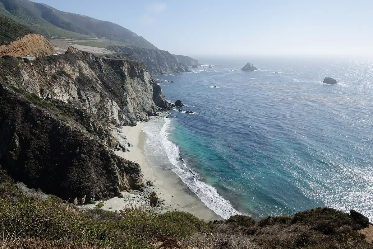
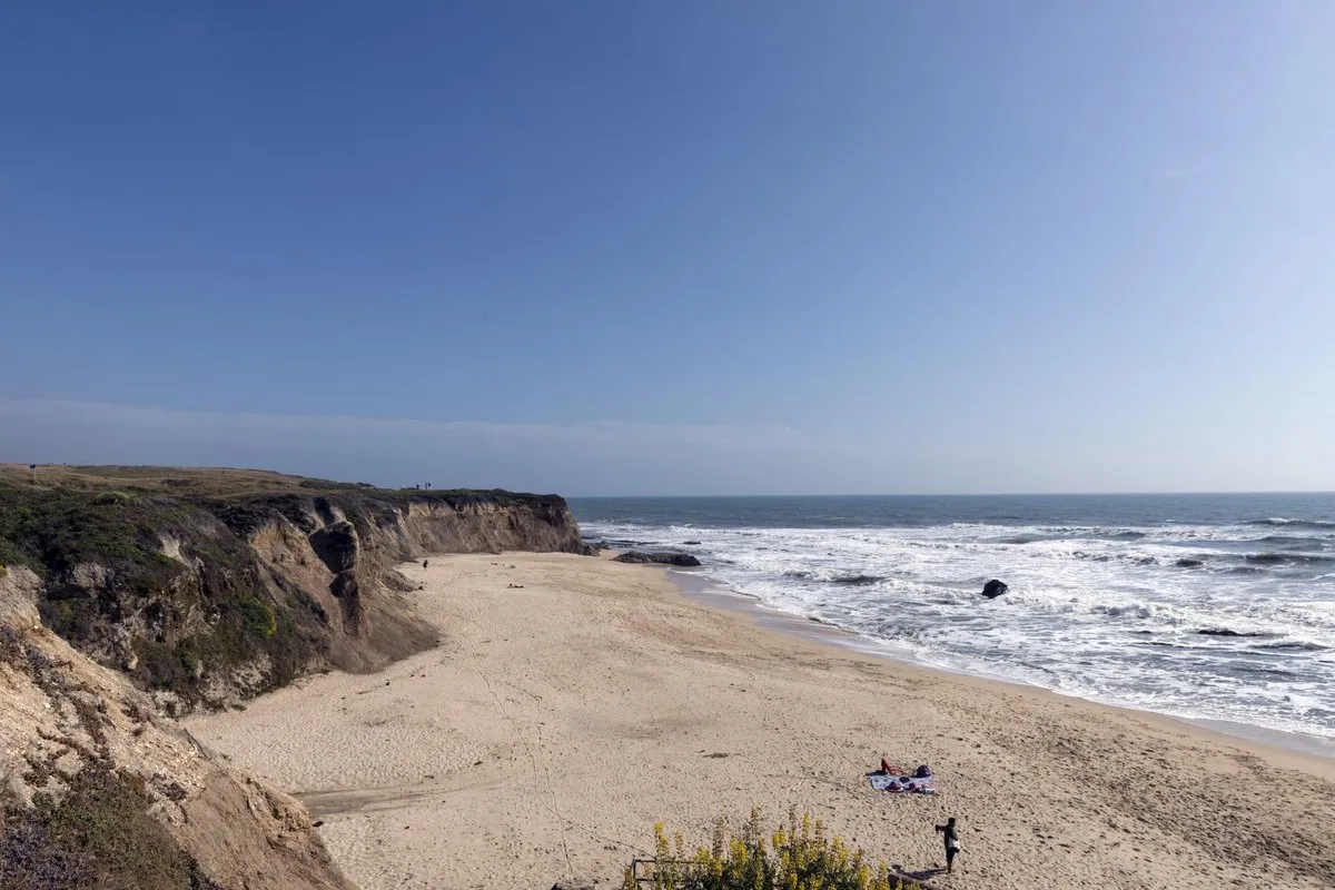
Look at the shoreline and you’ve got the answer. The bay curves south from Pillar Point in a long arc, and that outline is what the name describes. Henry Gannett, the Geological Survey’s authority on place names, filed it in 1905 under “Halfmoon,” one word, and tied the name to the bay’s crescent form. The town isn’t in his entry; he was writing about the bay.
An 1883 History of San Mateo County said much the same thing two decades earlier. It describes a fertile plain stretching around the shore of a bay that, because of its shape, “has long been known as Half Moon Bay.” So the water had its English name well before the town took it.
When did the town make the switch? The City of Half Moon Bay, in the history section of its budget, says the place was called San Benito in the 1840s, later Spanishtown, and “received its current name in 1874.” The local visitor bureau’s Main Street walking tour adds a reason: the crescent of coastline nearby moved residents to rename the town that year. Neither source names who proposed the change or how it was made official.
The older name didn’t vanish right away. The 1883 history heads its entry “Half Moon Bay, or Spanishtown” and describes a village of 500 to 600 people as “commonly called Spanishtown.” Taking a name from the water nearby is a pattern seen elsewhere. In Oregon, the people of Marshfield voted in 1944 to call their city Coos Bay, after the bay. In Iowa, the settlement of Sturgis Falls switched to the river’s name and became Cedar Falls.
Half Moon Bay history
The first people here were Ohlone. The city’s history names the Costanoan Rumsen Ohlone Tribe as the original inhabitants of the coast.
Under Mexico, the land went to a soldier. The city says Governor Juan B. Alvarado granted 4,424 acres (1,790 ha) to Juan José Candelario Miramontes in 1841, and that Rancho Miramontes became the downtown of today. The walking tour, from Visit Half Moon Bay, says Miramontes called his land Rancho San Benito.
The 1883 county history explains the name Spanishtown. It says the Spanish-Mexican families who settled along Pilarcitos Creek, drawn by its water and pastures, were the reason for it, and singles out the Miramontez and Vasquez families, who lived on opposite banks of the creek. The book also mentions an elderly Miramontez woman, said to have lived a full century, who was still there and was remembered for nursing sick members of the early American families. It says no Spanish town or village had been founded here before the American period, though a small landing handled the valley’s trade and some grain was sold to Russian traders. People traveled to San Francisco and Mission Dolores for business and church, and the settlement had no consecrated burial ground of its own until 1857.
Americans came to farm in the 1850s. According to the 1883 history, the first party arrived in February 1853 and settled on Rancho Cañada de Verde, and the four Johnston brothers followed soon after with eastern cattle, many of whose calves the local grizzly bears killed that first season. Settlers didn’t start gathering around Spanishtown itself until about 1860. Estanislaus Zaballa, related by marriage to the Miramontez family, was likely its first merchant. Henry Bidwell, a nephew of General John Bidwell, opened the first public house and became postmaster when the town got a post office. In October 1863 a court decree divided the land, and the history says a plat of Spanishtown followed.
The walking tour picks out survivors from those years: the Zaballa House, built around 1855 and billed as the town’s oldest home, and an 1872 Methodist church. The city adds that the Ocean Shore Railway ran from 1907 to 1920, and it claims the title of the county’s oldest settlement. It became a city in 1959; San Mateo LAFCo gives the date as July 15. Half Moon Bay is on the coast of California, in San Mateo County.
Half Moon Bay on the 1902 map
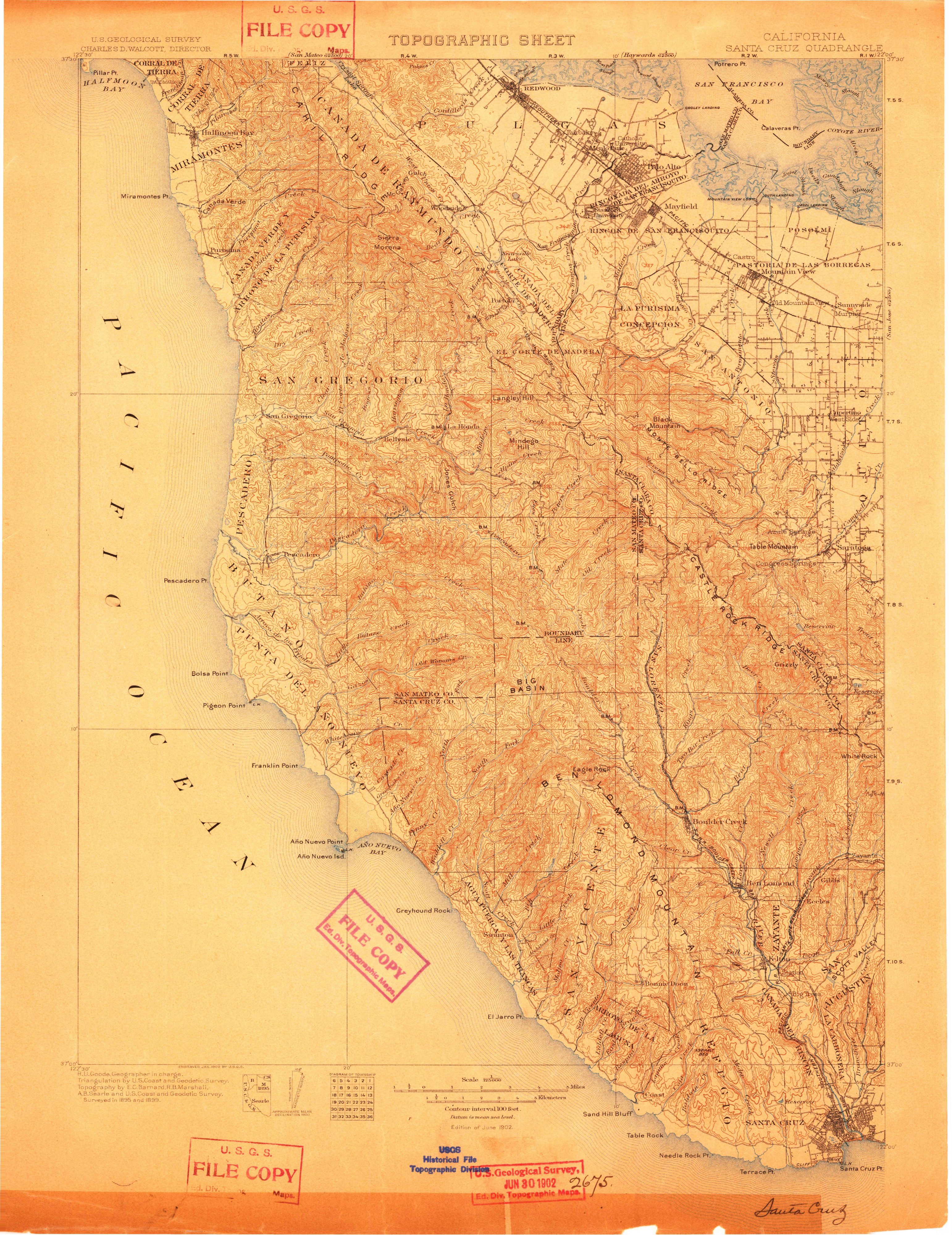
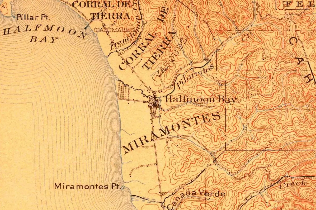
Our map is cropped from the Santa Cruz quadrangle, which shares its name with Santa Cruz, where a Spanish expedition first gave that name to a creek in 1769. The sheet, at 1:125,000, was issued while Charles D. Walcott led the Geological Survey, and R. U. Goode was the geographer in charge. Four names share the topography credit, E. C. Barnard, R. B. Marshall and A. B. Searle along with the Coast and Geodetic Survey. Printed dates follow: “Surveyed in 1895 and 1899,” “Engraved Jan. 1902” and “Edition of June 1902.” A Survey stamp dates the copy June 30, 1902.
The name appears twice. HALFMOON BAY is spaced out in large letters over the water beside Pillar Point, and a little street grid on the plain is labeled Halfmoon Bay, both written as one word the way Gannett would spell it. Around the town are the names of old land grants, Corral de Tierra (Palomares), Corral de Tierra (Vasquez) and Miramontes, along with Pilarcitos and Frenchman creeks, Miramontes Point and Canada Verde.
Quick answers
What was Half Moon Bay, California, called before?
San Benito in the 1840s and then Spanishtown, according to the city. An 1883 county history shows Spanishtown still in common use after the 1874 change the city reports.
When did Half Moon Bay, California, become a city?
On July 15, 1959, according to San Mateo LAFCo.
Is Half Moon Bay, California, shaped like a half moon?
The bay is. Gannett’s 1905 bulletin explains the name by its crescent shape, and the 1883 county history points to its outline.
Key dates
- 1841Governor Juan B. Alvarado grants 4,424 acres here to Juan José Candelario Miramontes.
- 1853American farmers begin settling on the county's coast in February.
- 1857The settlement gets its own consecrated burial ground.
- 1863A court decree of partition in October divides the land, followed by a plat of Spanishtown.
- 1874The city's date for the change from Spanishtown to Half Moon Bay.
- 1883A county history still calls the village Spanishtown in everyday use.
- 1902The Santa Cruz quadrangle labels both the bay and the town Halfmoon Bay.
- 1905Henry Gannett's bulletin explains the bay's name by its crescent shape.
- 1959Half Moon Bay incorporates as a city on July 15.
Things to do in Half Moon Bay, California
Half Moon Bay State Beach
Four miles (6.4 km) of sandy state beach with low dunes and shore fishing; Francis Beach, reached from Kelly Avenue inside the city, is the main way in.
Coastside Trail
The local stretch of the California Coastal Trail, a path for walkers and cyclists along the bluffs with ocean views, birds, wildflowers and now and then a whale.
Coastside History Museum
A museum on Johnston Street, opened in 2023 in a building that reuses the beams and siding of the old sheriff's garage, with exhibits on the Ohlone period, farming, surfing, the railroads and the cultures of the coast.
Historic Main Street
A self-guided walk through the old Spanishtown, starting at the Main Street Bridge of 1900 over Pilarcitos Creek and passing the Zaballa House, built around 1855 and called the town's oldest home.
Getting there
Open Half Moon Bay in Google Maps
Opens in a new tab. The pin is the center of Half Moon Bay in the USGS place-name record.
The closest airports, Amtrak stations and intercity bus stops, measured in a straight line from the center of Half Moon Bay.
Airports
- San Francisco International (SFO) San Francisco International Airport 11 mi 18 km
- Oakland San Francisco Bay (OAK) 21 mi 34 km
Amtrak trains
- Hayward station (HAY) 23 mi 37 km
- Oakland station (OAC) 24 mi 38 km
Intercity buses
- FlixBus San Francisco Bus Station 22 mi 35 km
- Amtrak Chartered Vehicle Amtrak Connecting Service · San Francisco 23 mi 36 km
- Greyhound San Francisco (Salesforce Transit Center) 23 mi 36 km
Distances are as the crow flies, not by road. We don't list schedules or fares because they change; check with the airline, Amtrak or the bus company before you go. Official data (FAA commercial service airports (2025), FAA airport locations, Amtrak stations and Intercity Bus Atlas) from the FAA and the U.S. Bureau of Transportation Statistics, checked Nov 21, 2026.
Sponsored
Staying in Half Moon Bay?
Compare hotels in Half Moon Bay, California, on Expedia.
See hotels in Half Moon BayWe may earn a commission if you buy through this link. It never changes what we write. Read our affiliate disclosure
Historical Sources & References
- Henry Gannett, The Origin of Certain Place Names in the United States, 2nd ed. (1905), p. 147. The bay named for its crescent shape. Checked against the page image.
- History of San Mateo County, California (1883), pp. 239-241. “Half Moon Bay, or Spanishtown,” the bay’s shape, the families behind the name Spanishtown, the 1857 burial ground, the settlers of 1853 and 1860, Zaballa, Bidwell and the 1863 partition. Checked against the page images.
- City of Half Moon Bay, FY 2022-23 Adopted Budget, “History,” pp. 43-44. The Rumsen Ohlone, the 1841 grant, San Benito, Spanishtown and the name of 1874, the Ocean Shore Railway and incorporation in 1959.
- San Mateo LAFCo, Half Moon Bay. The incorporation date.
- Visit Half Moon Bay, Historic Main Street walking tour. Rancho San Benito, the 1874 renaming, the Zaballa House, Bidwell and the 1900 bridge.
- California State Parks, Half Moon Bay State Beach; City of Half Moon Bay, Parks & Trails; Half Moon Bay History Association, Coastside History Museum. The details in the things-to-do list.
- U.S. Geological Survey, GNIS feature 277528. Half Moon Bay’s federal record.
- Santa Cruz quadrangle, surveyed 1895 and 1899, edition of June 1902. The sheet the map at the top was cropped from.
Sponsored
Put this 1902 map on your wall
The Geological Survey's Santa Cruz sheet, surveyed in 1895 and 1899 and published in June 1902, with the bay and the town both lettered Halfmoon Bay, is in the public domain. Download the full-size scan for free, then have it printed on canvas with CanvasOnTheCheap.
Print a map on canvasDownload the full-size mapWe may earn a commission if you buy through this link. It never changes what we write. Read our affiliate disclosure
Spot something wrong, or know more? Tell us here. You can also email us or use our contact page. Corrections are noted here with their date, never made silently.