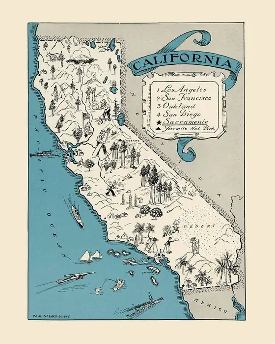
Petaluma, California: One Village Name, Three Meanings
Petaluma comes from a Native village on a hill east of Petaluma Creek. S. A. Barrett wrote in 1908 that it meant "flat back," and Kroeber followed him. A 2021 city report, citing Gudde's California Place Names, gives "hillside ridge" or "hillside back." Henry Gannett's 1905 bulletin said "duck pond," with no source.
Petaluma, California, took its name from a Native village on a nearby hill, and the word has been read as flat back, hillside ridge and duck pond. The village part is well documented. The meaning depends on whom you ask.
A village on a low hill
The oldest detailed account comes from S. A. Barrett, who mapped the villages of the Pomo and their neighbors for a University of California study published in 1908. Among the village sites around the town, he listed one called petaluma, “on a low hill east of Petaluma creek at a point probably about three and one-half miles a little north of east of the town of Petaluma.” That’s about 5.6 km.
“It would seem that this was a fairly large and important village,” Barrett wrote. The hill itself was also called petaluma, and he called it “a prominent feature of the landscape.” He listed a separate site “at the town of Petaluma,” with a different name, so the town doesn’t sit on the village it’s named for.
From the hill, the name traveled. Barrett says it was given to a land grant, the Petaluma rancho, bounded by Sonoma and Petaluma creeks and covering 66,622 acres (26,961 ha). “All circumstances tended toward the preservation of the name,” he wrote, “and it is now found as the name of a town, a creek, a township and a school district.”
Three readings of one word
Barrett broke the word into two parts: “from pe’ta, flat, and lu’ma, back.” That gives flat back.
A. L. Kroeber’s 1916 paper on California place names of Indian origin, in the same University of California series, counted it among the California names that came from Native languages. He quoted Barrett’s location and added that “the village belonged to the Coast Miwok, and its name in their dialect signifies ‘flat-back,’ no doubt from the appearance of the elevation on which it was situated.” Kroeber cites Barrett for the location, and his “flat-back” matches Barrett’s, so it’s probably not an independent reading. The “no doubt” about the hill’s shape is Kroeber’s own guess.
A second reading comes through Gudde’s California Place Names. A 2021 report on the city’s historic resources, prepared by Page & Turnbull for Petaluma’s general plan, says the village was “Péta Lúuma,” east of the current city, “which means ‘hillside ridge’ or ‘hillside back.’” Its footnote points to Gudde’s 1998 edition. Gudde’s book itself isn’t among the sources checked here, so that reading reaches you secondhand.
The third reading is older than both. Henry Gannett, cataloging American place names for the Geological Survey in 1905, wrote that Petaluma was “an Indian word meaning ‘duck pond.’” He gave no source and said nothing about a village or a hill. No later source on this page repeats it.
So you’ve got flat back, hillside ridge or hillside back, and duck pond. Kroeber tied flat-back to the hill’s shape, and Gudde’s reading names a hillside. If you like place names with several translations and no winner, Oconomowoc, Wisconsin, has four.
Whose village
The sources don’t line up exactly on the people, either. Kroeber says Coast Miwok, and so does the city report. The Petaluma Historical Library & Museum puts it more broadly: “The name ‘Petaluma’ is derived from one of several nearby Coast Miwok and Southern Pomo villages.” The museum also says the city “occupies the ancestral lands of the Coast Miwok people.”
Another town that kept a Native name is Nacogdoches, Texas, which carries the name of the Nacogdoche, a Caddo people of the Hasinai group.
Vallejo’s rancho
The name reached the map through a Mexican land grant. The 2021 city report says the Spanish adapted the village name to “Petaluma,” and that it “was the name given to the Rancho Petaluma land grant in 1834.” That year, Governor José Figueroa deeded the area to Mariano Guadalupe Vallejo, and the adobe at the rancho’s center was built two years later, in 1836. The report says about 2,000 Native people worked the rancho in a system of compulsory servitude.
California State Parks calls it “the largest private rancho in California between 1834 and 1846.” Vallejo’s own name ended up on another town, Vallejo, where his colleagues suggested it instead of the Eureka he’d wanted.
From rancho to town
The town came after the Gold Rush. The city report says Petaluma had 560 people in 1850, and it was incorporated in 1858. The museum’s building, the town’s old Carnegie Library, dates from 1904, when its cornerstone was laid.
None of the sources says who first applied the rancho’s name to the town, or when. By the time Barrett was writing, it was just there, on the town, the creek, the township and the school district.
Petaluma on the 1914 map
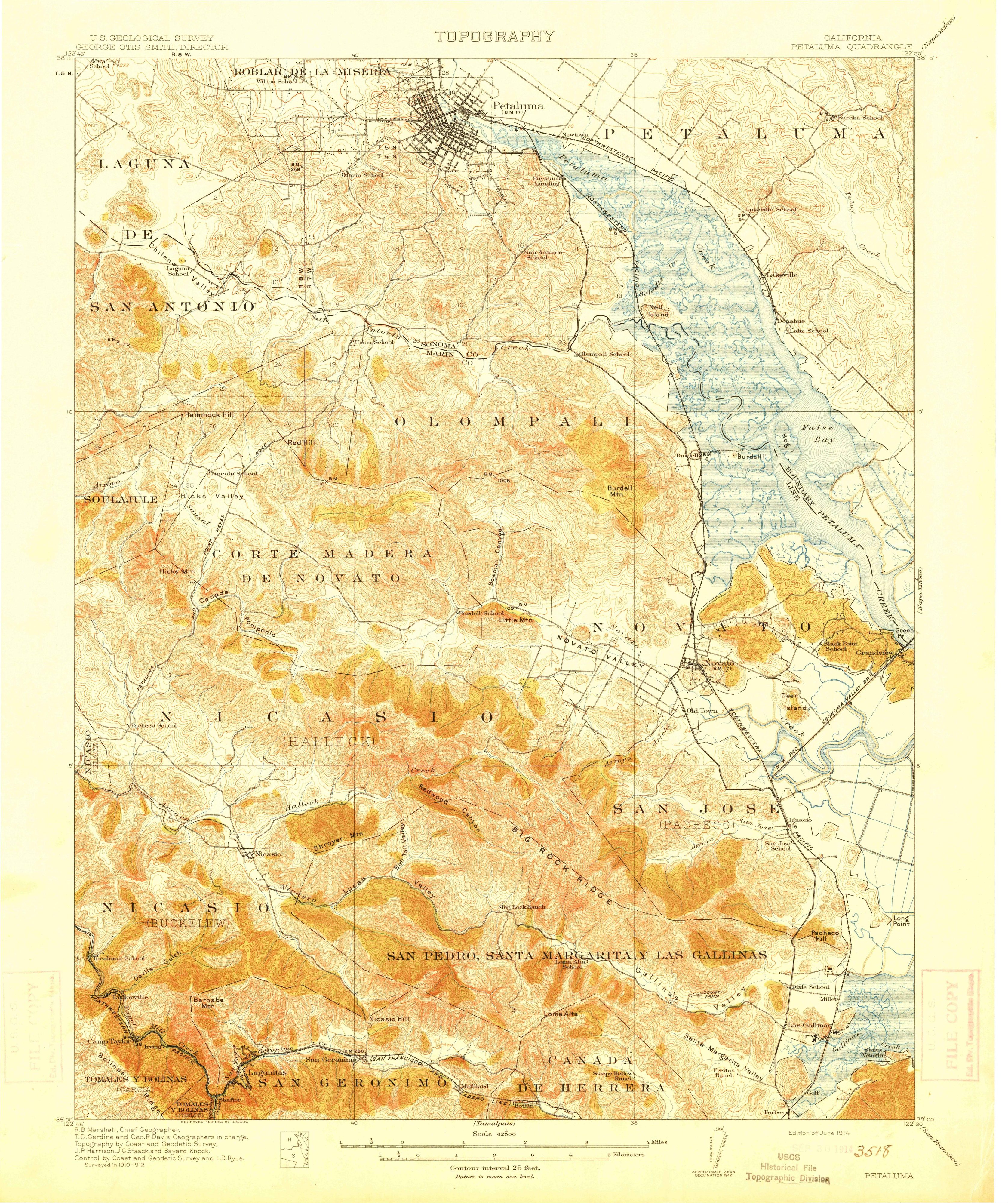
The map at the top of this page is the Geological Survey’s Petaluma quadrangle, “Edition of June 1914,” at 1:62,500. Its margin says it was “Surveyed in 1910-1912,” with topography by the Coast and Geodetic Survey, J. P. Harrison, J. G. Staack and Bayard Knock. On the full sheet, Petaluma sits along the top edge, left of center, and the old rancho names are lettered across the hills, from PETALUMA in big capitals at the upper right to Olompali and Novato.
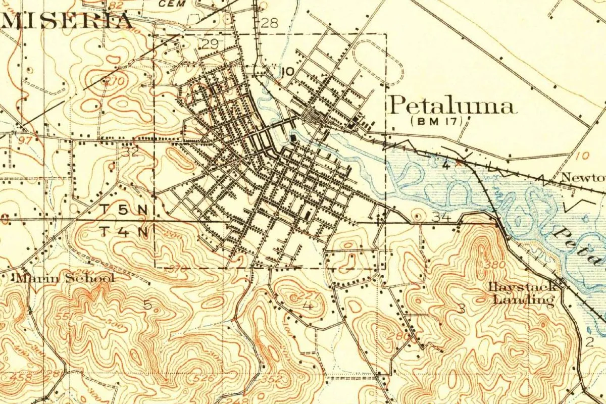
In this detail, the town is a tight grid of black streets with the label “Petaluma” beside it and “BM 17,” a bench mark 17 feet (5 m) above sea level, just below. The tidal creek runs off to the southeast through blue marsh, past Haystack Landing. The contour lines are drawn every 25 feet (7.6 m).
Quick answers
Does Petaluma mean flat back?
Possibly. S. A. Barrett gave “flat, and … back” in 1908, and Kroeber repeated it in 1916. A 2021 city report citing Gudde says “hillside ridge” or “hillside back,” and Gannett said “duck pond.”
Where was the original Petaluma village?
On a low hill east of Petaluma Creek, about three and a half miles (5.6 km) a little north of east of the town, according to Barrett.
When did the name Petaluma first appear on a land grant?
In 1834, when the Rancho Petaluma was granted to Mariano Guadalupe Vallejo, according to the city’s 2021 historic resources report.
Key dates
- 1834Governor José Figueroa grants the land to Mariano Guadalupe Vallejo as the Rancho Petaluma, according to the 2021 city report.
- 1836Vallejo's adobe is built, two years after the grant, says the same report.
- 1850The town has 560 people, two years after the Gold Rush began.
- 1858Petaluma is incorporated.
- 1904The cornerstone is laid for the Carnegie Library that now houses the Petaluma Historical Library & Museum.
- 1908S. A. Barrett publishes the village name petaluma and the meaning flat back.
- 1914The Geological Survey issues its Petaluma quadrangle, surveyed in 1910 to 1912.
- 1916A. L. Kroeber repeats Barrett's reading and calls the village Coast Miwok.
Things to do in Petaluma, California
Petaluma Adobe State Historic Park
The adobe at the center of Vallejo's Petaluma Rancho, which California State Parks calls "the largest private rancho in California between 1834 and 1846."
Petaluma Historical Library & Museum
A museum in the town's Carnegie Library, whose cornerstone was laid in 1904. It has exhibits on Petaluma poultry, dairy and Miwok history, a research library, and a leaded glass dome.
Petaluma River Park
A park on the McNear Peninsula along the Petaluma River, with a 1.4-mile (2.3 km) loop, planned as a model of tidal marsh restoration and run by the Petaluma River Park Foundation.
Helen Putnam Regional Park
A small park of wild land on the southwest side of Petaluma, with about 6 miles (10 km) of trail over open grassland and under oaks, plus a pond you can fish.
Getting there
Open Petaluma in Google Maps
Opens in a new tab. The pin is the center of Petaluma in the USGS place-name record.
The closest airports, Amtrak stations and intercity bus stops, measured in a straight line from the center of Petaluma.
Airports
- Charles M Schulz/Sonoma County (STS) Santa Rosa 21 mi 34 km
- Oakland San Francisco Bay (OAK) 42 mi 68 km
Amtrak trains
- Richmond station (RIC) 26 mi 41 km
- Martinez station (MTZ) 31 mi 50 km
Intercity buses
- Amtrak Chartered Vehicle Amtrak Connecting Service · Petaluma under 1 mi 0.5 km
- Gold Runner Petaluma - Copeland Transit Mall under 1 mi 0.5 km
- Greyhound Vallejo CA - Curtola Park & Ride (VAL) 22 mi 36 km
Distances are as the crow flies, not by road. We don't list schedules or fares because they change; check with the airline, Amtrak or the bus company before you go. Official data (FAA commercial service airports (2025), FAA airport locations, Amtrak stations and Intercity Bus Atlas) from the FAA and the U.S. Bureau of Transportation Statistics, checked Nov 18, 2026.
Sponsored
Staying in Petaluma?
Compare hotels in Petaluma, California, on Expedia.
See hotels in PetalumaWe may earn a commission if you buy through this link. It never changes what we write. Read our affiliate disclosure
Historical Sources & References
- S. A. Barrett, The Ethno-geography of the Pomo and Neighboring Indians (1908), pp. 310-311. The village on the low hill, “pe’ta, flat, and lu’ma, back,” and the name passed to the rancho, town, creek, township and school district. Checked against the page images.
- A. L. Kroeber, California Place Names of Indian Origin (1916), p. 54. Coast Miwok and “flat-back,” with Barrett as his source.
- Henry Gannett, The Origin of Certain Place Names in the United States (1905), p. 243. “An Indian word meaning ‘duck pond.’”
- Page & Turnbull, Historic Resources Existing Conditions Report for the City of Petaluma (2021), pp. 6-7. “Hillside ridge” or “hillside back,” citing Gudde; the rancho of 1834; 560 people in 1850; incorporation in 1858.
- Petaluma Historical Library & Museum, “About”. Coast Miwok and Southern Pomo villages, and the Carnegie Library of 1904.
- California State Parks, Petaluma Adobe State Historic Park, Petaluma River Park and Helen Putnam Regional Park. The places listed above.
- Petaluma’s GNIS entry, feature 277575 (U.S. Geological Survey). The city’s listing as a populated place in Sonoma County, with its coordinates.
- U.S. Geological Survey, Petaluma quadrangle (June 1914). The 1:62,500 sheet the map at the top was cropped from.
Sponsored
Put this 1914 map on your wall
The Geological Survey's 1914 Petaluma quadrangle, surveyed in 1910-1912, with the town at its northern edge, is in the public domain. Download the full-size scan for free, then have it printed on canvas with CanvasOnTheCheap.
Print a map on canvasDownload the full-size mapWe may earn a commission if you buy through this link. It never changes what we write. Read our affiliate disclosure
Spot something wrong, or know more? Tell us here. You can also email us or use our contact page. Corrections are noted here with their date, never made silently.