How Paducah, Kentucky, Got Its Name: A Chief or a People?
William Clark named Paducah when he laid out the town in 1827, on land where a settlement called Pekin already stood. Collins (1874) and Gannett (1905) say it honors a celebrated Indian chief buried by the Tennessee River. The state marker calls him the legendary Chief Paduke. The city says Clark meant the Padouca Indians.
Paducah, Kentucky, got its name from William Clark in 1827, but the old books, the state marker and the city still don’t agree on who it honors. Was it a chief buried by the Tennessee River, or a whole people Clark had heard of out West? Depending on where you look, you’ll get one answer, the other, or a polite “some claim.”
Pekin, before Clark
The place had a name before Paducah. The City of Paducah says the settlement at the meeting of the Ohio and Tennessee rivers was “originally known as Pekin” and was settled around 1815. The Kentucky Historical Society’s marker on Broadway says the same thing in five words: “Village was first named Pekin.”
Then, in 1827, William Clark showed up. By then he was the Superintendent of Indian Affairs, and he’d been to this stretch of river before. The National Park Service says the Lewis and Clark party came through the area in 1803 and hired Charles Drouillard there, a half-Shawnee, half-French interpreter and hunter who became key to the trip west. In 1827, according to the city, Clark came back holding a title deed to the land. The city thinks he most likely offered the land for sale to the settlers who were already there, and the town was platted and given its new name.
On that much, Collins, the state marker and the city agree: Clark laid out the town, and Clark named it. What he meant by it is where the stories split.
The chief by the river
The oldest account in this story is in Richard H. Collins’s History of Kentucky, published in 1874. In a long paragraph about McCracken County’s churches, factories and railroads, he slips in the name story:
“was laid out in 1827, by Gen. Clark, of St. Louis, and named after the celebrated Indian chief, Paducah, who was buried on the bank of the Tennessee river now in the city”
Notice the spelling. In Collins, the chief’s name is Paducah, the same as the town’s. He doesn’t give the chief a tribe, a date or a source. He just puts the grave inside the city limits, by the Tennessee.
Henry Gannett, who boiled thousands of American place names down to a line or two apiece for the Geological Survey, kept that version alive in 1905. His entry is close to Collins’s: the city was “named for a celebrated Indian chief who formerly lived in the vicinity and was buried on the banks of Tennessee River, now within the city limits.” He added that the chief had lived nearby. Gannett doesn’t say where he got it, and he doesn’t name the chief at all.
Chief Paduke and the state marker
The state’s version is on Kentucky Historical Society marker number 1111, “Paducah’s Indian Name,” at 415 Broadway. It calls Paducah the “only major Kentucky city with an Indian name” and says it “was named in honor of legendary Indian Chief Paduke by Gen. William Clark when he platted town in 1827.”
The marker gives the chief a people, too: “The Paducahs, Chief Paduke’s sub-tribe of Chickasaw Indians, had lived and hunted in this area until land was taken by Jackson Purchase in 1818.”
Two things stand out. The chief now has a different spelling, Paduke, and the marker itself chooses the word “legendary.” It doesn’t tell you where the story comes from either. So you’ve got a chief whose name changes depending on the source, and the state’s own sign hedging on him.
The Padouca version
The City of Paducah tells it another way. Its history page says the town was “named in honor of the largest nation of Native Americans that ever roamed North America, the Padouca Indians,” and adds that Lewis and Clark “had made acquaintance with many of them while on their trek west.” In this telling, there’s no single chief at all. Clark was naming the town for a people he knew from his own travels.
The city also points to evidence. “A letter written by Clark to his son clearly states the reason for the naming of the town,” the page says, and a facsimile of that letter, along with the original Paducah maps, is on display at the Market House Museum. The page doesn’t quote the letter, so if you want to read Clark’s own words, the museum is where the city sends you.
A name that kept “some claim”
The National Park Service, which lists the Market House Museum as a stop on the Lewis and Clark National Historic Trail, splits the difference in a single sentence: “Some claim that Clark named the town for Native American Chief Paduke and his tribe, the Padouca (a sub-tribe of the Chickasaw).” That’s the chief and the people folded into one story, with “some claim” in front of it.
So here’s how the record lines up. Collins and Gannett have a chief, buried by the Tennessee. The state marker has a legendary chief named Paduke and a Chickasaw band called the Paducahs. The city has the Padouca nation and a letter it says settles the matter. The Park Service puts the chief and the Padouca together and doesn’t pick either. None of these sources explains what the word Paducah means, and this page doesn’t guess.
The town on the 1926 map
Whatever Clark had in mind, his town did what river towns do. Collins called it the fifth city in Kentucky “in population and importance” in 1874, the end of two railroads, with tobacco warehouses, flour mills and a pork packing house. It was incorporated as a town on January 11, 1830, became the county seat in 1832, according to the city, and was made a city on March 10, 1856.
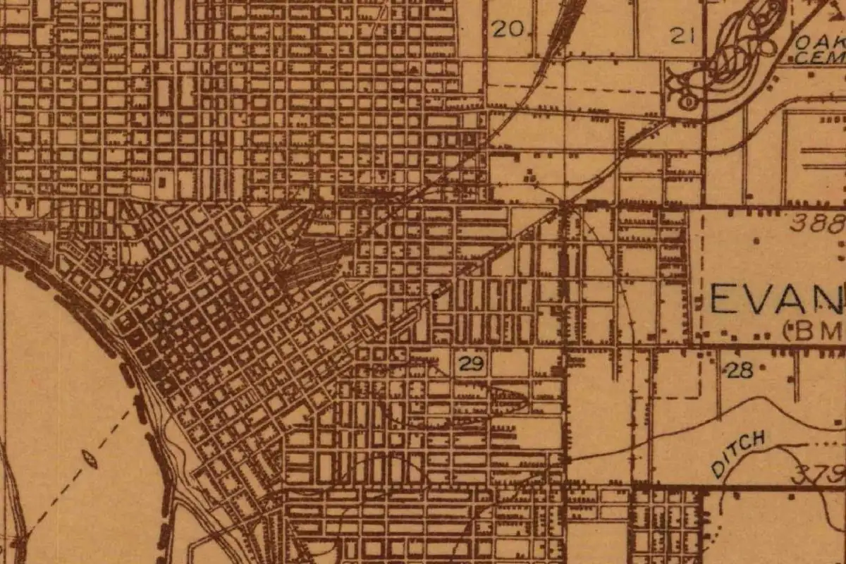
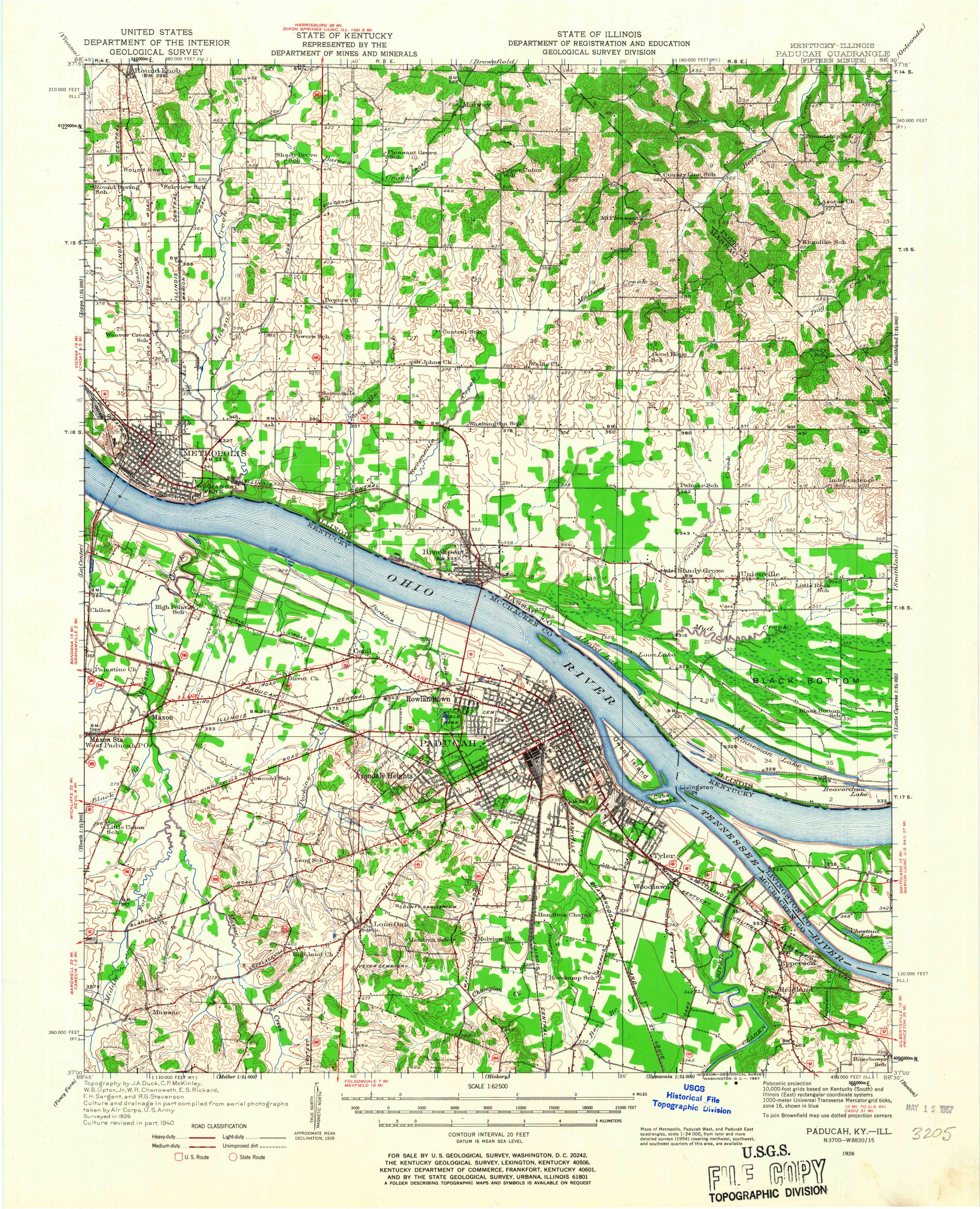
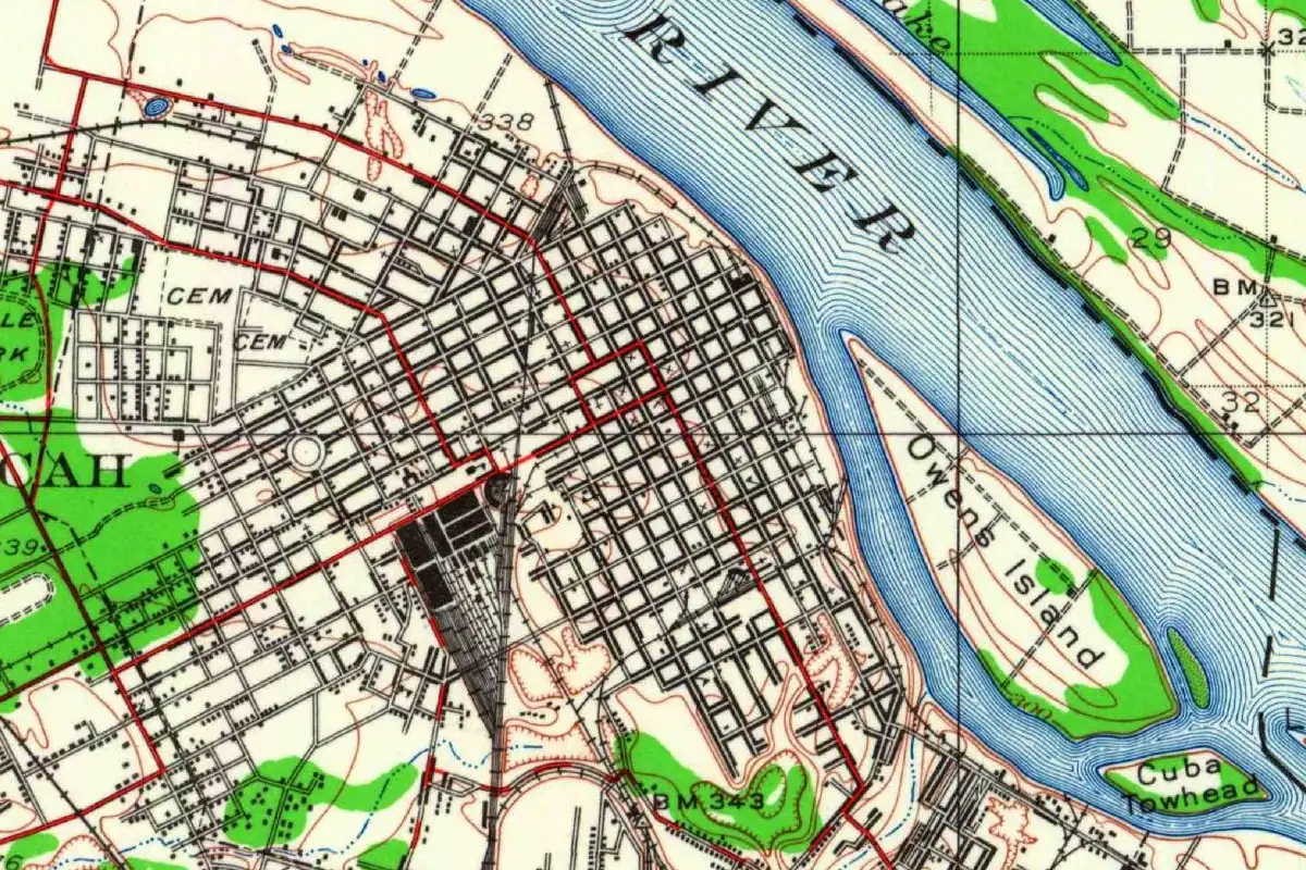
The map at the top of this page comes from the Geological Survey’s Paducah sheet, surveyed in 1926. You can see the street grid packed against the river, with railroad tracks fanning into the yards. The river is the reason it’s there, and it also brought what the city calls the worst natural disaster in its history. In 1937, the Ohio rose over its 50-foot (15 m) flood stage, and the Army Corps of Engineers afterward replaced the earthen levee with a floodwall.
For another Kentucky river town named for a person, look at Louisville, which Collins also covered. Bardstown shows how Collins and Gannett handled a founder’s name when they agreed. Clarksville, Tennessee honors a different Clark, and the same Gannett page credits William Clark with Clarksville, Missouri. You’ll find the rest on our Kentucky page.
Quick answers
Who is Paducah, Kentucky, named after?
It’s disputed. Collins (1874) and Gannett (1905) say a celebrated Indian chief buried by the Tennessee River; the state marker calls him the “legendary” Chief Paduke; the City of Paducah says William Clark named it for the Padouca Indians.
Who named Paducah?
William Clark, of the Lewis and Clark expedition. Collins, the Kentucky Historical Society marker and the city all say he named the town when he laid it out in 1827.
What was Paducah called before?
Pekin. The city says the settlement was known as Pekin around 1815, and the state marker says “Village was first named Pekin.”
Was Chief Paduke real?
Uncertain. The Kentucky Historical Society marker calls him “legendary,” and the National Park Service says only that “some claim” Clark named the town for him.
Key dates
- 1803Lewis and Clark's Corps of Discovery passes through the area and hires the interpreter Charles Drouillard.
- 1815Around this year, a settlement called Pekin grows up where the Tennessee meets the Ohio.
- 1827William Clark lays out the town and names it Paducah.
- 1830Paducah is incorporated as a town on January 11.
- 1832Paducah becomes the seat of McCracken County.
- 1856Paducah becomes a city on March 10.
- 1937The Ohio River rises over its 50-foot flood stage at Paducah.
Things to do in Paducah, Kentucky
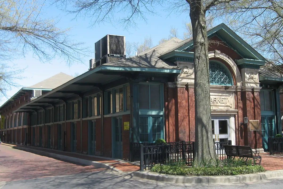
William Clark Market House Museum
A museum in the old public market building, named for the man who laid out the town, with an interactive timeline of Paducah's history, the interiors of the old List Drug Store and a historical photo gallery.
Paducah Wall to Wall floodwall murals
Paintings of Paducah's history by the Dafford Muralists on the floodwall overlooking the meeting of the Ohio and Tennessee rivers, begun in 1996, with the last panel in the three-block section finished in 2022.
National Quilt Museum
A museum that presents and collects work by contemporary quilters from America and around the world, with exhibitions and workshops by quilt artists.
River Discovery Center
A river museum where you can take the helm of a speedboat, towboat or Coast Guard vessel in a boat simulator and follow the past 24 hours of traffic on the river.
Lower Town Historical & Architectural Tour
A self-guided walk through one of Paducah's oldest residential neighborhoods, annexed in 1836, with Greek Revival and Italianate houses and the site of the Union's Fort Anderson.
Getting there
Open Paducah in Google Maps
Opens in a new tab. The pin is the center of Paducah in the USGS place-name record.
The closest airports, Amtrak stations and intercity bus stops, measured in a straight line from the center of Paducah.
Airports
- Barkley Regional (PAH) Paducah 10 mi 16 km
- Veterans Airport of Southern Illinois (MWA) Marion 52 mi 83 km
- Nashville International (BNA) 126 mi 202 km
Amtrak trains
- Fulton station (FTN) 42 mi 67 km
- Carbondale station (CDL) 56 mi 90 km
Intercity buses
- FlixBus Paducah KY (PAD) 2 mi 4 km
- Greyhound Cape Girardeau Leming Lane 55 mi 88 km
- Executive Transportation Amtrak Connecting Service · Carbondale 56 mi 90 km
Distances are as the crow flies, not by road. We don't list schedules or fares because they change; check with the airline, Amtrak or the bus company before you go. Official data (FAA commercial service airports (2025), FAA airport locations, Amtrak stations and Intercity Bus Atlas) from the FAA and the U.S. Bureau of Transportation Statistics, checked Nov 14, 2026.
Sponsored
Staying in Paducah?
Compare hotels in Paducah, Kentucky, on Expedia.
See hotels in PaducahWe may earn a commission if you buy through this link. It never changes what we write. Read our affiliate disclosure
Historical Sources & References
- Richard H. Collins, History of Kentucky, vol. 2 (1874), p. 594. Laid out in 1827 “by Gen. Clark, of St. Louis,” and “named after the celebrated Indian chief, Paducah, who was buried on the bank of the Tennessee river now in the city”; incorporated as a town January 11, 1830, and as a city March 10, 1856; the town’s churches, mills, warehouses and railroads.
- Collins (1874), p. 593. Paducah, “the 5th city in the state in population and importance,” on the Ohio just below the mouth of the Tennessee.
- Henry Gannett, The Origin of Certain Place Names in the United States (1905), p. 236. “Named for a celebrated Indian chief who formerly lived in the vicinity and was buried on the banks of Tennessee River, now within the city limits.”
- Kentucky Historical Society, Marker 1111, “Paducah’s Indian Name”. The “legendary Indian Chief Paduke,” Clark’s platting in 1827, “Village was first named Pekin,” and the “Paducahs, Chief Paduke’s sub-tribe of Chickasaw Indians.”
- City of Paducah, “History of City of Paducah”. Pekin around 1815; Clark’s arrival in 1827 with a title deed; the Padouca Indians; the letter to his son and its facsimile at the Market House Museum; county seat in 1832; the 1937 flood and the floodwall.
- National Park Service, “William Clark Market House Museum”. The 1803 visit and Charles Drouillard; Clark’s return in 1827; “Some claim that Clark named the town for Native American Chief Paduke and his tribe, the Padouca.”
- GNIS feature 500106 (U.S. Geological Survey). The GNIS entry for Paducah, McCracken County, with its coordinates.
- U.S. Geological Survey, Paducah sheet (1926). The 1:62,500 map, surveyed in 1926 and printed in 1967, that the image at the top of this page was cropped from.
Sponsored
Put this 1926 map on your wall
The USGS Paducah sheet, surveyed in 1926 and printed in 1967 with a partial 1940 revision, is in the public domain. Download the full-size scan for free, then have it printed on canvas with CanvasOnTheCheap.
Print a map on canvasDownload the full-size mapWe may earn a commission if you buy through this link. It never changes what we write. Read our affiliate disclosure
Spot something wrong, or know more? Tell us here. You can also email us or use our contact page. Corrections are noted here with their date, never made silently.