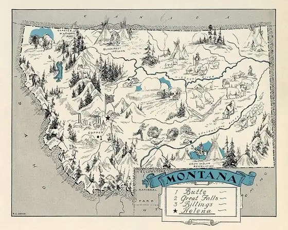
Kalispell, Montana: A Tribe's Name on a Railroad Town
Kalispell takes its name from the Kalispel people, who call themselves Ql̓ispé, per the Montana Historical Society Press and Henry Gannett. Who chose it is disputed: the city credits James J. Hill, while the Forest History Society says the commonly accepted story credits Charles E. Conrad. Its meaning is disputed too: readings include 'prairie above the lake' and 'camas prairie.'
Kalispell, Montana, had its name announced when the town was established in 1891, and people still argue over who picked it and what it means. Most accounts tie it to the Kalispel people. The National Register study of the town’s historic buildings, prepared by Kathy McKay in 1993, says the town “was formally established on March 17, 1891, and its name announced at that time,” and that the name “is attributed to several sources and is given various meanings.”
A name with a lot of owners
McKay’s study lists the versions one after another, and it’s worth seeing them side by side. Some said James J. Hill, the Great Northern Railway’s builder, named it after a Pend d’Oreille term for the area meaning “upper flat country.” Others said it was named for the tribe, or for the trading post David Thompson set up at Thompson Falls. Some believed Charles E. Conrad named it.
Then come the translations. Duncan McDonald, an early Flathead Valley resident, thought the word was a corruption of the Flathead words for camas prairie. The local historian Henry Elwood says it’s believed to mean “camas” or “the prairie above the lake.” And the Inter Lake newspaper reported on March 30, 1891, that the new town would be called Kalispel, “the liquid Indian synonym for Flathead.”
The spelling was Kalispel at first. McKay notes that the second L was “reportedly” added to put the accent on the last syllable.
Hill or Conrad
The city of Kalispell sides with Hill. The history in the city’s 2026 land use plan says Hill picked the site as a division point for the Great Northern, and that he “is credited with naming the city, drawing from the Pend d’Oreille term meaning ‘prairie above the lake.’”
The Forest History Society, which reprints the Forest Service’s The Flathead Story, goes the other way. It calls the naming “a subject of controversy,” says the commonly accepted story is that Conrad named it, and adds that “Northwest historians discredit the story that James Hill … named the city.” In that version Conrad changed the C to a K and added an L at the end, to get the accent right.
You don’t have to pick a winner. What the sources share is the tribe’s name at the root of it. In 1905, Gannett listed the city this way: “Kalispel; city in Flathead County, Montana, named for an Indian tribe.” The same page has Kalama, Washington, another name he tied to a Native word.
The people the name came from
The Montana Historical Society Press, in its Guide to Historic Kalispell, says the town was “named for the region’s Q’lispé tribe.” Iowa State University Library’s vocabulary of Indigenous peoples gives the preferred form as Ql̓ispé and lists Kalispel, Pend d’Oreille and Camas People among the other names. The Kalispel Tribe of Indians, on its own website, quotes elder JR Bluff: “We are Qlispé. We are Camas People.”
The name was in use long before the town. The Forest History Society says David Thompson, of the Northwest Fur Trading Company, gave the name Kullyspel in 1809 to the Indians on Pend Oreille Lake in northern Idaho, and to Kullyspel Lake and Kullyspel House. Thompson turns up in the story of Spokane, too: men working under him built Spokane House there in 1810.
Lots sold off a table in a hay meadow
The town itself was a railroad deal. The Kalispell Townsite Company was incorporated in St. Paul on January 20, 1891, with Great Northern townsite men and Charles and W. G. Conrad of Fort Benton among its members, McKay writes. Under “the generally accepted story,” Conrad, acting for Hill, first tried to buy land at Columbia Falls, where the owners asked too much, and Hill told him to “go and buy a townsite and I’ll build the railroad to it.”
Great Northern townsite men bought the land from seven homesteaders, and an irrigated timothy hay meadow became the center of the townsite. Nearby Demersville lost out, McKay says, “reportedly because of its less satisfactory railroad grades and because Kalispell had a better water supply.” The plat went on sale in April 1891, with a map on a table, and a newspaper reported in 1892 that $300,000 worth of lots sold within thirty days.
Kalispell “boomed until June,” McKay writes, and then, in a phrase she quotes, “The town went on the rocks.” In the summer of 1891 a man from nearby Ashley mowed hay in the surveyed streets, and the other valley towns called the new place “Wait a Spell,” “Alkali Flats” or “Collapsetown.” The first Great Northern construction train rolled in on January 1, 1892.
An Army map of a railroad town
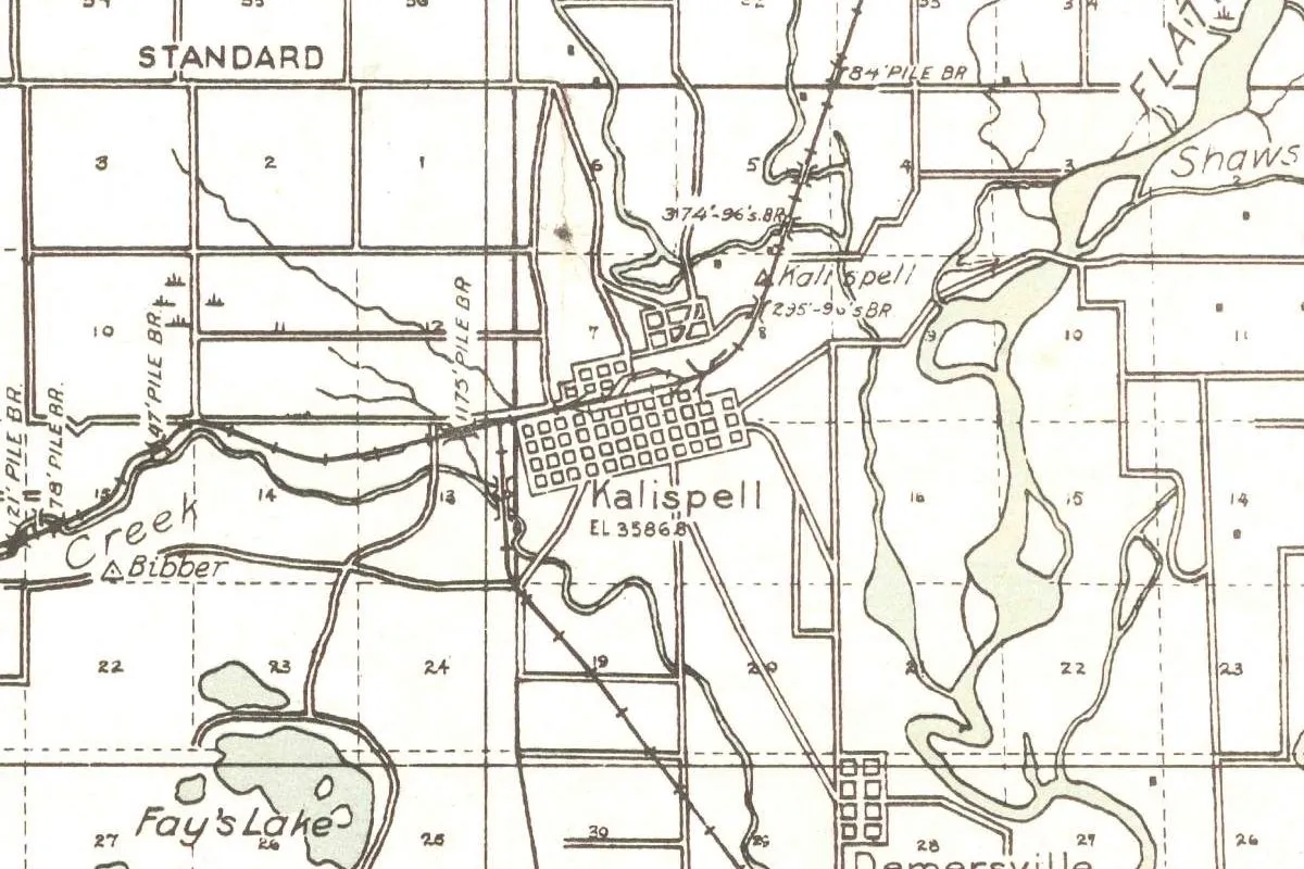
The map at the top of this page isn’t a Geological Survey sheet, even though it’s kept in the Survey’s historical map collection. Its margin calls it a Corps of Engineers “Progressive Military Map,” the Kalispell quadrangle, compiled in 1919 from Survey and General Land Office sheets and county maps, and printed by the Army Map Service in 1943. It shows Kalispell’s street grid with an elevation of 3,586.8 feet (about 1,093 m), the railroad running through it, and the smaller grid of Demersville near the bottom.
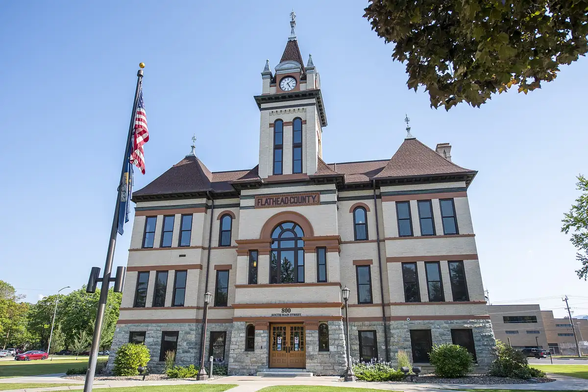
Kalispell’s run as a division point didn’t last. The Historical Society Press guide says the railroad relocated in 1904, the year Whitefish was platted as the Great Northern’s new division point. Kalispell had already been the county seat since 1894, and the courthouse, built in 1903 in the middle of Main Street at its south end, is in the photo below. If you want more Great Northern names, Havre got its name from railroad officials too, and the rest of Montana has plenty of others.
Quick answers
What does Kalispell mean?
Nobody has settled it. Accounts collected in the town’s National Register study include “upper flat country,” “camas prairie,” “camas” and “the prairie above the lake,” and an 1891 newspaper called it a synonym for Flathead. Most sources tie the name to the Kalispel people, who call themselves Ql̓ispé.
Who named Kalispell?
It’s disputed. The city credits James J. Hill of the Great Northern Railway. The Forest History Society says the commonly accepted story credits Charles E. Conrad and that Northwest historians discredit the Hill version.
When was Kalispell founded?
On March 17, 1891, when the town was formally established and its name announced, according to the National Register study and the city. The townsite was platted that April.
Key dates
- 1809David Thompson uses the name Kullyspel for the people on Pend Oreille Lake, and for Kullyspel Lake and Kullyspel House, according to the Forest History Society.
- 1891March 17: the town of Kalispell is formally established and its name announced.
- 1891The townsite company is incorporated in St. Paul on January 20, and the townsite is platted in April.
- 1892On January 1, the first Great Northern construction train reaches Kalispell.
- 1894Kalispell becomes the seat of Flathead County.
- 1903The courthouse is built in the middle of Main Street, at its south end.
- 1904The railroad relocates, and Whitefish is platted as the Great Northern's new division point.
Things to do in Kalispell, Montana
Conrad Mansion National Historic Site
The house that Spokane architect Kirtland Cutter designed and built in 1895 for Charles E. and Alicia Conrad, six blocks east of Main Street on 4th Street East. All three floors are restored, and over 90 percent of the furnishings are original.
Northwest Montana History Museum
The regional history museum, housed in the 1894 Central School, which it calls Kalispell's oldest public building. The Richardsonian Romanesque school was threatened with demolition in 1991 before the city renovated it.
Lone Pine State Park
A park about 5 miles (8 km) southwest of town with 7.5 miles (12 km) of trails for hiking, mountain biking, snowshoeing and horseback riding, a visitor center, and overlooks toward Flathead Lake, Big Mountain, Jewel Basin and Glacier National Park.
Woodland Park
A city park at 705 2nd Street East with pavilions and gardens, a playground, a skatepark, a walking path and ponds with wildlife, next to Woodland Water Park.
Getting there
Open Kalispell in Google Maps
Opens in a new tab. The pin is the center of Kalispell in the USGS place-name record.
The closest airports, Amtrak stations and intercity bus stops, measured in a straight line from the center of Kalispell.
Airports
- Glacier Park International (GPI) Kalispell 8 mi 13 km
- Missoula Montana (MSO) 89 mi 143 km
Amtrak trains
- Whitefish station (WFH) 15 mi 24 km
- West Glacier station (WGL) 26 mi 42 km
Intercity buses
- Jefferson Lines Kalispell 2 mi 4 km
Distances are as the crow flies, not by road. We don't list schedules or fares because they change; check with the airline, Amtrak or the bus company before you go. Official data (FAA commercial service airports (2025), FAA airport locations, Amtrak stations and Intercity Bus Atlas) from the FAA and the U.S. Bureau of Transportation Statistics, checked Nov 17, 2026.
Sponsored
Staying in Kalispell?
Compare hotels in Kalispell, Montana, on Expedia.
See hotels in KalispellWe may earn a commission if you buy through this link. It never changes what we write. Read our affiliate disclosure
Historical Sources & References
- Kathy McKay, “Historic and Architectural Properties of Kalispell, Montana” (1993). The founding on March 17, 1891, the list of naming versions and meanings, the Inter Lake report of March 30, 1891, the second L, the townsite company, Hill’s instruction to Conrad, Demersville, the lot sales, the nicknames and the first train.
- Forest History Society, “Naming of Kalispell”. Thompson’s Kullyspel of 1809, the Conrad version and the doubts about Hill.
- City of Kalispell, PLAN-IT 2045 land use plan, public hearing packet (2026). Hill as the namer and “prairie above the lake.”
- Montana Historical Society Press, A Guide to Historic Kalispell. “Named for the region’s Q’lispé tribe,” the county seat in 1894 and the railroad’s move in 1904.
- Iowa State University Library, “Ql̓ispé”. The preferred form of the name and its other forms, Kalispel and Camas People among them.
- Kalispel Tribe of Indians. Elder JR Bluff’s words on the name Qlispé.
- Henry Gannett, The Origin of Certain Place Names in the United States, 2nd ed. (1905), p. 171. “Named for an Indian tribe,” and Kalama on the same page. Checked against the page image.
- Conrad Mansion; Northwest Montana History Museum; Lone Pine State Park; Woodland Park. The details in the things-to-do list, including the 5 miles (8 km) and 7.5 miles (12 km) at Lone Pine.
- GNIS feature 785622 (U.S. Geological Survey). Kalispell’s listing as a populated place in Flathead County and its coordinates.
- Kalispell quadrangle, Army Map Service printing of 1943. The Corps of Engineers sheet the map at the top was cropped from, with the elevation of 3,586.8 feet (about 1,093 m).
Spot something wrong, or know more? Tell us here. You can also email us or use our contact page. Corrections are noted here with their date, never made silently.