Bandera, Texas: A Town Named for a Pass Called 'Flag'
Bandera, Texas, and its county were named for nearby Bandera Pass. Bandera is Spanish for "flag," but why the pass got that name is a mystery, the Handbook of Texas says. Legends tell of a flag left after a battle or a treaty, or of a General Bandera whom no record confirms.
Bandera, Texas, is named for nearby Bandera Pass, but why the pass was called bandera, the Spanish word for “flag,” is still a mystery. There are stories about a flag and stories about a general, and none of them has been proven.
The town took the pass’s name
The first step is the easy one. Bandera sits on Texas State Highway 16, “fifty miles northwest of San Antonio” (about 80 km), in Peggy Tobin’s entry on the town in the Handbook of Texas. Her verdict on the name is short: “The town and county were named for nearby Bandera Pass.”
Henry Gannett settled it in one line back in 1905: “Bandera; county, and town in same county, in Texas, named from a pass in the State. The word is Spanish, meaning ‘flag.’”
The pass is a gap in the hills to the north. J. Marvin Hunter, in his 1922 history of the county, put it at “about ten miles a little west of north of the town of Bandera,” which is about 16 km. Tobin’s separate entry on the pass describes “a narrow, V-shaped natural erosion cut” in the limestone ridge between the Medina and Guadalupe valleys, just south of the Kerr County line.
So the town’s name is settled. The trouble starts when you ask about the pass.
Three stories about a flag
Christopher Long’s Handbook entry on Bandera County begins with the obvious: “Bandera is Spanish for ‘flag,’ and there are a number of colorful accounts” of how the name came about. He lists three, and he calls the last one a legend.
- A Spanish general named Bandera led a punitive expedition against the Apaches after they raided San Antonio de Béxar.
- After chasing the Apaches to the pass, the Spanish left a flag or flags there as a warning against more raids.
- In 1752 (or 1732), Spanish and Native leaders held a council. The Spanish promised not to go north of the pass if the raids stopped in the south, and a red flag was planted on the pass to mark the treaty.
Tobin’s entry on the pass adds one more version: a flag “placed to mark a battle between Indians and Spaniards, at a date somewhere about 1732.” Then she gives her own conclusion: “Although a number of persistent legends seek to explain the naming of Bandera–‘Flag’–Pass, the origin of the name remains a mystery.”
The Texas Historical Commission’s marker at the pass, put up in 2016, chooses its words with the same care. “Early accounts recall a 1730s battle between Spanish soldiers and Apache,” it reads, and “the memory of a bandera which became the namesake of the pass, nearby creek and eventually the county and its seat of government.”
A general no record confirms
In his Pioneer History of Bandera County, Hunter had no doubts at all. “This pass was named for General Bandera, a Spaniard, who, in 1733 defeated there a large body of Apaches, who made these mountains their rendezvous for attacks on the Spanish missionaries around San Antonio.”
The Handbook went looking for that general. Tobin found a real Manuel Bandera who owned land near Mission Concepción in San Antonio. But “various popular accounts crediting Bandera as the Spanish general cannot be corroborated,” she writes, “nor has his name been found on any Bexar muster roll.” Some stories even call him Ciro instead of Manuel.
Notice the dates, too. Hunter says 1733, Tobin’s legend says about 1732, and one of Long’s says 1752 or 1732.
What the old maps show
If the reason is lost, the name itself is old. According to Tobin, Capt. José de Urrutia found the pass in 1739 while campaigning against the Apaches. The earliest map she knows with Bandera as a place name is an anonymous one from about 1815 to 1819, which marks an Apache village just north of “Puerta de la Bandera.” The THC marker also notes that early 1800s maps show “Puerta de la Bandera” at the site.
Stephen F. Austin used the same name for a creekbed near the pass on his 1829 map for the Mexican government, Tobin says. From John Arrowsmith’s map of 1841 on, maps “consistently show either Bandera Creek or Bandera Pass.” Long adds that the name “was in use by 1842,” when Texas Rangers fought Comanches at the pass. Hunter dates that fight to 1843.
The pass stayed busy. An 1849 Army survey of routes from San Antonio to El Paso took in a trail that crossed it, and on August 26 and 27, 1856, a herd of camels went through on its way to the cavalry post at Camp Verde.
A sawmill town on the Medina
The town came last. Tobin writes that John James, Charles DeMontel and John Herndon formed a partnership in 1853 to build a town and a water-powered lumber mill on a cypress-lined bend of the Medina River, where campers had been making shingles. Workers from Upper Silesia arrived in 1855. When Bandera County was created in 1856, the town was named its seat, and its plat was filed with the first commissioners’ court that year.
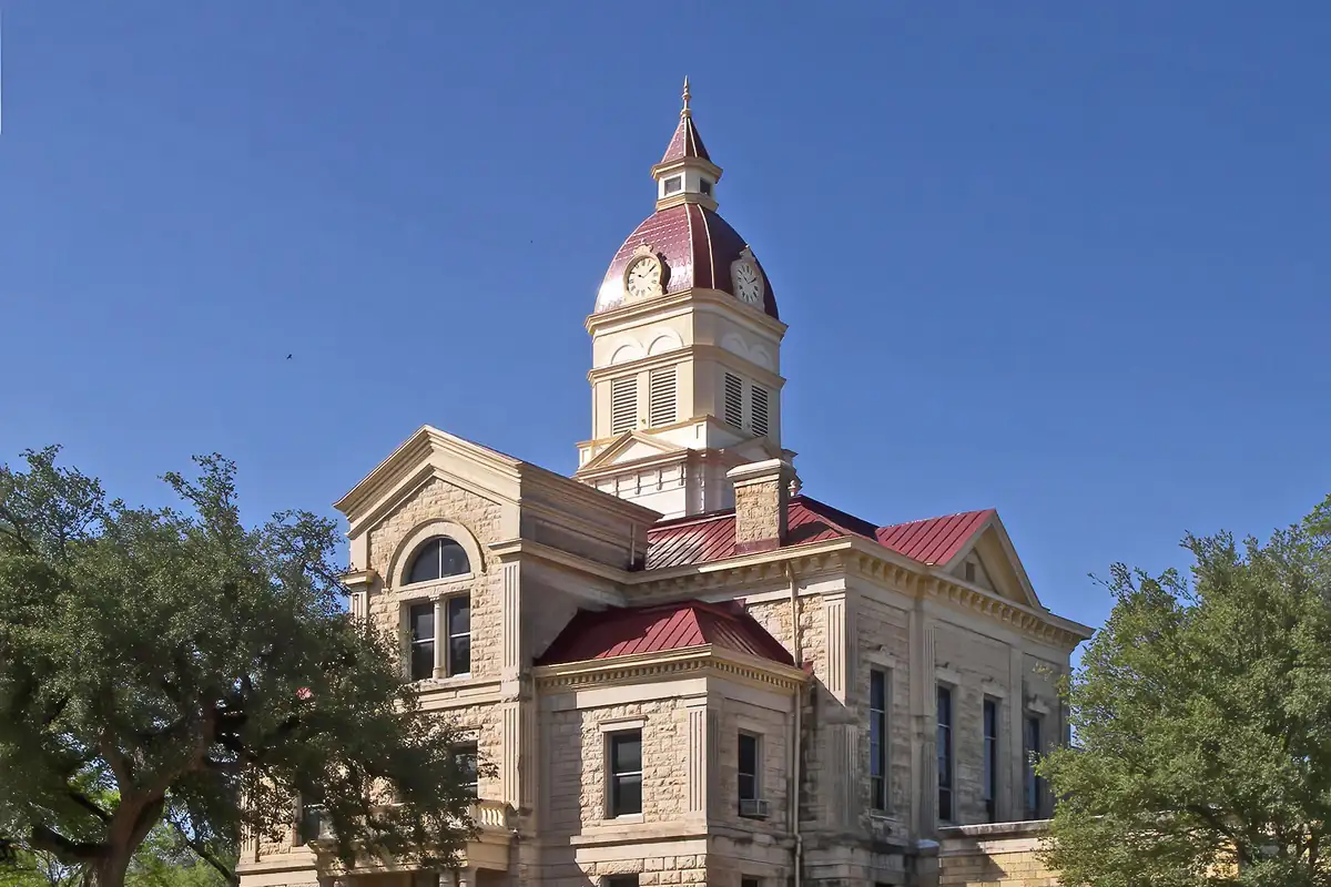
None of the sources says the founders chose the name, though. By the time they arrived, it had been on the maps for decades. After the Civil War the town boomed as a staging point for cattle drives, and the courthouse in the photo below was begun in 1890. Today, as Texas Parks and Wildlife puts it, “Bandera calls itself the ‘Cowboy Capital of the World.’”
The 1956 map
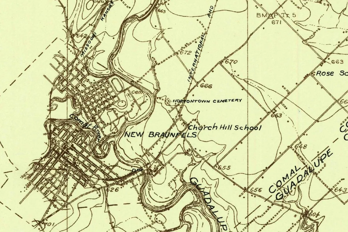
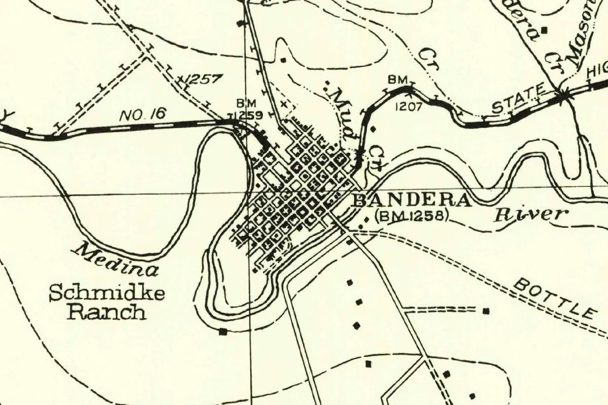
The map at the top of this page comes from the U.S. Geological Survey’s Bandera sheet of 1956. The town’s small grid sits inside a loop of the Medina River, with State Highway No. 16 crossing the top and Mud Creek and Mason Creek coming in from the north. A creek label at the upper edge is cut to “…dera Cr.”
You won’t find the pass on this crop. If you go by Hunter, it’s about ten miles (16 km) north of town, the gap whose name the Handbook still calls a mystery.
Quick answers
What does Bandera mean?
Bandera is Spanish for “flag,” as Gannett (1905), Long and the Texas Historical Commission all say. The town is named for Bandera Pass, and why the pass was called “flag” is unknown.
Why is Bandera Pass called Bandera?
Nobody knows for sure. The Handbook of Texas says “the origin of the name remains a mystery.” Legends tell of a flag marking a battle around 1732, flags left as a warning, or a red flag for a treaty.
Was there a General Bandera?
Hunter wrote in 1922 that the pass was named for a General Bandera who beat the Apaches there in 1733. The Handbook says the accounts of that general “cannot be corroborated,” and no Bexar muster roll lists him.
How old is the name Bandera?
A map from about 1815 to 1819 already shows “Puerta de la Bandera,” according to the Handbook. The town took the name when Bandera County was created in 1856.
Key dates
- 1739Capt. José de Urrutia comes upon the pass while campaigning against the Apaches, the Handbook of Texas says.
- 1829Stephen F. Austin's map labels a creekbed near the pass Puerta de la Bandera.
- 1842The name Bandera is in use by this year, when Texas Rangers fight Comanches at the pass, according to the Handbook.
- 1853John James, Charles DeMontel and John Herndon form a partnership to build a town and a lumber mill on the Medina River.
- 1856Bandera County is created, and the town plat is filed with the first commissioners' court; the town becomes the county seat.
- 1890Work begins on the Bandera County Courthouse.
- 1964Bandera is incorporated.
Things to do in Bandera, Texas
Frontier Times Museum
A museum whose mission, it says, is to preserve and share the cultural heritage of Bandera County and the Texas frontier. It has been part of the town for more than 90 years.
Bandera Natural History and Art Museum
Life-size dinosaur models and Ice Age animals line the outdoor trails. Inside you'll find a triceratops skeleton from Night at the Museum, dioramas of habitats from the African savanna to the Arctic tundra, and art from New Spain's colonial era.
Bandera City Park
The city's park in the middle of Bandera offers fishing, swimming and picnic areas with barbecue pits. The city asks visitors to use the gate at 8th Street and Maple.
Lost Maples State Natural Area
A protected stand of Uvalde bigtooth maples along the Sabinal River, known for its fall color. The Handbook of Texas places it near Vanderpool, at the west end of Bandera County.
Getting there
Open Bandera in Google Maps
Opens in a new tab. The pin is the center of Bandera in the USGS place-name record.
The closest airports, Amtrak stations and intercity bus stops, measured in a straight line from the center of Bandera.
Airports
- San Antonio International (SAT) 39 mi 62 km
- Austin-Bergstrom International (AUS) 90 mi 145 km
Amtrak trains
- San Antonio station (SAS) 42 mi 67 km
- San Marcos station (SMC) 69 mi 111 km
Intercity buses
- Greyhound Center Point Mini Mart 16 mi 25 km
- FlixBus San Antonio Bus Station 41 mi 65 km
Distances are as the crow flies, not by road. We don't list schedules or fares because they change; check with the airline, Amtrak or the bus company before you go. Official data (FAA commercial service airports (2025), FAA airport locations, Amtrak stations and Intercity Bus Atlas) from the FAA and the U.S. Bureau of Transportation Statistics, checked Nov 15, 2026.
Sponsored
Staying in Bandera?
Compare hotels in Bandera, Texas, on Expedia.
See hotels in BanderaWe may earn a commission if you buy through this link. It never changes what we write. Read our affiliate disclosure
Historical Sources & References
- Peggy Tobin, “Bandera Pass,” Handbook of Texas Online. The description of the pass, the legends and “the origin of the name remains a mystery,” Manuel Bandera and the muster rolls, Urrutia in 1739, the maps of about 1815-1819, 1829 and 1841, the 1849 Army survey and the camels of 1856.
- Peggy Tobin, “Bandera, TX,” Handbook of Texas Online. The location, “The town and county were named for nearby Bandera Pass,” the 1853 partnership, the Silesian workers, the 1856 plat and county seat, the cattle drives, the 1890 courthouse and the 1964 incorporation.
- Christopher Long, “Bandera County,” Handbook of Texas Online. “Bandera is Spanish for ‘flag,’” the three accounts of the name, the name in use by 1842, and Lost Maples near Vanderpool.
- J. Marvin Hunter, Pioneer History of Bandera County (1922), p. 20. The pass “about ten miles a little west of north” of town and the account of General Bandera in 1733. Checked against the page image.
- Texas Historical Commission, “Bandera Pass” marker (2016). “Early accounts recall a 1730s battle” and “Puerta de la Bandera” on early 1800s maps.
- Henry Gannett, The Origin of Certain Place Names in the United States, 2nd ed. (1905), p. 36. “Named from a pass in the State. The word is Spanish, meaning ‘flag.’” Checked against the page image.
- Texas Parks and Wildlife Department, Hill Country State Natural Area. “Bandera calls itself the ‘Cowboy Capital of the World.’”
- Frontier Times Museum; Bandera Natural History and Art Museum; Bandera City Park; Lost Maples State Natural Area. The details in the things-to-do list.
- GNIS feature 1330000 (U.S. Geological Survey). The national gazetteer’s entry for Bandera, Bandera County, with its coordinates.
- U.S. Geological Survey, Bandera sheet (1956). The 1:62,500 map that the image at the top of this page was cropped from.
Spot something wrong, or know more? Tell us here. You can also email us or use our contact page. Corrections are noted here with their date, never made silently.