Glenrio, Texas: Glen Plus Río, Right on the State Line
Glenrio, Texas, has a name made of English “glen” and Spanish “río,” yet its New Mexico half had a post office called Rock Island until 1915. Nobody on record says who put those two words together or why, and the old sources don’t even agree on when Glenrio took over from Rock Island.
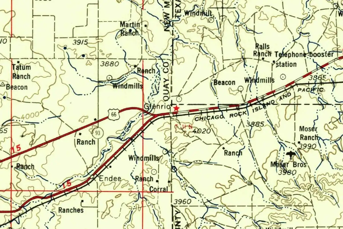
The town sits right on the line, too. Part of it is in Deaf Smith County, Texas, and part is in Quay County, New Mexico, 73 miles (117 km) west of Amarillo and 41 miles (66 km) east of Tucumcari.
A glen and a river, or neither?
T. M. Pearce’s New Mexico Place Names (1965) reads the name as English “glen” plus Spanish río, “river,” and calls it one of the rare blends of the two languages in a New Mexico place name. That’s about the word. Pearce doesn’t say who chose it.
Not everyone thinks the words fit the ground. A 2009 plan for New Mexico’s Route 66 scenic byway says flatly that the name “doesn’t make sense in English or in Spanish,” because there’s no river nearby and the town isn’t in a valley. The 1940 WPA guide to Texas saw it a little differently. It put Glenrio’s three small business houses and half a dozen homes “in the grassy hollow of a little creek.” You can decide for yourself whether a hollow and a creek make a glen and a river. None of these sources claims that’s why the town got its name.
Rock Island on one side, Glenrio on the other
The National Register nomination for the Glenrio Historic District, written in 2005, tells the standard version. The Chicago, Rock Island and Pacific Railroad set up a townsite company, and Colonel Wells E. Moses of Denver came to the site in 1907 and “first named the community Rock Island in honor of the railroad.” His town was platted entirely on the New Mexico side. The railroad built a depot in 1910, the nomination says, “the same year it decided to rename the community Glenrio.”
Newspapers from 1910 make that look less tidy. In September, the Santa Fe New Mexican reported oil excitement near “Glenrio, a new town which has sprung up on the border of New Mexico,” where the Capitol Freehold Land Company was selling lots at “that townsite.” Then, in December, the Tucumcari News said it had been corrected by A. R. Moses, “the townsite man at Rock Island,” for reporting that Rock Island had been renamed:
“There has been no change of name but Glenrio is a new line town across from Rock Island, Rock Island being in New Mexico and Glenrio in Texas.”
So at the end of 1910, at least one of the people selling the town said there were two names for two townsites, one on each side of the line, “pulling together to build one good one.”
The dates get murkier the more you look. The Handbook of Texas says the railroad established a station at Glenrio in 1906. The nomination itself reprints a “Plat of Glenrio, New Mexico” and labels it 1907, though the small print at the bottom of that sheet credits the Glenrio Tribune-Progress, a paper the same nomination says started in 1910 as the Rock Island Tribune. The earliest Glenrio we found in a dated newspaper is from June 1910, when men from San Jon passed through Endee “enroute to work on the Glenrio depot.”
The post office catches up
What’s clear is that the station and the post office went by different names for a while. In September 1915, the Tucumcari News reprinted a note from the Glenrio Tribune-Progress: the Post Office Department had accepted the W. E. Moses Townsite Company’s request to rename the Rock Island post office “Glenrio, New Mexico.” The paper explained the point:
“This should prove of much interest to the patrons of the postoffice, as it will eliminate further confusion throuh the railroad station being one name and the postoffice another.”
A week later, the Estancia News-Herald put it more simply: Rock Island would be “rechristened Glenrio,” and “the railroad station has borne the latter name for some time.” Pearce’s dictionary agrees on the outcome, listing a Rock Island post office from 1909 to 1915, “changed to Glenrio.” That’s the one name change here that has paperwork behind it.
Bars on one side, gas on the other
Glenrio’s second life came from the road. The Ozark Trails highway was marked through town by 1919, and in 1926 the route became U.S. 66. The state line shaped business. The Handbook of Texas and the National Park Service both say there were no bars on the Texas side, since Deaf Smith County was dry, and no service stations on the New Mexico side, where the gasoline tax was higher. Mail came in at the depot on the Texas side and went to the post office in New Mexico.
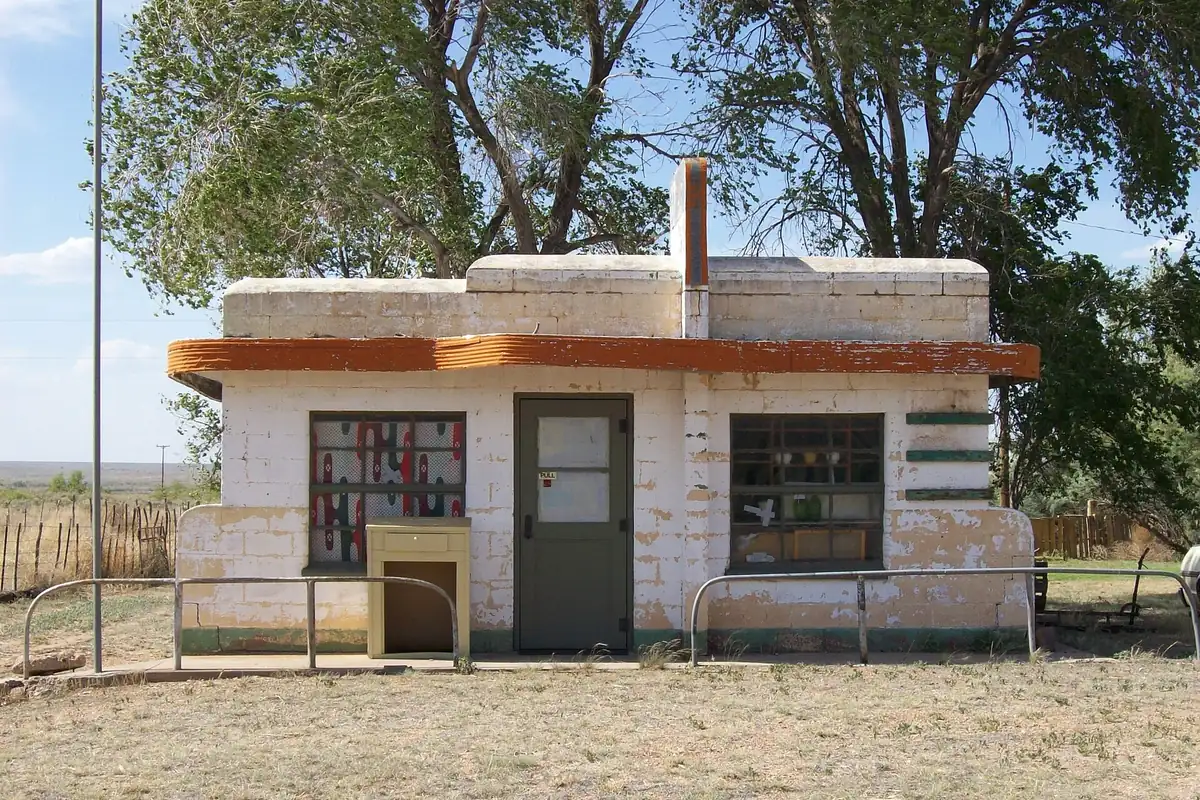
The nomination names the families who built what you’ll see today. John Wesley Ferguson, who came in 1924 as the railroad’s station master, built the State Line Bar and State Line Motel around 1930. Homer Ehresman put up the Texas Longhorn Motel and the State Line Café between 1953 and 1955, and Joe Brownlee added a Texaco station in 1950 and an Art Moderne diner in 1952. In 1940, the WPA guide to Texas gave Glenrio 20 people, while the New Mexico guide that same year said 80. Jack Rittenhouse’s 1946 guide to Highway 66 listed 84.
You may hear that The Grapes of Wrath was filmed here. The Handbook of Texas says some scenes of the 1940 movie were. The Park Service calls it local lore that “cannot be confirmed.”
After the interstate
Interstate 40 opened just north of town in 1975, and according to the nomination, “the traffic all but dried up.” Within two years, the Ferguson, Ehresman and Brownlee businesses had closed. When the nomination was written in 2005, only two buildings were occupied, and “only a handful of residents” remained. The Handbook of Texas gives a population of five in 2000.
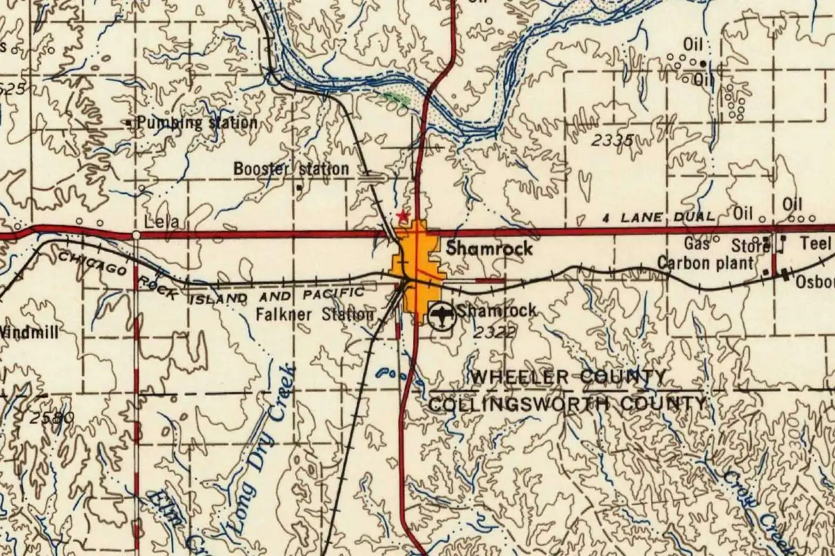
The Glenrio Historic District, with the old four-lane roadbed and 17 historic buildings and structures, was listed in the National Register in 2007. It’s one of the Panhandle stops in our Route 66 towns, along with Shamrock. The town’s name still reads like a landscape description, but the paper trail is about a depot, a post office and two townsites that never quite agreed what to call themselves.
Quick answers
What does Glenrio mean?
Glen plus river, according to T. M. Pearce’s 1965 dictionary: English “glen” and Spanish río. A 2009 New Mexico Route 66 plan says the name doesn’t fit the place, since there’s no river nearby and it isn’t in a valley. No source we found says who chose it or why.
Was Glenrio called Rock Island?
Partly. The New Mexico townsite and its post office were Rock Island, and the post office was renamed Glenrio in 1915. In 1910, the Rock Island townsite man said Glenrio was a separate new town on the Texas side.
Is Glenrio in Texas or New Mexico?
Both. It straddles the state line, with part in Deaf Smith County, Texas, and part in Quay County, New Mexico.
When did Glenrio become a ghost town?
Its Route 66 businesses closed after Interstate 40 bypassed it in 1975. It isn’t completely empty, though: the 2005 National Register nomination counted a handful of residents, and the Handbook of Texas gives five people in 2000.
Key dates
- 1907Wells E. Moses comes to the site for the railroad's townsite company and names the community Rock Island, the National Register nomination says.
- 1910The railroad builds a depot, and the name Glenrio shows up in the papers. In December, the townsite man at Rock Island insists there's been no change of name.
- 1915The Post Office Department accepts the townsite company's request to change the Rock Island post office to Glenrio, New Mexico.
- 1926The road through Glenrio becomes U.S. 66.
- 1975Interstate 40 opens north of town, and within two years the Route 66 businesses close.
- 2007The Glenrio Historic District is listed in the National Register of Historic Places.
Getting there
Open Glenrio in Google Maps
Opens in a new tab. The pin is the center of Glenrio in the USGS place-name record.
The closest airports, Amtrak stations and intercity bus stops, measured in a straight line from the center of Glenrio.
Airports
- Clovis Regional (CVN) 52 mi 84 km
- Rick Husband Amarillo International (AMA) 75 mi 121 km
Intercity buses
- Greyhound Tucumcari Mcdonald'S 39 mi 62 km
Distances are as the crow flies, not by road. We don't list schedules or fares because they change; check with the airline, Amtrak or the bus company before you go. Official data (FAA commercial service airports (2025), FAA airport locations, Amtrak stations and Intercity Bus Atlas) from the FAA and the U.S. Bureau of Transportation Statistics, checked Nov 10, 2026.
Sponsored
Staying in Glenrio?
Compare hotels in Glenrio, Texas, on Expedia.
See hotels in GlenrioWe may earn a commission if you buy through this link. It never changes what we write. Read our affiliate disclosure
Historical Sources & References
- National Register of Historic Places Registration Form, Glenrio Historic District (2005). Prepared by Philip Thomason. Section 7, pp. 1-2: location, distances to Amarillo and Tucumcari, “only a handful of residents,” two occupied buildings. Section 8, pp. 13-16: Wells E. Moses naming Rock Island “in honor of the railroad” (1907), the 1910 depot and renaming, the Ozark Trails, U.S. 66, the Ferguson, Ehresman and Brownlee businesses, 80 residents in 1940, Rittenhouse’s 84 in 1946, and I-40 in 1975. Section 8, p. 17: Figure 1, “Plat of Glenrio, 1907,” with the Glenrio Tribune-Progress imprint.
- The Tucumcari News and Tucumcari Times, December 24, 1910, p. 4. A. R. Moses, “the townsite man at Rock Island”: “There has been no change of name but Glenrio is a new line town across from Rock Island.”
- Santa Fe New Mexican, September 23, 1910, p. 6. “Glenrio, a new town which has sprung up on the border of New Mexico,” and the Capitol Freehold Land Company’s lots at “that townsite.”
- The Tucumcari News and Tucumcari Times, June 21, 1910, p. 8. Endee news: men “enroute to work on the Glenrio depot,” the earliest dated use of the name we found.
- The Tucumcari News and Tucumcari Times, September 16, 1915, p. 1. “Will Change Name,” from the Glenrio Tribune-Progress: the W. E. Moses Townsite Company’s request to rename the Rock Island post office, and the “confusion” of a station and post office with different names.
- Estancia News-Herald, September 23, 1915, p. 2. Rock Island to be “rechristened Glenrio”; “The railroad station has borne the latter name for some time.”
- T. M. Pearce, New Mexico Place Names (1965). Entry Glenrio: English “glen” plus Spanish río, “river,” a rare English-Spanish blend. Entry Rock Island: post office 1909-15, “changed to Glenrio.” Read in archive.org’s full-text search; the book itself is lending-only.
- Hugh Allen Anderson, “Glenrio, TX,” Handbook of Texas Online. The 1906 station, the mail and the depot, no bars on the Texas side and no gas stations on the New Mexico side, the Grapes of Wrath scenes, and a population of five in 2000.
- Writers’ Program, Texas: A Guide to the Lone Star State (1940). p. 492 (Tour 14): Glenrio, 20 people, “in the grassy hollow of a little creek.”
- Writers’ Program, New Mexico: A Guide to the Colorful State (1940). p. 312 (Tour 6): US 66 crosses the Texas line at Glenrio, 80 people, “a cluster of stores and gas stations among small frame houses.”
- Route 66 National Scenic Byway Corridor Management Plan (2009). p. 169: the name “doesn’t make sense in English or in Spanish; there is no river nearby and it’s not in a valley.” The same entry dates the change from Rock Island to about 1915.
- National Park Service, “Texas: Glenrio Historic District”. The state-line rules on bars and gas stations, the Grapes of Wrath story as unconfirmed lore, and the 2007 National Register listing.
- U.S. Geological Survey, Tucumcari sheet (1958). The map at the top of this page.
- GNIS feature 915829, Glenrio (historical) (U.S. Geological Survey). The USGS listing for the Texas side, in Deaf Smith County, with its coordinates. There’s no separate entry for the New Mexico side.
Sponsored
Gear up for your next road trip
Explore rooftop tents, vehicle awnings and outdoor gear from TOPOAK Overland.
Shop TOPOAK overlanding gearWe may earn a commission if you buy through this link. It never changes what we write. Read our affiliate disclosure
Spot something wrong, or know more? Tell us here. You can also email us or use our contact page. Corrections are noted here with their date, never made silently.